P-900 GPS
Sep 4, 2016 13:45:21 #
ClutchDisk
Loc: Fayetteville, NC
srfdude wrote:
One thing about GPS coordinates: there are several ways they are shown. When you input them into Chrome, say, you have to know which format Chrome uses. For example: Degrees. Decimal Degrees, Degrees. Decimal Minutes, or Degrees.minutes.seconds. You can be off miles by using the wrong format.
I did notice that google maps showed examples of what forms could be used. They did recommend using the Degree sign. That did sound ok. But as my brilliance goes I couldn't find the degree sign on the keyboard. Glad you mentioned that it would depend on the correct form that has to be used. With all the information received I'll have to find what will work. Many choices, if I do one of them correctly I will have learned something for sure. I enjoy a challenge.
Sep 4, 2016 14:07:05 #
srfdude
Loc: San Diego
If you show me the exact example of coordinates your photo program outputs, I can translate that into google, if you wish.
Sep 4, 2016 23:19:52 #
rhadams824
Loc: Arkansas
ClutchDisk wrote:
Not familiar with in camera GPS, but since the P-9... (show quote)
I have a MacBook Pro and open the photograph in Preview. Command I gives info. There is heading for GPS and gives the following:
Altitude: 119.7 m (392.72 ft)
Altitude Reference: above sea level
Date Stamp: Sep 2, 2016
GPS Version: 2.3.0.0
Latitude: 34° 25' 16.452" N
Longitude: 93° 2' 54.528" W
Map Datum: WGS84
Satellites: 13
Time Stamp: 22:57:37 UTC
There is also a location marked on a map. Click on "show in maps" for a larger version. Then there is a direction link to take you to the location. Also you can get a satellite view to show the terrain and the location from which you took the photograph. Amazing to an old bird.
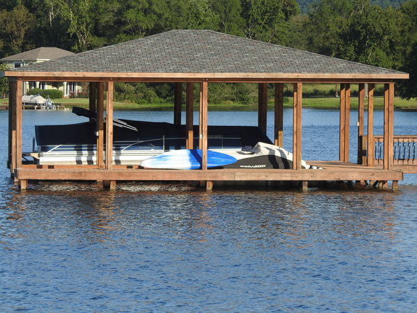
I have attached a photograph. I download it, got info and it still has the GPS data shown.
Sep 5, 2016 08:45:24 #
ClutchDisk
Loc: Fayetteville, NC
srfdude wrote:
If you show me the exact example of coordinates your photo program outputs, I can translate that into google, if you wish.
Well here it goes 35deg 1' 41.96"N, 79deg 3' 28.47"W
And another one is where in the world on the key board is the symbol for degrees ? I did use ViewNX2 (Nikon) as was suggested in an earlier post. To my amazement it worked without a hitch. So I guess it is on google maps (the above) somewhere it did show on ViewNX2 Google Map.
But doing a search using the coordinates on Google maps web site I didn't fair well at all. Yup and the little degree sign has me going. I have no problems with map reading with I call it paper. Had to do it for 20 years before the time of computers. Good old analog days of rabbit ears.

Sep 5, 2016 08:51:05 #
ClutchDisk
Loc: Fayetteville, NC
rhadams824 wrote:
I have a MacBook Pro and open the photograph in Pr... (show quote)
I downloaded the photo, brought it up in ViewNX2 (Nikon) worked like a champ. Also used one of my photos to see if it worked also and no problems. Still can't figure out how to do a search using coordinates in Google maps as I was attempting to do originally. I honestly thought that it had to be done in that way. Didn't realize that various PP software had those capabilities. It's fantastic that everyday can be a good and interesting learning time. Now if I can only figure out the little (0) sign for degrees !

Sep 5, 2016 08:55:44 #
ClutchDisk
Loc: Fayetteville, NC
Have to take a little time to thank all of you for such good information. Those of you that had positive ideas and suggestions such as software and etc added immensely to learning something new that I was unfamiliar with. On that note probably without doubt a lot more too.
Sep 6, 2016 02:25:54 #
rhadams824 wrote:
I have a MacBook Pro and open the photograph in Pr... (show quote)
When I pasted the web address for your photo, http://static.uglyhedgehog.com/upload/2016/9/4/837474-dscn3270.jpg into the Image URL field on Jeffrey's Image Metadata Viewer:
http://regex.info/exif.cgi
It showed:
Location: (70 null bytes)
Latitude/longitude: 34° 25' 17.4" North, 93° 2' 53.1" West
( 34.421512, -93.048078 )
Location guessed from coordinates:
100-198 Shadow Oak Point, Hot Springs National Park, AR 71913, USA
Map via embedded coordinates at: Google, Yahoo, WikiMapia, OpenStreetMap, Bing (also see the Google Maps pane below)
Altitude: 120 meters (394 feet)
And if you click on one of the hyperlinks following "Map via embedded coordinates at" it will open the map showing where the photo was taken. Google seems to do the best job.
If you want to reply, then register here. Registration is free and your account is created instantly, so you can post right away.

