S & E Asia 209 - Hong Kong 14: Nam Sang Wai - Wetland area with large bird population
Jan 29, 2023 10:57:06 #

From the market and lunch in Yuen Long, portrayed in the last two posts, we hopped into a taxi to bring us a short stretch north to one of our fairyland destinations in Hong Kong: A substantial piece of wetlands seemingly lost and forgotten by the population at large, tucked away close to Deep Bay and the border with Shenzhen/China, a triangular place almost totally surrounded by small rivers, adjacent to a huge area of commercial fish ponds and actually still containing a few operable fish ponds in its confines. My wife Susan knew this area from the time of her youth, when in her late teens she would stroll with her friends in this magic landscape and enjoy the rural, pastoral settings virtually unknown to most Hong Kong residents. - I previously visited this area with Susan a couple of times, once while we were still courting in the late Sixties, and another time when we lived in Hong Kong from 1979 to 1984. The memory was still vivid for Susan as she visited this area much more frequently than I, while for me it was this hazy memory of a place deserving another visit. At that time, we also repeatedly visited the nearby lookout at the police station of Lok Ma Chau, where one could see across the mudflats over to the small fishing villages in Shenzhen, China, the only place where one could actually look into China from Hong Kong, and I yearned to see these places again. Of course, the fishing villages of Shenzhen have all disappeared, and in their place stands now a ultra-modern city with some 15 million inhabitants. - Well - after our lunch at the market in Yuen Long, our time had come. What I did not realize then and just became acquainted with it now when doing this present research is that this isolated area was not forgotten but actually plans had been made already decades ago to turn this paradise into yet another golf course cum housing development and battles were and are being fought in the courts to achieve this or to prevent it.
WIKIPEDIA has the following brief, rather "dry" information:
Nam Sang Wai is a wetland area in San Tin in the New Territories to the north of Yuen Long. It is considered ecologically important, and serves as a stopping place for migratory birds. It is also a popular recreational destination, especially on weekends. Since the 1990s, various development proposals have been made at Nam Sang Wai by a consortium of Henderson Land and KHI Holdings Group. These plans have been challenged by environmentalists, politicians, the Agriculture, Fisheries and Conservation Department, the World Wildlife Fund, the Conservancy Association, and the Town Planning Board. Nam Sang Wai is home to many birds, including seagulls, northern pintails (Anas acuta), yellow-nib ducks (Anas zonorhyncha) and black-faced spoonbills (Platalea minor). Flora includes reeds and mangroves. The area is threatened by illegal logging and by fires, on land owned by the Nam Sang Wai Development Company, that environmental advocates called "suspicious" and "professionally started". - A small boat in the southern part of Nam Sang Wai serves as a ferry across the Kam Tin River towards the village of Shan Pui Tsuen, north of Yuen Long Kau Hui.
I found another online site by HKBWS (Hong Kong Bird Watching Society) which provides the following, more lively set of information (slightly abbreviated):
Nam Sang Wai is a place where you can appreciate the beauty of fishponds, reed beds and River Red Gum woods, making it a favorite outing spot for Hong Kong people as well as one of the sites preferred by bird watchers. Scenic spots:
1. NAM SANG WAI FERRY ~ Shan Pui Village is separated from Nam Sang Wai by river. Villagers will take a five-minute ferry ride to cross the river. Instead of being drawn by a rope, the ferry is paddled by a boatman. It is now the only river-crossing wooden ferry which is still operating in Hong Kong.
2. BRIDAL BRIDGE ~ Built by Nam Sang Wai residents, this bridge is a hot spot for wedding pictures. On a sunny day, one can see beautiful reflections in the water.
3. RIVER RED GUM WOODS (Eucalyptus) ~ According to the villagers, River Red Gum trees were planted in Nam Sang Wai as early as in the 1950s. The lines of tall and unique-looking River Red Gum trees have since become the landmark of Nam Sang Wai and a favorite shooting object for TV and film crews as well as tourists.
4. GRASSLAND ~ People come to this grassland on their day off for all sorts of activities, such as playing remote-controlled airplanes, walking dogs, picnicking, cycling or taking pictures
5. FISHPONDS ~ Fishponds have been existing in Nam Sang Wai for over 40 years, raising mainly Grey Mullet, Grass Carp and Bighead Carp. Most of the fishponds are deserted today. Only a small number of them are still operating, some of which are located next to a store. People can appreciate the beauty of the fishpond when they enjoy their food.
6. MUDFLATS ~ Nam Sang Wai is surrounded by the Kam Tin River and Shan Pui River and located at the intersection of the two rivers. There are intertidal mudflats at the estuaries, the river banks covered by mangroves. The river bed and mudflats revealed at low tide are a feeding ground for a large number of birds and other animals. Fiddler crabs, mudskippers and many birds can be found on the mudflats.
DISCLAIMER - My regular viewers probably know that I am anything but a birder: I don't know my birds, don't own the proper equipment and don't know any of the techniques necessary to capture birds at their best. What we didn't realize when we started our walk around the triangular piece of land at Nam Sang Wai, was that there was a rather large and quite active bird population and, even though not really knowing what I was doing, I was firing away at these birds, enjoying the sights and the sometimes quite funny poses I was able to capture. Over the next 3 days, I will post the most memorable of my captures and, where I can, I will indicate my take of what these birds were. I would be very happy to receive input from my viewers, either confirming or correcting my bird identifications, or to provide input where I came up empty handed. Thank you all.
Notes
TRIP INFO: Set # 1 provides a brief introduction to THIS SERIES on SOUTH & EAST ASIA. See it at
https://www.uglyhedgehog.com/t-724330-1.html
HONG KONG COUNTRY INFO in set # 196: https://www.uglyhedgehog.com/t-762698-1.html
NEW TERRITORIES in set # 207: https://www.uglyhedgehog.com/t-763687-1.html
EARLIER POSTS of this series: Access my topic list at UHH, the new posts are listed in reverse chronological order:
https://www.uglyhedgehog.com/user-topic-list?usernum=45105
Thanks for visiting, for improved clarity please view the downloads. I look forward to your comments and questions.
.
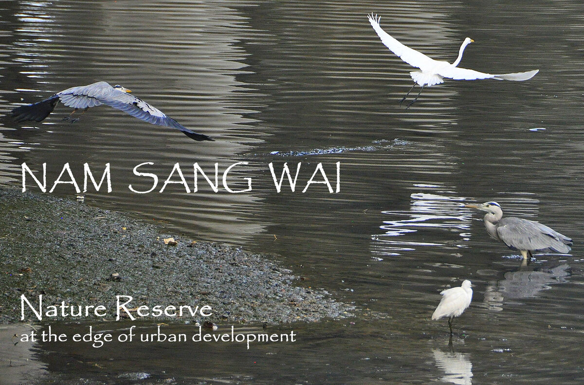
1 - Wetland/Nature Reserve: My album title image
(Download)
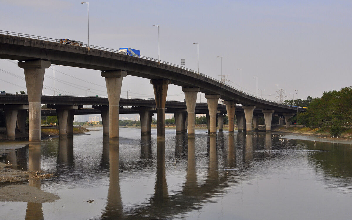
2 - Walking along the Kam Tin River, passing under a number of highway bridges: Nothing indicates that we are approaching a major wetland preserve populated by migratory birds
(Download)
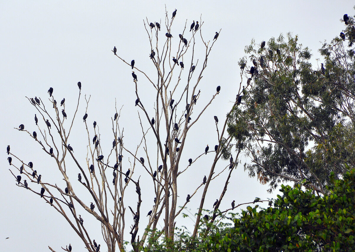
3 - Birds of a feather flock together … I counted over 100 birds congregating on the bare branches of this tree
(Download)
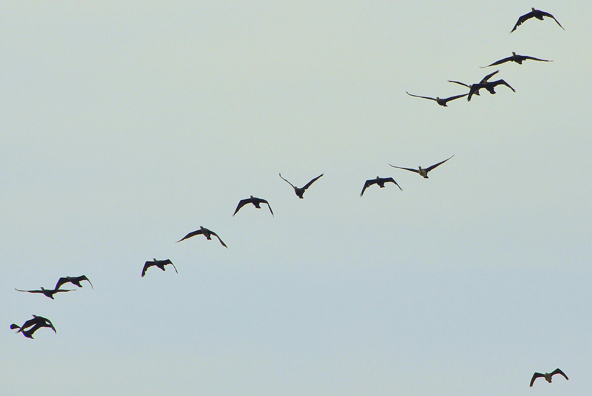
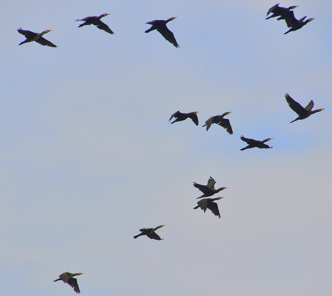
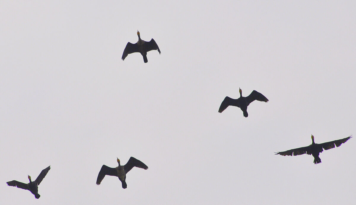
4 - Flying in unison with their wing movements in different positions
(Download)
5 - Another formation, this time the features of the birds are a bit more discernible - I believe these are Cormorants
(Download)
6 - Capture from pretty much straight underneath with interesting different wing positions - more Cormorants, I assume
(Download)
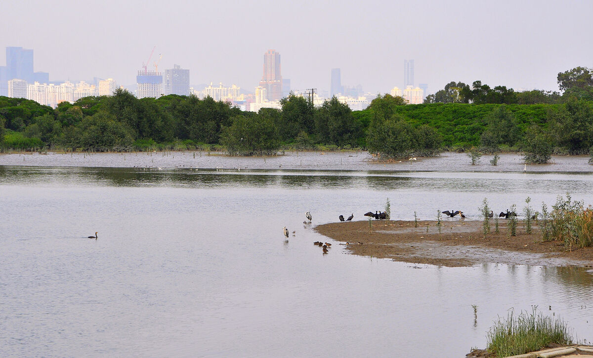
7 - Shallow spit with an interesting mix of birds where the Kam Tin and the Shan Pui rivers meet, at the rear the high-rise towers of Shenzen where 50 years ago there were but a few small fisher villages
(Download)
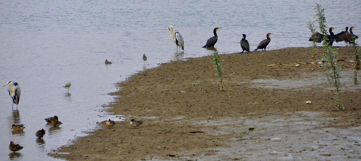
8 - Closer view of the birds congregating at this spit: 2 Herons at far left and upper center plus a number of Cormorants at upper right
(Download)
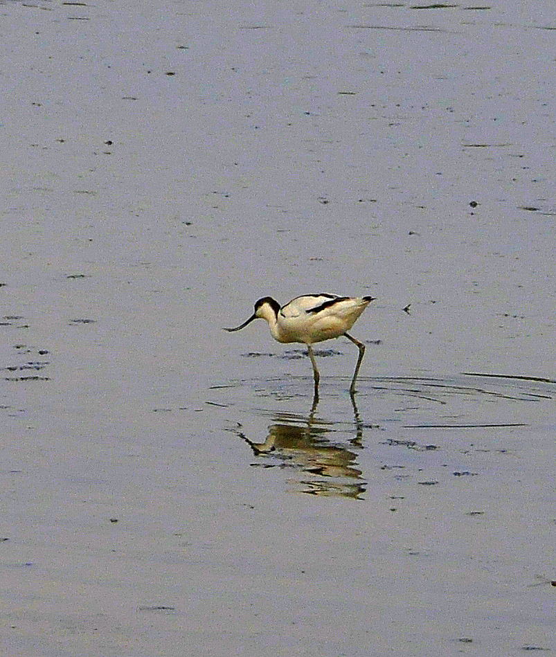
9 - Image of a solitary bird with a long curved upturned beak - possibly an Avocet?
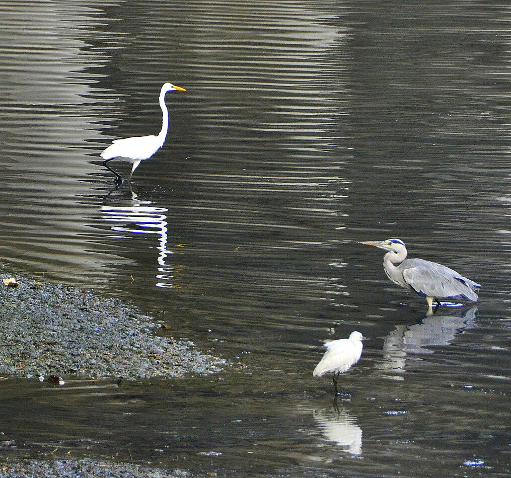
10 - Three different birds all seemingly frozen on their spot in the water; Great Egret at upper left, Heron at far right, unidentified white bird at bottom (Reddish Egret???)
(Download)
Jan 29, 2023 10:58:13 #
For your reference:
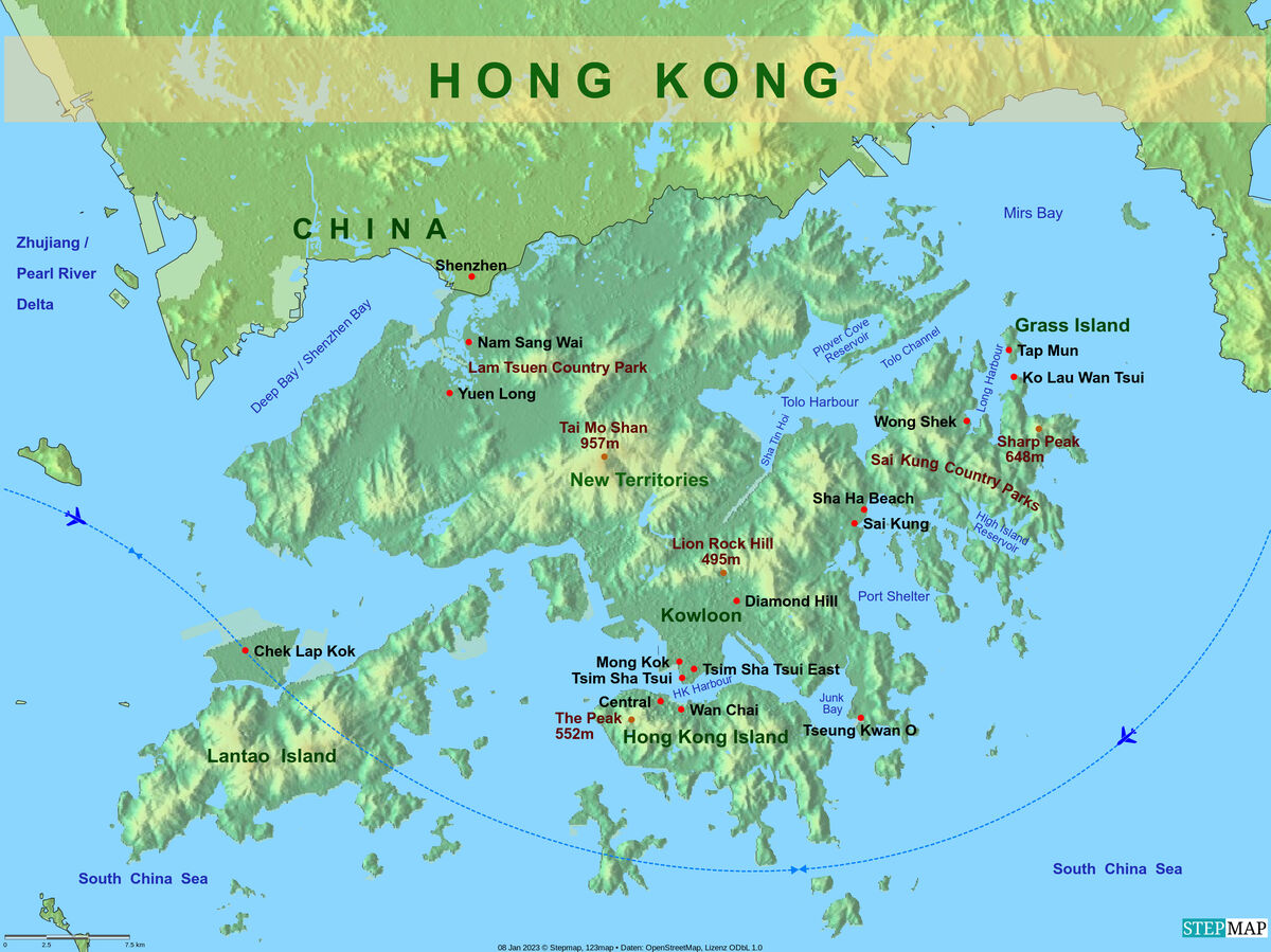
11 - Trip map of the Hong Kong segment of our tour, you can find Nam Sang Wai in the upper left side of the map
(Download)
Jan 29, 2023 12:00:06 #

Jan 29, 2023 12:06:15 #

Jan 29, 2023 13:21:59 #
phlash46 wrote:
Thank you very much Bruce for all these thumbs of approval, very much appreciated and I am happy to see that you enjoyed this set.
Jan 29, 2023 13:23:31 #
UTMike wrote:
Very nice bird work, Joe!
Thank you very much Mike for such a nice comment from a very proficient birder!
Jan 29, 2023 13:26:43 #

Fun change of pace here Joe! I really like the bridge shot and it always amazes me how wildlife finds its niche, even when we encroach!
Rob
Rob
Jan 29, 2023 13:53:22 #
Umnak wrote:
Fun change of pace here Joe! I really like the bridge shot and it always amazes me how wildlife finds its niche, even when we encroach!
Rob
Rob
Thanks Rob, yes, we are moving away from the markets and from civilization and we were quite amazed at the variety of avians we found here.
Jan 29, 2023 13:53:37 #

Jan 29, 2023 14:01:37 #
NMGal wrote:
A very nice surprise, Joe.
Thank you Barbara - yes, I recently had my good share of civilization, markets and crowds and the walk in this rural area was a great escape and gave me the chance to capture some bird images in nature.
Jan 29, 2023 23:00:28 #
Jan 29, 2023 23:44:58 #
kpmac wrote:
Wow, Joe. Egrets, Herons, Cormorants, and Avocets. Just like here at home.
Thank you Ken - did I get all these birdies right? - I know absolutely nothing about birds, spent quite some time online trying to figure out what I captured. And also, I don't really know what is "just like here at home" - looks like I hit a home port here! Thanks for your input, Ken, I really enjoy it.
Jan 30, 2023 05:32:27 #

Jan 30, 2023 05:41:05 #

Jan 30, 2023 05:41:15 #

If you want to reply, then register here. Registration is free and your account is created instantly, so you can post right away.