Posts for: Dave.Largent
Oct 5, 2021 13:23:13 #
Oct 5, 2021 13:22:45 #
Oct 5, 2021 13:21:30 #
ORpilot wrote:
Nice B&W... I hope you took the time to go to the Painted Hills over by Mitchell OR....
I will post shots from the Painited Hills in the next day or so.
Thanks for the comments.
Dave
Oct 5, 2021 12:30:26 #
Thanks to everyone for the comments, I am glad you enjoyed the photographs and I really appreciate your input.
Dave
Dave
Oct 5, 2021 12:29:41 #
bbrown5154 wrote:
I like all of them and the exposure and conversion to B&W is spot on.
My only issue is I think there is too much sharpening going on and maybe scale back the contrast a tad.

My only issue is I think there is too much sharpening going on and maybe scale back the contrast a tad.
Thanks for the comment, several of these are focus stacked to keep the foreground sharp and clean so I think that is why they may look over sharp to you. And yes, they may be a bit to much contrast but I really dislike flat shots and tend to lean on the bit more contrast than some.
Thanks again,
Dave
Oct 5, 2021 12:26:46 #
saxman71 wrote:
These shots have an infrared look to them that is very appealing. And you got some great clouds to add interest. I've wanted to visit that part of Oregon for some time now. But it's pretty much in the middle of nowhere which has put me off so far.
It is definitely in the middle of nowhere, we stayed in Bend, Oregon. We went to a lot of cool places over the week we were there and they were all within and hour or two from Bend. I have posted pictures of those places over the past week if you want to look at them.
Thanks for commenting.
Dave
Oct 5, 2021 12:22:53 #
PaulBrit wrote:
Fascinating! Fort Rock is over 200 miles from Merlin and our present lifestyle prohibits that trip. Shame.
Out of interest and as much as I enjoy the monochrome pictures why did you not shoot in colour?
Out of interest and as much as I enjoy the monochrome pictures why did you not shoot in colour?
I did shoot in color, they are also posted in another gallery.
Thanks for the comment.
Oct 4, 2021 10:02:29 #
Oct 4, 2021 01:08:26 #
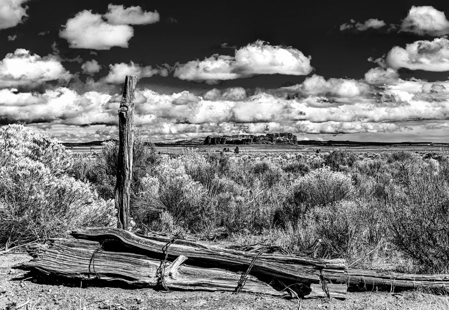
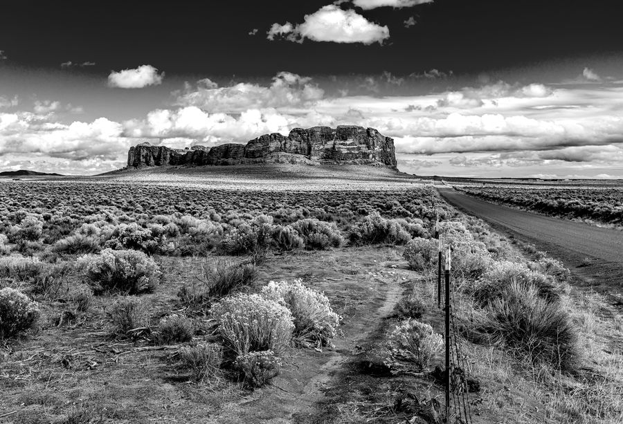
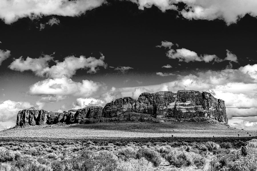
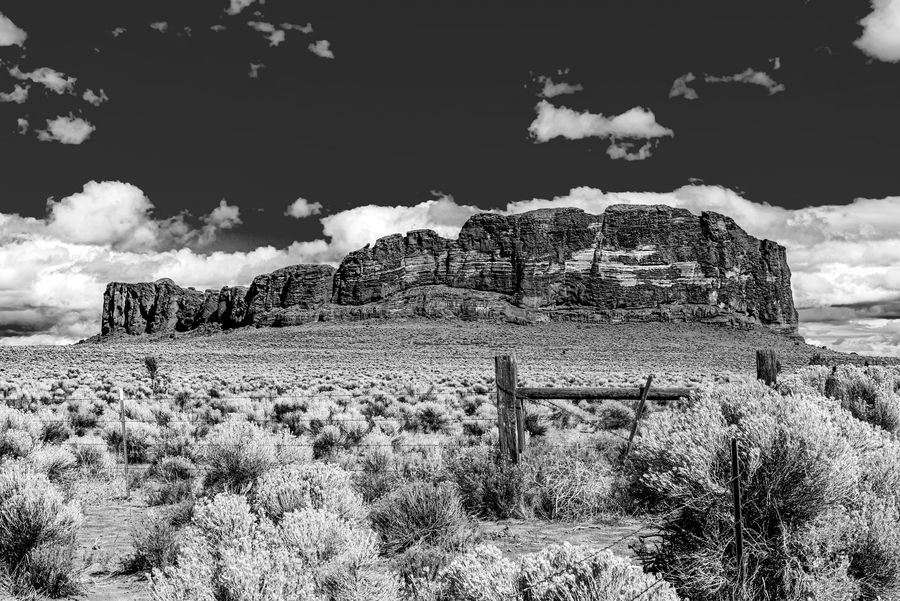
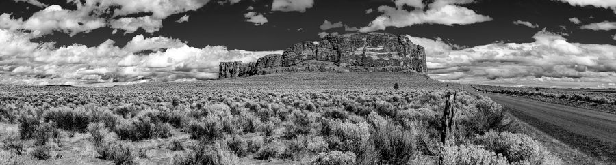
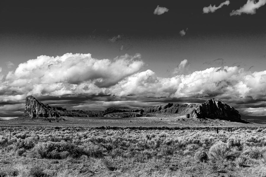
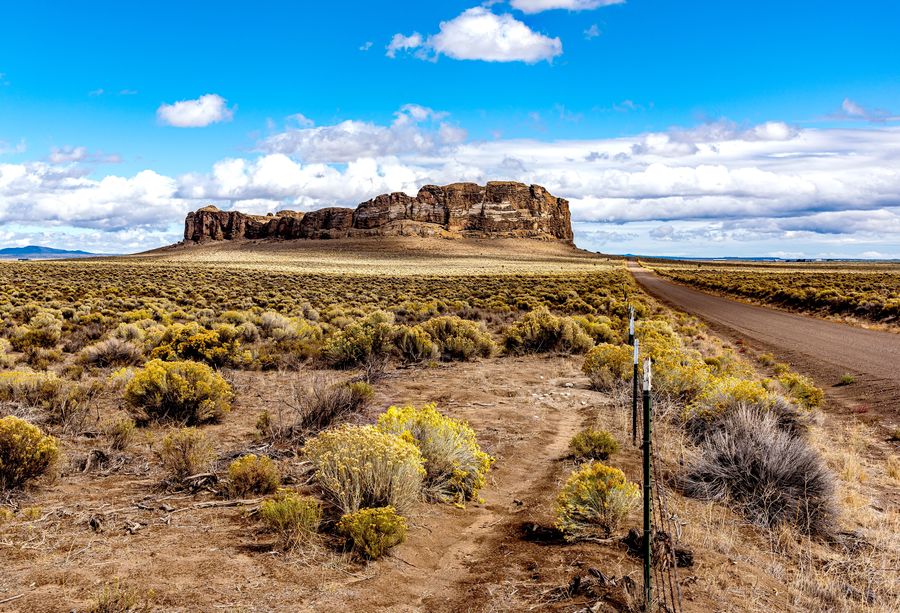
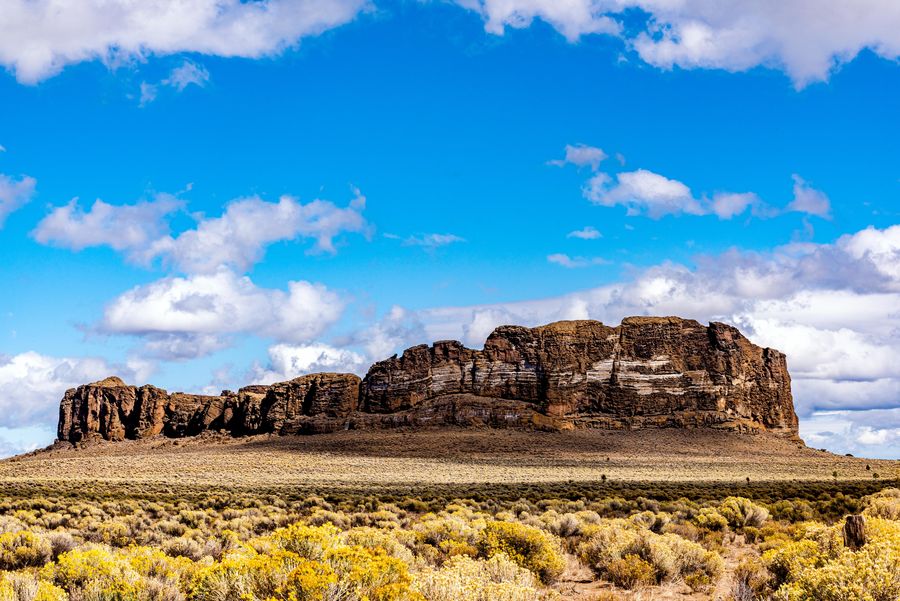
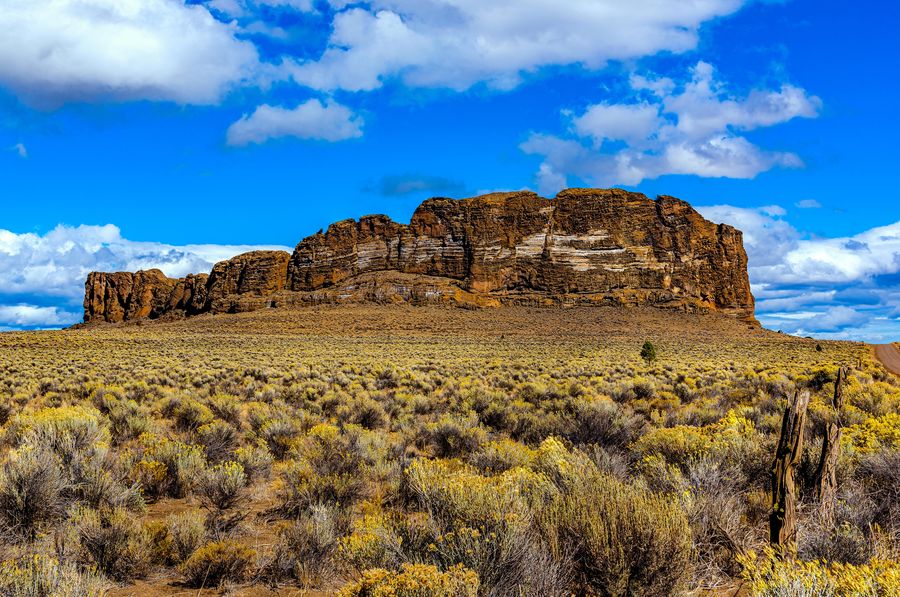
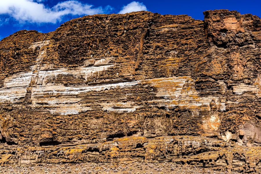
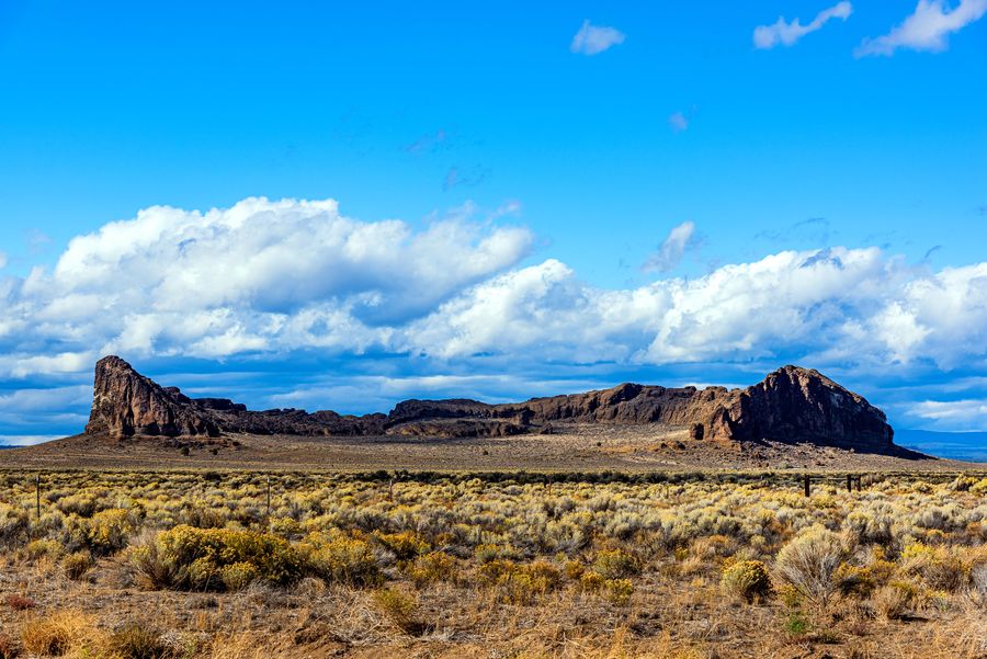
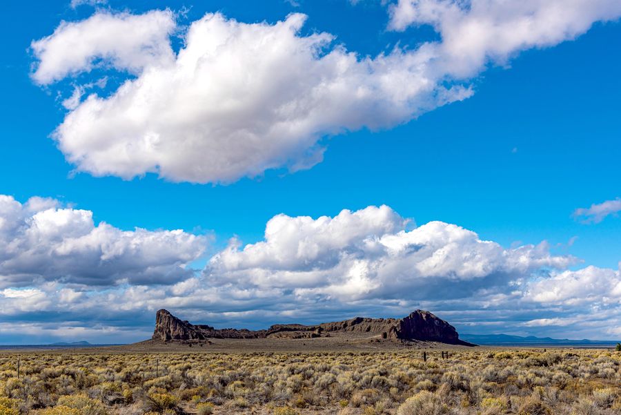
Fort Rock is a tuff ring located on an ice age lake bed in north Lake County, Oregon. The ring is about 4,460 feet in diameter and stands about 200 feet high above the surrounding plain. Its name is derived from the tall, straight sides that resemble the palisades of a fort. The region around Fort Rock contains about 40 such tuff rings and is located in the Brothers Fault Zone of central Oregon's Great Basin. William Sullivan, an early settler in the area, named Fort Rock in 1873 while searching for lost cattle. Fort Rock was created when basalt magma rose to the surface and encountered the wet mud of a lake bottom.
Like a desert mirage, this National Natural Landmark rises out of the barren, immense flatness of Oregon's high desert. An enormous near-circle of towering jagged rock walls make it look like a fort. Hike around and you'll soon realize it's even bigger than it looks! It's an old tuff ring set in what was a shallow sea in prehistoric times.
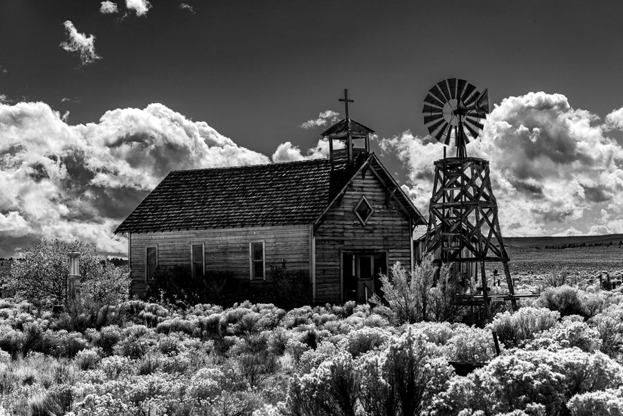
The town of Fort Rock had a general store which also included a gas station that was in operation from the early 1900s until it closed in May 2013.
Like a desert mirage, this National Natural Landmark rises out of the barren, immense flatness of Oregon's high desert. An enormous near-circle of towering jagged rock walls make it look like a fort. Hike around and you'll soon realize it's even bigger than it looks! It's an old tuff ring set in what was a shallow sea in prehistoric times.
The town of Fort Rock had a general store which also included a gas station that was in operation from the early 1900s until it closed in May 2013.
Oct 4, 2021 01:05:58 #
Fort Rock is a tuff ring located on an ice age lake bed in north Lake County, Oregon. The ring is about 4,460 feet in diameter and stands about 200 feet high above the surrounding plain. Its name is derived from the tall, straight sides that resemble the palisades of a fort. The region around Fort Rock contains about 40 such tuff rings and is located in the Brothers Fault Zone of central Oregon's Great Basin. William Sullivan, an early settler in the area, named Fort Rock in 1873 while searching for lost cattle. Fort Rock was created when basalt magma rose to the surface and encountered the wet mud of a lake bottom.
Like a desert mirage, this National Natural Landmark rises out of the barren, immense flatness of Oregon's high desert. An enormous near-circle of towering jagged rock walls make it look like a fort. Hike around and you'll soon realize it's even bigger than it looks! It's an old tuff ring set in what was a shallow sea in prehistoric times.
The town of Fort Rock had a general store which also included a gas station that was in operation from the early 1900s until it closed in May 2013.
.
Fort Rock looms up out of the sagebrush with no rhyme nor reason (some might suggest it was a government project) making a spectacle of itself.
(Download)
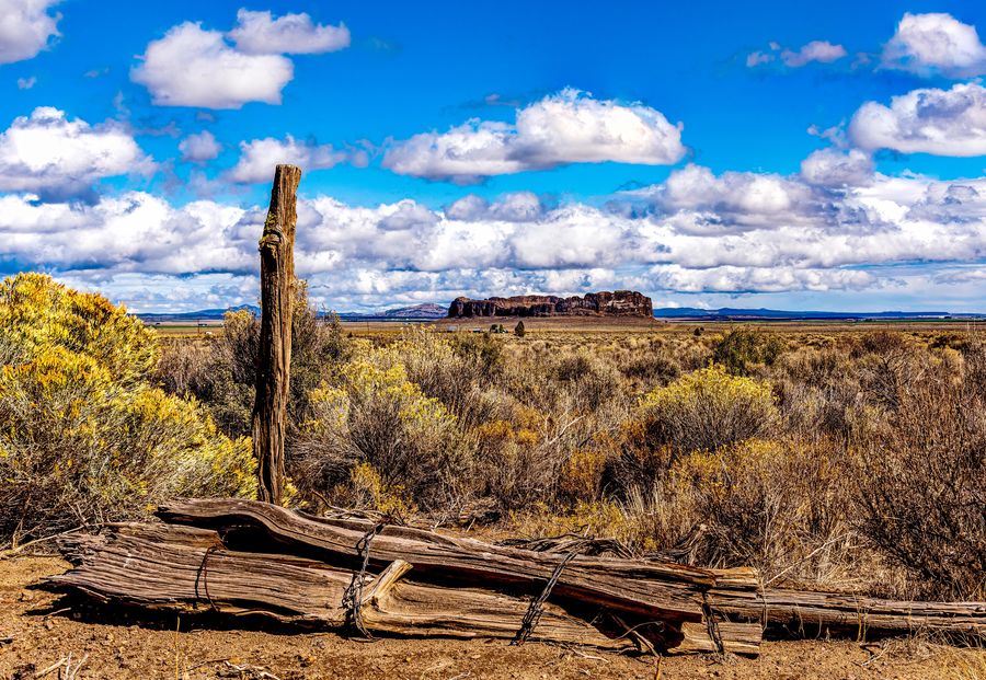
Trying to fence in the sagebrush.
(Download)
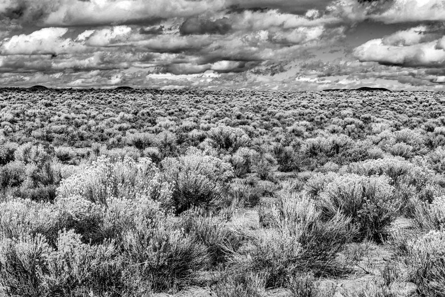
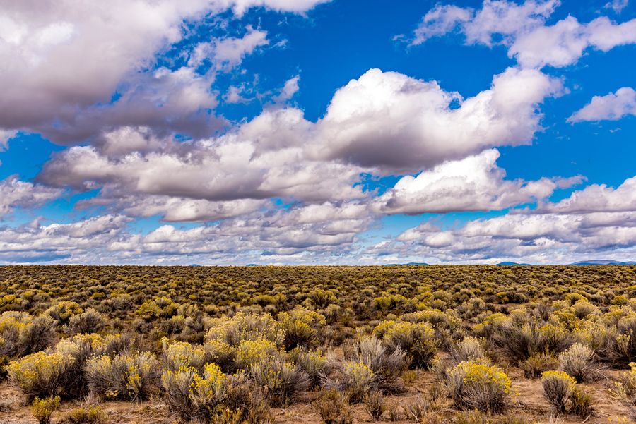
As far as the eye can see.
(Download)
It just pops up out of nowhere.
(Download)
(Download)
Looks like somebody was writing a message, but I can't read it.
(Download)
Looking inside the ring.
(Download)
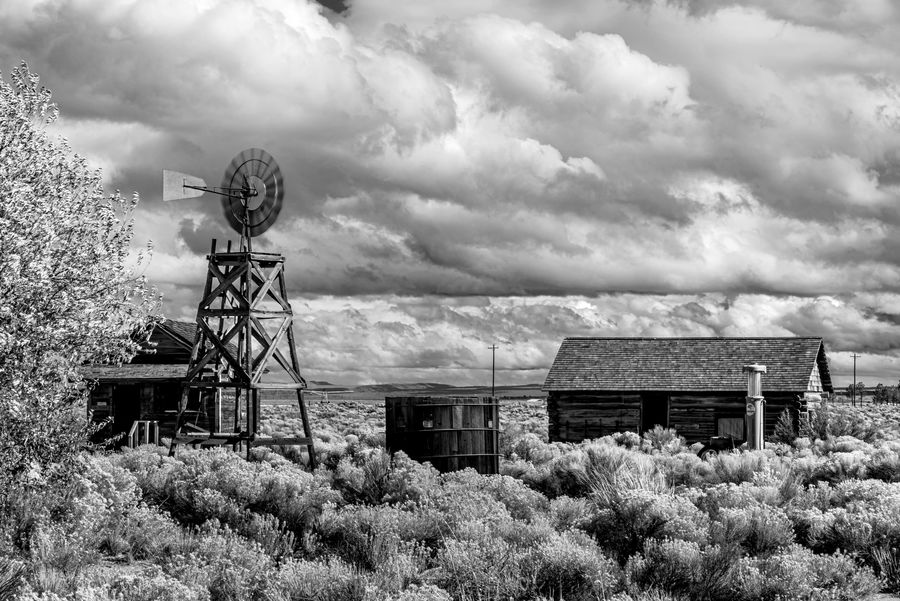
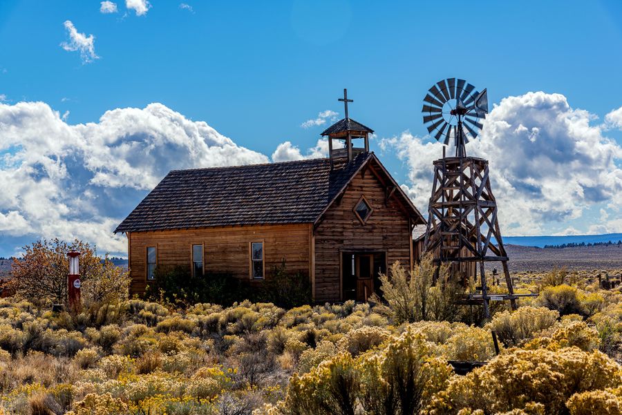
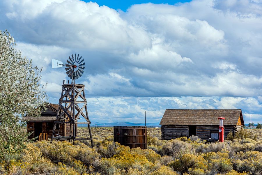
In the town of Fort Rock they have a museum with some of the original buildings and some not original buildings that just look like they could have been. I don't think the windmill is connected to the gas pump.
(Download)
(Download)
(Download)
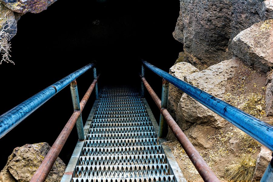
Oct 3, 2021 00:14:14 #
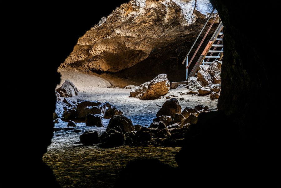
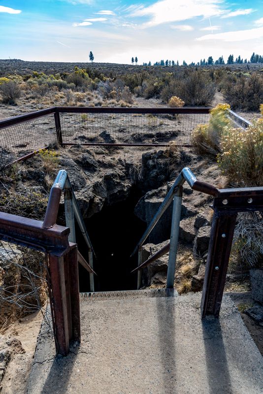
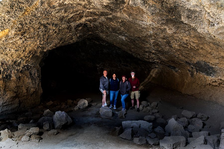
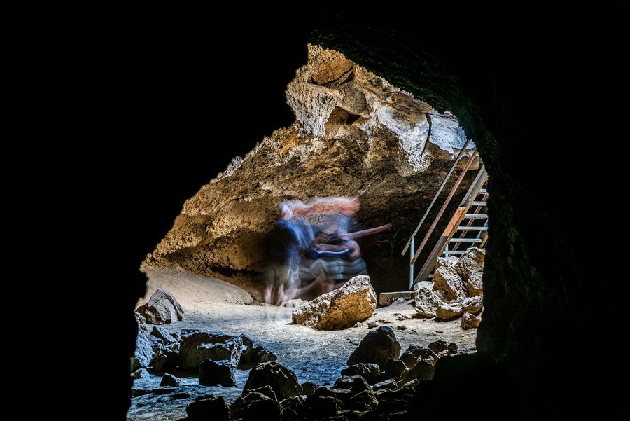
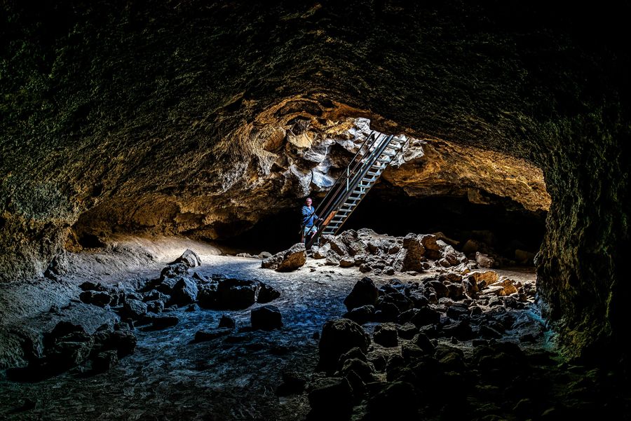
Boyd Cave is within Deschutes National Forest and is located on the northern flank of Newberry Volcano near the city of Bend. It is a 1,880-foot-long lava tube. By venturing down 20 feet via a set of sturdy steel stairs, visitors enter into a unique and chilly underground setting. Be sure to dress warmly as temperatures in the cave remain around 42 degrees year round, and be sure to bring headlights, flashlights, or lanterns for visibility and safety.
Just inside the cave looking back at the stairwell.
(Download)
The stairwell from the top. There is not much going on around the area and it is easy to think the GPS is leading you astray.
(Download)
The four of us heading into the cave. Be sure to bring a light, but don't try and illuminate yourself for the picture!
(Download)
Talk softly or you will disturb the spirits.
(Download)
Everybody else left me behind. I guess they might be right, I do spend a lot of time taking photographs.
(Download)
Looking back over my shoulder to make sure the spirits were not following me out.
(Download)
Not much around the cave but sage brush.
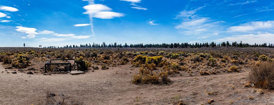
(Download)
Some nice clouds as we head back to civilization.
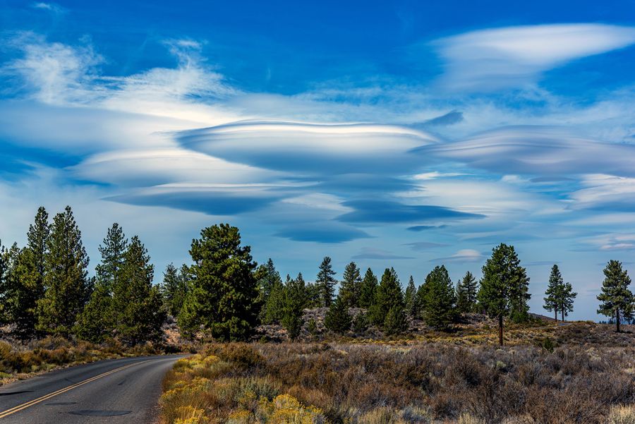
(Download)
Oct 2, 2021 00:51:56 #
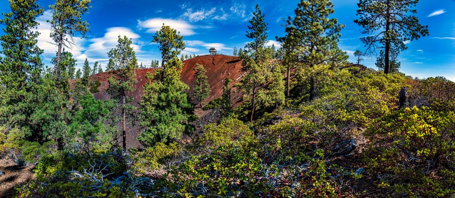
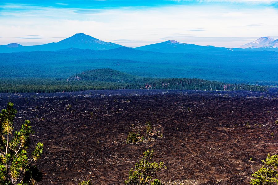
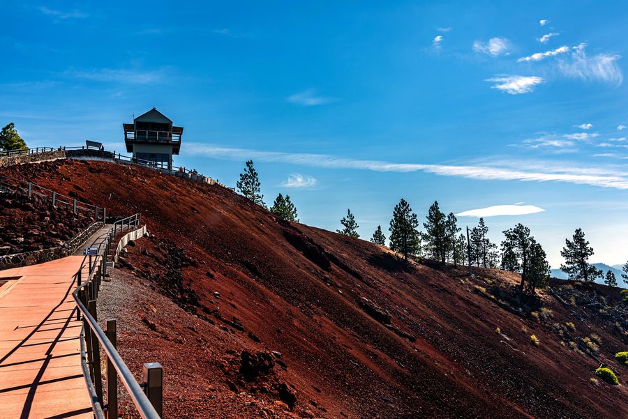
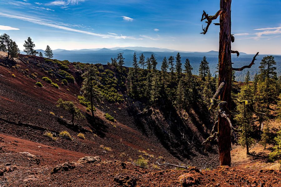
Lava Butte is a cinder cone in central Oregon, United States, just west of U.S. Route 97 between the towns of Bend, Oregon, and Sunriver, Oregon in Deschutes County. It is part of a system of small cinder cones on the northwest flank of Newberry Volcano, a massive shield volcano which rises to the southeast. The cinder cone is capped by a crater which extends about 60 feet (20 m) deep beneath its south rim, and 160 feet (50 m) deep from the 5,020-foot (1,530 m) summit on its north side. Lava Butte is part of the Newberry National Volcanic Monument.
.
.
A viewing station at the top of the crest.
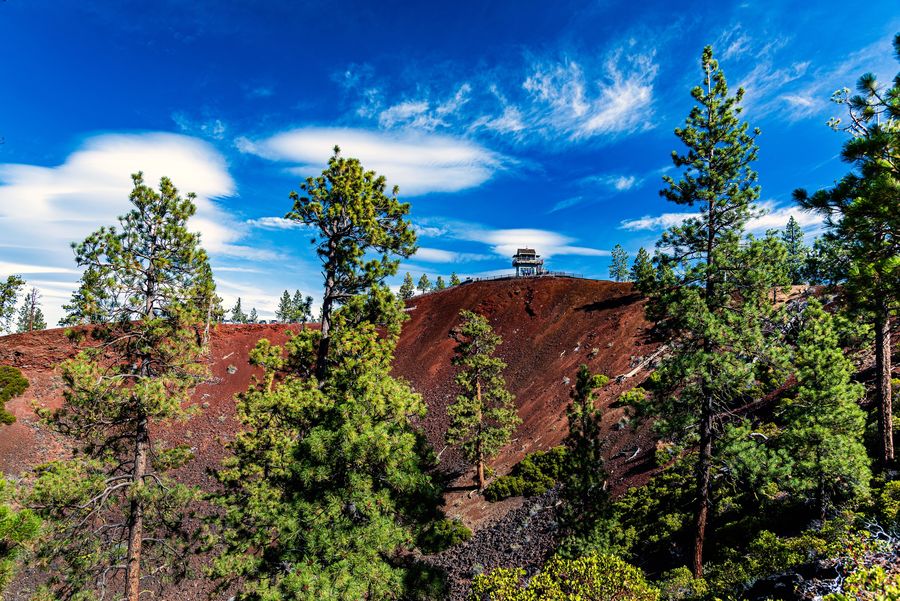
(Download)
A Panoramic shot of the tallest side of the volcano rim.
(Download)
The lava fields below the volcano. From below the edge of the lava flow is ten to twenty feet tall.
(Download)
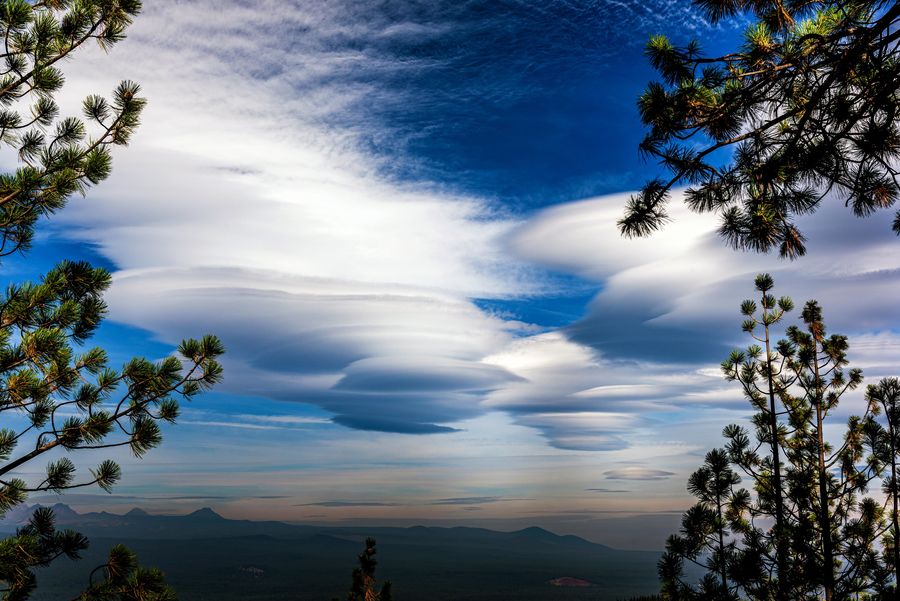
Some clouds were a nice change compared to the smoke from the previous days.
(Download)
The road spirals around the butte to the parking lot and it is a short uphill walk to the viewpoint. You can hike all the way around the crest and even down to the lava fields below.
(Download)
Looking into the crater of the butte.
(Download)
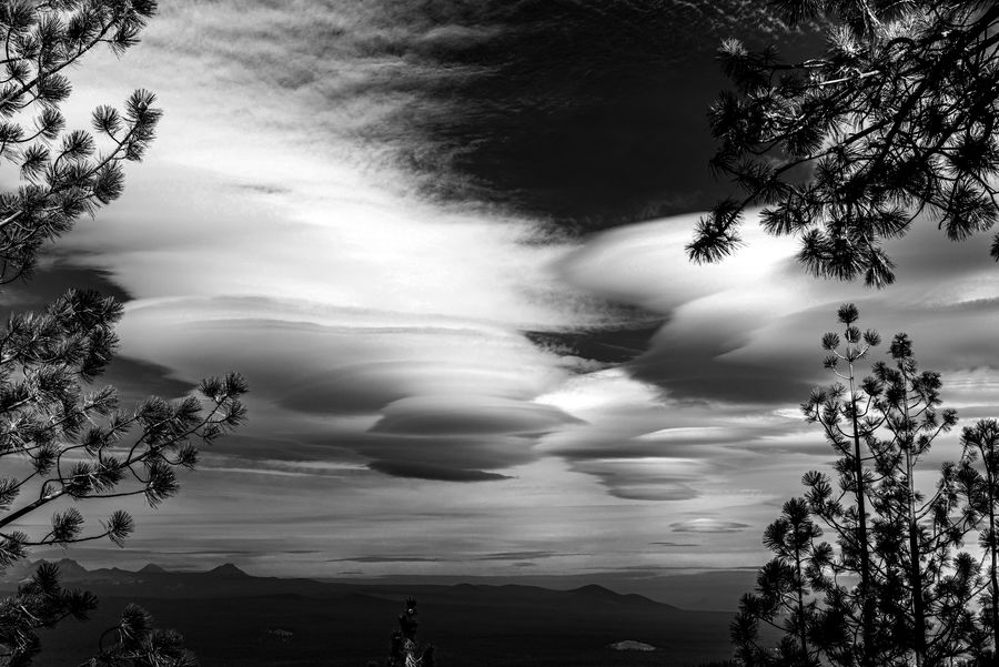
A black and white just because I can.
(Download)
Oct 1, 2021 00:06:04 #
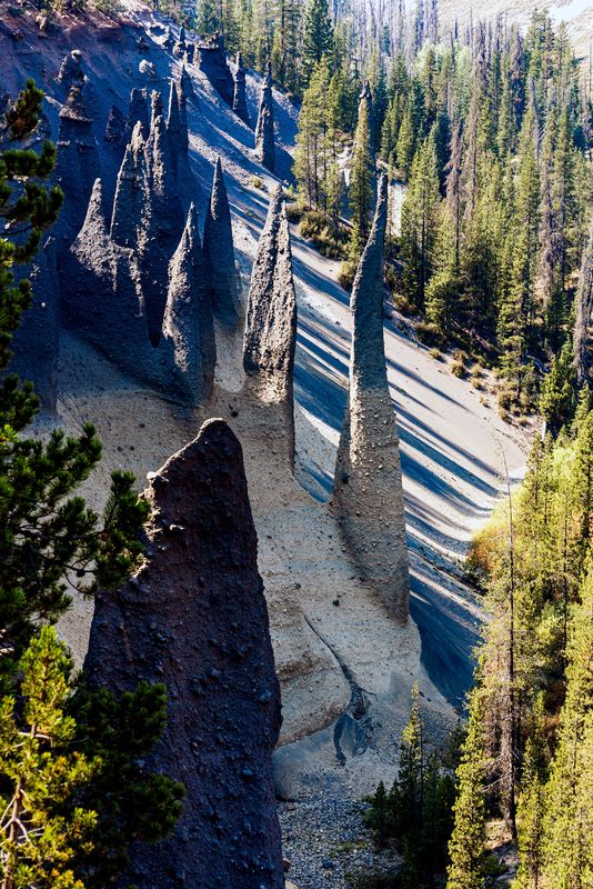
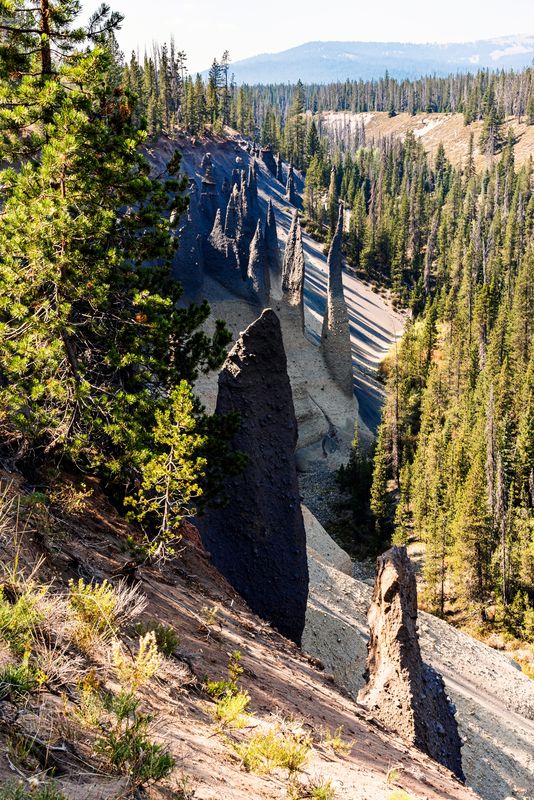
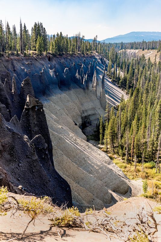
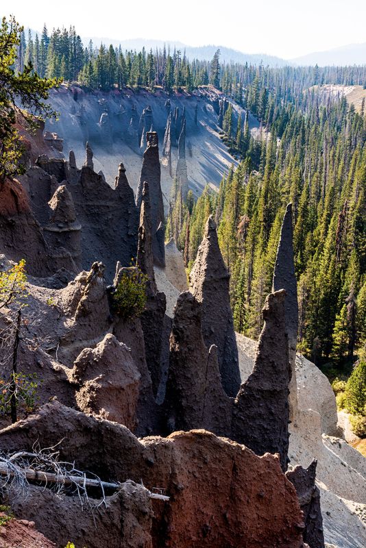
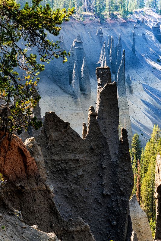
Pinnacles Valley lets you view some of the leftovers after the eruption of Mount Mazama which later collapsed and formed Crater Lake in Southern Oregon. The Pinnacles are a group of volcanic pumice spires, colored various shades of grey and brown. They were formed by erosion along the south edge of the steep-sided canyon. Some cones are especially tall and graceful and taper very gradually to a sharp point.
Sep 30, 2021 12:22:10 #
Thanks everyone for the comments. It was a great trip and I would recommend it highly. Bend, Oregon was a nice place as a base and all the points we went to were within an hour or two away. We had nice weather (only rained once) but some smoke in the early part of our week there. I hope you watch for the rest of my posts from the trip.
Sep 30, 2021 01:19:09 #
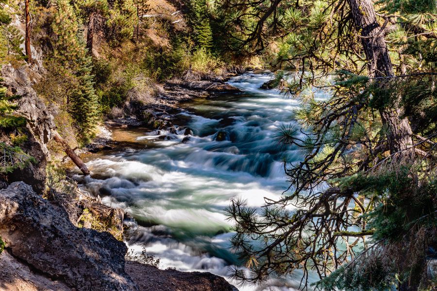
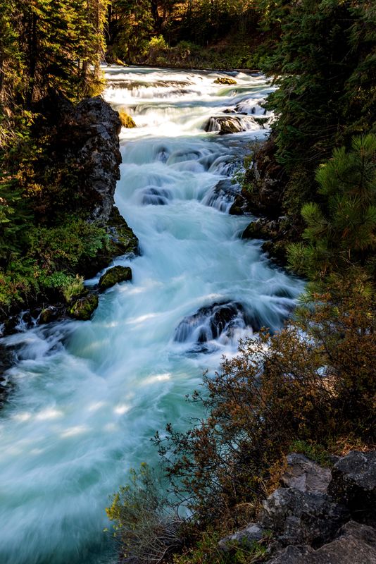
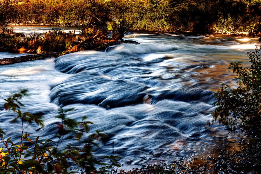
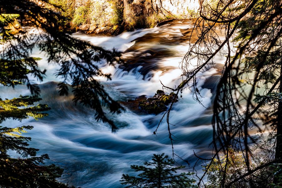
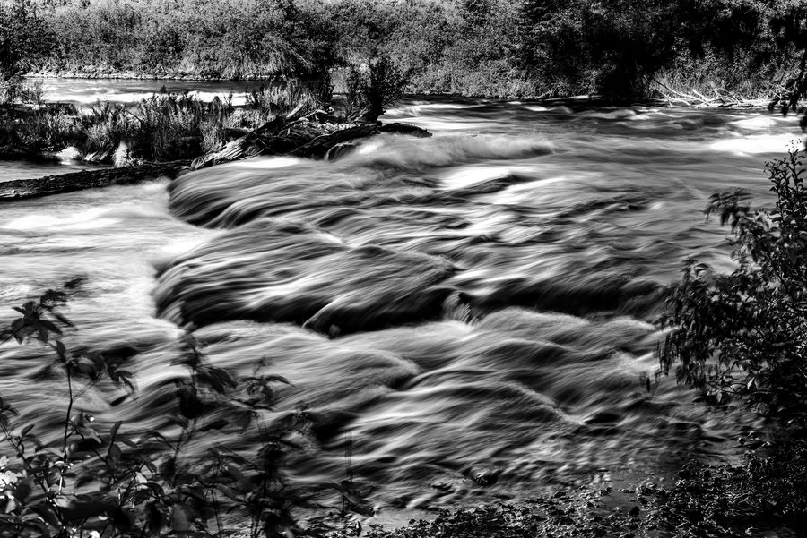
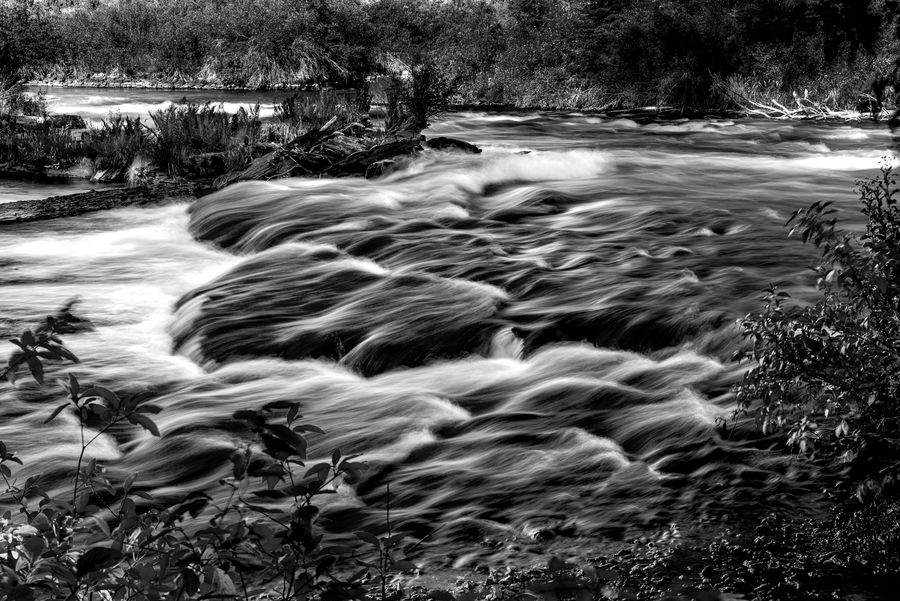
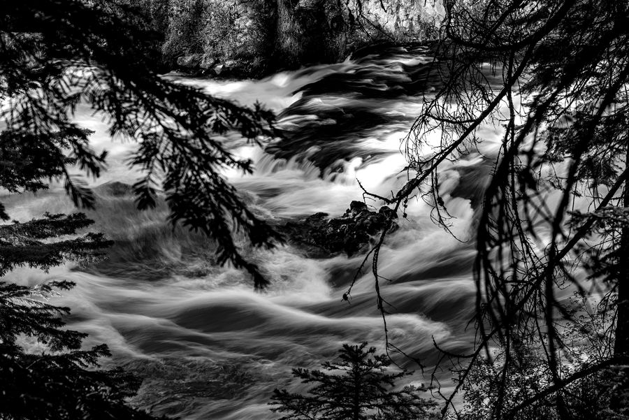
Benham Falls are rapids of the Deschutes River located between Sunriver and Bend, Oregon and are the largest falls on the upper Deschutes. The park ranger said we should go to the Falls, then corrected himself and said since the water was low this time of year that they were just rapids. The falls were created by lava which formed a narrow canyon giving this part of the river it's Class 5 rating.
.
.