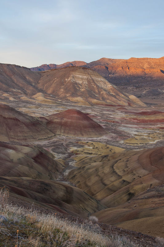
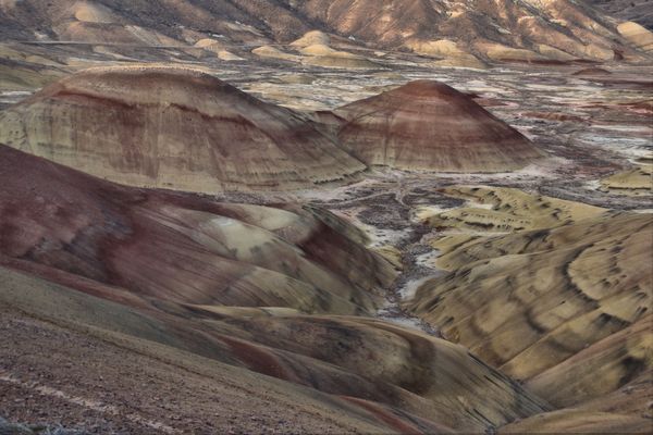
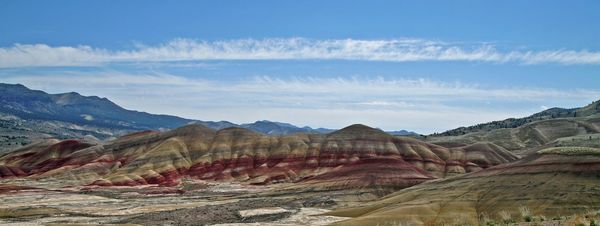
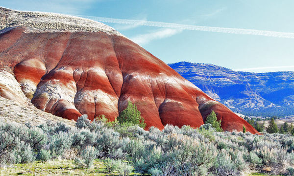
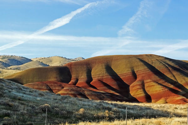
Painted Hills Unit: John Day Fossil Beds National Monument
Jan 3, 2014 12:39:57 #

frankeieio wrote:
Good way to spend New Years Day, exploring Central Oregon :)
Very nice! :thumbup: Were these taken from an airplane?
Jan 3, 2014 14:12:44 #
Jan 3, 2014 14:24:23 #
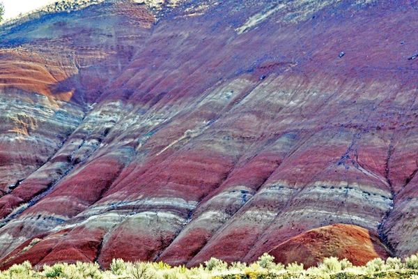
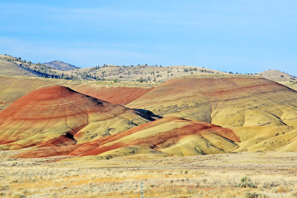
No. There is a trail that takes you right above them. Here are a couple more perscpectives from that trail:
CAM1017 wrote:
Very nice! :thumbup: Were these taken from an airplane?
HDR
Jan 3, 2014 17:32:43 #
Jan 3, 2014 20:37:58 #
A fascinating part of the OP's excursion to the Painted Hill is to read about the geology and chemical reactions that form such sights.
I live about 15 miles North of the OP. 2-3 hours East and all these wonderful photo opportunities, which we call Oregons High Desert country.
Two hours West, over the Cascade Mountain range and to the Oregon Coast, with a completely different set of photo ops.
And the Coast from the California Border, to the Washington border North, is so dissimilar and offering quite different scenic sites.
If you live in Central Oregon and don't have the Painted Hills in your portfolio... well, where you been?
Photographed from the Observation Deck the OP mentioned at the head of the trail around to the right, right up to the right end of that ridge you are viewing.
No thunderstealing here, just another take
Jan 3, 2014 21:03:32 #
dmeyer2m wrote:
I'll be in NE Oregon in May and have been looking at routes which might take us by the John Day Painted Hills area. My question to you, frankeieio, is whether you can clearly see the painted hill from Hwy. 218 from Antelope to Fossil and Service Creek, then onto Hwy. 19 and east?
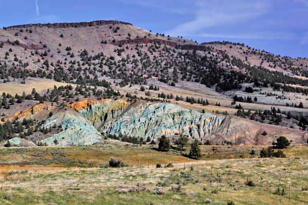
No, you can't. The Painted Hills Unit is located 9 miles northwest of of the town of Mitchell. The entrance is on Burnt Ranch Road, 6 miles north of its junction with Highway 26. You can see the entire Painted Hills area in an hour or two, even if you take the marked trails. Even during mid-day, they're photogenic. The bottom photo is not from the Painted Hills; the outcrop is west of Service Creek Road, just south of the village of Service Creek.
Jan 3, 2014 21:21:52 #
sunshooter wrote:
No, you can't. The Painted Hills Unit is located 9 miles northwest of of the town of Mitchell. The entrance is on Burnt Ranch Road, 6 miles north of its junction with Highway 26. You can see the entire Painted Hills area in an hour or two, even if you take the marked trails. Even during mid-day, they're photogenic. The bottom photo is not from the Painted Hills; the outcrop is west of Service Creek Road, just south of the village of Service Creek.
Thanks, Sunshooter, for showing the difference in locations! If you have any more images from Hwy. 218, I'd like to see them.
Jan 3, 2014 21:24:11 #

Love the tones in the first shot... Great subject and awesome shots... :)
Like em' all
Like em' all
Jan 3, 2014 23:03:35 #

frankeieio wrote:
Good way to spend New Years Day, exploring Central Oregon :)
Interesting colors. Nice shots. :thumbup: :thumbup:
Jan 4, 2014 02:33:27 #
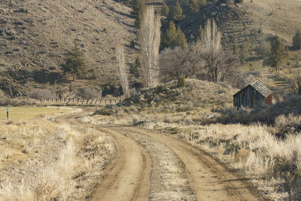
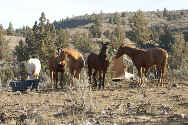
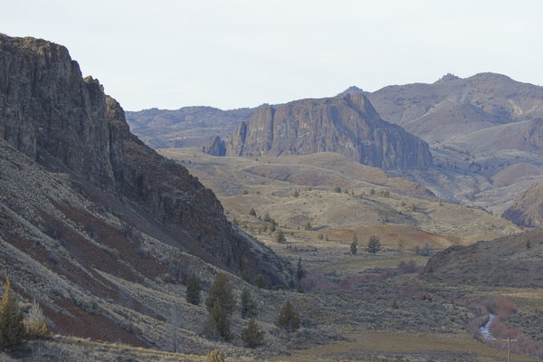
We arrived at the Painted Hills from the 218 cutting south onto the old Antelope to Prineville stagecoach road and then turning east again at an old junction few miles short of Ashwood, heading right past Horse Heaven Mountain and its abandoned cinnebar mine. This road took us through the Cherry Creek Ranch and BLM land down to the John Day River north of the town of Twickenham. We then made our way on to Burnt Ranch Rd, from the north, roughly following, but not skirting the John Day River till we got to the Painted Hills. The roads were gravel and dirt and I believe, and beyond being principally being an actual stage coach road, generally follow wagon routes as they were first laid out way back when. They were fairly well graded, and in great shape for a mid-winters day. Of course the road beds have been reworked for more modern vehicle travel. We pretty much had the road to ourselves the entire way. The journey looked as follows (as you can see the light was pretty nice, but it was spectacular at sunset...:)
dmeyer2m wrote:
Thanks, Sunshooter, for showing the difference in locations! If you have any more images from Hwy. 218, I'd like to see them.
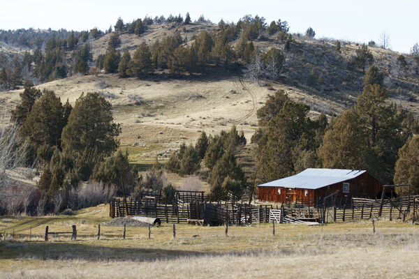
Old Ranch off of former Antelope to Prineville Stagecoach Rd.
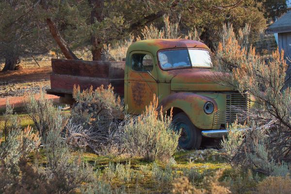
Abandoned truck at Horse Heaven Mine
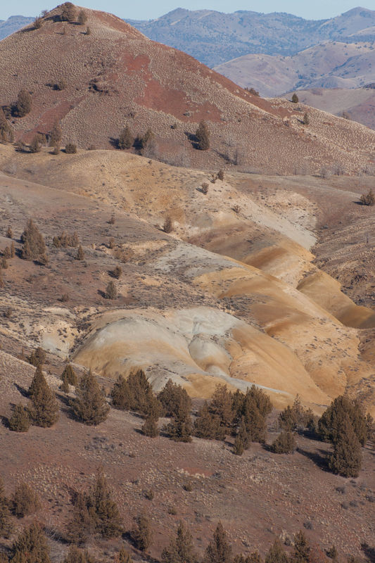
Painted Hill just east of Horse Heaven Mtn.
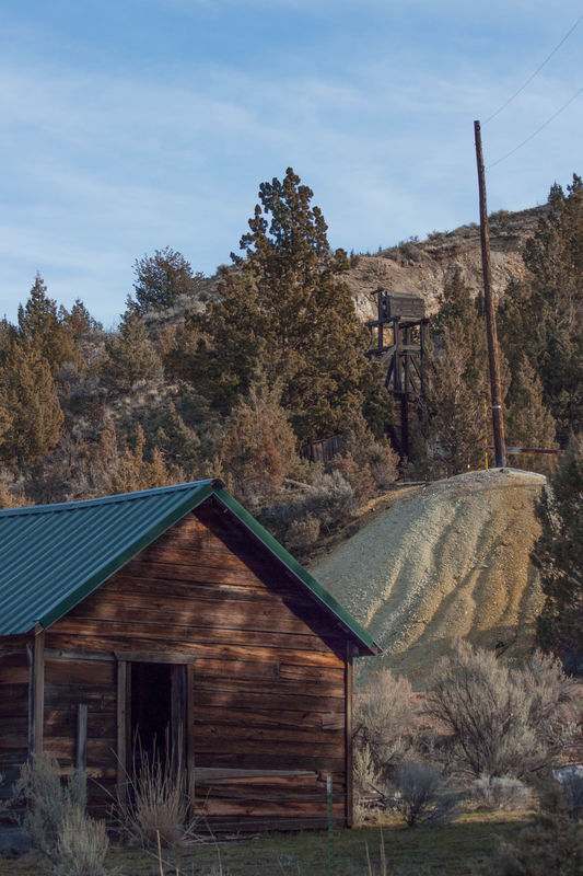
Abandoed Horse Heaven Cinnebar Mine
Driving through Cherry Creek Ranch
Ponies mugging for the camera ;)
John Day River a few miles north of Priest Hole
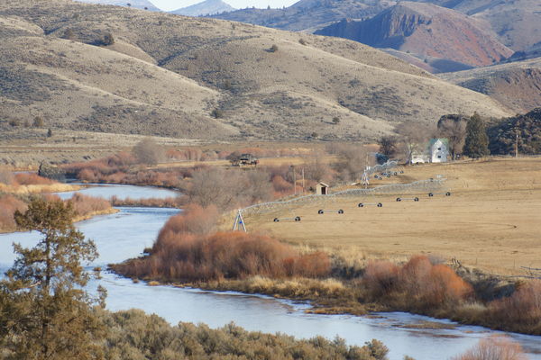
Somewhere between the John Day and Burnt Creek Ranch Rd.
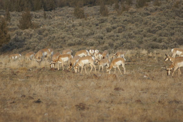
Here, the deer and the antelope (and the photographer) play.
Jan 4, 2014 03:20:34 #

frankeieio wrote:
Good way to spend New Years Day, exploring Central Oregon :)
The shots in this thread are mind boggling. I have never seen that part of the country. Didn't even know it existed. I really enjoyed looking at them. Thanks for posting them.
Jan 4, 2014 06:07:43 #
frankeieio wrote:
We arrived at the Painted Hills from the 218 cutti... (show quote)
Great share, frankeieio--these images show so many interesting aspects to the route and provide the incentive to work this area into the itinerary. Glad you gave specifics on the roads. I know it's time consuming to add so many images, so thank you--I appreciate it!! :D
Jan 4, 2014 11:44:46 #
From our base, Bend, it was roughly a 200 mile round trip tour, all of it scenic. This trip included rounding a bend to witness a just born calf taking its first steps, I posted that series here on UHH the same day as this as well (cropping off the part of the images that would be interesting to veterinarians..) We lollygagged on the dirt roads, touring in this manner really is an intimate way to visit the countryside. We've done longer trips, of course where time constraints forced us to stick to paved highways and their requisite speeds, but taking the time to tour like this really connects you the memory of the day.
Essentially, in Oregon's outback, every vista presents an opportunity to look back in time, millions of years of time. If one is open to it, the car then becomes an effective time machine. The experience of taking all the wonders in on a beautiful day can be quite satisfying, and a really, really good way to start the New Year... :)
Essentially, in Oregon's outback, every vista presents an opportunity to look back in time, millions of years of time. If one is open to it, the car then becomes an effective time machine. The experience of taking all the wonders in on a beautiful day can be quite satisfying, and a really, really good way to start the New Year... :)
mosbenav wrote:
The shots in this thread are mind boggling. I have never seen that part of the country. Didn't even know it existed. I really enjoyed looking at them. Thanks for posting them.
Jan 4, 2014 11:56:32 #

Jan 4, 2014 11:57:56 #
If you want to reply, then register here. Registration is free and your account is created instantly, so you can post right away.