Photographing rarely seen Cummings Mesa: Day 9 most spectacular day yet
May 27, 2023 06:57:35 #
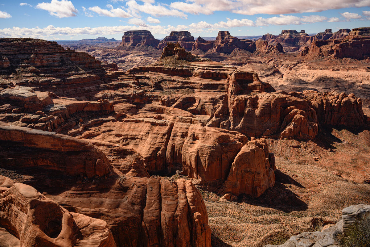
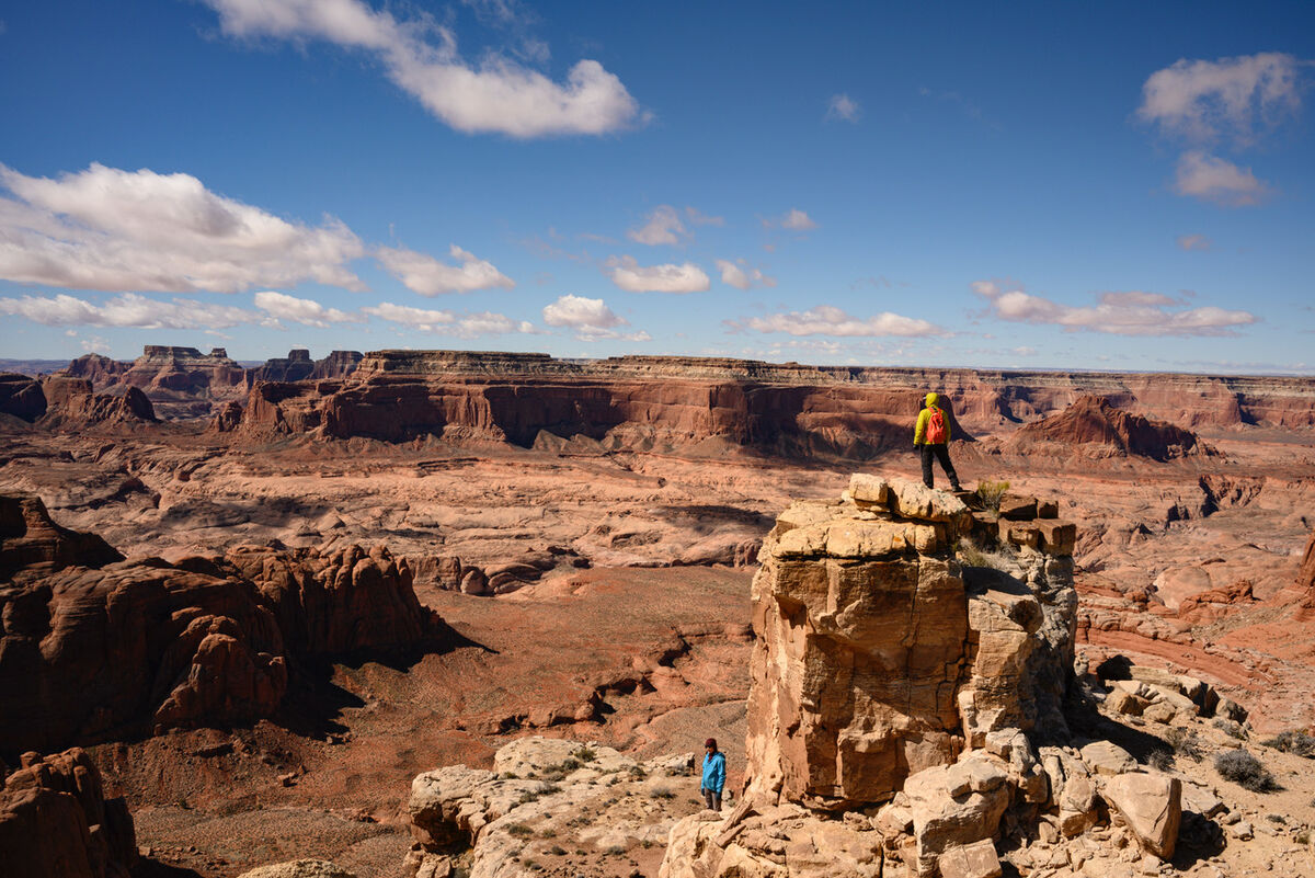
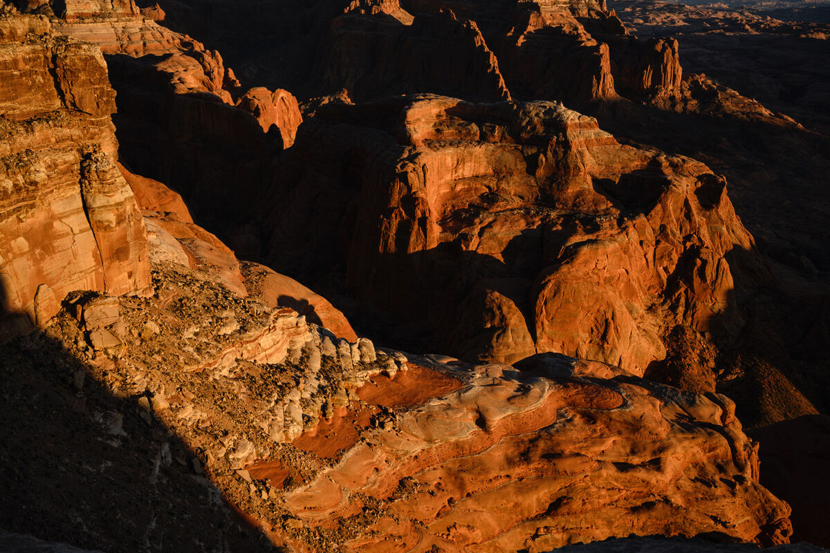
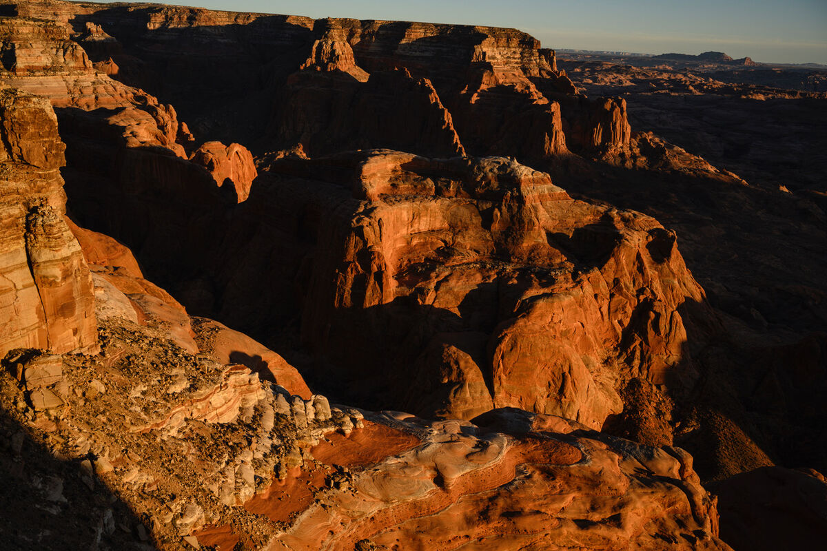
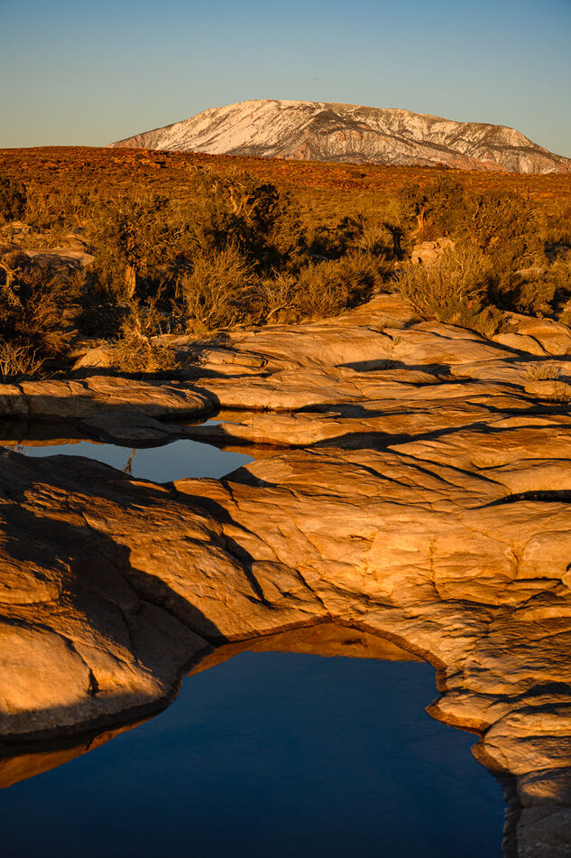
Once the latest storm blew over we crossed back over to the far western edge of Cummings Mesa. This edge, overlooking West Canyon had by far the best views as well as very interesting archaeology. Half way thru the trip the scenery just got crazy spectacular. The first two photos gives a nice sense of the immense vertical scale of the West Canyon region. The rest were taken from the edge of our camp that night. It had a very "Sierra-like" feel to it as there were literally 30 little "tarns" some as big as 30 feet across, accompanied by Navajo Mountain peering down on us from the distance.
May 27, 2023 07:12:24 #
May 27, 2023 07:15:27 #

Impressive scenery! Thanks for sharing. Is that a part of the Grand Canyon?
May 27, 2023 07:22:30 #

May 27, 2023 07:35:29 #

May 27, 2023 07:42:36 #

May 27, 2023 08:14:49 #
Tdearing wrote:
Well done.
No, it's on the Navajo Nation just off of Lake Powell. You might want to go back and see my earlier posts from this trip to get the full back story.
May 27, 2023 08:20:47 #
May 27, 2023 08:28:45 #
May 27, 2023 08:54:12 #

May 27, 2023 08:54:29 #

Desolate, but spectacular, landscapes! Once again, fantastic photography on your part.
May 27, 2023 09:06:27 #
May 27, 2023 11:01:20 #

Great photos! I would be especially interested in seeing some of the "archaeology"!
May 27, 2023 11:24:41 #

May 27, 2023 16:46:29 #

…the people really help with perspective…but getting down from the top may be harder than getting up…?
If you want to reply, then register here. Registration is free and your account is created instantly, so you can post right away.