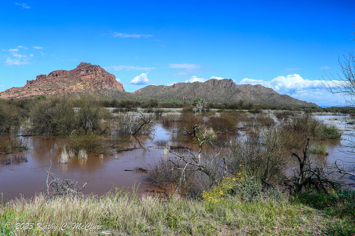
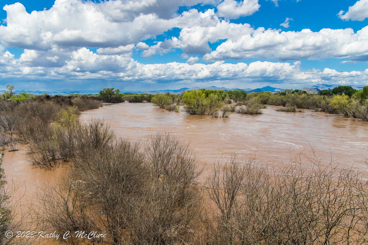
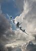
When it rains in the desert
Mar 24, 2023 19:18:13 #

things change. When it rains a lot, things get dangerous.
Visitors to our desert frequently ask why our bridges are so wide when there's no water. The attached pictures show why! I can remember when there weren't bridges, and it was all "drive through the river bottom" crossings. Then, when it rained and the rivers and washes started running, one literally get anywhere!
The first one is the Salt in a normally dry flood plain area. The last one is the Verde. I haven't been down to the Gila yet.
Mar 24, 2023 19:21:44 #
AzPicLady wrote:
things change. When it rains a lot, things get da... (show quote)
Very nice,
I have some old photos of the Salt just south of Phoenix when it was wet and was a mile wide.
Mar 24, 2023 19:29:32 #
Architect1776 wrote:
Very nice,
I have some old photos of the Salt just south of Phoenix when it was wet and was a mile wide.
I have some old photos of the Salt just south of Phoenix when it was wet and was a mile wide.
I remember the days of the "100-year-floods." Thing was, they happened rather frequently for awhile! The only way to cross the Salt was the Mill Avenue bridge. Since the Agua Fria is also running, it would be interesting to see what Three Rivers looks like right now!
Mar 24, 2023 19:39:31 #
AzPicLady wrote:
I remember the days of the "100-year-floods." Thing was, they happened rather frequently for awhile! The only way to cross the Salt was the Mill Avenue bridge. Since the Agua Fria is also running, it would be interesting to see what Three Rivers looks like right now!
You are correct.
One year it was bad enough when even I10 was also washed out and only Central Ave and Mill Ave were open.
The thing was Mill Ave was one way and the other way went into the river bed and was only 2 way when the river was flooding until the second Mill avenue bridge was added in the early 90's (I believe, hard to remember).
Mar 24, 2023 20:55:28 #

Wow, Kathy, we saw a little bit of this around Page, but your area really got rain.
Mar 24, 2023 21:21:46 #
UTMike wrote:
Wow, Kathy, we saw a little bit of this around Page, but your area really got rain.
Thanks, Mike. Actually, we did get a lot of rain here, but one must remember that the Salt and Verde carry the runoff from the high country also. So all those raging washes end up running through the Valley.
Mar 25, 2023 05:38:27 #

AzPicLady wrote:
things change. When it rains a lot, things get da... (show quote)
Great set !! Kathy
The little river (name Big River) still haven't figured that one out😗 behind my house Looked like that, but luckily I'm just a mile or so from the head waters so no real flooding,miles down stream are another story!
Mar 25, 2023 05:41:50 #
AzPicLady wrote:
things change. When it rains a lot, things get da... (show quote)
Beautiful images Kathy.
Mar 25, 2023 06:11:42 #


Mar 25, 2023 08:31:56 #
Mar 25, 2023 08:33:14 #

Mar 25, 2023 09:06:41 #

Mar 25, 2023 09:45:05 #
Mar 25, 2023 10:13:56 #

Mar 25, 2023 10:25:47 #
If you want to reply, then register here. Registration is free and your account is created instantly, so you can post right away.