Century old train wrecks
Mar 9, 2023 18:15:06 #
in the early 1900’s a railroad line was built west of Denver over the Continental Divide, where it crossed a pass that exceeded 11,000 feet in elevation. It was a major engineering and construction project involving tunnels, trestles, switchbacks, wyes and many maintenance buildings, sidings and facilities etc.
There were several wrecks that occurred over the years. Two separate wrecks involved a couple of work trains. One train was swept off a cliff face by an avalanche and rolled into a meadow about 100 feet below.
The other wreck occurred when a train lost its air, and subsequently its brakes, on a downhill run. The engineer and fireman jumped from the locomotive at about 10mph and weren’t killed.
The train gained speed going down hill and couldn’t navigate a curve, left the tracks, flew through the air into the tree tops and came to rest in the same meadow as the avalanche wreck. It was said the train fell over 700 feet. I don’t recall which wreck happened first.
The RR built roads, sidings and ramps etc to get to the meadow to retrieve the salvageable parts of both wrecks. There are still many small pieces of wreckage down there.
In the 1920’s a tunnel was built under the Divide and the route over the pass was eventually discontinued. The RR pulled up all the tracks and anything of any value and the roadbed became a wagon and auto road for awhile.
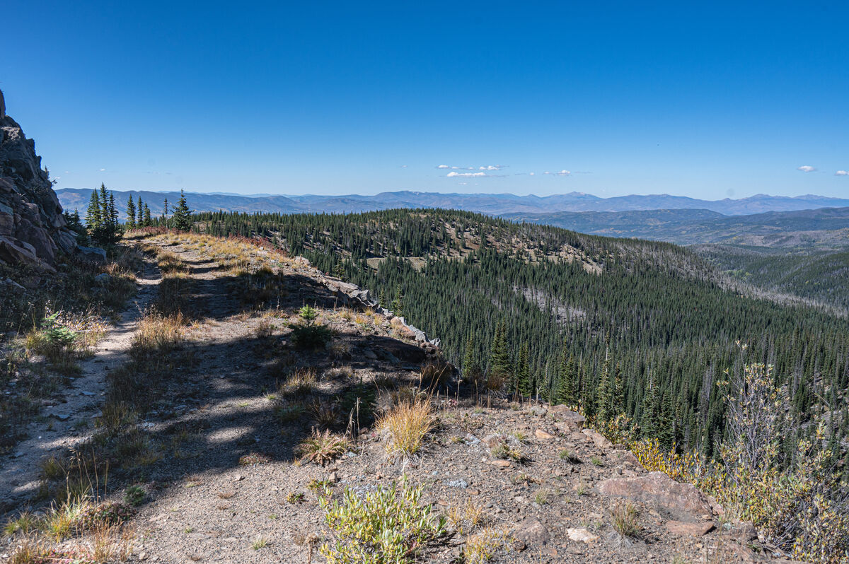
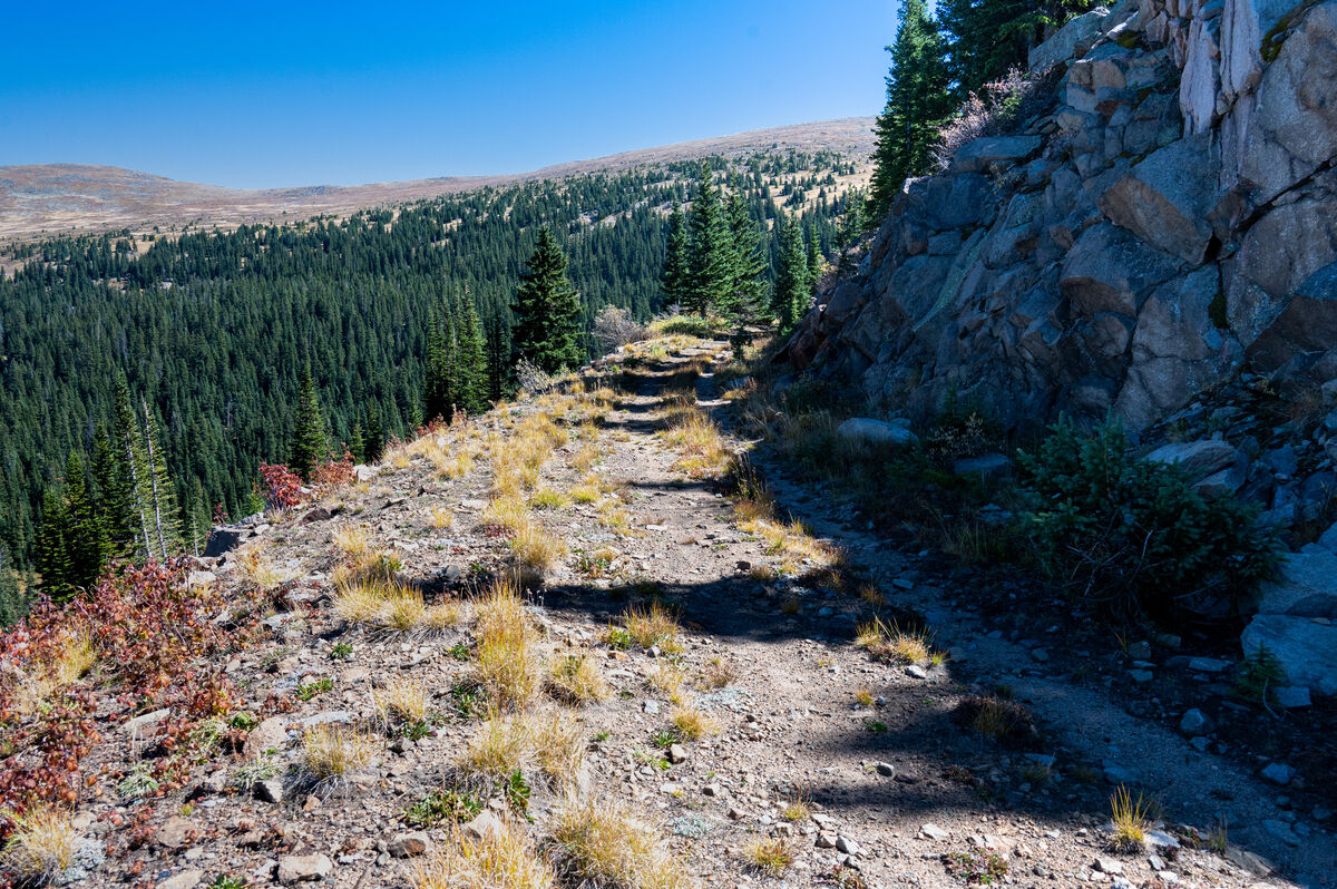
Over the years, tunnels and trestles collapsed and a primitive road now exists on both sides of the pass but does not cross it due to a blocked tunnel. Much of the current road follows the old RR roadbed but has had to detour around the collapsed or destroyed sections. The abandoned sections of the main line can be located as well as stems and sidings etc. and abandoned town sites along the route. This old roadbed still contains numerous rusty artifacts ie spikes, connector plates, broken tools, valves and ??? etc.
My friend and I spent a several days last summer searching for the wreckage sites and the locations where the trains left the tracks. Due to weather, darkness and too much time spent taking pix during the hikes we never got into the meadow itself but will do so this coming summer now that we know where it is and the best trails to take to get to it. Further research and satellite photos also have hints as to other interesting sites to visit along the RR route.
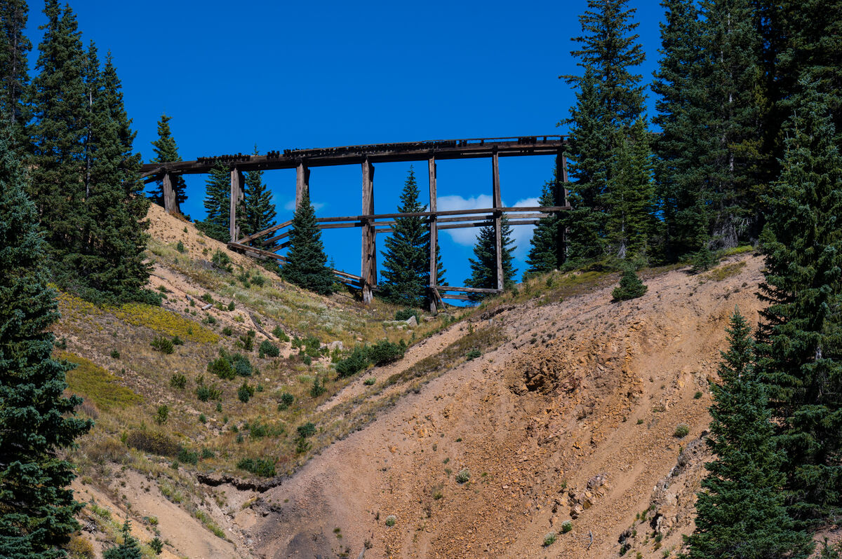
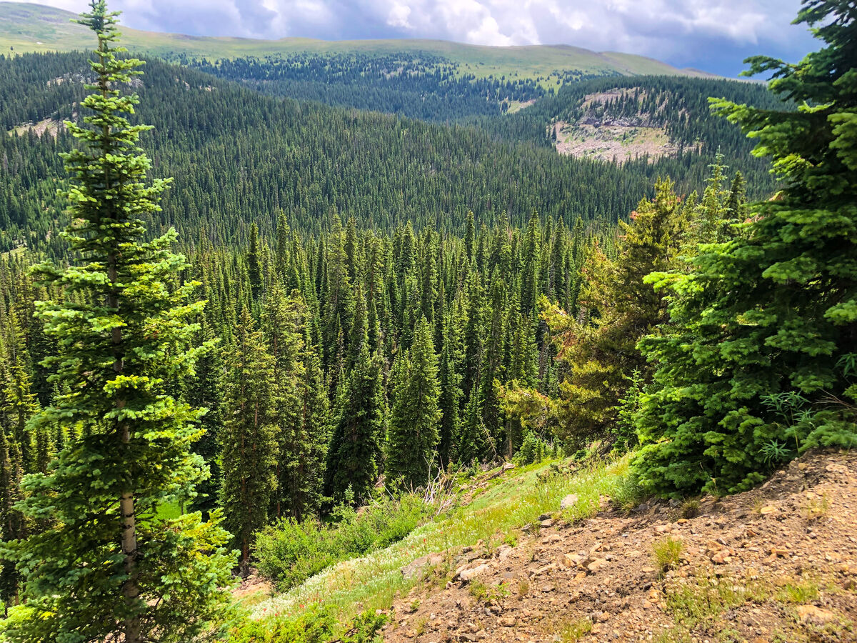
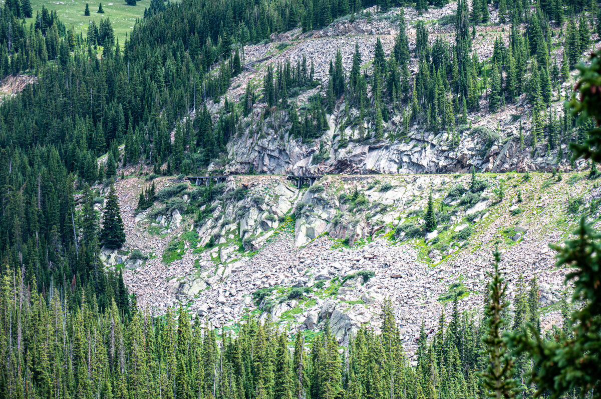
The train crossed the trestle in the first pic from the right to the left. We climbed to the trestle and followed the RR road bed to the upper wreck site. Most shots were taken in that area.
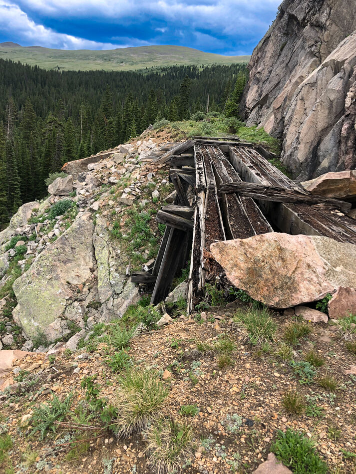
The bare area in the lower right is the collapsed tunnel. Trains would cross the trestle and proceed to a switchback and descend and go thru the tunnel to lose elevation on the way down---or reverse on the way up.
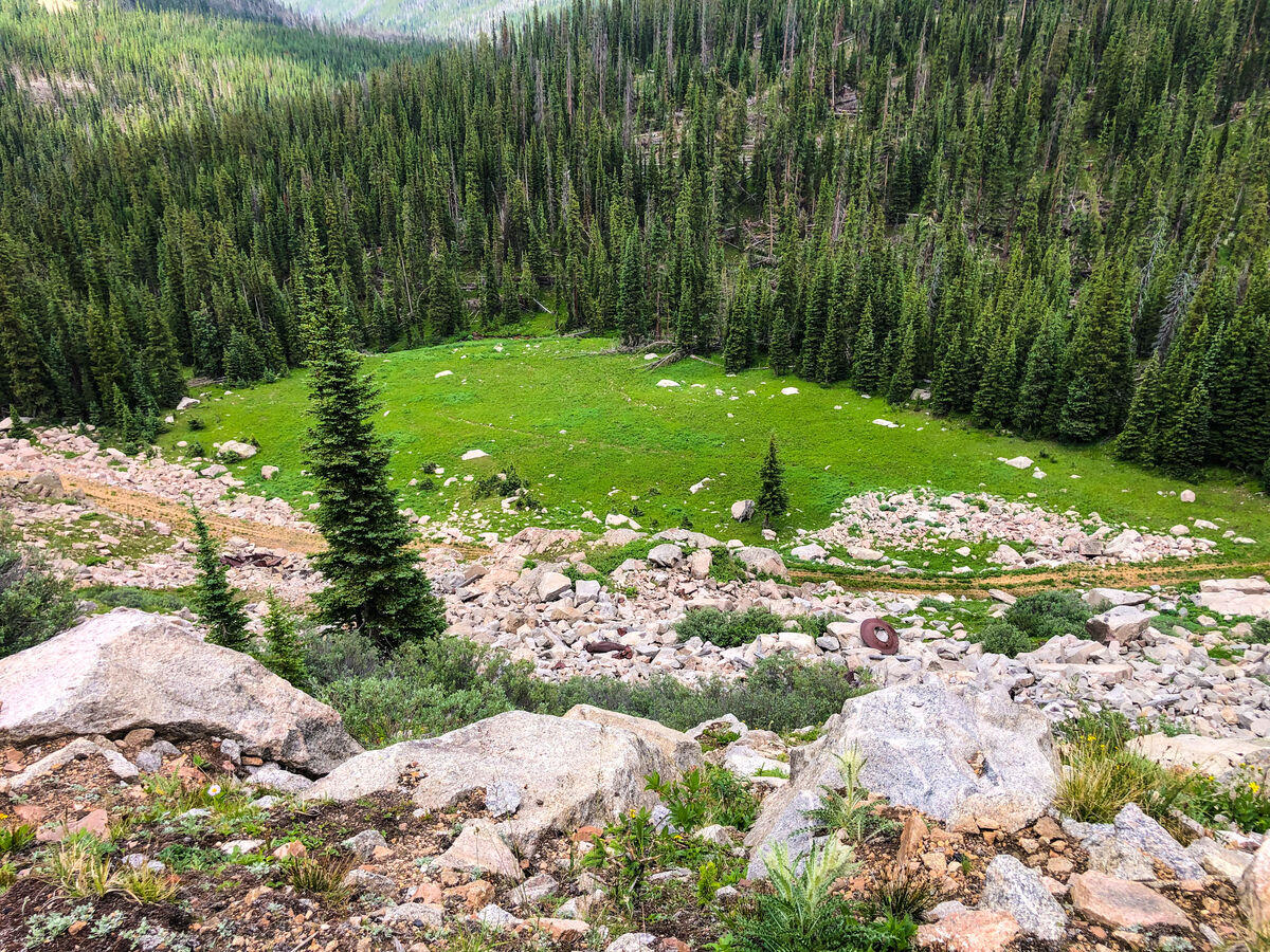
Note how the color of the meadow changed due to the season change.
There were several wrecks that occurred over the years. Two separate wrecks involved a couple of work trains. One train was swept off a cliff face by an avalanche and rolled into a meadow about 100 feet below.
The other wreck occurred when a train lost its air, and subsequently its brakes, on a downhill run. The engineer and fireman jumped from the locomotive at about 10mph and weren’t killed.
The train gained speed going down hill and couldn’t navigate a curve, left the tracks, flew through the air into the tree tops and came to rest in the same meadow as the avalanche wreck. It was said the train fell over 700 feet. I don’t recall which wreck happened first.
The RR built roads, sidings and ramps etc to get to the meadow to retrieve the salvageable parts of both wrecks. There are still many small pieces of wreckage down there.
In the 1920’s a tunnel was built under the Divide and the route over the pass was eventually discontinued. The RR pulled up all the tracks and anything of any value and the roadbed became a wagon and auto road for awhile.
Over the years, tunnels and trestles collapsed and a primitive road now exists on both sides of the pass but does not cross it due to a blocked tunnel. Much of the current road follows the old RR roadbed but has had to detour around the collapsed or destroyed sections. The abandoned sections of the main line can be located as well as stems and sidings etc. and abandoned town sites along the route. This old roadbed still contains numerous rusty artifacts ie spikes, connector plates, broken tools, valves and ??? etc.
My friend and I spent a several days last summer searching for the wreckage sites and the locations where the trains left the tracks. Due to weather, darkness and too much time spent taking pix during the hikes we never got into the meadow itself but will do so this coming summer now that we know where it is and the best trails to take to get to it. Further research and satellite photos also have hints as to other interesting sites to visit along the RR route.
The train crossed the trestle in the first pic from the right to the left. We climbed to the trestle and followed the RR road bed to the upper wreck site. Most shots were taken in that area.
The bare area in the lower right is the collapsed tunnel. Trains would cross the trestle and proceed to a switchback and descend and go thru the tunnel to lose elevation on the way down---or reverse on the way up.
Note how the color of the meadow changed due to the season change.
Trestle above collapsed tunnel. Train crossed trestle shortly before leaving the tracks.
(Download)
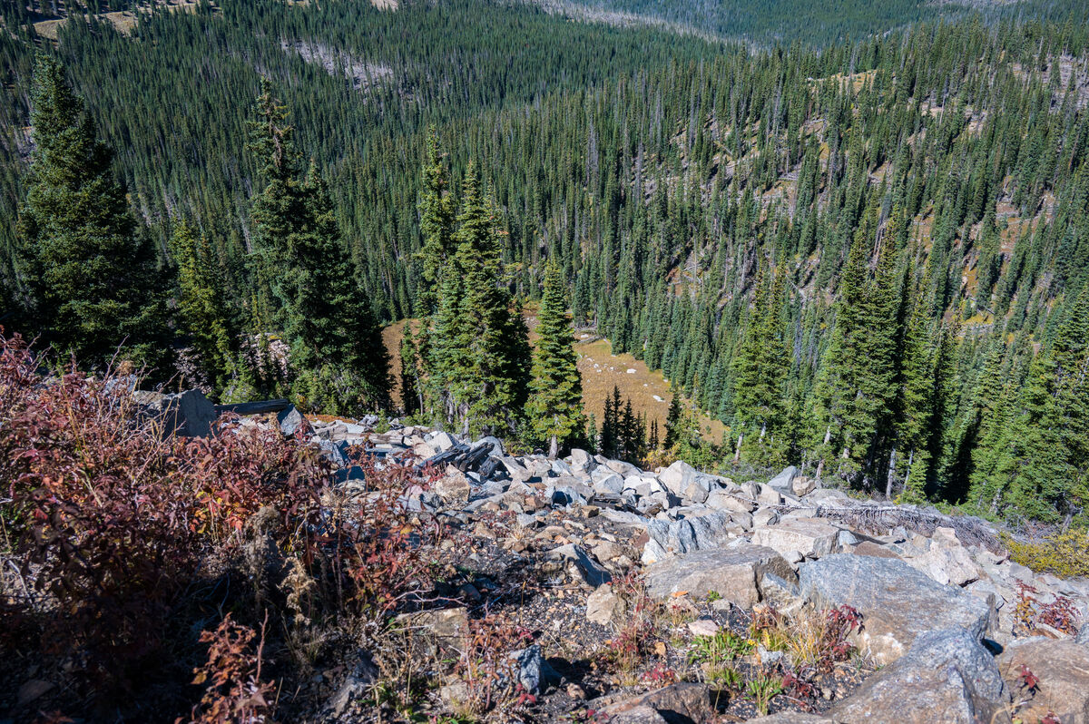
Area where train left tracks---looking downhill
(Download)
Looking uphill from where train left tracks
(Download)
Train landed in meadow below. The downed trees have regrown
(Download)
Note meadow with fragments of wreakage. Pic taken from site of the avalanched wreck.
(Download)
Small trestle very near to where avalanche occurred
(Download)
View of both wreck sites in clearing in upper right. Upper left of clearing for one wreci and center of clearing for the avalanche
(Download)
One wreck left tracks at top of pic, avalanche wreck happened in center of pic
(Download)
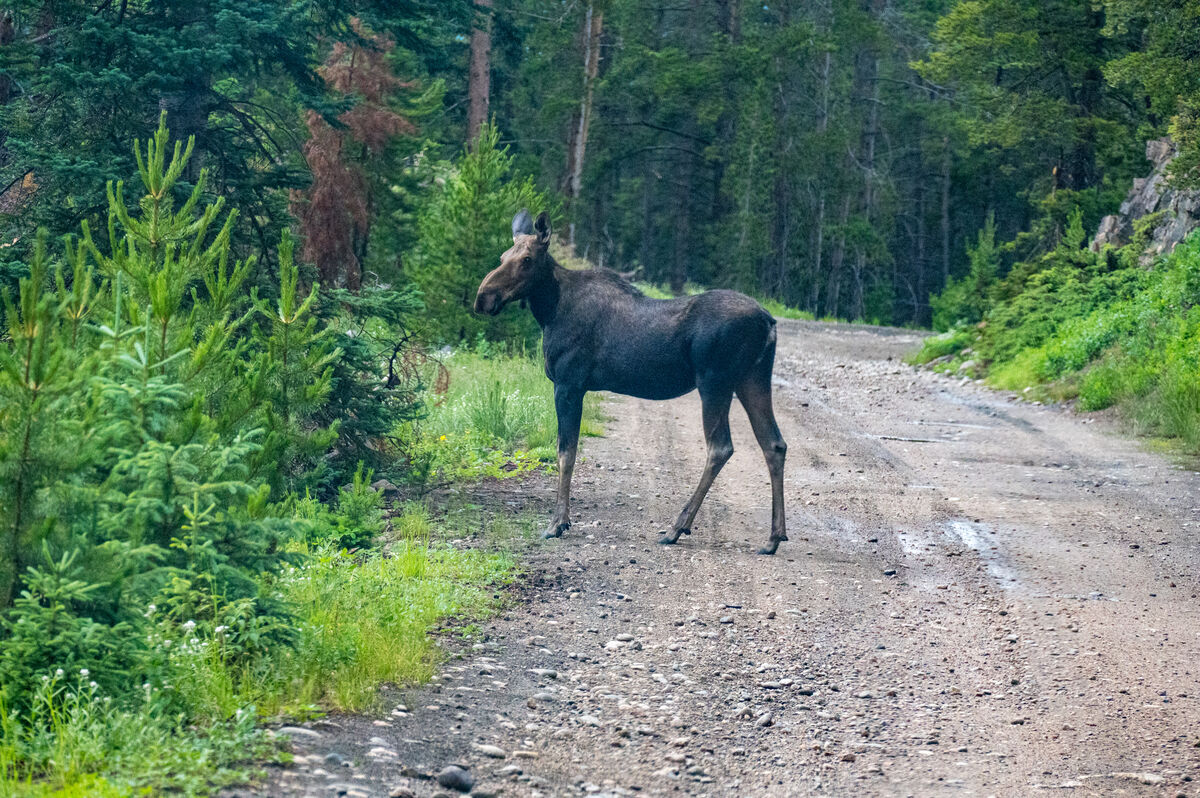
Small moose on good section of auto access road on way to trail heads
(Download)
Mar 9, 2023 18:27:57 #
2buckskin
Loc: Wyoming
Nice photo series, thanks for the historical narrative.
Is this the Rollins pass area, where after the Moffat tunnel was completed the old line became obsolete?
I traveled the old roadbed a few years ago, up to needles eye a collapsed tunnel.
Is this the Rollins pass area, where after the Moffat tunnel was completed the old line became obsolete?
I traveled the old roadbed a few years ago, up to needles eye a collapsed tunnel.
Mar 9, 2023 19:10:58 #

Mar 9, 2023 19:17:35 #
2buckskin wrote:
Nice photo series, thanks for the historical narrative.
Is this the Rollins pass area, where after the Moffat tunnel was completed the old line became obsolete?
I traveled the old roadbed a few years ago, up to needles eye a collapsed tunnel.
Is this the Rollins pass area, where after the Moffat tunnel was completed the old line became obsolete?
I traveled the old roadbed a few years ago, up to needles eye a collapsed tunnel.
That's exactly correct. All the pix were taken on the west side where there is a road that goes all the way to the top of the pass. The road on that side begins near Winter Park Ski Area and is much more scenic but it can get very difficult in a few spots.
If you ever come back I'd recommend that side of the pass because there is a lot more to see, including building ruins etc at the top of the pass on the Divide. For some reason the road on the west side is frequently called Corona Pass. Corona was the name of the establishment on top.
Thanks for you comment.
Mar 9, 2023 19:17:58 #
lukevaliant wrote:
great story and photos,a little view from the past! 

thanks for the comments.
Mar 9, 2023 23:01:11 #
wdross
Loc: Castle Rock, Colorado
fantom wrote:
in the early 1900’s a railroad line was built west... (show quote)
I was out there when the the railroad bed could be driven from Nederland to the Winter Park area. Sad to know it can no longer be driven (haven't been in that neck of the Colorado woods for a long time). I can still remember driving over that small trestle. I could put my hand out and catch the waterfall on the driver's side and my passenger could open the car door, with no place to really stand, and look down at what seemed to be a thousand feet below. Not sure I would like to take a car across that small trestle now. Thank you for bring back a wonderful time with your wonderful photos.
Mar 10, 2023 00:31:28 #
wdross wrote:
I was out there when the the railroad bed could be... (show quote)
The road has been closed by a fallen tunnel on the east side about a mile or two from the summit for roughly 15 years. There are no trestles that you can drive over now but we have walked over them carefully.
Mar 10, 2023 05:23:57 #
Mar 10, 2023 06:22:14 #

Mar 10, 2023 06:36:13 #

Mar 10, 2023 06:41:13 #

Mar 10, 2023 07:41:01 #

Mar 10, 2023 09:38:21 #

Wonderful story and photos. Please consider sharing this with the Colorado Railroad Museum in Golden.
Mar 10, 2023 09:46:11 #
Mar 10, 2023 14:32:48 #

If you want to reply, then register here. Registration is free and your account is created instantly, so you can post right away.