Autumn Scenes in The High Country
Dec 4, 2022 12:59:07 #

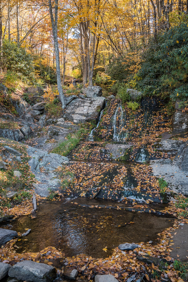
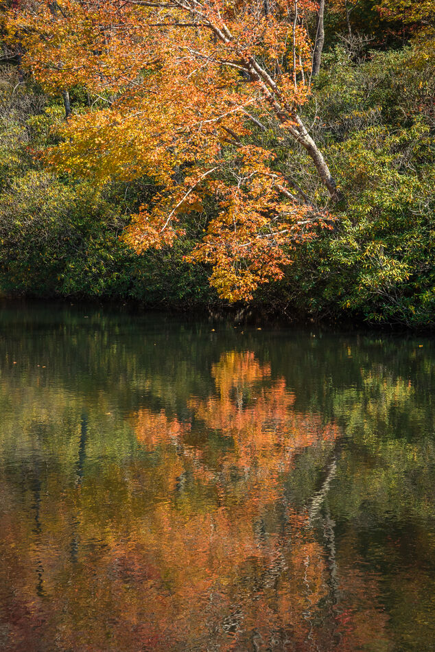
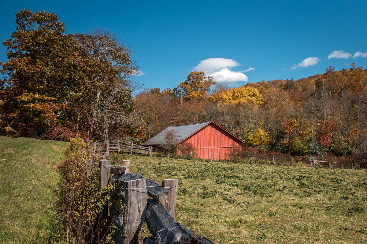
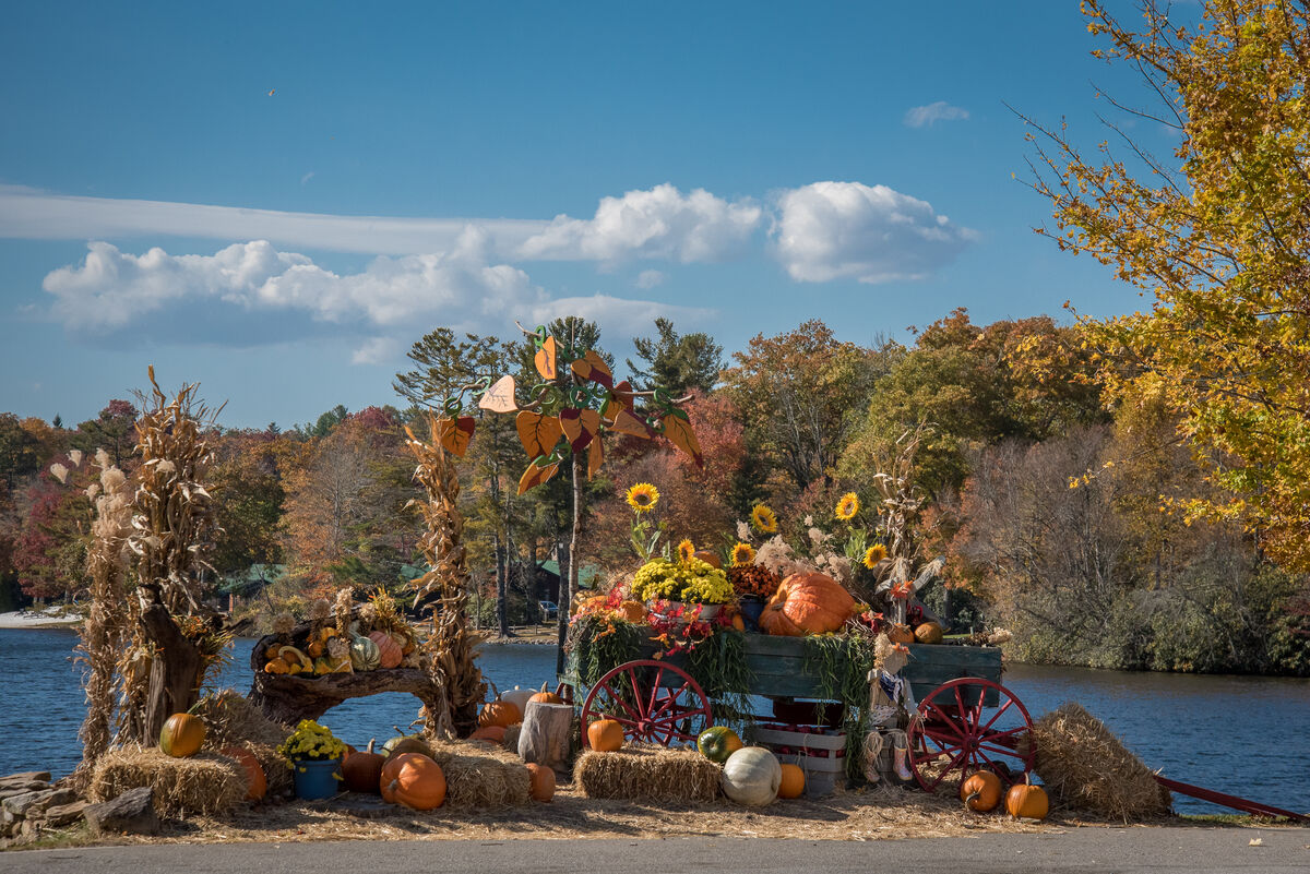
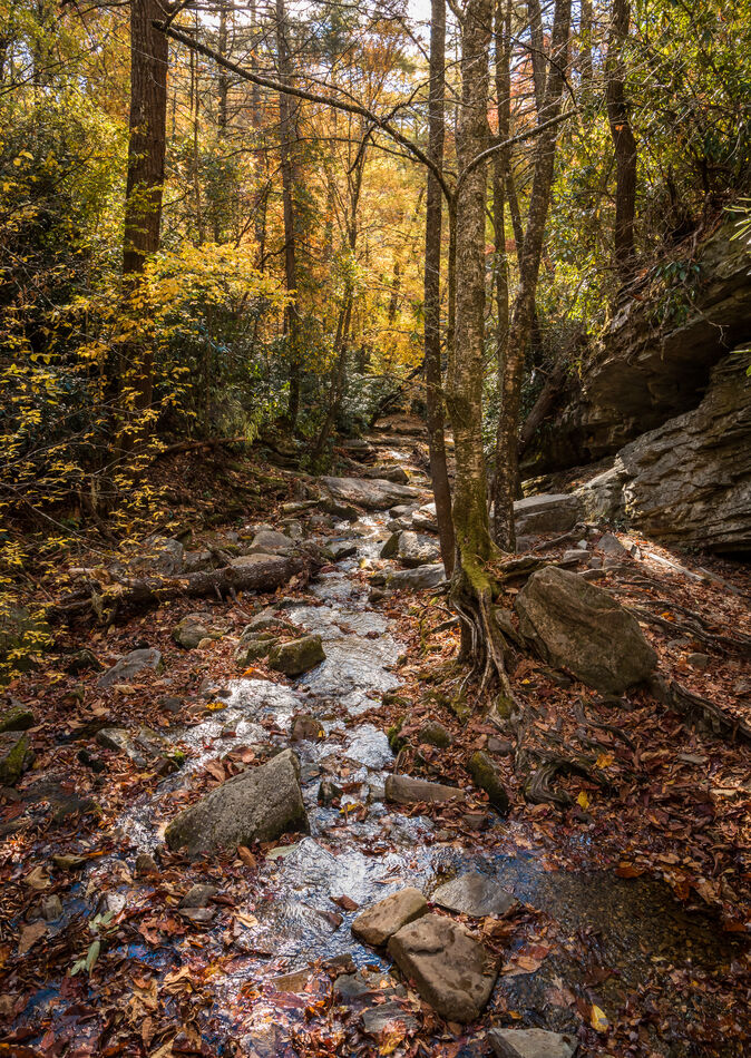
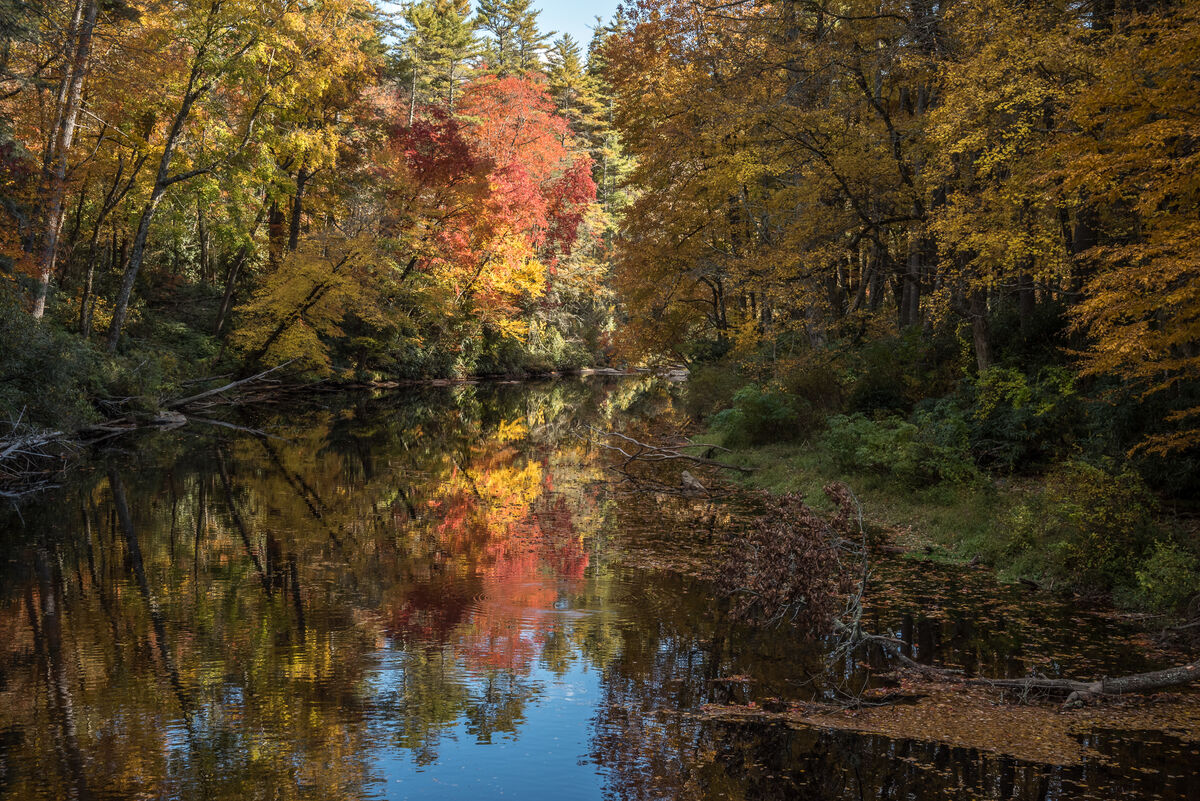
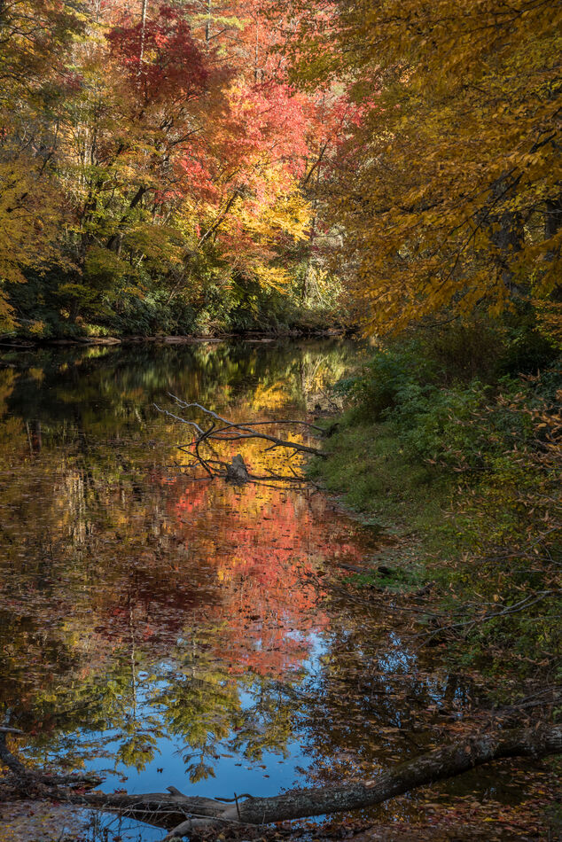
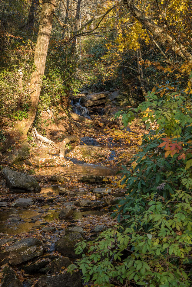
The day before heading out on our trip to West Virginia, I took some time to show my travel buddy Sam the lay of the land near where I live in WNC. We headed up to the roadside waterpark at Newland and then followed the Blue Ridge Parkway to Blowing Rock, coming back through the Linville Falls area.
Dec 4, 2022 13:00:47 #

Dec 4, 2022 13:12:22 #
Dec 4, 2022 13:33:36 #
dmeyer wrote:
The day before heading out on our trip to West Virginia, I took some time to show my travel buddy Sam the lay of the land near where I live in WNC. We headed up to the roadside waterpark at Newland and then followed the Blue Ridge Parkway to Blowing Rock, coming back through the Linville Falls area.
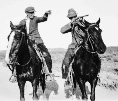
Ah, Autumn in the east, you are making me homesick for Kentucky.
I am from the Western part, right by the Mississippi-Ohio junction.
Back in the early 1960s, my Grandmother noticed a lot of cars stopping across the road from the farm house and people getting out, often with cameras and spending time looking and snapping. After a few days she walked out to talk to one group, and she found out how and why they found that little two lane road that went by her house
They showed her one of the major tourist guide books had put the road in their 'Best of Autumn' road trips list with notes where the stretch that went by the farm was singled out as one of the best spots to observe and take pictures.
Farm house first built in the late 1860s with large mature shade trees and farm out buildings on a ridge with a valley and creek behind it, a mix of woods and fields with farm animals etc. Then the up slope on the other side of the valley with a few more farm houses and buildings, more mixed woods and fields and more animals. The road was oriented East West by the farm and the view was looking South across the road to the house, across the valley to the next ridge.
From then until she sold the farm in 1967 she had a steady stream of out of state tourists driving by, stopping and often even coming to talk - many were polite enough to ask her if she minded them looking and taking pictures of the farmhouse etc.
Dec 4, 2022 13:36:29 #
dmeyer wrote:
The day before heading out on our trip to West Virginia, I took some time to show my travel buddy Sam the lay of the land near where I live in WNC. We headed up to the roadside waterpark at Newland and then followed the Blue Ridge Parkway to Blowing Rock, coming back through the Linville Falls area.

Dec 4, 2022 14:36:45 #
Dec 4, 2022 14:38:32 #
Curmudgeon wrote:
Beautiful set, I really like the second reflection shot
Thanks so much, Curmudgeon--I always get happy when I can build an image around reflections!
Dec 4, 2022 14:40:32 #
robertjerl wrote:
Ah, Autumn in the east, you are making me homesick... (show quote)
Oh, how I wish you had a picture of the old homestead to share!!
Dec 4, 2022 14:41:00 #
Dec 4, 2022 15:21:10 #

dmeyer wrote:
The day before heading out on our trip to West Virginia, I took some time to show my travel buddy Sam the lay of the land near where I live in WNC. We headed up to the roadside waterpark at Newland and then followed the Blue Ridge Parkway to Blowing Rock, coming back through the Linville Falls area.
Lovely scenery.
Dec 4, 2022 16:02:35 #
dmeyer wrote:
Oh, how I wish you had a picture of the old homestead to share!!
Somewhere I have photos, the old kind, if I happen to find one I'll scan it.
I can see the house as it is now on Google Maps, Street View. It has been remodeled and fixed up. Some brick facing over part of the white wooden siding, smoke house, chicken houses, hog house, corn crib and garage/tool shed are gone. The garage was replaced with a steel building, the tobacco barn to the west is replaced with another steel building and the cow/hay barn south of the house with milking stalls is gone. The pond is still there and bigger - maybe they stocked fish. The large garden and orchard to the west of the house is now just a patch of wild grass, and the small pasture with another orchard on the east side is now rutted dirt with what looks like a foundation for another steel building at the time they took the aerial photos. Some of the old shade trees have died and been removed but the ones that were small and the bushes/hedges are now much bigger, and you can hardly see the house from the road.
If you want to try:
Go to Google Maps and search "Barlow Kentucky", zoom in and follow US 60 south to the first road going to the east - VFW Road - follow that around a bunch of twists and turns until it turns south and meets Tabor Road (Rt 1368). Zoom in on the intersection and go to aerial photo view - the farm is just south of the intersection on the east side.
I just realized that in the previous post about the tourists, I got my directions mixed up. The road in front of the house is oriented North-South and the view is looking East across the valley.
If you zoom the view out a large wildlife management area and a bunch of lakes, ponds etc appear, and finally you will see the Ohio-Missippi junction area and Cairo,Illinois on one side of the river and Wickliffe, Kentucky (count seat) on the other.
Zoom in on Barlow and look at the aerial photos, it isn't the town I remember, most of the old buildings downtown are gone and replaced or now vacant lots. Even the market is gone. But they do have the county Recreation Center Offices, a Fish and Chips and a BBQ place in the center of town where US 60 takes a 90° turn. When I was a kid the old guys would often sit on the steps of the businesses at the intersection to talk and whittle while watching and laughing at the big rig drivers working their way through that turn. The street was two lanes with parking on each side, so the larger rigs you could often see the driver getting worked up and even hear some very colorful language (kids loved that). Almost all the big rigs now bypass the town on the interstate several miles east or stay on the west side of the Mississippi where there is another interstate. Back when those interstates first went in, I imagine the older drivers familiar with the US 60 turn in Barlow had a sudden drop in their blood pressure and were in general very happy to never see Barlow or that turn again.
Dec 4, 2022 17:48:24 #

Dec 4, 2022 21:38:49 #

Dec 5, 2022 05:40:46 #
Dec 5, 2022 05:46:17 #

If you want to reply, then register here. Registration is free and your account is created instantly, so you can post right away.