Long Ago and Far Away Arizona
Oct 5, 2022 21:41:35 #
HamBar06
Loc: Philadelphia, PA
Digging around in the archives, I found and am sharing some photos from Canyon de Chelly in 1995 which totally blew me away with its beauty. Hope you enjoy looking.
Larry B.
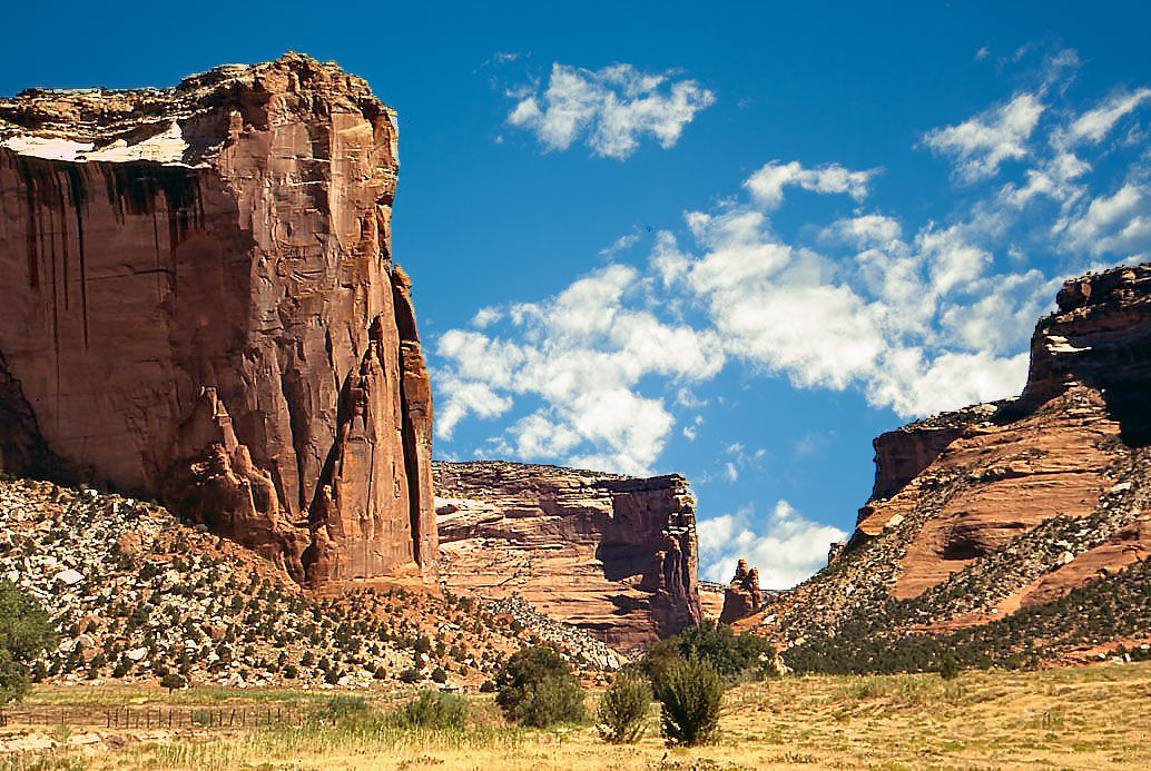
Chinle, Arizona Navajo name from original; meaning “Flowing Out”, located in Apache County, Arizona. Semi-arid climate area of 16.1 square miles.
Many nationalities reside here; 91.3 % Native American 6.4% White, minimal percentages of Black, Asian and Pacific Islanders. Gateway to Canyon de Chelly.
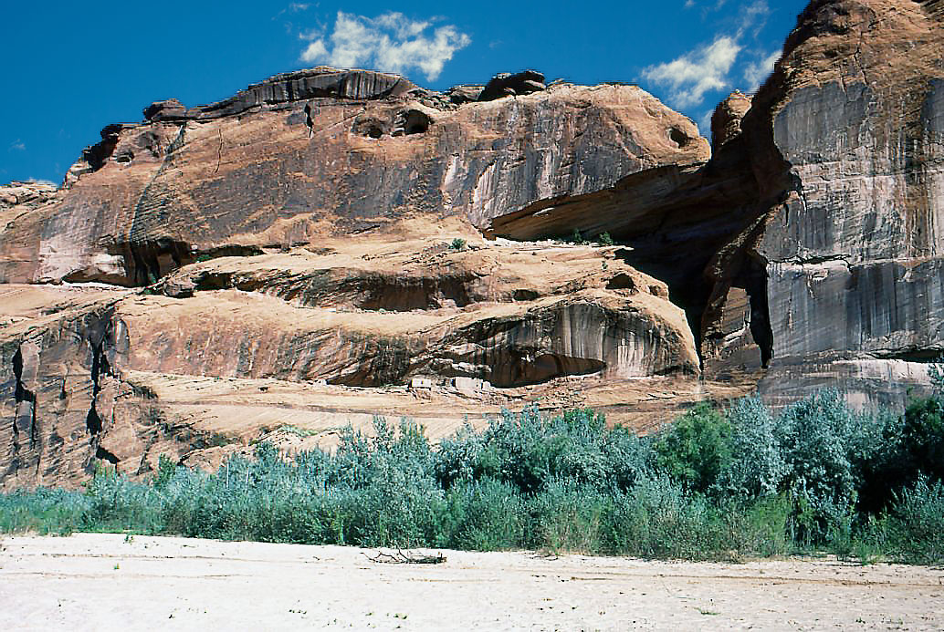
Canyon de Chelly National Monument Established in 1931 to preserve Archaeological sites and early history. It is located entirely on Navajo Tribal land and contains a residential community in the canyon. People have resided in the canyon for nearly 5000 years. The Park and the Navajo Nation work together to manage the land’s resources.
Free entrance but limited access in park. White House Trail (2.5 miles round trip) is the only public trail. (Currently closed). All other access by roads. Native guides and companies provide truck tours.
The canyon park was listed on the National Register of Historic Places in 1970.
Larry B.
Chinle, Arizona Navajo name from original; meaning “Flowing Out”, located in Apache County, Arizona. Semi-arid climate area of 16.1 square miles.
Many nationalities reside here; 91.3 % Native American 6.4% White, minimal percentages of Black, Asian and Pacific Islanders. Gateway to Canyon de Chelly.
Canyon de Chelly National Monument Established in 1931 to preserve Archaeological sites and early history. It is located entirely on Navajo Tribal land and contains a residential community in the canyon. People have resided in the canyon for nearly 5000 years. The Park and the Navajo Nation work together to manage the land’s resources.
Free entrance but limited access in park. White House Trail (2.5 miles round trip) is the only public trail. (Currently closed). All other access by roads. Native guides and companies provide truck tours.
The canyon park was listed on the National Register of Historic Places in 1970.
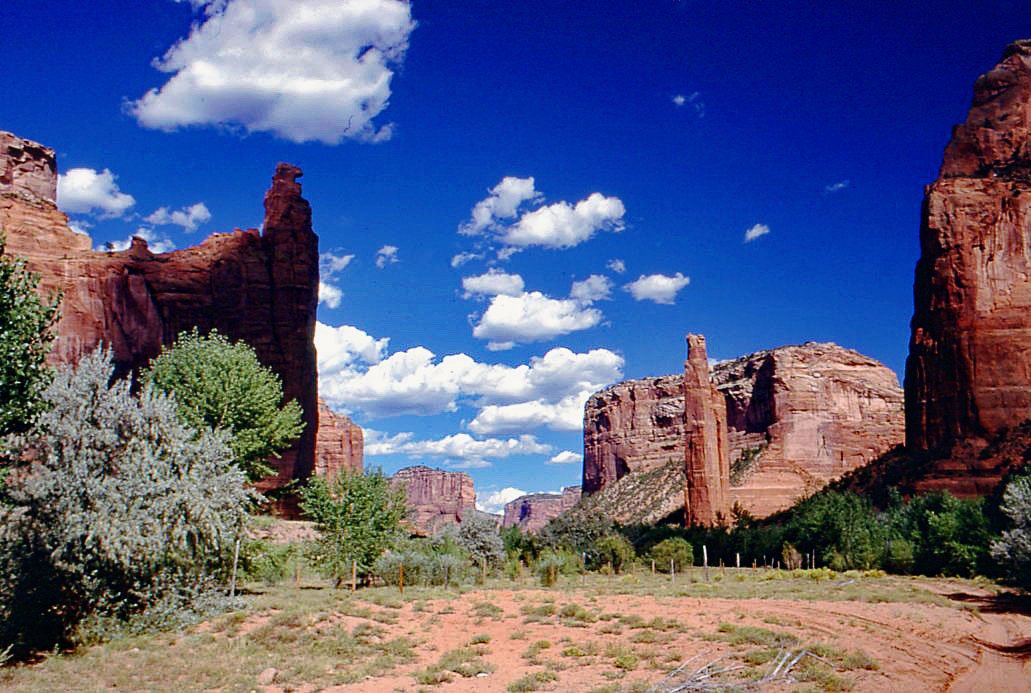
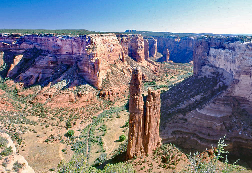
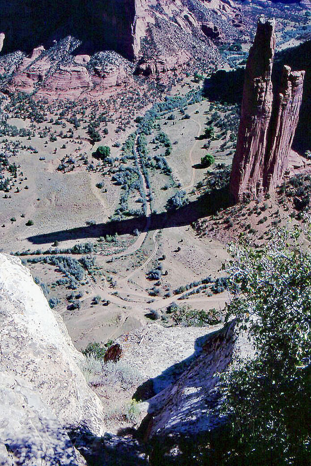
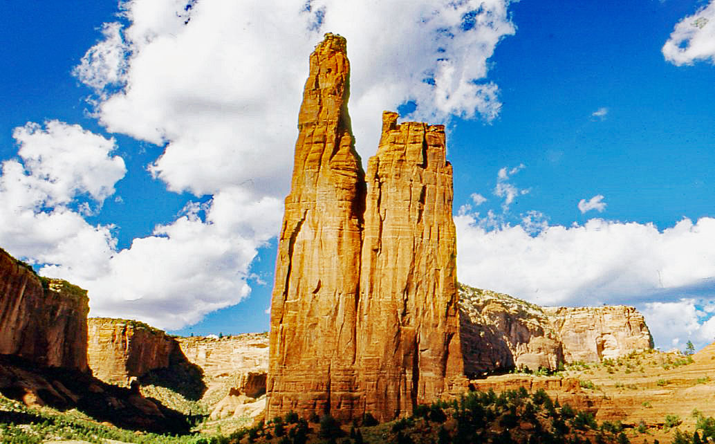
Spider Rock 759 feet tall sandstone.
(Download)
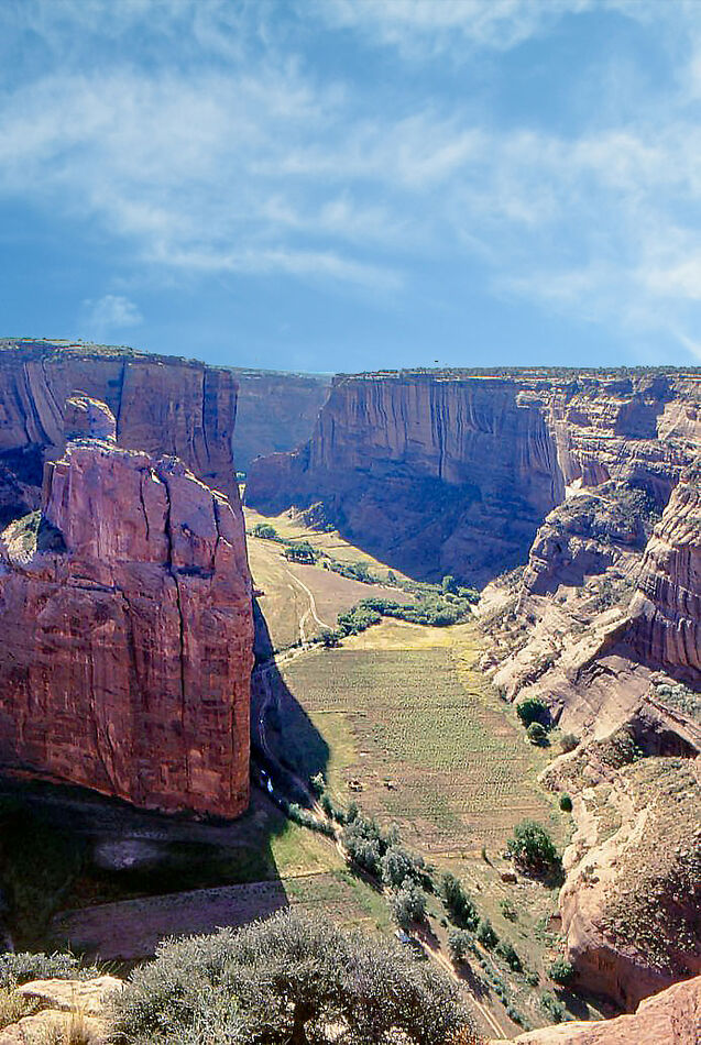
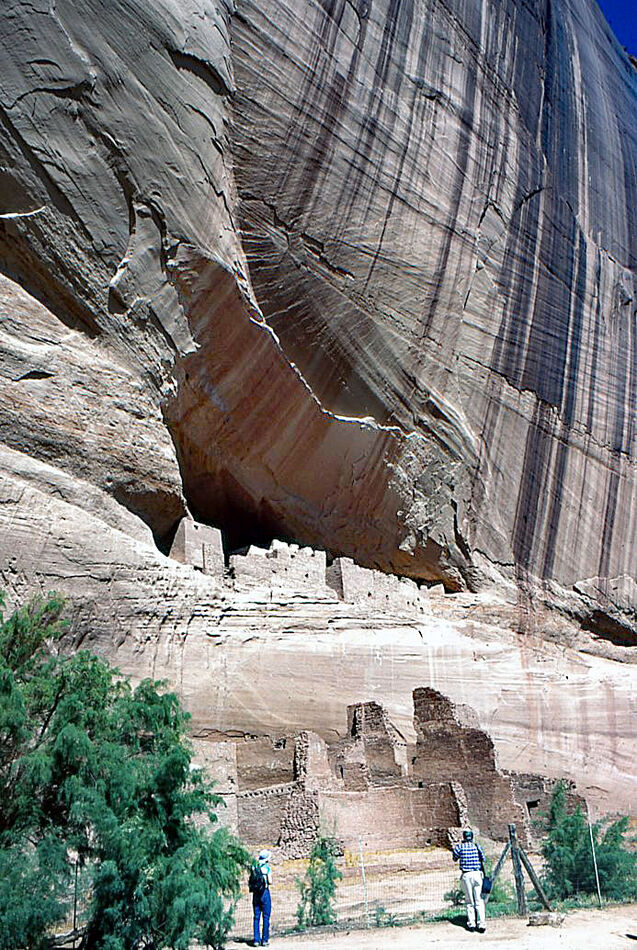
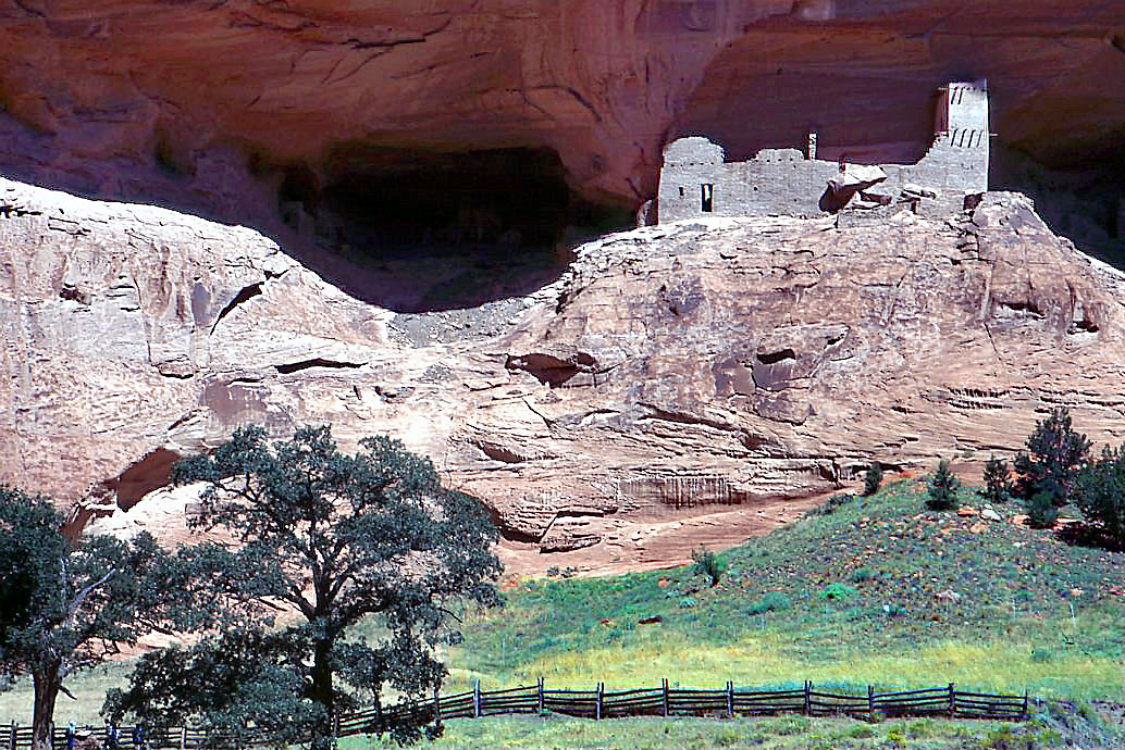
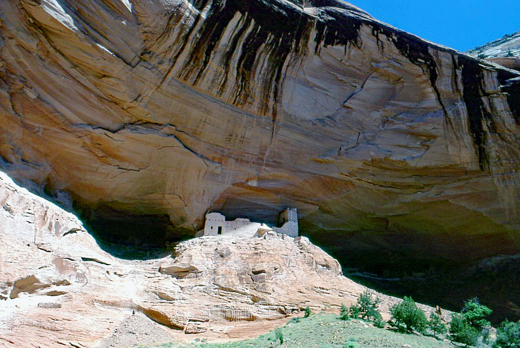
White House Ruin.
(Download)
(Download)
White House Ruin.
Oct 5, 2022 21:45:42 #

One of my favorite places to visit, Larry. A very nice series noting the features throughout the canyon.
--Bob
--Bob
HamBar06 wrote:
Digging around in the archives, I found and am sha... (show quote)
Oct 5, 2022 22:00:17 #

Oct 5, 2022 22:16:53 #

Oct 5, 2022 22:22:04 #
Oct 5, 2022 22:47:34 #
Oct 5, 2022 23:25:02 #

Oct 6, 2022 06:26:29 #

Oct 6, 2022 06:44:08 #

Oct 6, 2022 08:08:04 #


Oct 6, 2022 08:34:25 #

Oct 6, 2022 09:04:53 #

It's such a lovely place. I really like your first two images. I've been there several times but have yet to get the image of Spider Rock that I want.
Oct 6, 2022 10:17:28 #

I have always wanted to visit there with one of the biggest draws for me being able to photograph the White House ruins. Angel Adams image of those ruins has always been an inspiration, for me anyway. As you note, access to those ruins seems restricted due to road/trail closures, which has been the case for at least the last couple of years. I wonder whether there are any plans to re-open that access. Anyone know. Beautiful shots and thanks for sharing.
Oct 6, 2022 10:23:22 #
DougS
Loc: Central Arkansas
Beautiful, and interesting!
Have you been there during the autumn? The yellow leaves add an interesting, and beautiful contrast.
Have you been there during the autumn? The yellow leaves add an interesting, and beautiful contrast.
Oct 6, 2022 12:58:12 #

If you want to reply, then register here. Registration is free and your account is created instantly, so you can post right away.