FIRE Info for Northern CA.
Aug 21, 2021 14:37:53 #
FYI: - Anyone considering a VaCa or trip to N. CA, may want to Re-Consider!
Forests closed for fire season
So far, more than 1.4 million acres of California’s drought-parched landscape already have burned this year, and it’s almost certain to get worse.
About half of the area burned so far has been in the Dixie fire — a more than 700,000-acre behemoth spread across that started over a month ago in the Plumas National Forest and is now the single-largest wildfire in recorded state history.
Nine national sites will be shut to public because of potential for blazes
The closures begin at midnight Sunday and extending at least through the Labor Day holiday, when conditions will be re-evaluated.
Aug 21, 2021 15:02:30 #
Aug 21, 2021 15:25:34 #
Aug 21, 2021 16:16:35 #
therwol
Loc: USA
pshane wrote:
FYI: - Anyone considering a VaCa or trip to N. CA,... (show quote)
I live approximately 15 miles from the Caldor fire in El Dorado County. 23,000 people have been evacuated to this point. Evacuation warnings extend almost to Lake Tahoe. The air has been intermittently filled with dense, choking smoke. This fire is 0% contained. Fortunately, the wind is pushing the fire away from where I live, but that could change. You can zoom in on this map to see the extent of the fires.
https://www.arcgis.com/apps/webappviewer/index.html?id=6dc469279760492d802c7ba6db45ff0e
Aug 22, 2021 01:06:17 #

As others have stated, air quality in Northern California has been very poor due to the fires. I live about 45 miles north of Sacramento and we have had AQI (Air Quality Index) numbers from 200-400 in recent weeks. Not a pleasant experience for vacationers and tourists at this time, even without the National Forest closures. It seems when one fire is brought near containment, there is another large fire that erupts in the Sierra.
Aug 22, 2021 12:12:55 #

I was born, raised and lived in California most of my life, both in the north and the south. I moved away 16 years ago and went to Northern Nevada. I'm getting to think I didn't move away far enough. AirNow.gov is saying our AQI will be hazardous today and unhealthy tomorrow.
Aug 22, 2021 16:19:47 #
therwol
Loc: USA
jdub82 wrote:
As others have stated, air quality in Northern California has been very poor due to the fires. I live about 45 miles north of Sacramento and we have had AQI (Air Quality Index) numbers from 200-400 in recent weeks. Not a pleasant experience for vacationers and tourists at this time, even without the National Forest closures. It seems when one fire is brought near containment, there is another large fire that erupts in the Sierra.
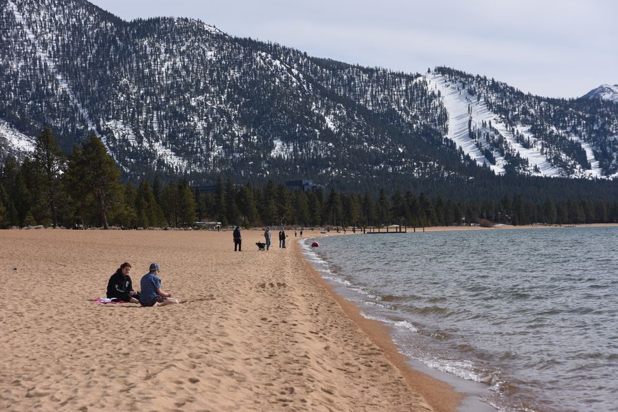
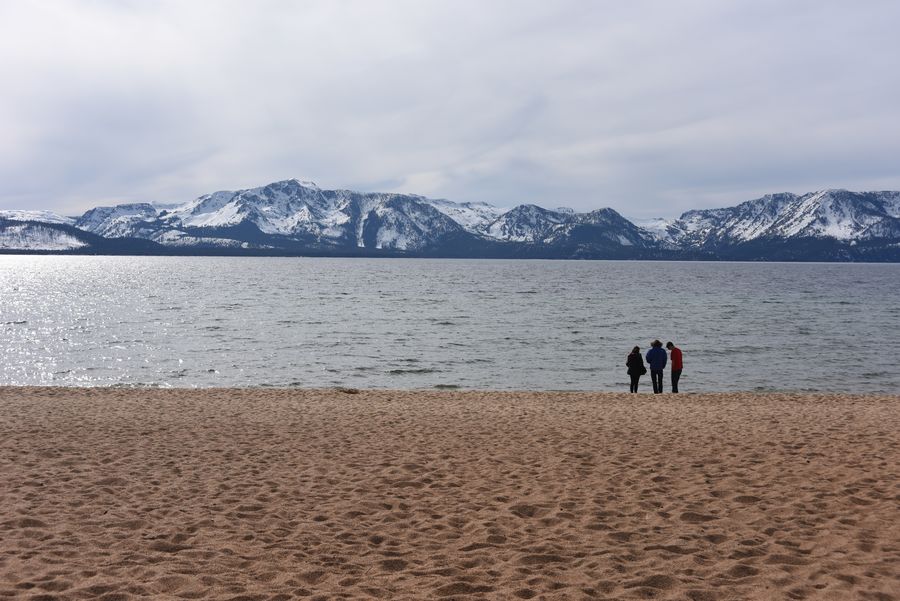
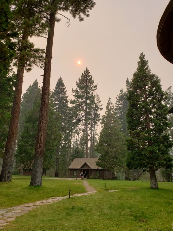
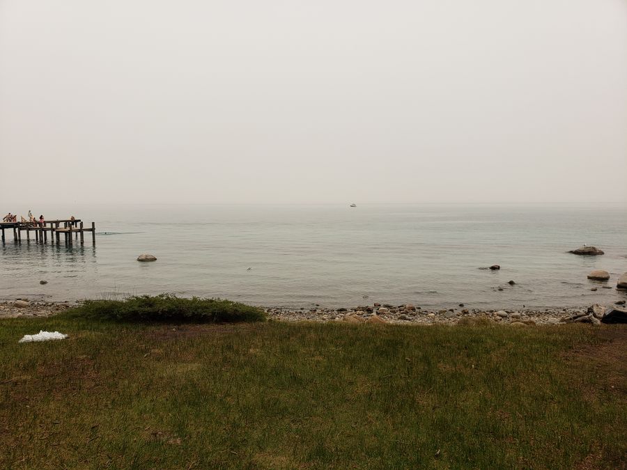
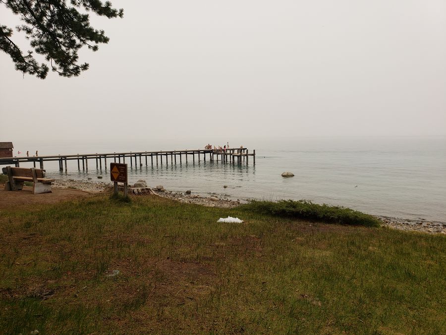
I live near Placerville. I want to post some pictures of Lake Tahoe, with and without fire nearby. The first two were taken in 2015 with my Nikon D810. The third was taken on film in 1992. The next three (with smoke) were taken two weeks ago when I attended an outdoor event at the Sugar Pine State Park on the western shore. I took those with my cell phone. The Dixie Fire was responsible for the smoke you see. The smoke was really dense driving up there as well. I've been waking up every morning with smoke in the air. You can taste it. It irritates my eyes.

If you want to reply, then register here. Registration is free and your account is created instantly, so you can post right away.