Europe 2023 Spring - Photo Preview 5 - Switzerland: Alpine Meadows - Mount Niederbauen+
Jan 20, 2024 10:50:58 #

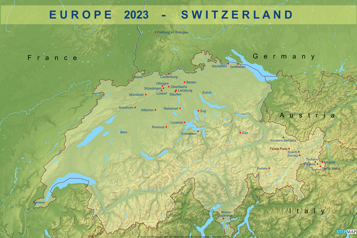
Even late in the month of May, it is still too early to venture in the higher alpine mountainscape. Most of the mountain passes are still closed, though just about getting ready to open. In today's presentation, I bring you a set of pictures from one of the lower alpine areas in Central Switzerland, located in Emmetten, high above the town of Beckenried: Mount Niederbauen overlooking Lake Lucerne at an altitude of 1923 m / 6300 ft. The actual hiking area starts out at just below 1600 m / 5200 ft and can be reached very comfortably with a "Luftseilbahn" (aerial cable car). We had a middling day for this walk, the weather was basically good but quite hazy and I promised myself to return here on a clearer day - which I still have to do. But these images should give you a pretty good idea of the vistas to be had here in this enchanting corner, populated by hikers and a good number of cows enjoying already the spring-time pastures with juicy grass and herbs.
To this pastoral scene, I am adding 3 images from the small town of Laufenburg about 120 km / 70 miles to the north of this mountain area, situated at the river Rhein. There actually exist two towns with the same name: The Swiss Laufenburg on the southern banks of the Rhein, and the German Laufenburg on the northern banks. Both are connected by a bridge over the river which can be passed without any border controls, as the borders between many of the European states are open.
Notes
TRIP INFO: Set # 1 provides a brief introduction to this series. Please use the link below if you would like to review this intro:
https://www.uglyhedgehog.com/t-797460-1.html
EARLIER POSTS of this series: Access my topic list at UHH, the new posts are listed in reverse chronological order:
https://www.uglyhedgehog.com/user-topic-list?usernum=45105
Thanks for visiting, I recommend viewing the downloads and look forward to your comments and questions.
.
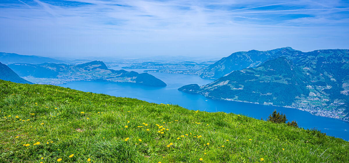
1 - Nidwalden/Emmetten - Hazy view from the Mount Niederbauen alpine meadows to Lake Lucerne with some of its many arms visible, at right Mount Rigi (1798m/5897 ft) and at center left the Mount Bürgenstock ridge (1115m/3658 ft) jutting into the lake
(Download)
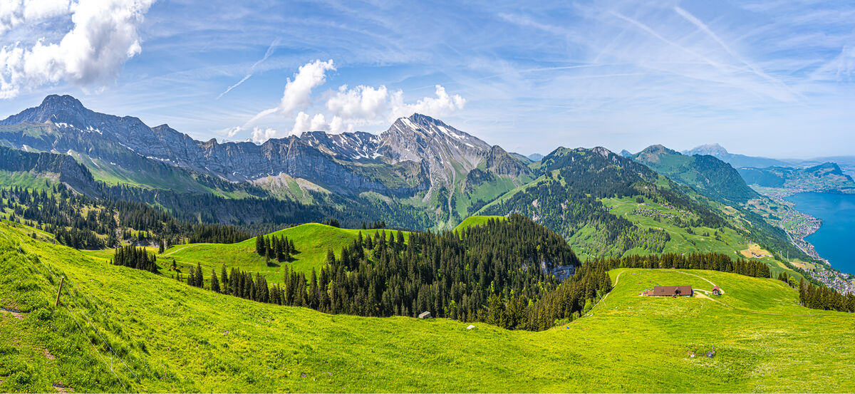
2 - Nidwalden/Emmetten - Panoramic view from the Niederbauen alpine meadows to Mounts Brisen (2403m/7887ft) at left and Schwalmis (2246m/7369ft) at center, at far right Lake Lucerne with the towns Beckenried and Buochs
(Download)
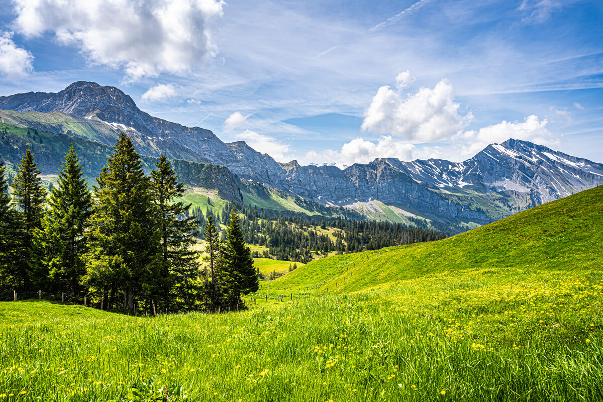
3 - Nidwalden/Emmetten - Detail of the previous image from a slightly different position: View from the Niederbauen alpine meadows to Mounts Brisen at left and Schwalmis at right
(Download)
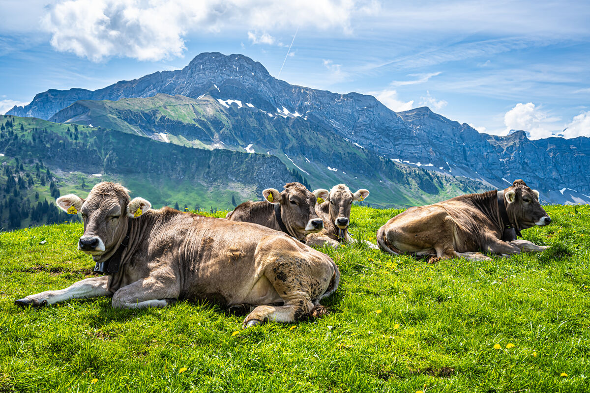
4 - Nidwalden/Emmetten - Four of our bovine friends at rest on the Niederbauen alpine meadows, at rear Mount Brisen
(Download)
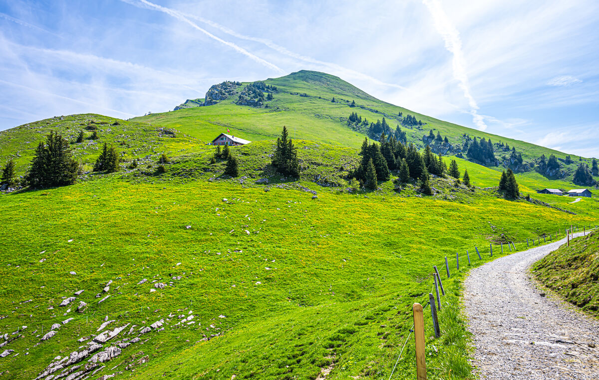
5 - Nidwalden/Emmetten - On the gravel road to Alp Tritt: At center the alpine dairy/restaurant building of Alp Tritt, at rear the peak of Mount Niederbauen Kulm (1923 m/6309 ft)
(Download)
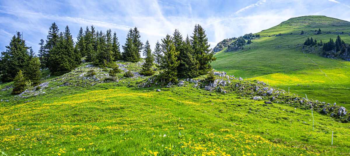
6 - Nidwalden/Emmetten - Embedded in a rolling hillside: Flower-covered alpine meadows and a rocky outcrop studded with fir trees at center left, at right the top of Mount Niederbauen Kulm
(Download)
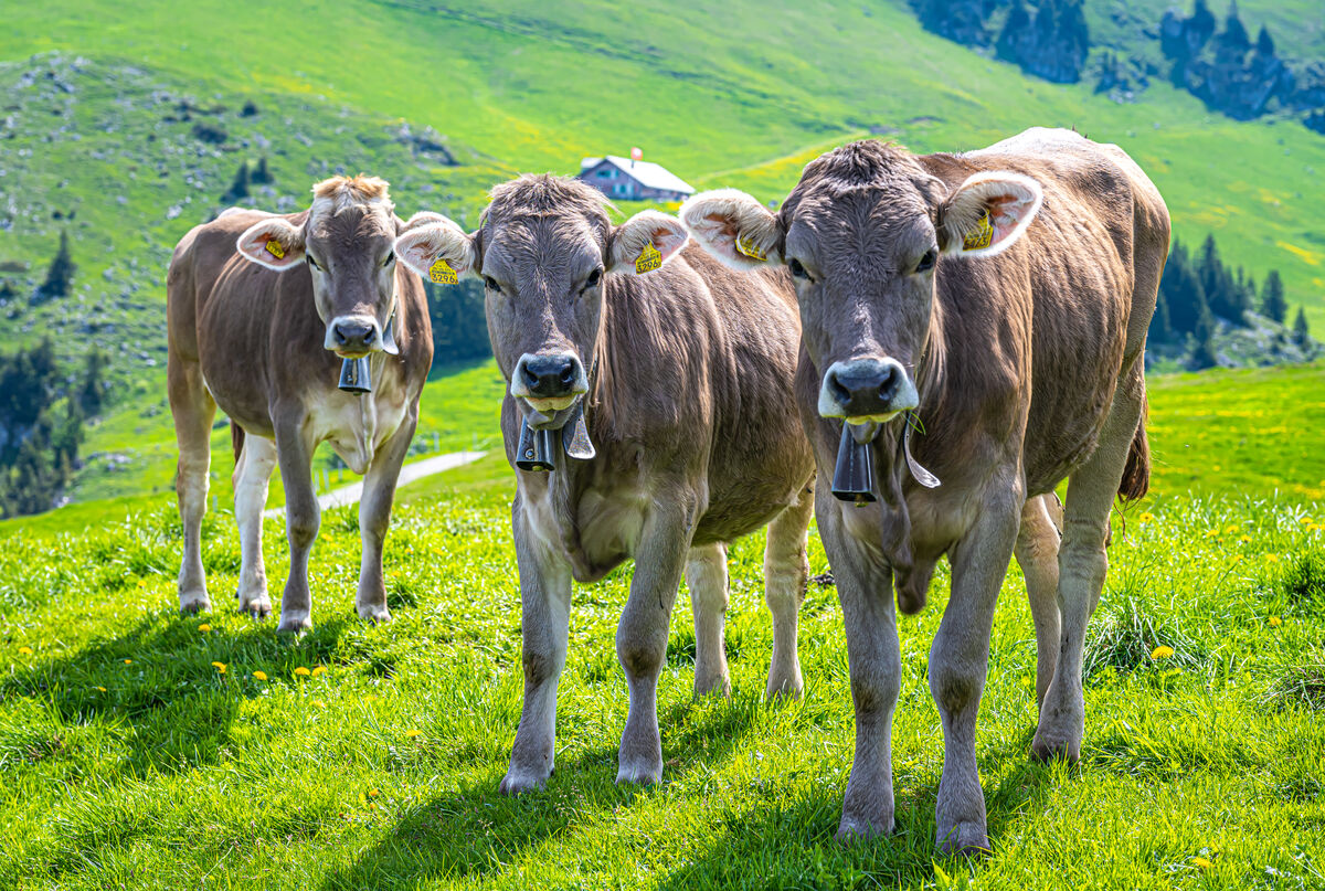
7 - Nidwalden/Emmetten - On the walk to Alp Tritt at Mount Niederbauen: Three serious, curious but well-behaved bovine onlookers with their traditional cowbells, at center rear the building with the alpine dairy and restaurant Tritt
(Download)
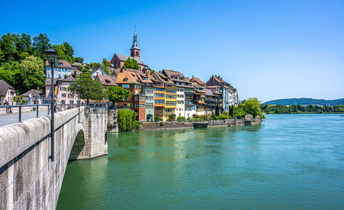
8 - Aargau/Laufenburg - Laufenburg/Germany at the river Rhein viewed from its Swiss counterpart with the identical name, the bridge at left connects the two towns
(Download)
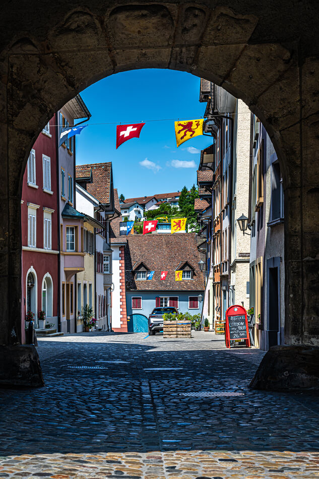
9 - Aargau/Laufenburg - View through the Wasentor gate, built in 1248, in the town fortification wall to the flag-bedecked Obere Wasengasse in the old town core
(Download)
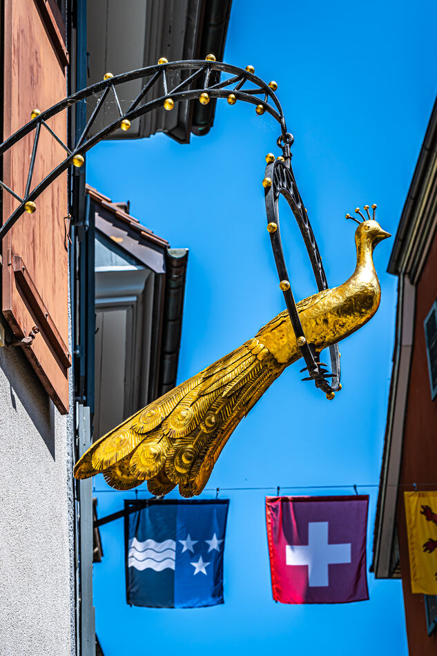
10 - Aargau/Laufenburg - Sculpture of a golden peacock above the "Rhytürli" (Little Rhein door) gate at Marktgasse/Laufengasse, below the flags of the canton Aargau and of Switzerland
(Download)
Jan 20, 2024 10:52:07 #
For your reference:
Jan 20, 2024 10:56:29 #

Jan 20, 2024 11:15:28 #

Jan 20, 2024 11:36:56 #

Jan 20, 2024 11:39:24 #

Jan 20, 2024 12:52:56 #

Jan 20, 2024 14:04:09 #
Jan 20, 2024 14:05:24 #
Earnest Botello wrote:
Great and colorful landscape and portrait shots, Joe.
Thank you Earnest, happy to hear that you liked both the colorful landscape and the bovine group portraits!
Jan 20, 2024 14:06:35 #
kpmac wrote:
Beautiful. Great set, Joe.
Thank you Ken for your kind appreciative words!
Jan 20, 2024 14:07:25 #
NMGal wrote:
Wonderful, Joe. Such beautiful country.
Thank you Barbara, it is a beautiful country, but there is so much beauty in this world!
Jan 20, 2024 14:08:11 #
UTMike wrote:
Gorgeous overview, Joe! So lush.
Thank you Mike, yes, these meadows were ready for them cows!
Jan 20, 2024 16:21:04 #

Jan 20, 2024 17:21:09 #
srfmhg wrote:
Great set Joe. I love the through the arch shot as well as the cows.
Thanks Mark - now if I could just get a shot through an arch of some cows looking at me!
Jan 20, 2024 17:47:52 #

weberwest wrote:
Even late in the month of May, it is still too ear... (show quote)
Love your Native Country, Joe! The most memorable impression about it was that every square inch of the Land, no matter where it was, either in a town or in the wild, was taken loving care of!
If you want to reply, then register here. Registration is free and your account is created instantly, so you can post right away.