Hong Kong Part 4: Victoria Harbor
May 10, 2023 14:32:20 #

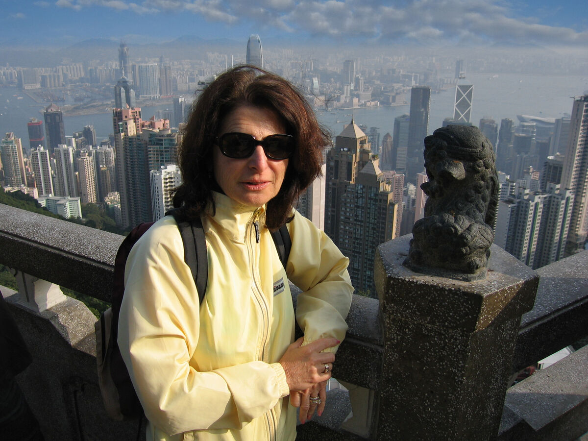
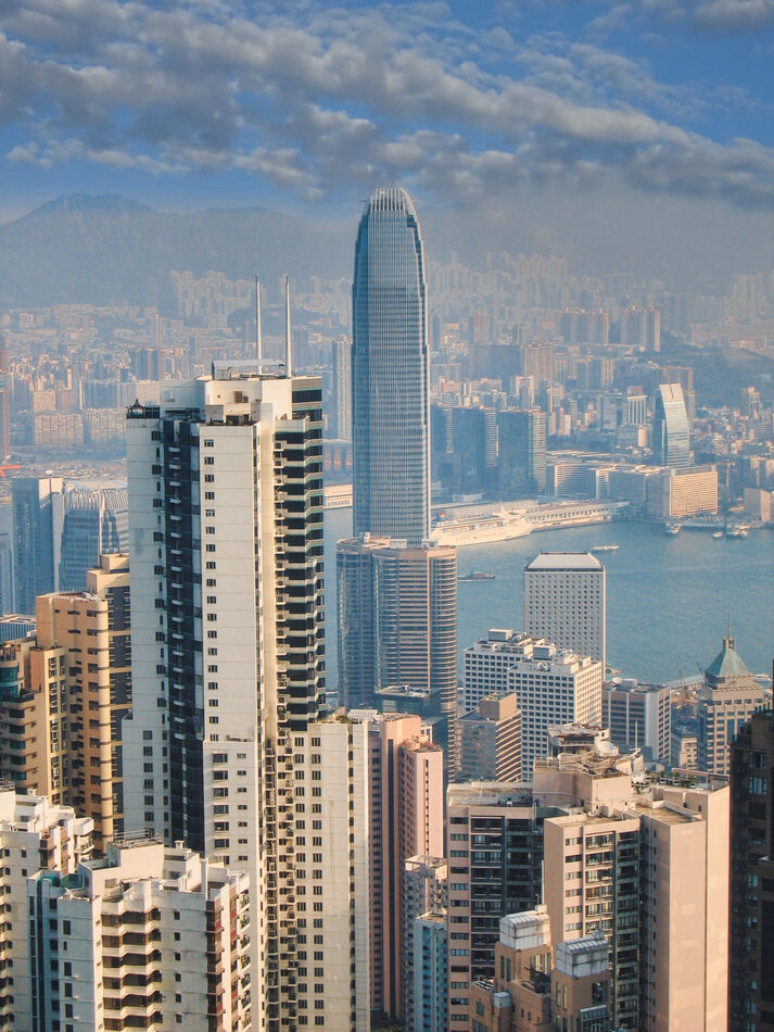
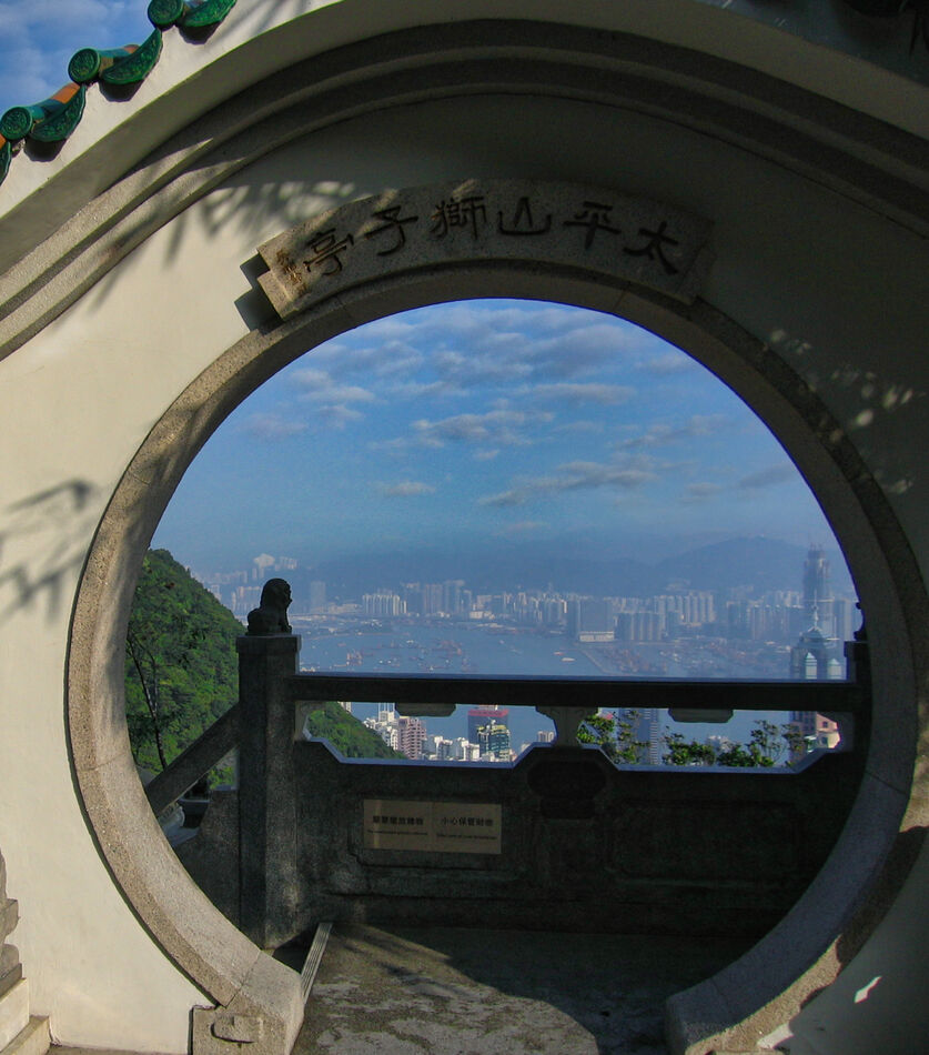
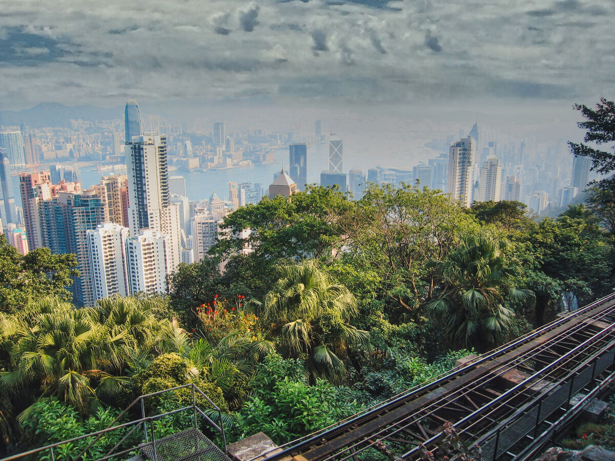
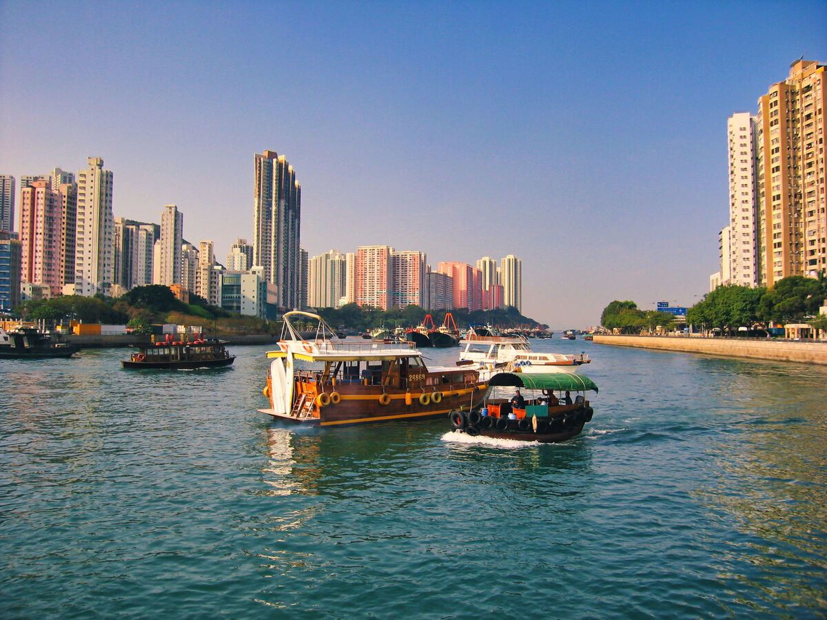
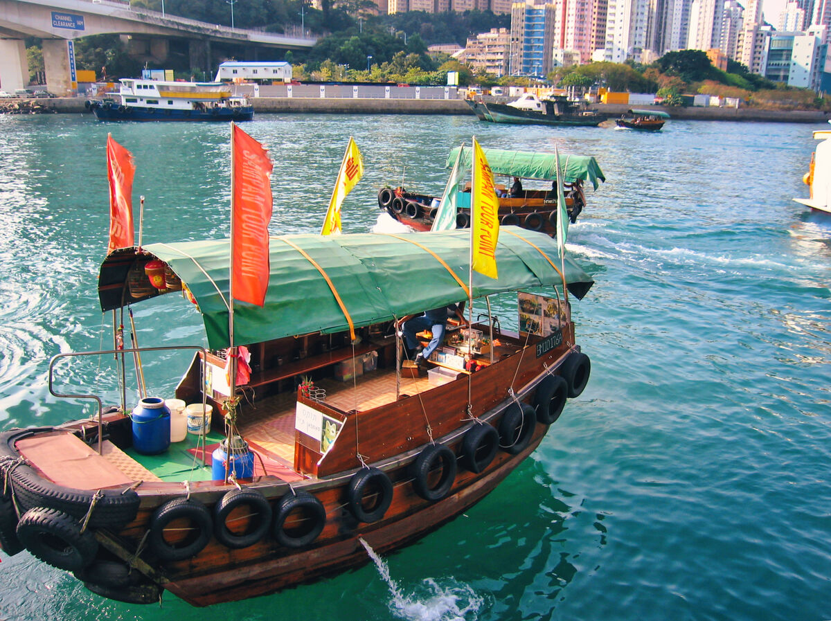
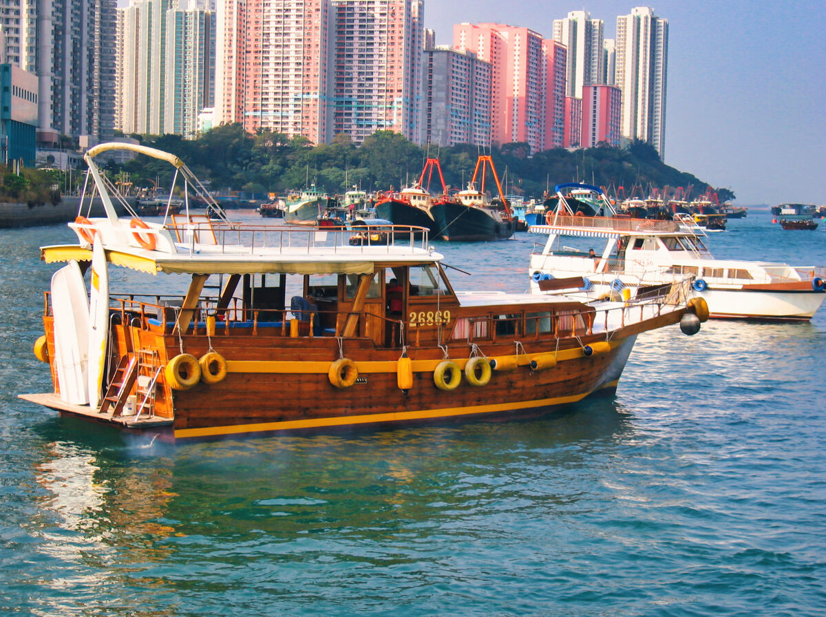
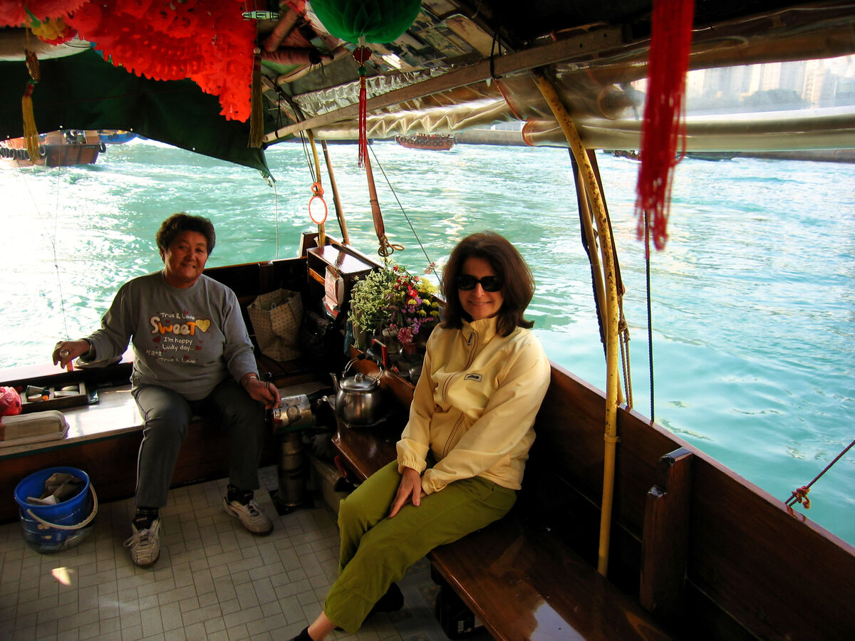
We descended Victoria Peak on the tram, had lunch at the cafe at the base station and boarded a private sampan for a cruise on Victoria Harbor. By the time we boarded the boat the skies had cleared and we enjoyed a bright blue day. I personally love water scenes so I hope you'll enjoy these. A few more from the peak included.
Victoria Harbour is a natural landform harbour in Hong Kong separating Hong Kong Island in the south from the Kowloon Peninsula to the north. The harbour's deep, sheltered waters and strategic location on South China Sea were instrumental in Hong Kong's establishment as a British colony in 1841 and its subsequent development as a trading centre.
Throughout its history, the harbour has seen numerous reclamation projects undertaken on both shores, many of which have caused controversy in recent years. Environmental concerns have been expressed about the effects of these expansions, in terms of water quality and loss of natural habitat. It has also been proposed that benefits of land reclamation may be less than the effects of decreased harbour width, affecting the number of vessels passing through the harbour. Nonetheless Victoria Harbour still retains its founding role as a port for thousands of international vessels each year.
The harbour is a major tourist attraction of Hong Kong. Lying in the middle of the territory's dense urban region, the harbour is the site of annual fireworks displays and its promenades are used as gathering places for residents and also tourists.
History
The first reference to what is now called Victoria Harbour is found in Zheng He's sailing maps of the China coast, dated c.1425, which appear in the Wubei Zhi (A Treatise on Armament Technology), a comprehensive 17th-century military book. While the harbour was charted in later maps, the first map depicting it in detail is an 1810 marine chart prepared for the East India Company by Daniel Ross and Philip Maughan, lieutenants of the Bombay Marine.
Some of the first recreational activities to take place in the harbour were water competitions such as swimming and water polo in the 1850s, undertaken by members of Hong Kong's first sports club, the Victoria Recreation Club.
During the Taiping Rebellion, armed rebels paraded the streets of Hong Kong. On 21 December 1854, the Hong Kong police arrested several armed rebels who were about to attack Kowloon City. On 23 January 1855, a fleet of Taiping war boats was on the verge of a naval battle against Chinese imperial war boats defending the harbour. The Chinese defenders were ordered away by the British colonial authorities. These incidents caused rising tension that would eventually lead to the Arrow War. The harbour was originally called "Hong Kong Harbour", but was later renamed to "Victoria Harbour", to assure shelter for the British fleet under Queen Victoria.
The subject of pollution came to the fore in the 1970s with the rapid growth of the manufacturing sector. The water club races were stopped in 1973 due to pollution in the harbour, a year after the former RMS Queen Elizabeth burned and sank at the Tsing Yi island anchorage. Studies also showed excessive nitrogen input from discharges of the Pearl River Delta into the harbour for decades.
After completion of the Central and Wan Chai Reclamation Feasibility Study in 1989, the Land Development Policy Committee endorsed a concept for gradual implementation of this additional reclamation. It consists of three district development cells separated by parks, namely, Central, Tamar and Exhibition.
The latest proposed reclamation, extending along the waterfront from Sheung Wan to Causeway Bay, faced public opposition, as the harbour has become a pivotal location to Hongkongers in general. Activists have denounced the government's actions as destructive not only to the natural environment, but also to what is widely considered one of the most prized natural assets of the territory. NGOs, including the Society for Protection of the Harbour, were formed to resist further attempts to reduce the size of the waterbody, with its chairman, Christine Loh, quoted as saying that the harbour "...is a precious national asset and we must preserve it for future generations. I believe an insightful and visionary chief executive would support our stance and work with us to protect the harbour". Reclamation work also led to the demolition of Queen's Pier and Edinburgh Place Ferry Pier, structures of historic significance, to massive public opposition.
Geography
Victoria Harbour covered an area of about 41.88 km2 (16.17 sq mi) in 2004. The eastern boundary is generally considered to be the line formed between the westernmost extremity of Siu Chau Wan (小酒灣) and A Kung Ngam. The western boundary is generally considered to consist of a line drawn from the westernmost point of Hong Kong Island to the westernmost point of Green Island, thence a straight line drawn from the westernmost point of Green Island to the southeasternmost point of Tsing Yi, thence along the eastern and northern coastal lines of Tsing Yi to its westernmost extremity, and thence a straight line drawn true north towards the mainland.
There are several islands within the harbour:
Green Island
Little Green Island
Kowloon Rock
Tsing Yi Island
Tourism
Victoria Harbour is known for its panoramic night view and skyline, particularly in the direction towards Hong Kong Island where the skyline of skyscrapers is superimposed over the ridges behind. Among the best places to view the harbour are the Peak Tower atop Victoria Peak, or from the piazza at the Cultural Centre or the promenade of Tsim Sha Tsui on the Kowloon side. Rides on the Star Ferry, including the route between Central and Tsim Sha Tsui, are another way to view the harbour and cityscape.
As the natural centre of the territory, the harbour has played host to many major public shows, including the annual fireworks displays on the second night of the Lunar New Year. These shows are popular with tourists and locals alike, and the display is usually telecast on local television. To enhance the popularity of the harbour as a sightseeing location, the government introduced a show dubbed A Symphony of Lights.
Also recently opened was the Avenue of Stars, built along the promenade outside the New World Centre in Tsim Sha Tsui. Modeled on the Hollywood Walk of Fame, it honours the most illustrious people the Hong Kong film industry has produced over the past decades.
https://en.wikipedia.org/wiki/Victoria_Harbour
For additional images and narrative. Please see my previous posts:
https://www.uglyhedgehog.com/t-772991-1.html#13890073
https://www.uglyhedgehog.com/t-773192-1.html#13893955
https://www.uglyhedgehog.com/t-773472-1.html
I hope you enjoy these!
Mark
By the end of November every year, the outer walls of buildings in the central business districts on both sides of the harbours are dressed with Christmas-related decorations, and replaced with Lunar New Year-related ones by January.
She was a little chilled up there!
(Download)
(Download)
(Download)
(Download)
(Download)
Our luxury yacht
(Download)
(Download)
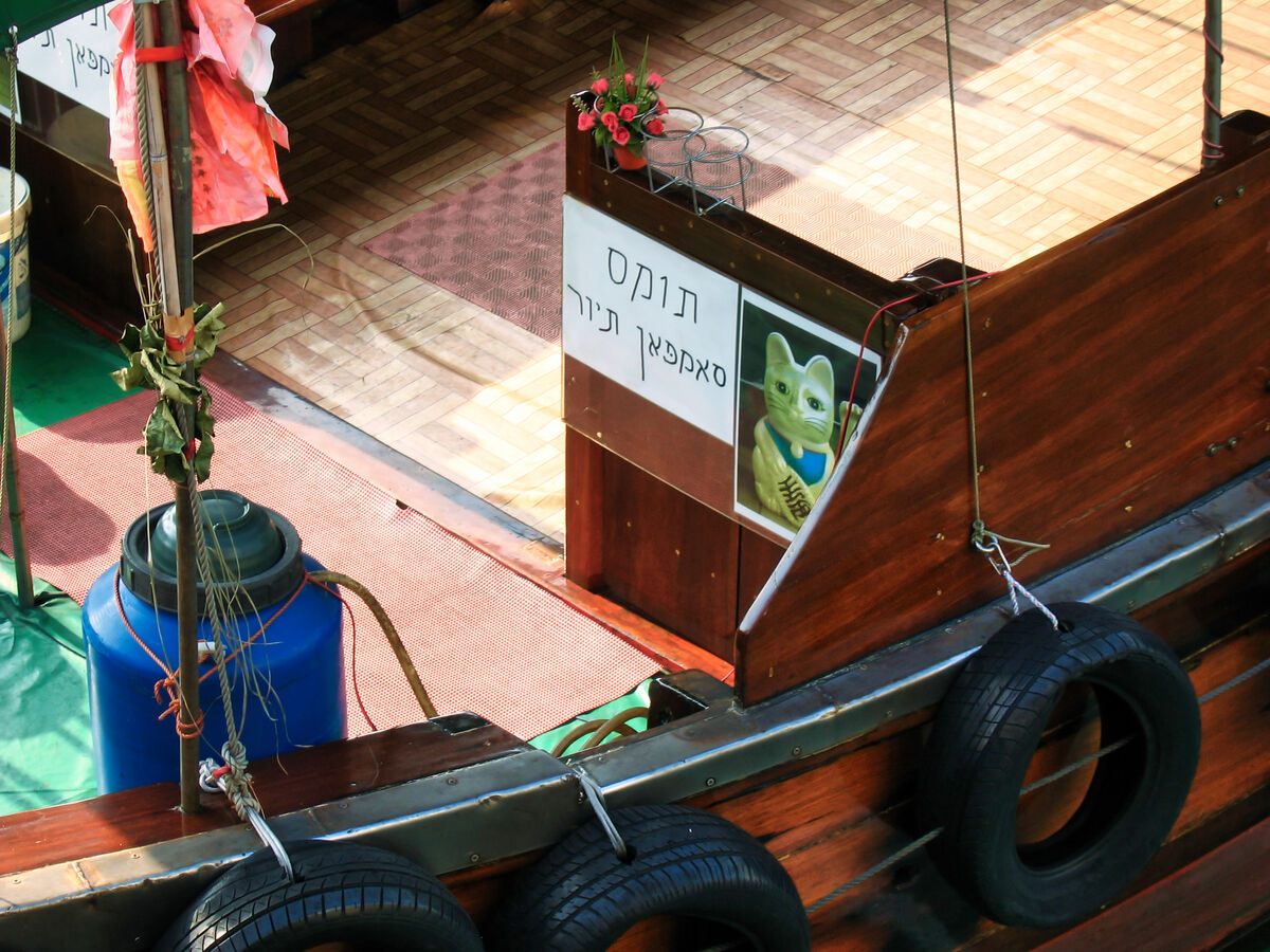
The Hebrew translation or close to it, courtesy of Ben (Rab-Eye) is Thomas Tour Sampan
(Download)
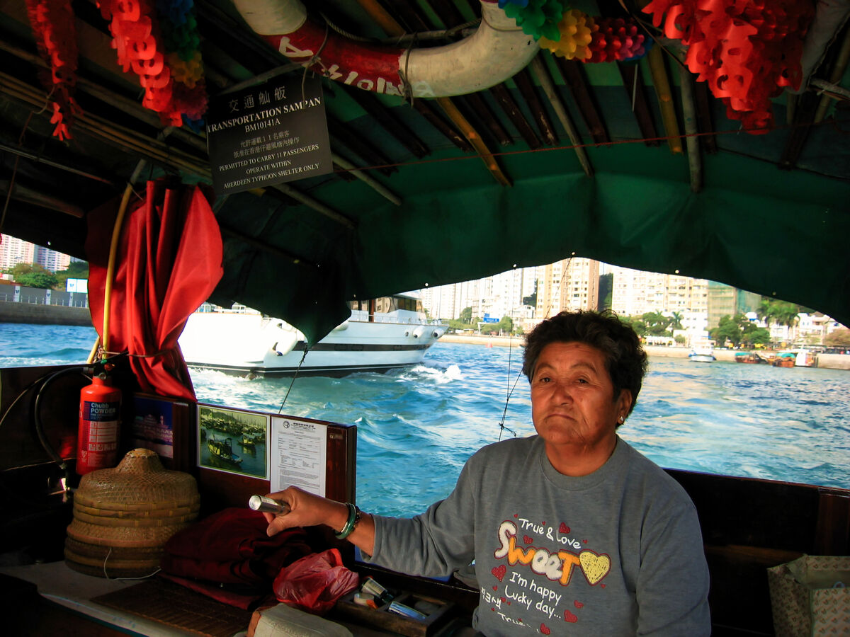
Our Captain really was happy but not so much here
(Download)
Gail managed to bring a smile to her face!
(Download)
May 10, 2023 14:33:17 #
May 10, 2023 14:33:42 #


May 10, 2023 14:37:52 #
May 10, 2023 14:50:12 #

May 10, 2023 15:15:30 #

Our son married a woman from Hong Kong and has lived there many years. Your photos brought back many memories of our visits there.
May 10, 2023 17:25:41 #

srfmhg wrote:
We descended Victoria Peak on the tram, had lunch ... (show quote)
Shots that take one's breath away 💰💰💰💰💰
May 10, 2023 17:37:33 #

May 10, 2023 18:49:37 #
May 10, 2023 18:50:35 #
revhen wrote:
Our son married a woman from Hong Kong and has lived there many years. Your photos brought back many memories of our visits there.
Thanks very much revhen. So pleased that they brought back pleasant memories.
May 10, 2023 18:51:29 #
joecichjr wrote:
Shots that take one's breath away 💰💰💰💰💰
Thanks so much Joe. Good to hear from you.
May 10, 2023 18:52:04 #
May 10, 2023 19:51:40 #

srfmhg wrote:
We descended Victoria Peak on the tram, had lunch ... (show quote)
Another excellent set Mark. It looks like it was worth being chilled for the views. I also like water scenes and these are excellent.
May 10, 2023 22:26:22 #

May 11, 2023 01:56:48 #
DJphoto wrote:
Another excellent set Mark. It looks like it was worth being chilled for the views. I also like water scenes and these are excellent.
Thanks very much Dennis. Another set of water scenes coming.
If you want to reply, then register here. Registration is free and your account is created instantly, so you can post right away.