Cambodia: Siem Reap Part 12 - Angkor Thom
Jan 16, 2023 15:15:41 #

After leaving the Ta Prohm Temple, we took a short drive to the ancient walled city of Angkor Thom to explore the Bayon Temple and Angkor Wat which will be the subjects of my next few sets.
Angkor Thom (Khmer: អង្គរធំ [ʔɑŋkɔː tʰom]; meaning "Great City"), alternatively Nokor Thom (Khmer: នគរធំ [nɔkɔː tʰom]) located in present-day Cambodia, was the last and most enduring capital city of the Khmer Empire. It was established in the late twelfth century by King Jayavarman VII. It covers an area of 9 km², within which are located several monuments from earlier eras as well as those established by Jayavarman and his successors. At the centre of the city is Jayavarman's state temple, the Bayon, with the other major sites clustered around the Victory Square immediately to the north. The site is one of the major tourist attractions of southeast Asia.
Angkor Thom (Khmer: អង្គរធំ) is the transform name from another alternative name of Nokor Thom (Khmer: នគរធំ), which is believed to be the correct one, due to neglect of calling it in incorrect pronunciation. The word Nokor (Khmer: នគរ, Nôkô) is literally derived from Sanskrit word of Nagara (Devanāgarī: नगर), which means City, combining with Khmer word Thom (Khmer: ធំ, Thum), which means Big or Great so as to form Nokor Thom then being altered to current name of Angkor Thom.
Angkor Thom was established as the capital of Jayavarman VII's empire, and was the centre of his massive building program. One inscription found in the city refers to Jayavarman as the groom and the city as his bride.
Angkor Thom seems not to be the first Khmer capital on the site, however. Yasodharapura, dating from three centuries earlier, was centred slightly further northwest, and Angkor Thom overlapped parts of it. The most notable earlier temples within the city are the former state temple of Baphuon, and Phimeanakas, which was incorporated into the Royal Palace. The Khmers did not draw any clear distinctions between Angkor Thom and Yashodharapura: even in the fourteenth century an inscription used the earlier name. The name of Angkor Thom—great city—was in use from the 16th century.
The last temple known to have been constructed in Angkor Thom was Mangalartha, which was dedicated in 1295. Thereafter the existing structures continued to be modified from time to time, but any new creations were in perishable materials and have not survived.
The Ayutthaya Kingdom, led by King Borommarachathirat II, sacked Angkor Thom, forcing the Khmers under Ponhea Yat to relocate their capital southeast to Phnom Penh.
Angkor Thom was abandoned some time prior to 1609, when an early western visitor wrote of an uninhabited city, "as fantastic as the Atlantis of Plato". It is believed to have sustained a population of 80,000–150,000 people.
The Poem of Angkor Wat composed in Khmer verse in 1622 describes the beauty of Angkor Thom.
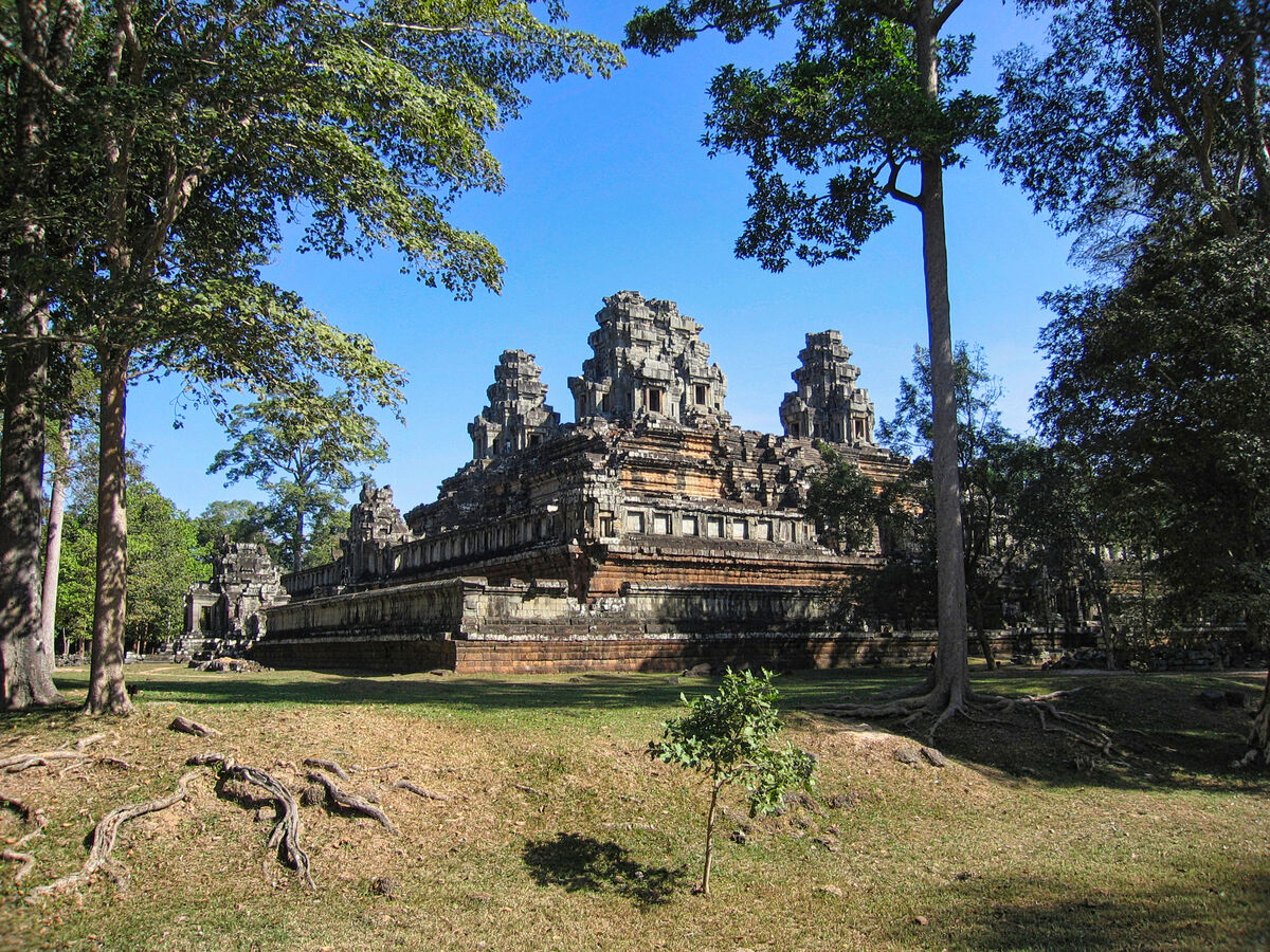
Angkor Thom is in the Bayon style. This manifests itself in the large scale of the construction, in the widespread use of laterite, in the face-towers at each of the entrances to the city and in the naga-carrying giant figures which accompany each of the towers.
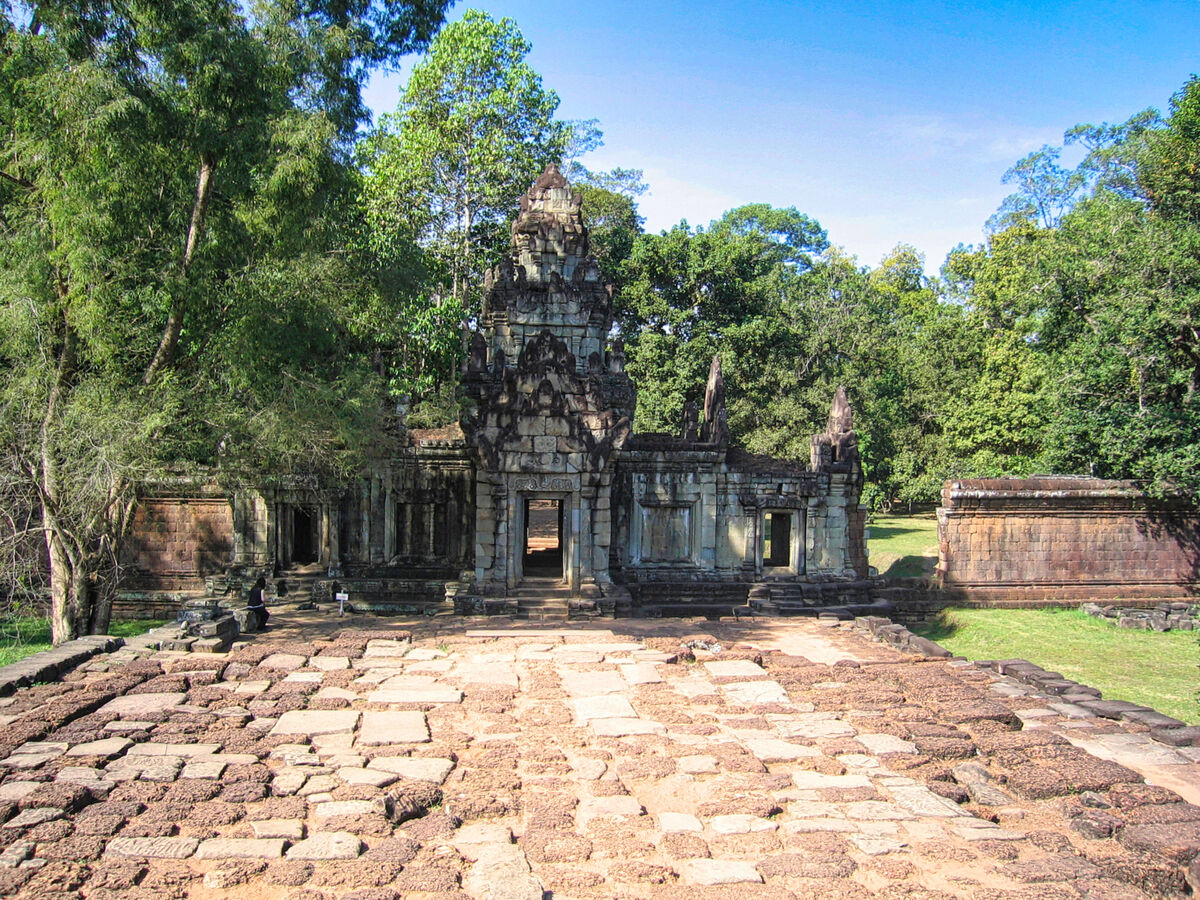
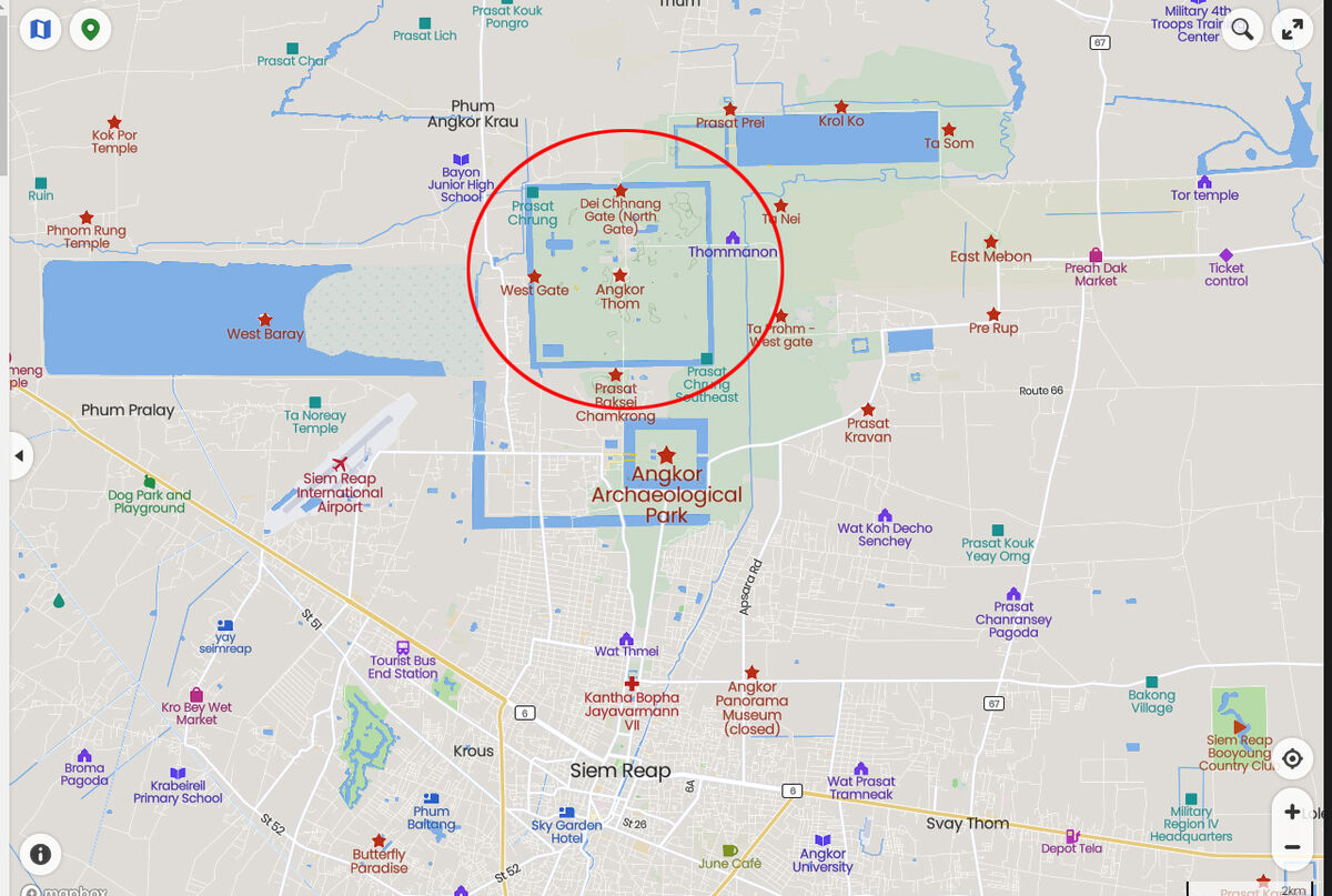
The city lies on the west bank of the Siem Reap River, a tributary of Tonle Sap, about a quarter of a mile from the river. The south gate of Angkor Thom is 7.2 km north of Siem Reap, and 1.7 km north of the entrance to Angkor Wat. The walls, 8 m high and flanked by a moat, are each 3 km long, enclosing an area of 9 km². The walls are of laterite buttressed by earth, with a parapet on the top. There are gates at each of the cardinal points, from which roads lead to the Bayon at the centre of the city. As the Bayon itself has no wall or moat of its own, those of the city are interpreted by archaeologists as representing the mountains and oceans surrounding the Bayon's Mount Meru. Another gate—the Victory Gate—is 500 m north of the east gate; the Victory Way runs parallel to the east road to the Victory Square and the Royal Palace north of the Bayon. It is around 30 minutes from central Siem Reap.
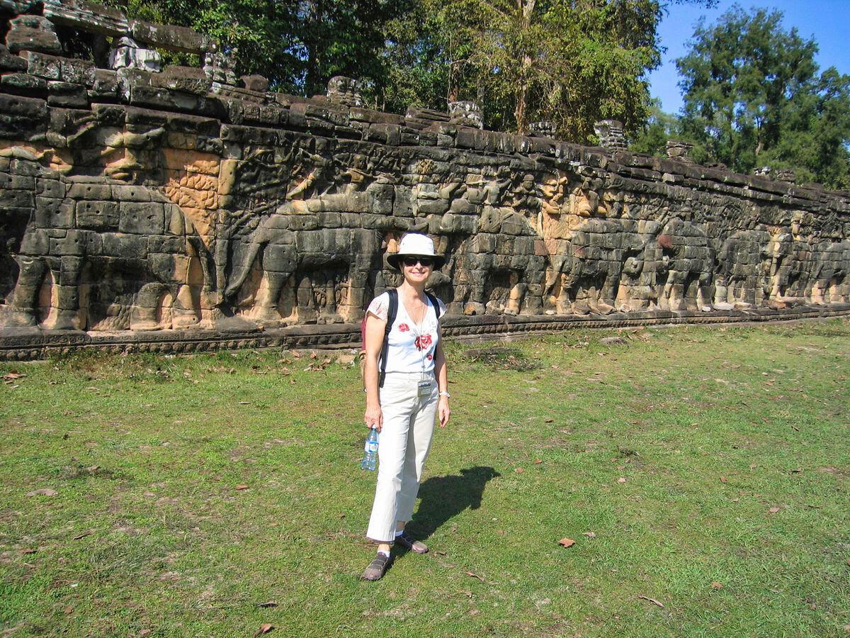
The faces on the 23 m towers at the city gates, which are later additions to the main structure, take after those of the Bayon and pose the same problems of interpretation. They may represent the king himself, the bodhisattva Avalokiteshvara, guardians of the empire's cardinal points, or some combination of these. A causeway spans the moat in front of each tower: these have a row of devas on the left and asuras on the right, each row holding a naga in the attitude of a tug-of-war. This appears to be a reference to the myth, popular in Angkor, of the Churning of the Sea of Milk. The temple-mountain of the Bayon, or perhaps the gate itself, would then be the pivot around which the churning takes place. The nagas may also represent the transition from the world of men to the world of the gods (the Bayon), or be guardian figures. The gateways themselves are 3.5 by 7 m, and would originally have been closed with wooden doors.The south gate is now by far the most often visited, as it is the main entrance to the city for tourists. At each corner of the city is a Prasat Chrung—corner shrine—built of sandstone and dedicated to Avalokiteshvara. These are cruciform with a central tower, and orientated towards the east.
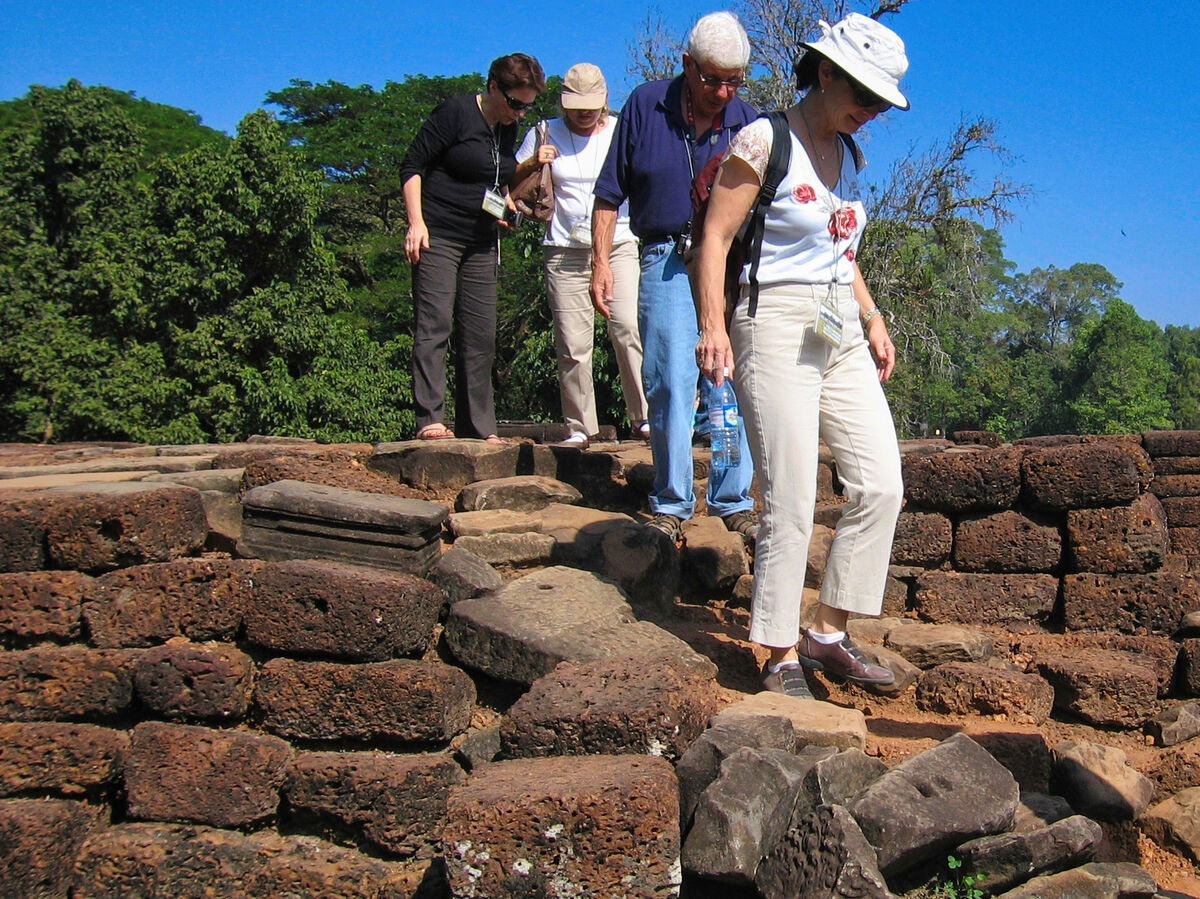
Within the city was a system of canals, through which water flowed from the northeast to the southwest. The bulk of the land enclosed by the walls would have been occupied by the secular buildings of the city, of which nothing remains. This area is now covered by forest.
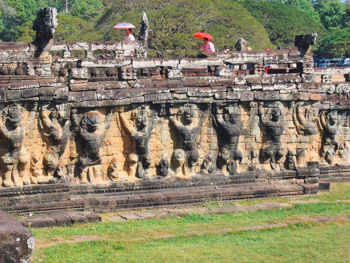
Most of the great Angkor ruins have vast displays of bas-relief depicting the various gods, goddesses, and other-worldly beings from the mythological stories and epic poems of ancient Hinduism. Mingled with these images are actual known animals, like elephants, snakes, fish, and monkeys, in addition to dragon-like creatures that look like the stylized, elongated serpents (with feet and claws) found in Chinese art.
But among the ruins of Ta Prohm, near a huge stone entrance, one can see that the "roundels on pilasters on the south side of the west entrance are unusual in design."
What one sees are roundels depicting various common animals—pigs, monkeys, water buffaloes, roosters and snakes. There are no mythological figures among the roundels, so one can reasonably conclude that these figures depict the animals that were commonly seen by the ancient Khmer people in the twelfth century.
For more images of Siem Reap and narratives, please see my previous posts:
https://www.uglyhedgehog.com/t-760858-1.html#13633063
https://www.uglyhedgehog.com/t-761100-1.html#13638505
https://www.uglyhedgehog.com/t-761169-1.html
https://www.uglyhedgehog.com/t-761242-1.html
https://www.uglyhedgehog.com/t-761379-1.html
https://www.uglyhedgehog.com/t-761630-1.html
https://www.uglyhedgehog.com/t-761797-1.html#13655239
https://www.uglyhedgehog.com/t-761937-1.html
https://www.uglyhedgehog.com/t-762169-1.html
Sets from Ta Prohm:
https://www.uglyhedgehog.com/t-762322-1.html#13669002
https://www.uglyhedgehog.com/t-762482-1.html#13672574
I hope you enjoy this set!
Mark
Angkor Thom (Khmer: អង្គរធំ [ʔɑŋkɔː tʰom]; meaning "Great City"), alternatively Nokor Thom (Khmer: នគរធំ [nɔkɔː tʰom]) located in present-day Cambodia, was the last and most enduring capital city of the Khmer Empire. It was established in the late twelfth century by King Jayavarman VII. It covers an area of 9 km², within which are located several monuments from earlier eras as well as those established by Jayavarman and his successors. At the centre of the city is Jayavarman's state temple, the Bayon, with the other major sites clustered around the Victory Square immediately to the north. The site is one of the major tourist attractions of southeast Asia.
Angkor Thom (Khmer: អង្គរធំ) is the transform name from another alternative name of Nokor Thom (Khmer: នគរធំ), which is believed to be the correct one, due to neglect of calling it in incorrect pronunciation. The word Nokor (Khmer: នគរ, Nôkô) is literally derived from Sanskrit word of Nagara (Devanāgarī: नगर), which means City, combining with Khmer word Thom (Khmer: ធំ, Thum), which means Big or Great so as to form Nokor Thom then being altered to current name of Angkor Thom.
Angkor Thom was established as the capital of Jayavarman VII's empire, and was the centre of his massive building program. One inscription found in the city refers to Jayavarman as the groom and the city as his bride.
Angkor Thom seems not to be the first Khmer capital on the site, however. Yasodharapura, dating from three centuries earlier, was centred slightly further northwest, and Angkor Thom overlapped parts of it. The most notable earlier temples within the city are the former state temple of Baphuon, and Phimeanakas, which was incorporated into the Royal Palace. The Khmers did not draw any clear distinctions between Angkor Thom and Yashodharapura: even in the fourteenth century an inscription used the earlier name. The name of Angkor Thom—great city—was in use from the 16th century.
The last temple known to have been constructed in Angkor Thom was Mangalartha, which was dedicated in 1295. Thereafter the existing structures continued to be modified from time to time, but any new creations were in perishable materials and have not survived.
The Ayutthaya Kingdom, led by King Borommarachathirat II, sacked Angkor Thom, forcing the Khmers under Ponhea Yat to relocate their capital southeast to Phnom Penh.
Angkor Thom was abandoned some time prior to 1609, when an early western visitor wrote of an uninhabited city, "as fantastic as the Atlantis of Plato". It is believed to have sustained a population of 80,000–150,000 people.
The Poem of Angkor Wat composed in Khmer verse in 1622 describes the beauty of Angkor Thom.
Angkor Thom is in the Bayon style. This manifests itself in the large scale of the construction, in the widespread use of laterite, in the face-towers at each of the entrances to the city and in the naga-carrying giant figures which accompany each of the towers.
The city lies on the west bank of the Siem Reap River, a tributary of Tonle Sap, about a quarter of a mile from the river. The south gate of Angkor Thom is 7.2 km north of Siem Reap, and 1.7 km north of the entrance to Angkor Wat. The walls, 8 m high and flanked by a moat, are each 3 km long, enclosing an area of 9 km². The walls are of laterite buttressed by earth, with a parapet on the top. There are gates at each of the cardinal points, from which roads lead to the Bayon at the centre of the city. As the Bayon itself has no wall or moat of its own, those of the city are interpreted by archaeologists as representing the mountains and oceans surrounding the Bayon's Mount Meru. Another gate—the Victory Gate—is 500 m north of the east gate; the Victory Way runs parallel to the east road to the Victory Square and the Royal Palace north of the Bayon. It is around 30 minutes from central Siem Reap.
The faces on the 23 m towers at the city gates, which are later additions to the main structure, take after those of the Bayon and pose the same problems of interpretation. They may represent the king himself, the bodhisattva Avalokiteshvara, guardians of the empire's cardinal points, or some combination of these. A causeway spans the moat in front of each tower: these have a row of devas on the left and asuras on the right, each row holding a naga in the attitude of a tug-of-war. This appears to be a reference to the myth, popular in Angkor, of the Churning of the Sea of Milk. The temple-mountain of the Bayon, or perhaps the gate itself, would then be the pivot around which the churning takes place. The nagas may also represent the transition from the world of men to the world of the gods (the Bayon), or be guardian figures. The gateways themselves are 3.5 by 7 m, and would originally have been closed with wooden doors.The south gate is now by far the most often visited, as it is the main entrance to the city for tourists. At each corner of the city is a Prasat Chrung—corner shrine—built of sandstone and dedicated to Avalokiteshvara. These are cruciform with a central tower, and orientated towards the east.
Within the city was a system of canals, through which water flowed from the northeast to the southwest. The bulk of the land enclosed by the walls would have been occupied by the secular buildings of the city, of which nothing remains. This area is now covered by forest.
Most of the great Angkor ruins have vast displays of bas-relief depicting the various gods, goddesses, and other-worldly beings from the mythological stories and epic poems of ancient Hinduism. Mingled with these images are actual known animals, like elephants, snakes, fish, and monkeys, in addition to dragon-like creatures that look like the stylized, elongated serpents (with feet and claws) found in Chinese art.
But among the ruins of Ta Prohm, near a huge stone entrance, one can see that the "roundels on pilasters on the south side of the west entrance are unusual in design."
What one sees are roundels depicting various common animals—pigs, monkeys, water buffaloes, roosters and snakes. There are no mythological figures among the roundels, so one can reasonably conclude that these figures depict the animals that were commonly seen by the ancient Khmer people in the twelfth century.
For more images of Siem Reap and narratives, please see my previous posts:
https://www.uglyhedgehog.com/t-760858-1.html#13633063
https://www.uglyhedgehog.com/t-761100-1.html#13638505
https://www.uglyhedgehog.com/t-761169-1.html
https://www.uglyhedgehog.com/t-761242-1.html
https://www.uglyhedgehog.com/t-761379-1.html
https://www.uglyhedgehog.com/t-761630-1.html
https://www.uglyhedgehog.com/t-761797-1.html#13655239
https://www.uglyhedgehog.com/t-761937-1.html
https://www.uglyhedgehog.com/t-762169-1.html
Sets from Ta Prohm:
https://www.uglyhedgehog.com/t-762322-1.html#13669002
https://www.uglyhedgehog.com/t-762482-1.html#13672574
I hope you enjoy this set!
Mark
(Download)
(Download)
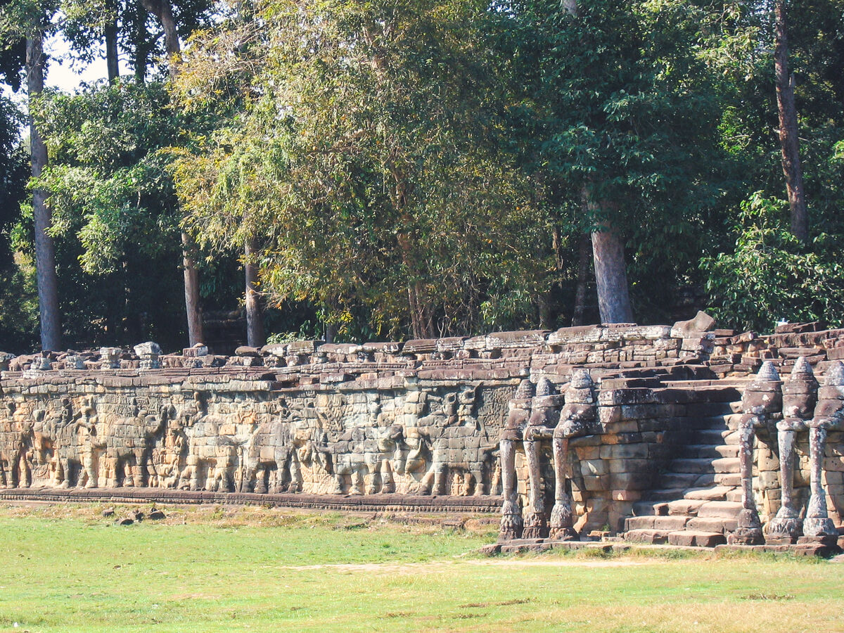
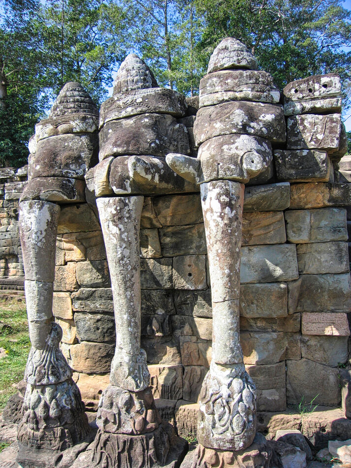
The Elephant Wall
(Download)
I still managed to cut off her feet!
(Download)
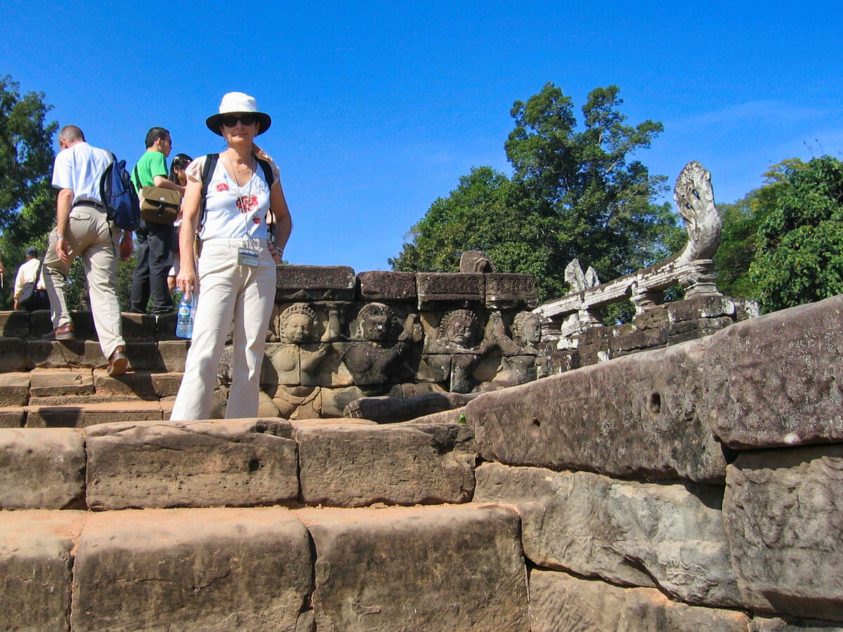
From inside the west gate
(Download)
She does have lovely feet!
(Download)
(Download)

(Download)
Thye Elephant Terrace
(Download)
Note the bullet scars in the Elephant Wall.
(Download)
Jan 16, 2023 15:16:27 #
Jan 16, 2023 15:28:06 #

Jan 16, 2023 15:31:04 #

Really enjoyed the tour you provided of this magnificent place. You have a lovely wife.
will
will
Jan 16, 2023 15:40:40 #

Jan 16, 2023 15:41:50 #

Jan 16, 2023 15:47:29 #

Jan 16, 2023 15:58:26 #

srfmhg wrote:
After leaving the Ta Prohm Temple, we took a short... (show quote)
Mesmerizingly beautiful shots 🎯🎯💎🎯🎯
Jan 16, 2023 17:37:36 #
Jan 16, 2023 17:38:33 #
Soul Dr. wrote:
Really enjoyed the tour you provided of this magnificent place. You have a lovely wife.
will
will
Thanks so much for your kind comments Will. Gail thanks you for the compliment.
Jan 16, 2023 17:39:39 #
UTMike wrote:
Beautiful tour with many excellent images of Gail, Mark!
Thanks very much Mike. She's my favorite subject as you can see!
Jan 16, 2023 17:40:01 #
Jan 16, 2023 17:41:26 #
NMGal wrote:
The elephant wall is something else.
It was quite a site Barbara. I will post a few more from that spot. Thanks so much for commenting.
Jan 16, 2023 17:42:42 #
joecichjr wrote:
Mesmerizingly beautiful shots 🎯🎯💎🎯🎯
Thank you so much Joe. I always appreciate your superlatives.
Jan 16, 2023 19:41:22 #

If you want to reply, then register here. Registration is free and your account is created instantly, so you can post right away.