Canon 5D4 GPS
Apr 25, 2022 14:08:33 #
It is so convenient to take a photo using my iPhone and seeing my current location and landmark displayed on the screen. My new Canon 5D4 has built in GPS but I can't figure out how to get the GPS info (coordinates or location) displayed anywhere. All the "You Tubes" tell you how to plot your travels on a map. Who needs that? I assume the GPS data is stored somewhere in each photo's metadata. Does anyone know how to display it? And yes I have gone into the menu and activated GPS. Thanks for any help.
Apr 25, 2022 14:39:38 #

Chapter 5 of the EOS 5DIV User Manual, starting page 227, is dedicated to the GPS functionality of this camera model.
Apr 26, 2022 09:50:36 #

If you like to see the GPS coordinates on the camera display for an image taken, just push the "info" button next to the menu button twice. If you like to see the location on a map, you would have to download the image to a photo app supporting a map. I'm using Affinity, but I also can use "Preview" on my Mac.
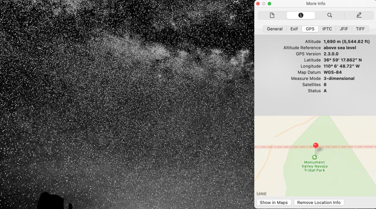
Apr 26, 2022 09:50:41 #
Apr 26, 2022 09:53:32 #
Apr 26, 2022 14:53:44 #

It's easy to turn on the GPS but don't forget to turn it off. It will drain your batteries quickly.
Apr 27, 2022 07:38:44 #

jimvanells wrote:
It's easy to turn on the GPS but don't forget to turn it off. It will drain your batteries quickly.
If I remember correctly my 5DIV had a menu option to automatically shut down the GPS when the camera shut down. I think it was my 6D that had to be shut down manually. Or, my 5DIV would not shut down automatically but my R would. Either way, the OP should check for that option. Whichever camera it was, the first time I turned on the GPS the battery went dead overnight.
If you want to reply, then register here. Registration is free and your account is created instantly, so you can post right away.