Long's Peak, Colorado
Feb 7, 2022 11:56:21 #
Caribou
Loc: St. Louis, MO
I saw a recent post by Funkmaster J about Long’s Peak. It reminded me of a time a few years ago when my son-in-law and I climbed it. As was pointed out, it is not a technical climb along the path we took but it was a quite a climb. I was without a doubt the oldest person up there. There was a group of Air Force Academy cadets who passed us but they admitted that it was more difficult than they expected. As you can see from the pictures, a lot of people make the climb.
It is definitely best to start very early in order to summit and be on the way back down by early afternoon in the event of a storm. We got to the ranger station at 4 a.m. and parking was already scarce.
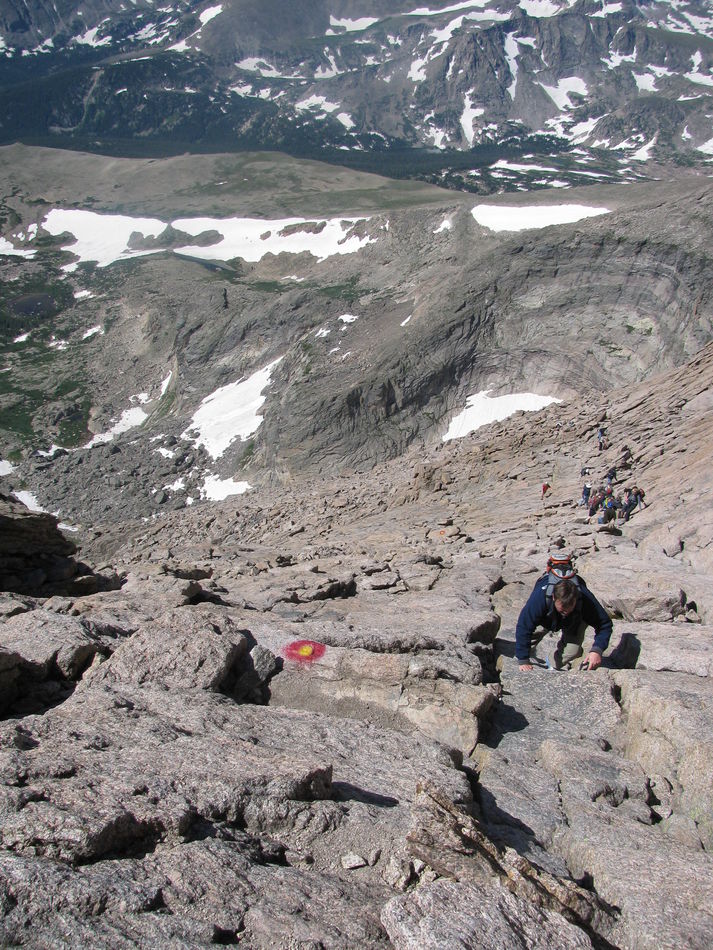
The station is at about 9,000 feet. The trail is a switchback trail. You walk for a long time in trees, mostly pines until you hit about 11,000 feet where the tree line ends. At that point you have another long walk as you approach the Keyhole. Every significant part of the trail has a name. As you approach the Keyhole you have to navigate a boulder field as you are going up to the Keyhole. At that point, as you go through the Keyhole you are on the other side. I think it is at about 13,000 feet. So you have another 1200+ vertical feet to go. I began to notice that I was breathing more heavily but it wasn’t really a problem until we got to the Homestretch which is the path to the summit. As you can see from the photos, that is more vertical. By that point it was one step and a few breaths then another step. (It made me wonder how climbers on Mt Everest do it. This is half the height. But they are normally much younger, in far better shape, and more acclimated. Still…)
Because of the distance and altitude I tried to be prudent about how much I carried with me. For water I relied solely on a Camelback water pouch and I tried to use it carefully. Nevertheless, I ran out of water at the summit. So, the 5 hour hike back down was not fun. We kept seeing these beautiful cold, clear streams of snowmelt water but it is advisable to not drink it. You can get something called “Beaver fever”. But it was hard to pass that up.
As I recall we got to the summit at about noon and finally got back to the ranger station at about 5 p.m. I’m glad we did it. We’ve discussed doing it again with my grandsons.
It is definitely best to start very early in order to summit and be on the way back down by early afternoon in the event of a storm. We got to the ranger station at 4 a.m. and parking was already scarce.
The station is at about 9,000 feet. The trail is a switchback trail. You walk for a long time in trees, mostly pines until you hit about 11,000 feet where the tree line ends. At that point you have another long walk as you approach the Keyhole. Every significant part of the trail has a name. As you approach the Keyhole you have to navigate a boulder field as you are going up to the Keyhole. At that point, as you go through the Keyhole you are on the other side. I think it is at about 13,000 feet. So you have another 1200+ vertical feet to go. I began to notice that I was breathing more heavily but it wasn’t really a problem until we got to the Homestretch which is the path to the summit. As you can see from the photos, that is more vertical. By that point it was one step and a few breaths then another step. (It made me wonder how climbers on Mt Everest do it. This is half the height. But they are normally much younger, in far better shape, and more acclimated. Still…)
Because of the distance and altitude I tried to be prudent about how much I carried with me. For water I relied solely on a Camelback water pouch and I tried to use it carefully. Nevertheless, I ran out of water at the summit. So, the 5 hour hike back down was not fun. We kept seeing these beautiful cold, clear streams of snowmelt water but it is advisable to not drink it. You can get something called “Beaver fever”. But it was hard to pass that up.
As I recall we got to the summit at about noon and finally got back to the ranger station at about 5 p.m. I’m glad we did it. We’ve discussed doing it again with my grandsons.
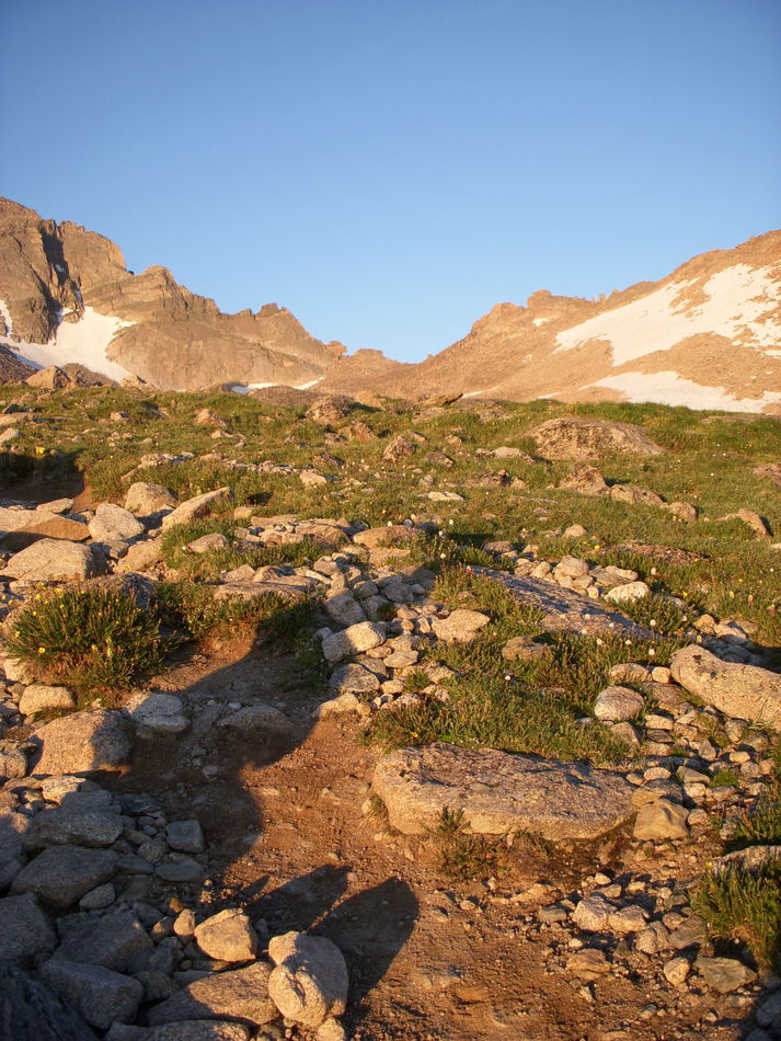
At this point you are out of the treeline but with quite a distance until the Keyhole which can be seen to the left in the V shaped area
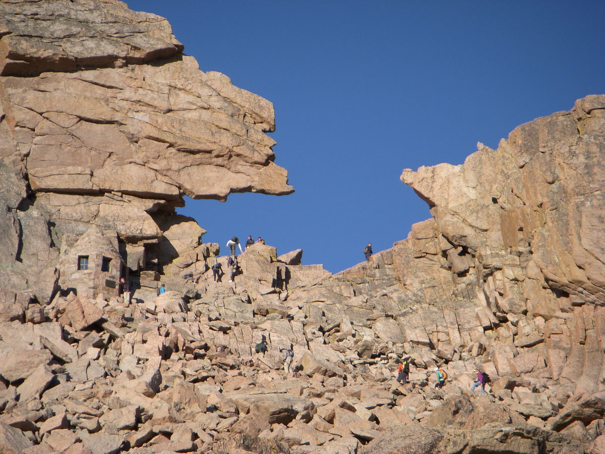
The Keyhole. You can see the boulder field you have to navigate to get up to it. That little shelter on the left was built in honor of a climber who died from exposure during a winter storm.
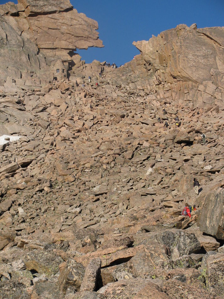
Another of the boulder field
On the back side of the Keyhole
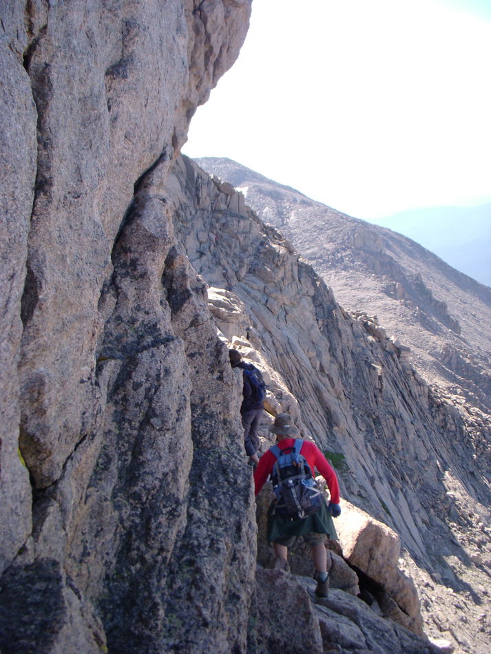
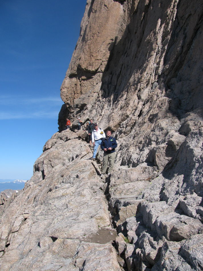
I believe this is along the area called The Ledge
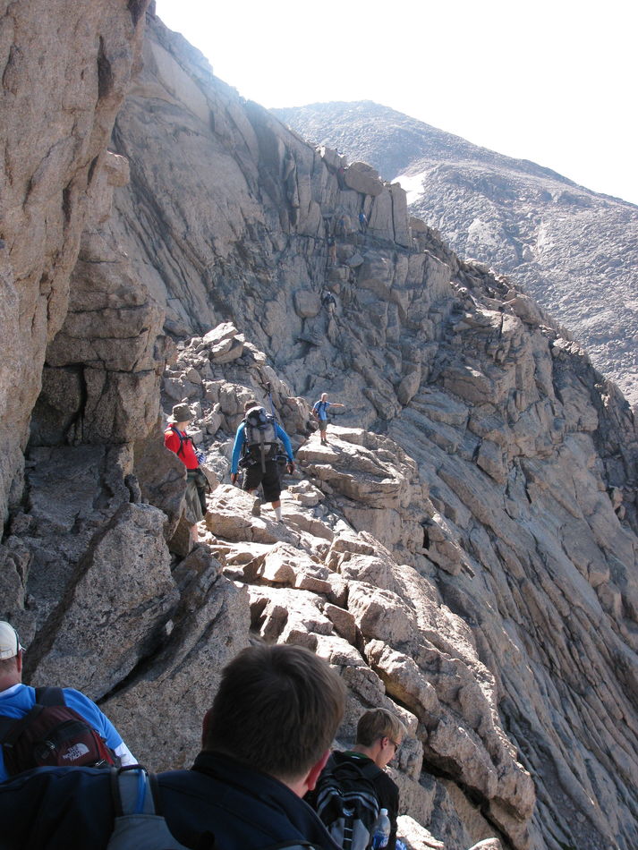
Another climber at some point on The Ledge
Someone took our picture. I think this was along The Narrows.
Near the base of The Homestretch
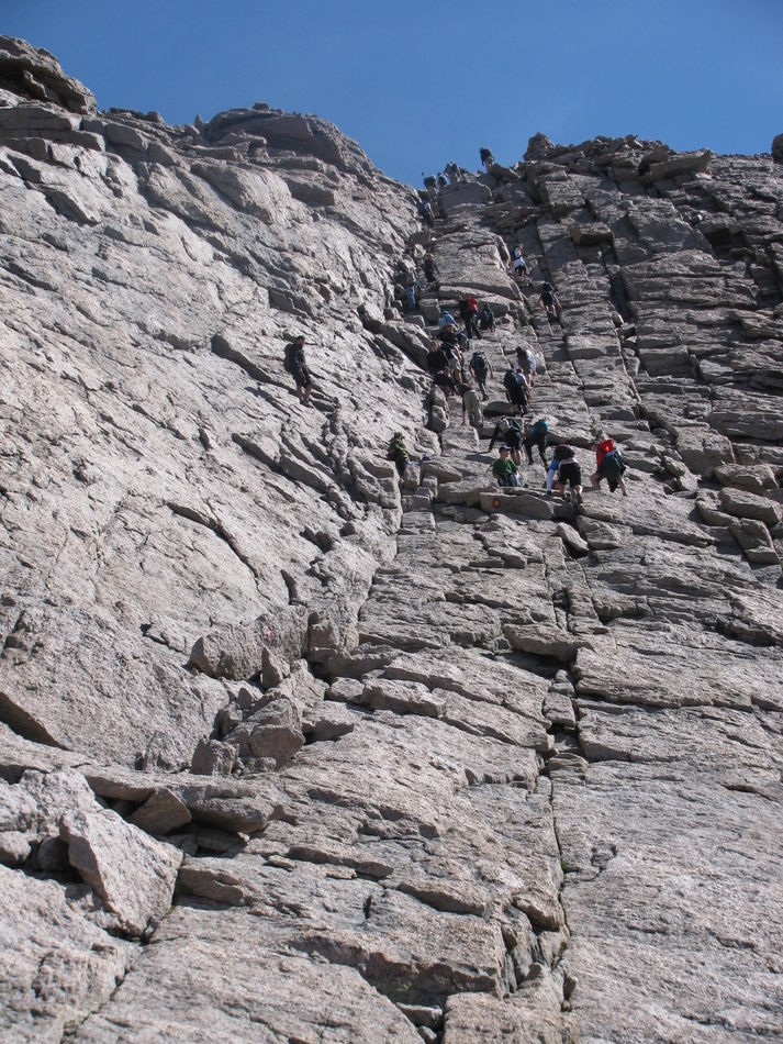
Looking down at The Homestretch
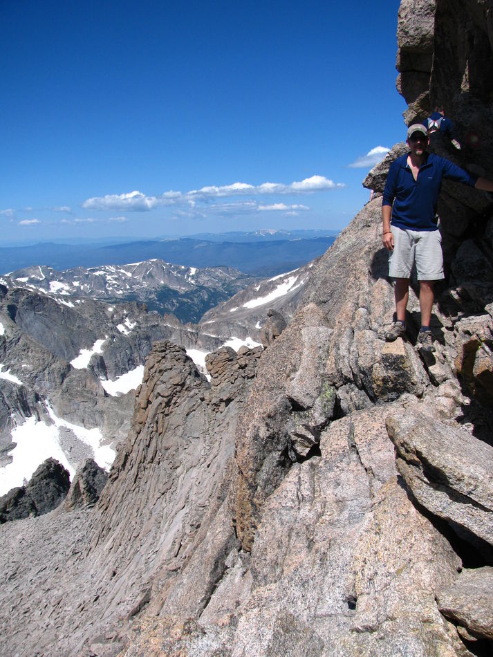
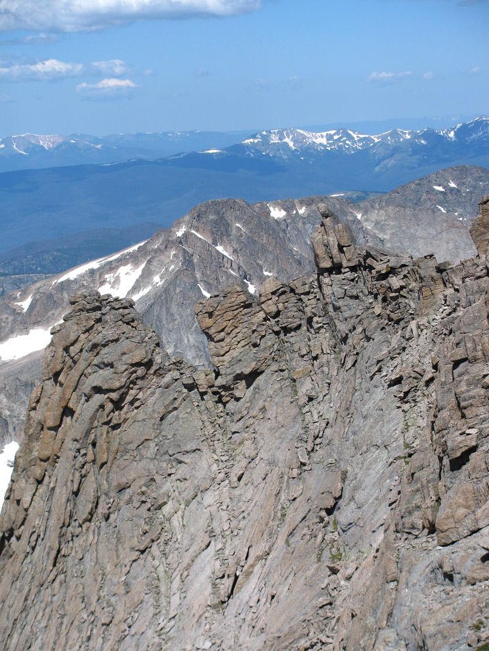
One view from the summit
Feb 7, 2022 12:04:43 #

Neat set!
Any purpose for the "building" on the left in the second image?
Any purpose for the "building" on the left in the second image?
Feb 7, 2022 12:29:15 #

Feb 7, 2022 12:30:17 #
Caribou
Loc: St. Louis, MO
My understanding is that it is a shelter built in memory of a climber who was caught in a winter storm and died.
Feb 7, 2022 12:37:58 #
I understand the desire to lighten the load by carrying less water, but that is dangerous. Dehydration causes problems that interfere with your ability to both think and move. And if there are streams available, you can get filters or chemical purifiers that will make the water safe to drink.
Feb 7, 2022 12:38:52 #
Caribou wrote:
My understanding is that it is a shelter built in memory of a climber who was caught in a winter storm and died.
Wow...
Feb 7, 2022 12:40:06 #

Feb 7, 2022 12:45:37 #

Caribou wrote:
I saw a recent post by Funkmaster J about Long’s P... (show quote)
Thanks for posting this informative set. I live in Longmont, CO (named after Long's Peak) and I get to see the Peak and Mt. Meeker every day. Your description of the climb and the amount of time needed is dead on. Thanks again.
Feb 7, 2022 12:52:30 #

Feb 7, 2022 14:19:33 #

Wow!! You are a braver soul than I. Thanks for sharing your adventure.
Dodie
Dodie
Feb 7, 2022 14:45:38 #
NMGal wrote:
To my mind, this sort of thing is reserved for the “younger generation “.
Younger generation? That must mean me since I can run so fast that my hair can't keep up.
Feb 7, 2022 14:56:36 #
Caribou, Thanks for your fine photos and accurate description of the round trip hike. Having climbed Longs a few times, I would recommend at least a hike up to Flat Top Mountain and maybe Twin Sisters or similar easy hike, high peaks to acclimate to the altitude and physical requirements. A 1000 feet of altitude adjustment can require 1 day to fully adjust. Of course, thousands of people do not follow those guidelines and successfully summit Longs and other above 13,000 peaks. I finally learned to hide a few containers of water off the trail on the way up; that way I would not encounter the systems of dehydrations on the way down. Be certain to wear quality hiking boots and two layers of socks. Carry ample clothing and a good hat in case you are caught in freezing rain, hail, or snow. Don't delay too long on the summit of Longs. LIGHTNING does not compromise for the novice or expert climbers. Use good judgement: Mountains don't care if you live or die.
Feb 7, 2022 15:04:30 #

Caribou wrote:
I saw a recent post by Funkmaster J about Long’s P... (show quote)
Great shots, and congratulations
 I would have been exhausted even if I had started out on top
Feb 7, 2022 16:31:26 #
Caribou
Loc: St. Louis, MO
Barn Owl wrote:
Caribou, Thanks for your fine photos and accurate ... (show quote)
Excellent advice. Can you imagine having to rescued off that mountain?
Feb 8, 2022 05:16:15 #

Caribou wrote:
I saw a recent post by Funkmaster J about Long’s P... (show quote)
Nice set but not for me lol
If you want to reply, then register here. Registration is free and your account is created instantly, so you can post right away.