Bob Marshall Wilderness Area Montana 1
Aug 25, 2021 01:00:08 #

I was invited a few years ago by my brother and nephew to join them and a few friends on a hike into the Bob Marshall Wilderness area. They said it was about six and a half mile hike and that it usually took them about six and a half hours to hike in. Well the term, "It's a pretty good hike," can be interpreted a lot of different ways.
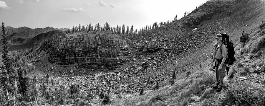
It wasn't until we were finishing the first two miles of a pretty easy hike down an old forest service road that the term, "Next up is the Hill of Death" did I start to realize I had misinterpreted their meaning of "a pretty good hike."
Well as you can see below, I did make it, but it took us nine hours to make it in. At the top of the Hill of Death, I offered to sell my Nikon D810 with a 24-120 f/4 lens and Tripod very cheap. Luckily I guess there were no takers willing to carry the extra weight. We stayed a few days resting up for the trip back out.
The Bob Marshall Wilderness Complex is located in Northwestern Montana on both sides of the Continental Divide; this large complex includes three Wilderness areas: the Great Bear, the Scapegoat, and the Bob Marshall Wilderness. Together the Bob Marshall Wilderness Complex makes up an area of more than 1.5 million acres, the third largest in the lower 48 states. While we didn’t see any wildlife except a Marmot during our trip in, the area has a population of grizzly bear, lynx, wolverine, deer, elk, gray wolf, moose, black bear, mountain lion, mountain goat, and mountain sheep that roam about these rugged ridge tops, gently sloping alpine meadows and lakeshores. Over 1700 miles of trail provide challenges and experiences for visitors with a wide range of skills.
The Bob Marshall Wilderness was named for Bob Marshall, an early wilderness advocate, explorer and conservationist who promoted the development of effective and meaningful wilderness management. Designated in 1964 with the passage of the Wilderness Act, the Bob Marshall Wilderness is the oldest of the three wilderness areas composing the BMWC. It is also the largest, covering 1,063,503 acres. There are approximately 1,100 miles of system trail in this wilderness. Much of the area now comprising the Bob Marshall Wilderness was originally protected as the South Fork, Pentagon and Sun River Primitive Areas, which were established in 1931, 1933, and 1934 respectively. In 1978, additional lands were designated in the Birch Creek area. Then in 2014, additional lands were designated along the Rocky Mountain Front bringing the Bob Marshall Wilderness to its current size. The Continental Divide separates the Bob Marshall Wilderness into the Flathead and Sun River drainages, with elevations ranging from 4,000 feet to more than 9,000 feet. A huge escarpment called the Chinese Wall, is one of the most spectacular features of the landscape, averaging 1,000 feet in height and extending 22 miles. East of the Divide, the mountains of the Rocky Mountain Front rise from the plains, with elevations of 2,000 to 8,000 feet, and extend over 60 miles from north to south along the eastern edge of the Wilderness area.
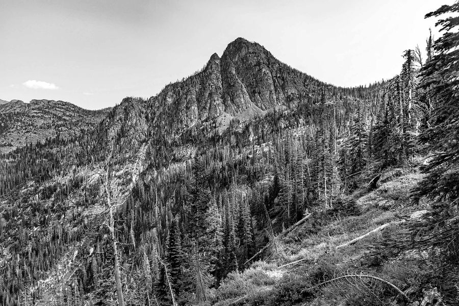
The hike in after the Hill of Death comes the Shale Rock Slides, then the Boulder Fields, around another mountain and finally down the dry creek bed which includes all of the above.
(Download)
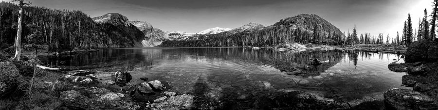
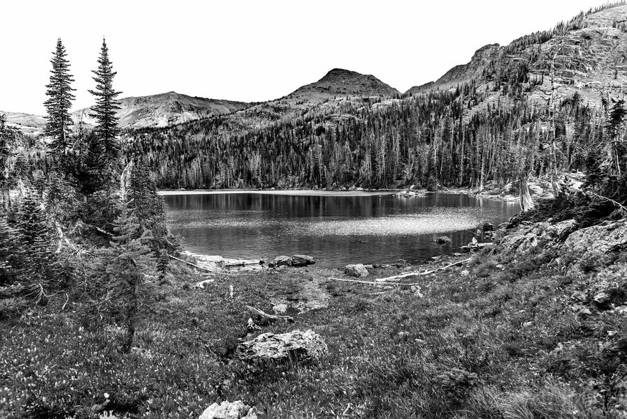
The lake unlike the hike in was beautiful and relaxing.
(Download)
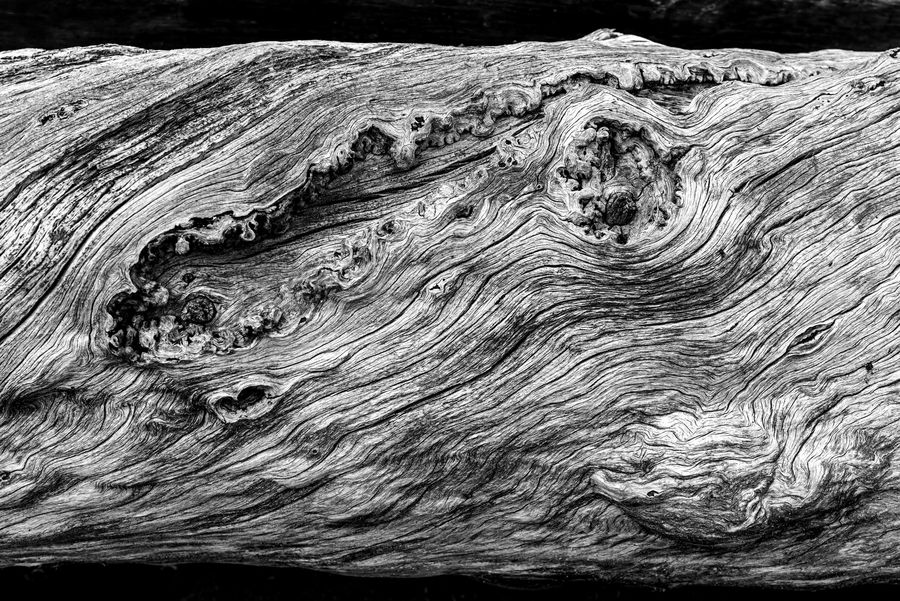
The logs on the banks of the lake tell the story of their life much like the weathered face of a person.
(Download)
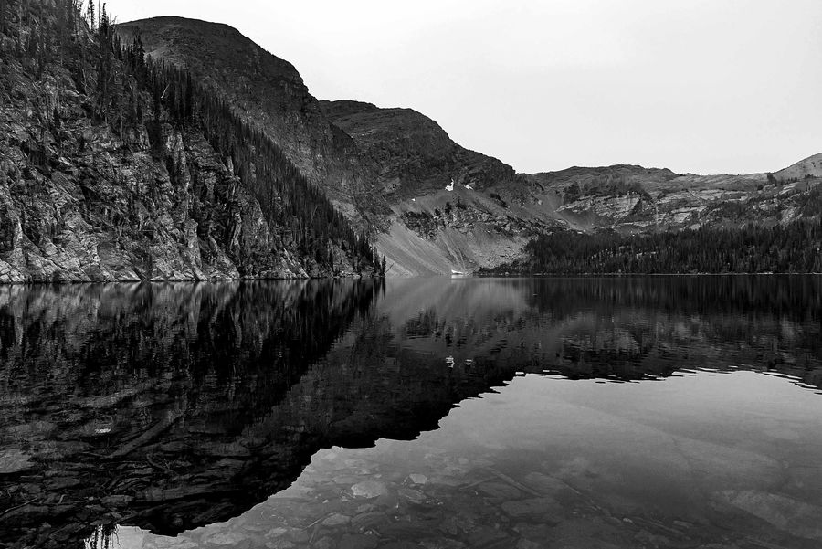
Most of the time a stiff breeze blew over the lake but when it did calm down it gave us very clean mirror images.
(Download)
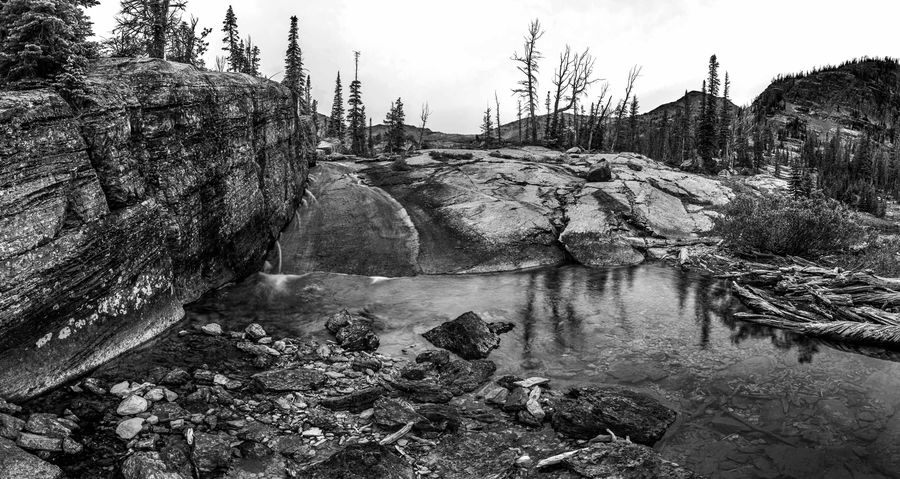
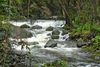
The lake has a large log jam at the head of the creek that serves as an outlet. The water level was low but enough to run over a large smooth rock into a smaller pond.
(Download)
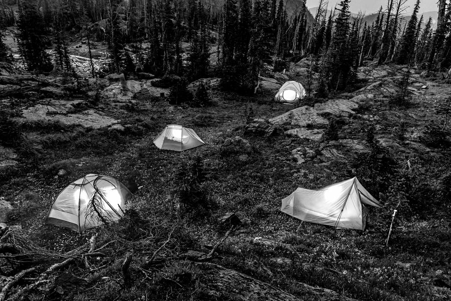
Just before bedtime was a good time to let the tents glow.
(Download)
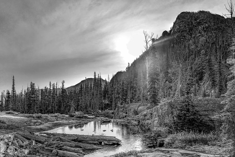
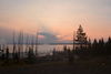
Sunrise on the lower pond.
(Download)
The log jam and first pond and the top of the creek before heading down the smooth rock.
(Download)
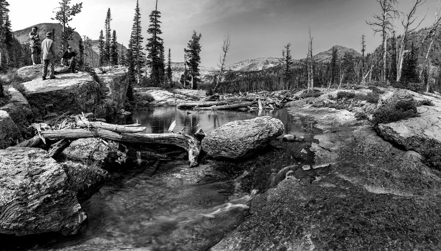
The mountain we had to walk around on the hike in.
(Download)
The lake.
(Download)
Aug 25, 2021 01:34:37 #

Super set, and very spectacular country. Thanks for taking us there.
Aug 25, 2021 01:43:09 #

Aug 25, 2021 02:30:26 #
Aug 25, 2021 05:16:01 #

David, thank you for letting me tag along. It brings back memories of another time.
Aug 25, 2021 05:22:06 #

Aug 25, 2021 05:43:29 #
Aug 25, 2021 05:51:29 #
Aug 25, 2021 05:56:55 #

I'm thinking Ansel here. These are great! Don't dare sell the Nikon! Good thing no one bought it. Kudos. 
Aug 25, 2021 06:03:15 #

Aug 25, 2021 06:27:47 #

Aug 25, 2021 06:37:06 #

Aug 25, 2021 06:48:17 #
Aug 25, 2021 06:50:05 #

Aug 25, 2021 07:04:32 #

Excellent images! And thanks for the safety tip. I’m going to think twice about any hike that includes a « Hill of Death! »
If you want to reply, then register here. Registration is free and your account is created instantly, so you can post right away.