Ireland: The Cliffs of Moher
Oct 9, 2020 16:34:06 #

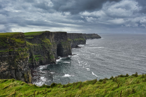
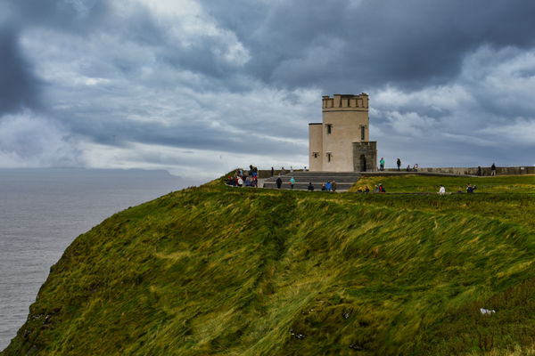
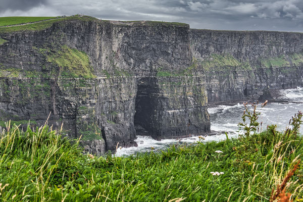
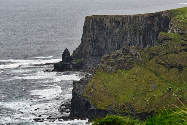
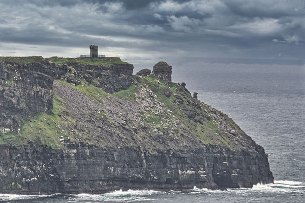
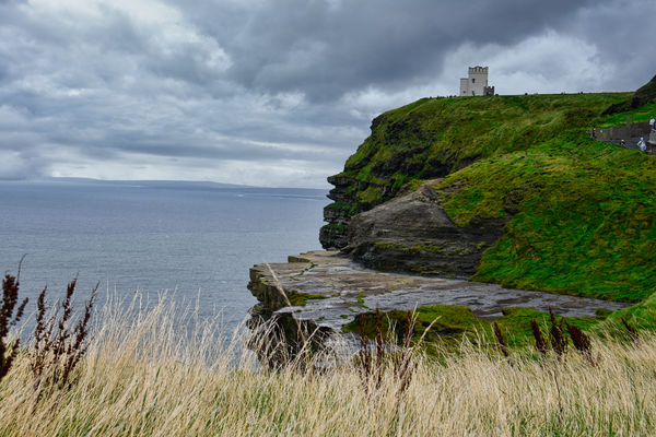
The Cliffs of Moher (/ˈmoʊ(h)ər/; Irish: Aillte an Mhothair) are sea cliffs located at the southwestern edge of the Burren region in County Clare, Ireland. They run for about 14 kilometres (9 miles). At their southern end, they rise 120 metres (390 ft) above the Atlantic Ocean at Hag's Head, and, 8 kilometres (5 miles) to the north, they reach their maximum height of 214 metres (702 ft) just north of O'Brien's Tower, a round stone tower near the midpoint of the cliffs, built in 1835 by Sir Cornelius O'Brien, then continue at lower heights. The closest settlements are the villages of Liscannor 6 km (4 miles) to the south, and Doolin 7 km (4 miles) to the north. From the cliffs, and from atop the tower, visitors can see the Aran Islands in Galway Bay, the Maumturks and Twelve Pins mountain ranges to the north in County Galway, and Loop Head to the south. The cliffs rank among the most visited tourist sites in Ireland, with around 1.5 million visits per annum.
The cliffs take their name from an old promontory fort called Mothar or Moher, which once stood on Hag's Head, the southernmost point of the cliffed coast, now the site of Moher Tower. The writer Thomas Johnson Westropp referred to it in 1905 as Moher Uí Ruis or Moher Uí Ruidhin. The fort still stood in 1780 and is mentioned in an account from John Lloyd's A Short Tour Of Clare (1780). It was demolished in 1808 to provide material for a lookout/telegraph tower that was intended to provide warning in case of a French invasion during the Napoleonic wars.
In the 1990s the local authority, Clare County Council, initiated development plans to enable visitors to experience the cliffs without significant intrusive man-made amenities. In keeping with this approach, a modern visitor centre, the Cliffs of Moher Visitor Experience, was built into a hillside approaching the cliffs. The centre was planned to be environmentally sensitive in its use of renewable energy systems including geothermal heating and cooling, solar panels, and grey water recycling.
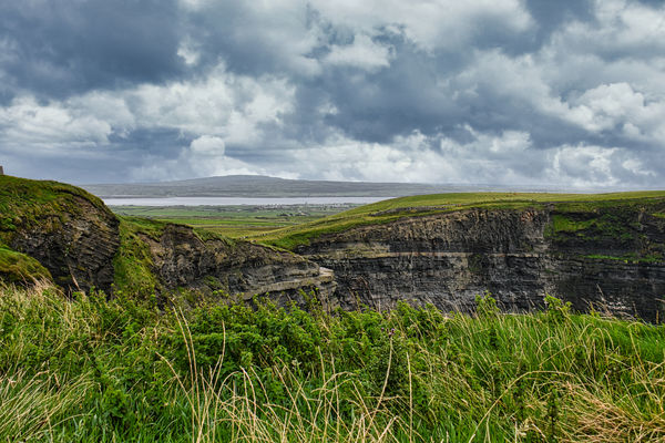
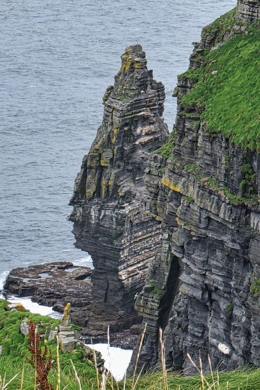
The cliffs consist mainly of beds of Namurian shale and sandstone, with the oldest rocks being found at the bottom of the cliffs. During the time of their formation between 313 and 326 million years ago, a river dumped sand, silt and clay into an ancient marine basin. Over millions of years, the sediments collecting at the mouth of this ancient delta were compacted and lithified into the sedimentary strata preserved in the now-exposed cliffs. The area is considered a geologic laboratory that preserves a record of deltaic deposition in deep water. Individual strata vary in thickness from just a few centimeters to several meters, each representing a specific depositional event in the history of the delta. In aggregate, up to 200 meters of sedimentary rocks are exposed in the Cliffs of Moher. Trace fossils are abundant, comprising two main types: (1) scolicia or worming trails, which are interpreted as feeding trails left by as-yet-unidentified invertebrates, and (2) burrow marks, which are circular features preserved as casts of burrows once occupied by as-yet-unidentified marine creatures. Ripple marks are preserved in some stones.
The Cliffs of Moher have appeared in numerous media. In cinema, the cliffs have appeared in several films, including The Princess Bride (1987) (as the filming location for "The Cliffs of Insanity"), Harry Potter and the Half-Blood Prince (2009), and Leap Year (2010). The cliffs are mentioned in the Martin Scorsese film Bringing Out the Dead (1999) and are noted in the 2008 documentary Waveriders as the location of a large surfing wave known as "Aileens". In music, the cliffs have been the scene for music videos, including Maroon 5's "Runaway", Westlife's "My Love", and Rich Mullins' "The Color Green". Most of singer Dusty Springfield's ashes were scattered at the cliffs by her brother, Tom. There is also an Irish fiddle tune called The Cliffs Of Moher.
https://en.wikipedia.org/wiki/Cliffs_of_Moher
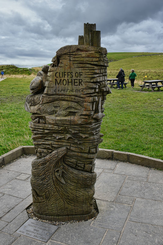
It rained on and off during our visit to The Cliffs but thankfully the fog (which we encountered heavily during our drive around The Ring of Kerry) stayed away. I hope you enjoy these images, none of which were taken through the tour bus windows!
Mark
The cliffs take their name from an old promontory fort called Mothar or Moher, which once stood on Hag's Head, the southernmost point of the cliffed coast, now the site of Moher Tower. The writer Thomas Johnson Westropp referred to it in 1905 as Moher Uí Ruis or Moher Uí Ruidhin. The fort still stood in 1780 and is mentioned in an account from John Lloyd's A Short Tour Of Clare (1780). It was demolished in 1808 to provide material for a lookout/telegraph tower that was intended to provide warning in case of a French invasion during the Napoleonic wars.
In the 1990s the local authority, Clare County Council, initiated development plans to enable visitors to experience the cliffs without significant intrusive man-made amenities. In keeping with this approach, a modern visitor centre, the Cliffs of Moher Visitor Experience, was built into a hillside approaching the cliffs. The centre was planned to be environmentally sensitive in its use of renewable energy systems including geothermal heating and cooling, solar panels, and grey water recycling.
The cliffs consist mainly of beds of Namurian shale and sandstone, with the oldest rocks being found at the bottom of the cliffs. During the time of their formation between 313 and 326 million years ago, a river dumped sand, silt and clay into an ancient marine basin. Over millions of years, the sediments collecting at the mouth of this ancient delta were compacted and lithified into the sedimentary strata preserved in the now-exposed cliffs. The area is considered a geologic laboratory that preserves a record of deltaic deposition in deep water. Individual strata vary in thickness from just a few centimeters to several meters, each representing a specific depositional event in the history of the delta. In aggregate, up to 200 meters of sedimentary rocks are exposed in the Cliffs of Moher. Trace fossils are abundant, comprising two main types: (1) scolicia or worming trails, which are interpreted as feeding trails left by as-yet-unidentified invertebrates, and (2) burrow marks, which are circular features preserved as casts of burrows once occupied by as-yet-unidentified marine creatures. Ripple marks are preserved in some stones.
The Cliffs of Moher have appeared in numerous media. In cinema, the cliffs have appeared in several films, including The Princess Bride (1987) (as the filming location for "The Cliffs of Insanity"), Harry Potter and the Half-Blood Prince (2009), and Leap Year (2010). The cliffs are mentioned in the Martin Scorsese film Bringing Out the Dead (1999) and are noted in the 2008 documentary Waveriders as the location of a large surfing wave known as "Aileens". In music, the cliffs have been the scene for music videos, including Maroon 5's "Runaway", Westlife's "My Love", and Rich Mullins' "The Color Green". Most of singer Dusty Springfield's ashes were scattered at the cliffs by her brother, Tom. There is also an Irish fiddle tune called The Cliffs Of Moher.
https://en.wikipedia.org/wiki/Cliffs_of_Moher
It rained on and off during our visit to The Cliffs but thankfully the fog (which we encountered heavily during our drive around The Ring of Kerry) stayed away. I hope you enjoy these images, none of which were taken through the tour bus windows!
Mark
(Download)
(Download)
O'Brien's Tower
(Download)
(Download)
(Download)

(Download)
(Download)
Close up of ruins seen at the tip of cliffs visible in images #2 and #6
(Download)
(Download)
Branaunmore sea stack
(Download)
Oct 9, 2020 16:37:14 #

Oct 9, 2020 16:50:15 #

Oct 9, 2020 17:01:21 #
Oct 9, 2020 17:01:52 #
Bluefish wrote:
Quite a sight. Great shots. Thanks for the tour.
Thank you for coming along Bluefish.
Oct 9, 2020 17:03:01 #
Your inclusion of foreground gives us a good sense of scale - not easy to portray, sometimes, without falling off the edge. Beautiful series with your habitually excellent narrative. Please stay well and keep on sharing your great work.
Oct 9, 2020 17:08:16 #
Ourspolair wrote:
Your inclusion of foreground gives us a good sense of scale - not easy to portray, sometimes, without falling off the edge. Beautiful series with your habitually excellent narrative. Please stay well and keep on sharing your great work.
Thank so much for your wonderful compliments ourspolair. I appreciate that you take the time to read the narrative. It really makes me feel good at a time when there is very little to feel good about when I read your kind comments. You stay well also.
Oct 9, 2020 17:32:30 #

Oct 9, 2020 17:34:25 #

srfmhg wrote:
The Cliffs of Moher (/ˈmoʊ(h)ər/; Irish: Aillte an... (show quote)
Fantastic set Mark! There is something about cliffs at the ocean, such as these, Big Sur, the Nordkapp and other places.
Oct 9, 2020 17:52:57 #

srfmhg wrote:
The Cliffs of Moher (/ˈmoʊ(h)ər/; Irish: Aillte an... (show quote)
I enjoyed these scenes.
Oct 9, 2020 18:03:04 #
Oct 9, 2020 18:07:10 #
DJphoto wrote:
Fantastic set Mark! There is something about cliffs at the ocean, such as these, Big Sur, the Nordkapp and other places.
Thanks Dennis. I agree that cliffs are great as long as there are sturdy railings between me and the cliff. I do have a bit of agoraphobia when it comes to unprotected areas. That's one of the reasons my cliff shots usually have a foreground.
Oct 9, 2020 18:07:47 #
photophile wrote:
I enjoyed these scenes.
Thanks Karin. So pleased that you enjoyed them.
Oct 9, 2020 18:30:45 #

Oct 9, 2020 18:45:21 #
If you want to reply, then register here. Registration is free and your account is created instantly, so you can post right away.