Convert lat/long to a location
Apr 18, 2019 16:30:45 #
I just purchased a Micnova GPS-N PLUS device to get lat/long EXIF data onto my Nikon D750 picture files. It works fine; but it does not provide a location. Is it possible to convert this data to a location like City, State and then load that onto the EXIF data for that picture? If yes, please recommend how to do that. Thanks.
Apr 18, 2019 16:58:34 #
Interesting.
Personally I'd rather have the Lat/Lon figures as I can put that into a map program and display where I was on trails/roads on Mount Desert Island (As well as other places.). This would be more beneficial <to me> instead of just saying Bar Harbor or Southwest harbor.
I'd be interested in finding if I can edit the "location" field in the exif data.
Apr 18, 2019 16:58:50 #
Haven't tried it, but found this on line https://www.latlong.net to convert from Geo code to address. There are others.
Apr 18, 2019 17:26:33 #
Do you have Lightroom? If so, then if your photos have lat/long embedded, you can readily use the Map module to see their locations.
Apr 18, 2019 18:57:55 #
tscali wrote:
I just purchased a Micnova GPS-N PLUS device to get lat/long EXIF data onto my Nikon D750 picture files. It works fine; but it does not provide a location. Is it possible to convert this data to a location like City, State and then load that onto the EXIF data for that picture? If yes, please recommend how to do that. Thanks.
I haven;t done it in a while but if you have Adobe Bridge you can edit your Long. and Latitude in there.
Apr 19, 2019 05:24:57 #
Apr 19, 2019 06:13:23 #
Thank you for your replys. I'm looking for a process that will convert my lat/long into a location that can be added to my EXIF data for each of my picture files. Does anyone know of such a process or app that will do this?
Apr 19, 2019 06:49:14 #
StanMac
Loc: Tennessee
At what granular level do you want the location - country, state/province, county, city, street address? Are you looking for an automated something that will read the EXIF lat-long in post processing and add the place name?
Stan
Stan
Apr 19, 2019 08:22:32 #
Linckinn
Loc: Okatie, SC and Edgartown, MA
There is wonderful software called Photolinker that will do what you need. It will convert lat/long info into precise location and add tp EXIF.
Further, there are any number of iPhone apps that will create lat/long time stamped tracks called GPX files. The software will then match those to the time stamp in the EXIF data and embed the lat/long measurements and description of location.
In addition, this all plots on a map, showing where each picture was taken, and allowing the “ placement” of picture for which you don’t have data.
Apr 19, 2019 08:29:30 #
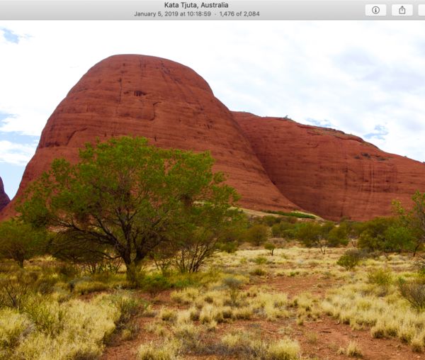
I import my GPS photos into Apple "Photos" library. On top of the image it will give you the location.
(Image is only a screen shot).
(Image is only a screen shot).
Apr 19, 2019 13:21:06 #
Apr 19, 2019 14:48:25 #
you can plug the numbers into either Google Maps or Google Earth and it will take you to the exact location.
Apr 19, 2019 15:04:16 #
hassighedgehog wrote:
Haven't tried it, but found this on line https://www.latlong.net to convert from Geo code to address. There are others.
Great link! I entered my street address, city, state, zip and country and got a Lat/Long as well as a road map image location and a satellite image location map!
Thanks for sharing this treasure!
Apr 19, 2019 15:15:26 #
Apr 19, 2019 19:20:08 #
I have used a free program called Geosetter for years that will match gpx files to photos by time tags and also will do a location lookup and write it into the metatdata.
If you want to reply, then register here. Registration is free and your account is created instantly, so you can post right away.


