France's Wild West - 13: Normandy: Mont-Saint-Michel
Apr 1, 2019 16:00:31 #

We have now moved from "Wild" Brittany to the more gentle NORMANDY, though it definitely had its violent moments in history: settled by the Celts about 2400 years ago, invaded by the Romans under Julius Caesar, raided by the Saxons in the 3rd century and by the Vikings in the 9th century. The name Normandy reflects the Viking (i.e. "Norseman") origins. Today Normandy is predominantly agricultural in character, famous for horse and cattle breeding, its products include world-famous cheeses (i.e. Camembert) and apples, which form the basis for its well-known ciders and calvados, an apple brandy. In recent history, Normandy was the scene of the landing of the allied forces towards the end of WWII.
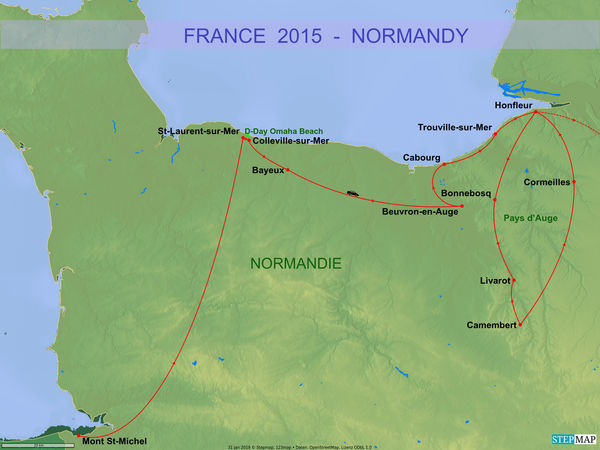
I include a map which shows our drive through Normandy and the places we visited and will present over the coming days.
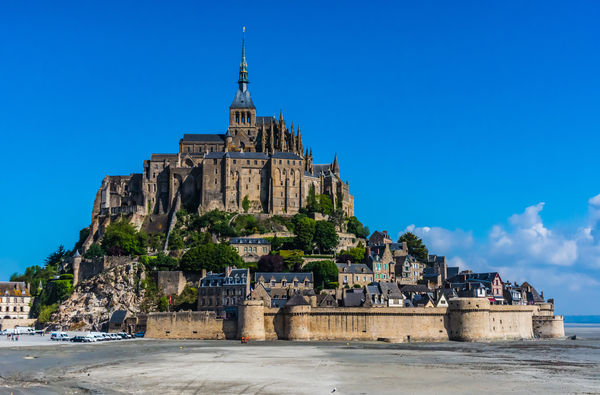
MONT-SAINT-MICHEL is one of France's most recognizable landmarks, visited by more than 3 million people each year. It is on the UNESCO list of World Heritage Sites. Its strategic island location, occupied since the 5th century, has been recognized for centuries, it served as an abbey but also as prison. It used to be closed off to land traffic during high tides, but a relatively new higher causeway now guarantees dry access at all times.
.
I include a map which shows our drive through Normandy and the places we visited and will present over the coming days.
MONT-SAINT-MICHEL is one of France's most recognizable landmarks, visited by more than 3 million people each year. It is on the UNESCO list of World Heritage Sites. Its strategic island location, occupied since the 5th century, has been recognized for centuries, it served as an abbey but also as prison. It used to be closed off to land traffic during high tides, but a relatively new higher causeway now guarantees dry access at all times.
.
1 - Map of the Normandy segment of our Drive
(Download)
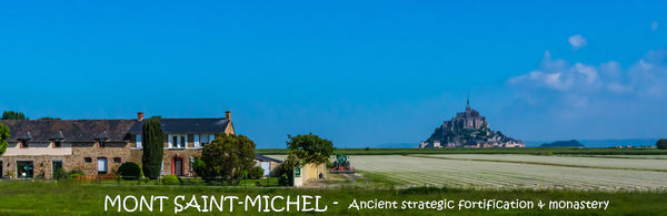
2 - Rural setting with a farm house in front and the Mount at rear
(Download)
3 - View from the causeway with the abbey on top and the village to the right
(Download)
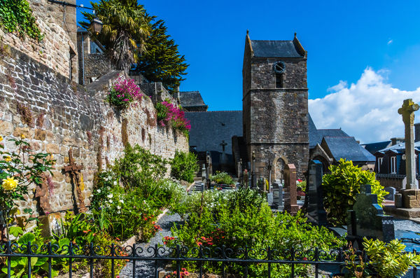
4 - St-Peter's church and cemetery
(Download)
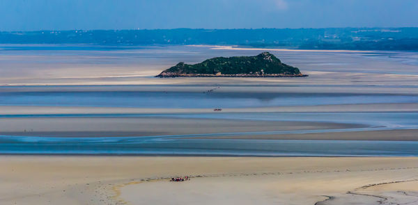
5 - View from the abbey: in the center of the bay the uninhabited Tombelaine Island, which can be reached on foot during low tide - see 3 groups traversing on this picture
(Download)
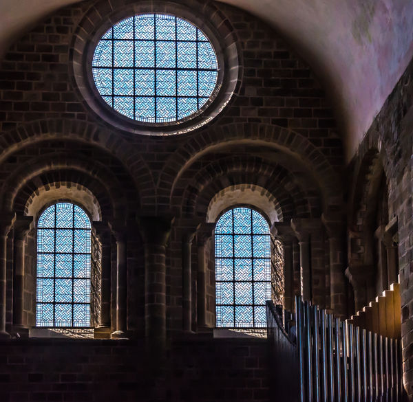
6 - The Abbey: Windows and organ pipes
(Download)
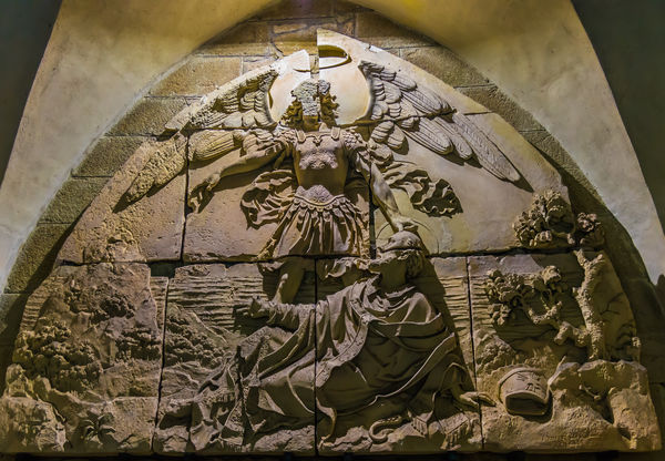
7 - The Abbey: sculpture depicting Michael the Archangel appearing to St. Aubert in 708 and telling him to build a chapel at the Mont
(Download)
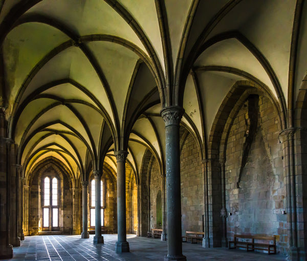
8 - One of the many rooms in the Abbey
(Download)
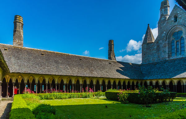
9 - A quiet court yard in the abbey
(Download)
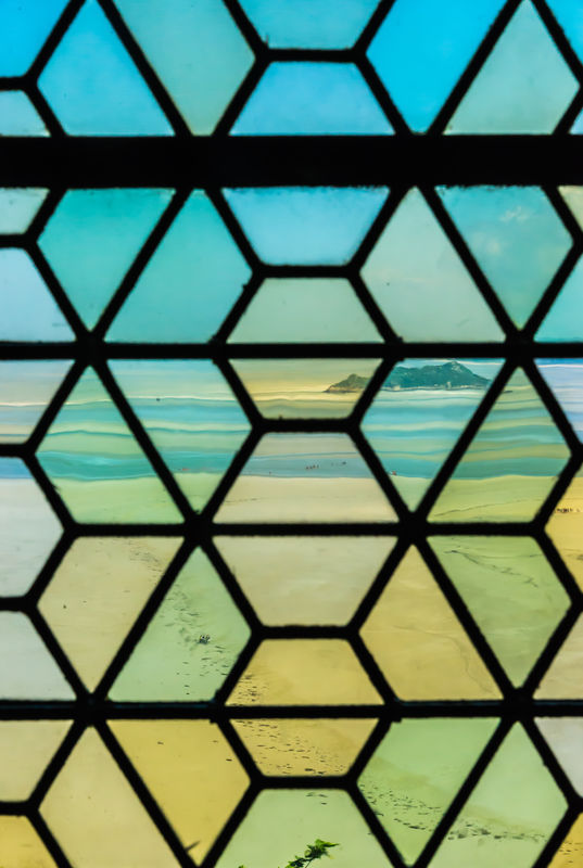
10 - Gently distorted view from the multi-hued abbey window over the sand flats to Tombelaine Island
(Download)
Apr 1, 2019 16:07:07 #

Apr 1, 2019 16:07:22 #

Super set.
Beautiful countryside, and thanks very much for taking us there.
Beautiful countryside, and thanks very much for taking us there.
Apr 1, 2019 16:11:13 #

What a fascinating place. In number 8, it looks like there used to be a bas relief sculpture on the wall over the bench on the right.
Apr 1, 2019 16:14:26 #
Apr 1, 2019 16:15:20 #
RichardTaylor wrote:
Super set.
Beautiful countryside, and thanks very much for taking us there.
Beautiful countryside, and thanks very much for taking us there.
Thank you Richard for commenting and I am very happy that you are still with me on this trip!
Apr 1, 2019 16:20:07 #
Apr 1, 2019 16:20:41 #
NMGal wrote:
What a fascinating place. In number 8, it looks like there used to be a bas relief sculpture on the wall over the bench on the right.
Hi NMGal - this place has had a place on my to-do-list for decades, ever since I saw a first picture of it - it took many decades, but I finally made it there. That spot on number 8 had me wondering also when I was processing the pictures: it looks like there is a flue like from a chimney on top, that space is definitely different from the two adjoining spaces. I didn't notice it when I took the shot, so now can only wonder.
Thanks for staying with me on this series.
Apr 1, 2019 16:21:43 #
Apr 1, 2019 21:34:34 #

Apr 1, 2019 21:38:14 #
UTMike wrote:
Very nice set!
Thank you UTMike - it really is a very historic place.
Apr 2, 2019 06:01:22 #

We were there about seven years ago. An amazing and interesting place. Nice photos. Thanks for sharing.
Apr 2, 2019 06:28:14 #

Apr 2, 2019 07:48:38 #
Apr 2, 2019 08:10:21 #
JimBart
Loc: Western Michigan
Brings back a lot of memories. I am surprised you didn’t encounter a lot of people.
Great shots and a great set
Great shots and a great set
If you want to reply, then register here. Registration is free and your account is created instantly, so you can post right away.