Philadelphia Grays Ferry Part 2 Swing Bridge Demolition
Jul 15, 2018 09:28:54 #
Hamltnblue
Loc: Springfield PA
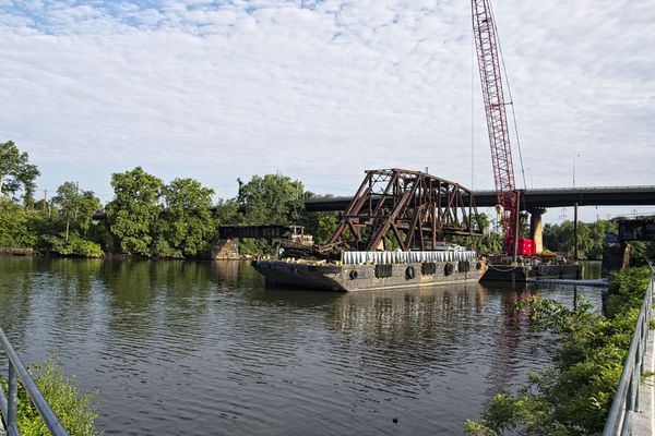
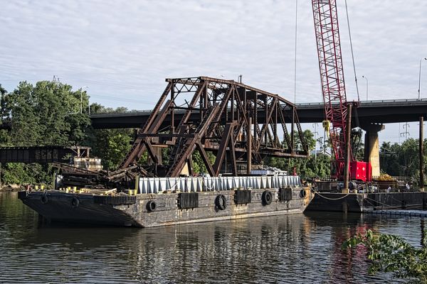
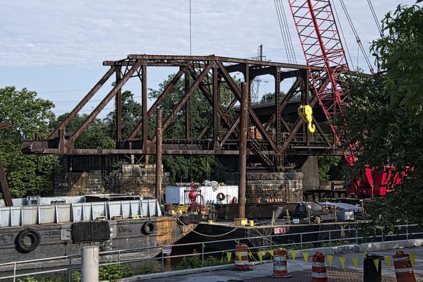
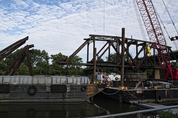
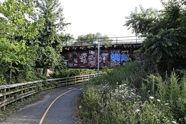
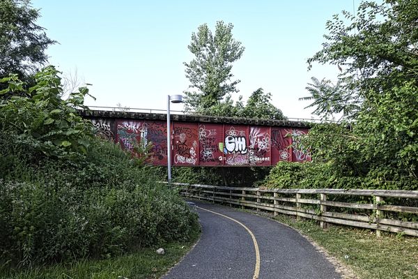
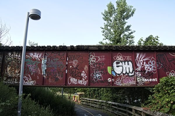
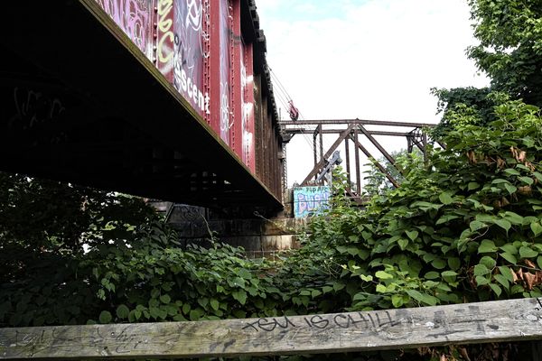
After leaving the CSX terminal I moved about a half mile up the road to the old swing bridge over the Schuylkill River.
This bridge has been abandoned for some time and is now being demolished ahead of another project. The following are the pics I took this weekend.
I included several angles including the graffiti, since this is the last chance to capture it before it is gone. Click on the download of each for a better look.
If you're in the philly area and want to visit it, the address to get there is 3699 Wharton St, Phila. That will bring you to the Schuylkill banks walking trail. The bridge is a short walk away.
Also here is a short story on the construction project.
Enjoy
http://www.phillyrecord.com/2018/05/construction-to-begin-on-schuylkill-river-swing-bridge/
Jul 15, 2018 09:31:57 #
Jul 16, 2018 07:47:06 #

Interesting in that it appears to be a disassembly instead of the more dramatic BOOM.
Jul 16, 2018 08:18:49 #

Jul 16, 2018 08:19:25 #
Jul 16, 2018 12:27:54 #
Hamltnblue
Loc: Springfield PA
TJBNovember wrote:
Interesting in that it appears to be a disassembly instead of the more dramatic BOOM.
If you look at the attached story they have an artist rendition of what it will look like.
It appears that the footings will be re-used, as well as the existing bridge approach structure.
Jim
Jul 16, 2018 14:41:09 #
Hamltnblue wrote:
If you look at the attached story they have an artist rendition of what it will look like.
It appears that the footings will be re-used, as well as the existing bridge approach structure.
Jim
It appears that the footings will be re-used, as well as the existing bridge approach structure.
Jim
Thanks for sharing Jim, I did read the story. What I found exceptionally interesting was that what appears to be an unused or underused rail line is finding new use. Would you happen to know how much rail traffic that bridge had seen in recent times?
Jul 16, 2018 16:59:54 #
Hamltnblue
Loc: Springfield PA
From another article " Completed in 1902, the Philadelphia, Wilmington, and Baltimore Railroad Bridge No. 1 was constructed by the American Bridge Company out of Coraopolis, Pennsylvania. The Railroad Revitalization and Regulatory Reform Act of 1976 allowed for the sale of the bridge to the Consolidated Rail Corporation, aka Conrail, which used the bridge sporadically until 1984"
Here is a link to the google maps view of the bridge and area. Just cut and paste the line into your browser address bar.
https://www.google.com/maps/@39.9410597,-75.2051926,3a,60y,220.24h,90t/data=!3m6!1e1!3m4!1sJljJKxdu2UiPEn3FvXNBiw!2e0!7i13312!8i6656?hl=en
You'll see that there is significant track coverage on both sides of the river. This ole bridge simply didn't fit in with the plan.
Jul 16, 2018 17:03:45 #
Hamltnblue
Loc: Springfield PA
Library of Congress site on it.
https://www.loc.gov/resource/hhh.pa3757.photos?st=gallery
Wiki on the bridge: Some good history.
https://en.wikipedia.org/wiki/Philadelphia,_Wilmington_and_Baltimore_Railroad_Bridge_No._1
https://www.loc.gov/resource/hhh.pa3757.photos?st=gallery
Wiki on the bridge: Some good history.
https://en.wikipedia.org/wiki/Philadelphia,_Wilmington_and_Baltimore_Railroad_Bridge_No._1
Jul 19, 2018 14:54:27 #


Aug 1, 2018 15:46:35 #
Hamltnblue
Loc: Springfield PA
After doing some reading I found that the Newkirk Monument is on the other side of the river, behind the trees.
I'll have to put a visit on my todo list
http://newkirkmonument.org/
I'll have to put a visit on my todo list
http://newkirkmonument.org/
If you want to reply, then register here. Registration is free and your account is created instantly, so you can post right away.