Entering The Locks at Sault Ste. Marie.......(3)
Oct 21, 2015 01:12:07 #

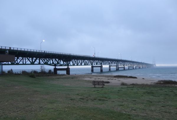
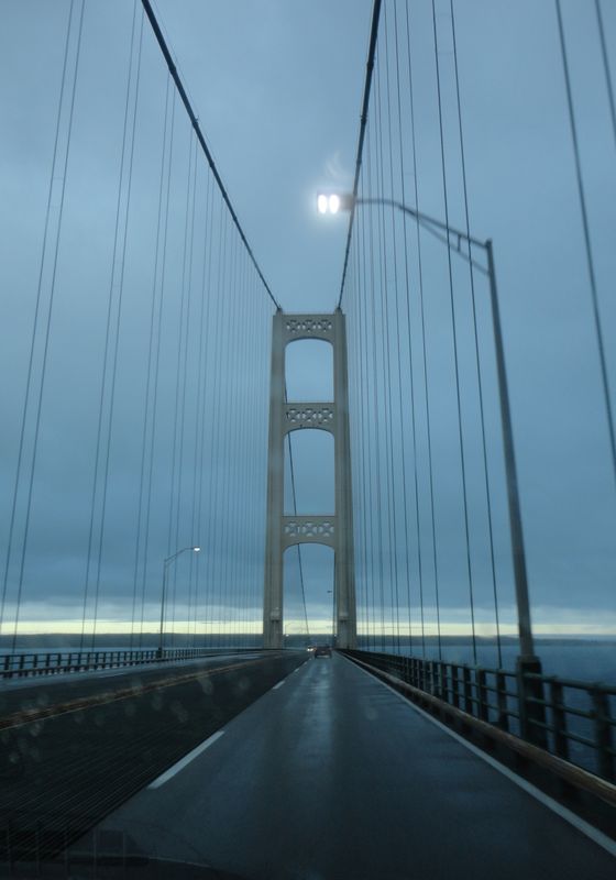
Day 4 of our road trip started with us crossing the Mackinac Bridge out of Mackinaw City as we headed for Sault Ste. Marie (pronounced Soo Saint Marie) where we visited both the US side in Michigan & the Canadian side in Ontario. Through these pictures my intention is to transport you around this important, interesting, industrial harbor area as we tour The Soo Locks. In order to complete the story this will be about 20 photos. But you can zip through as fast as you please. I realize some of you will have done this trip while others may never have the opportunity. I really enjoyed what we saw!!
Mackinac Bridge where the early morning clouds hung low! 1
(Download)
2
(Download)
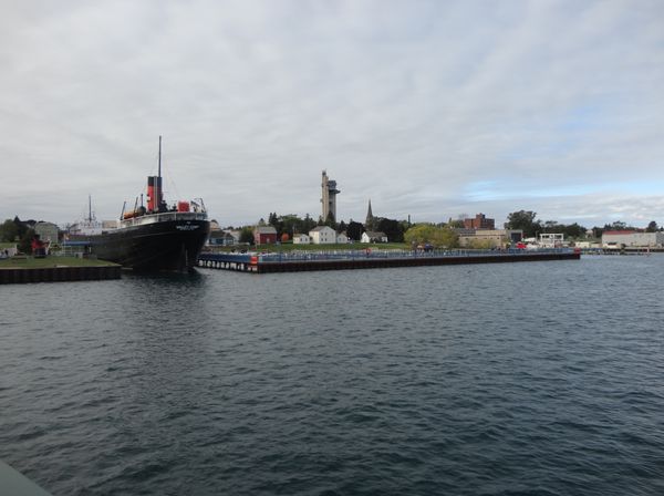
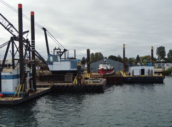
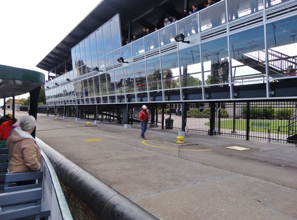
Our Soo Lock boat tour took us around the harbor area as we waited for clearance to enter the locks on the U.S. side.
(Download)
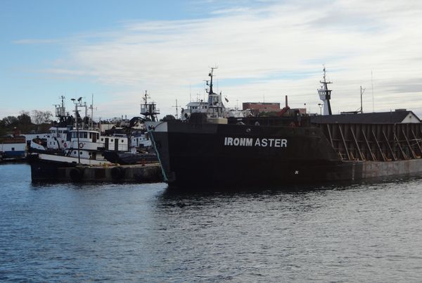
Being industrial....this shows what one sees as you go around the harbor! 4
(Download)
5
(Download)
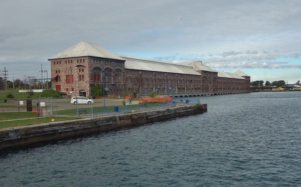
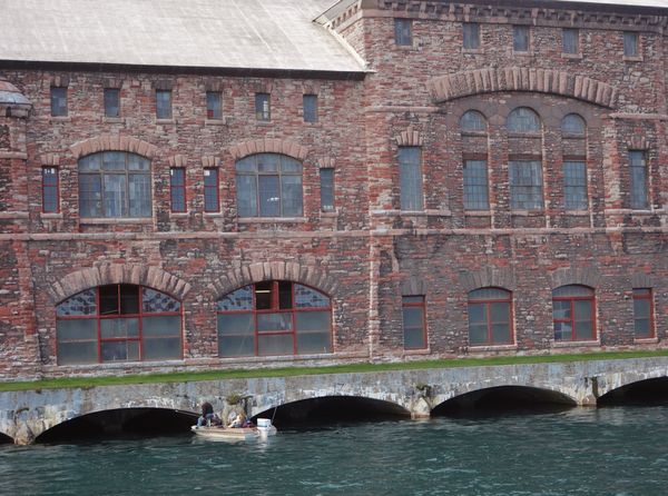
This is the Edison Sault Electric Co. What a striking building! It was completed in 1902. It's one quarter mile long & is the longest hydroelectric plant in the world. The power canal that feeds the plant water from Lake Superior is more than 2 miles long, cutting right thru Sault Ste. Marie, MI. making the downtown area of the city an island. 6
(Download)
7
(Download)
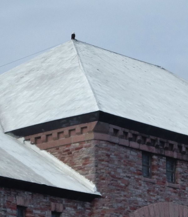
I should probably skip this one.....but with a zoom you can see a Bald Eagle on the top of the roof line. 8
(Download)
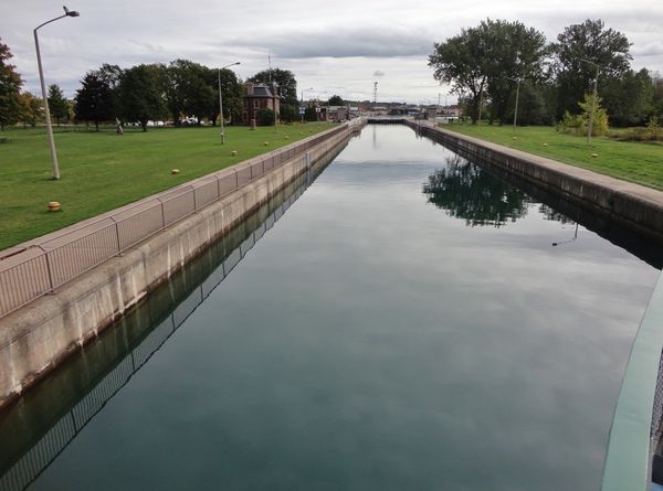
OK....the captain told us that it's our turn to enter the Lock System. We will use the left side which is in the U.S. & will return using a much smaller Canadian lock. 9
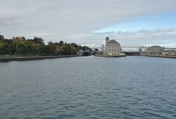
(Download)
The locks allow for safe passage past the St Marys Rapids for deep-draft ships that carry iron ore, coal, grain, stone, road salt, petroleum & manufactured goods between the U.S. & Canada. 10
(Download)
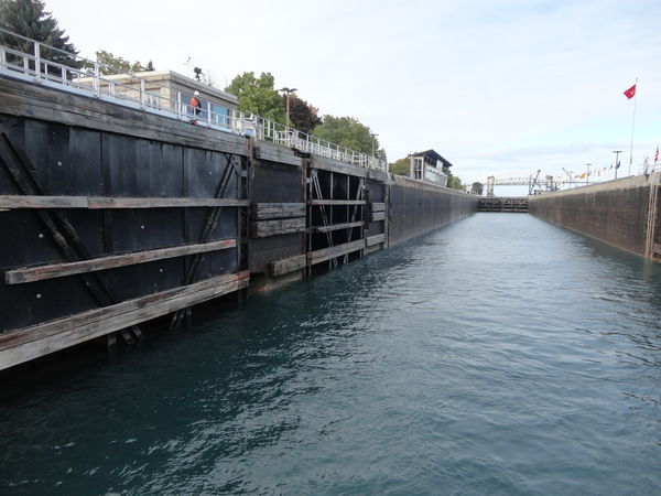
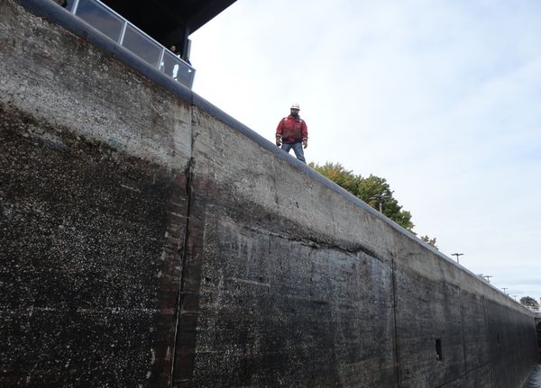
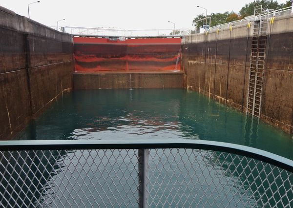
The Soo Locks overcomes a 21 foot natural difference in water level between Lake Superior & Lake Huron. The St Marys River connects the two lakes. They are about to tossa rope to this guy so we can be somewhat secure against the wall. As the water rises, some 10 million gallons, they tighten the rope. 11
(Download)
We are now facing the Lake Superior side. When the water level rises the 21 feet.....those gates will open. 12
(Download)
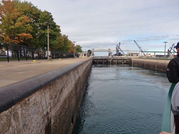
Still rising, but almost there! That building is an observation place for folks to gather & watch the various ships that come through the locks. 13
(Download)
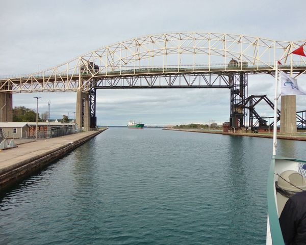
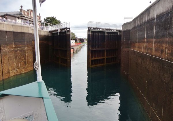
Gates are now open so we're headed for the Lake Superior side. We're going under The International Bridge which connects the U.S. & Canada at Sault Ste. Marie. It's jointly owned by the State of Michigan & the Providence of Ontario. 14
(Download)
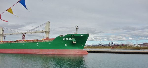
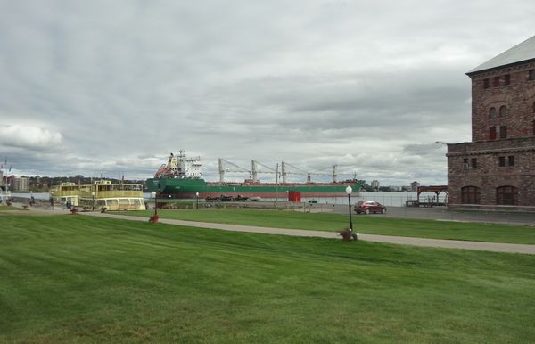
It's now this cargo ships turn to enter the locks as they leave Lake Superior & head over to Lake Huron. It's a Russian ship from Monrovia. 15
(Download)
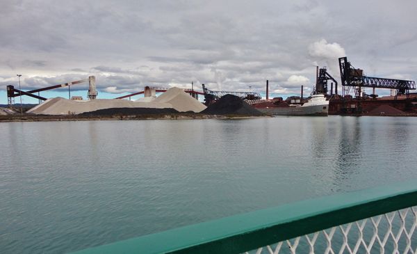
A ship being loaded on the Canadian side before we return via the Canadian lock . 16
(Download)
17
(Download)
Back of boat as water levels drop. 18
(Download)
gate opening to Lake Huron 19
(Download)
Meanwhile back on the US side.....Oh Look!! The Russians are coming......the Russians are coming!!! 20
(Download)
Oct 21, 2015 06:18:58 #
Wonderful set. We spent some time there but didn't take the Tour you just did for us. I remember the power plant + the tall tower building in the background of one of your photos. Thanks for the post. djt
Oct 21, 2015 15:48:35 #
djtravels wrote:
Wonderful set. We spent some time there but didn't take the Tour you just did for us. I remember the power plant + the tall tower building in the background of one of your photos. Thanks for the post. djt
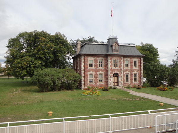
Thanks djt....for responding to the Sault Ste. Marie post. The tall tower in the 3rd photo in the background is called The Tower of History. It's a 210 foot structure erected in 1968 as a monument to the missionaries who 1st settled the area. ( By the way....all the facts given have been taken from "The Soo Locks Vistor's Guide" that we purchased from the gift shop.)
Glad to hear from someone who has been there & at least seen the area. Funny thing happened. While there & on the US side....we wanted to mail our daughter a birthday card with enclosed $ gift so we made a point of finding a local post office. We mailed it on the morning of 10/6 (Tues) figuring it would arrive by her BD 10/9 (Fri). She called us late last night to say it just arrived on 10/20......two weeks from date of mail! Guess we were really O U T there!!! :D Thanks again! Bob :roll:
Oct 22, 2015 07:13:13 #
Add
Loc: S.W.Florida
I hope you noticed the much more attractive lock tenders on the Canadian side !
Oct 22, 2015 10:40:51 #
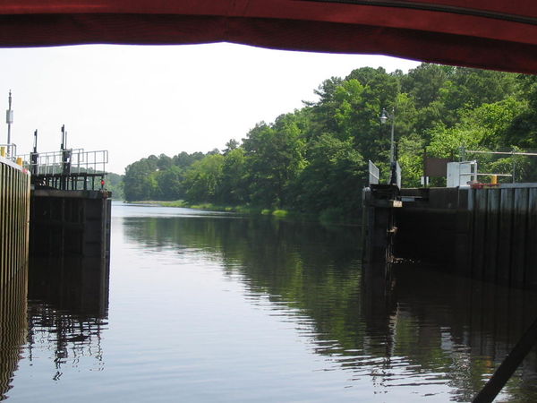
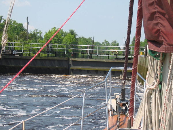
If you really want to get the feel of just how the locks work, you should take a small boat down the Dismal Swamp Canal (VA & NC). It's a day's trip unless you opt to raft overnight at the NC Dismal Canal Welcome Center, and you get the opportunity to go through two different locks. Rise and fall of each one is about 12 feet. If you proceed at about 5.0 MPH from the northern morning opening@ about 9:30, you can make the southern afternoon opening at about 3:30PM. Speed higher than about 5 Kn are not allowed because of the damage to the banks by wake.
According to the rules of transit, the farmer's bridge has the right of way; if he is deploying it, boats wait until he gets his cattle and/or equipment across and retracts the bridge. We did not encounter it extended; too bad, it would have made a great picture opportunity!
In the fourth picture you can see a turn in the canal; that is not typical of the route, it is mostly as straight as an arrow. I don't know the reason for the turn, but assume there was some natural obstacle that they opted to circumvent.
The canal doesn't quite go through the middle of nowhere, but you can sense it in the wilderness mostly along the western shore.
The original canal was surveyed by George Washington and that survey is mostly where the canal still is today. You can see in the last shot of the GPS that the precision wasn't perfect, but not bad considering it was done in the mid 1700's and Route 17 that you can see to the left in the GPS shot was not there. The survey crew mostly cut their way through the swamp; it was wilderness then.
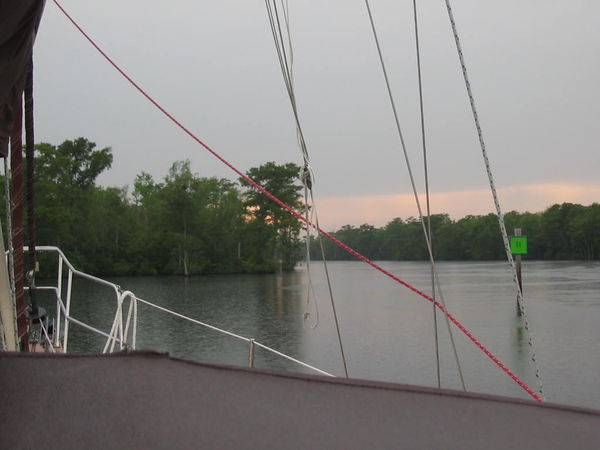
The Northern Lock from in the lock
(Download)
Gates closed, flooding the lock
(Download)
A farmer's private floating bridge
(Download)
Typical view along the canal
(Download)
Oct 22, 2015 11:35:36 #
canarywood1
Loc: Sarasota,Florida
Bob I 41 wrote:
Day 4 of our road trip started with us crossing th... (show quote)
Thanks for the very nice pic's, been through the Soo many times as a crew member on various ore carriers many years ago,brought back a lot of memories.
Oct 22, 2015 20:13:09 #
Bob I 41 wrote:
Day 4 of our road trip started with us crossing th... (show quote)
Great set, thanks for the complete explanations.
Oct 23, 2015 01:18:36 #
Add wrote:
I hope you noticed the much more attractive lock tenders on the Canadian side !
We certainly did!! I held back putting more pictures out there that might show some of that attractiveness. So will add some to your comment. Thanks for looking Add. Much appreciated. Bob :D
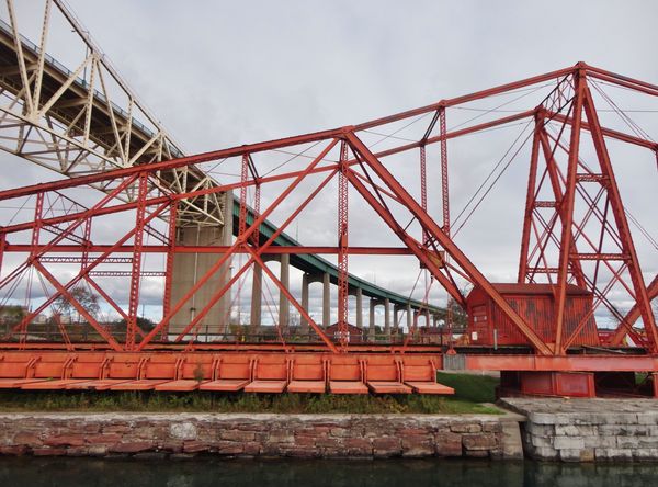
(Download)
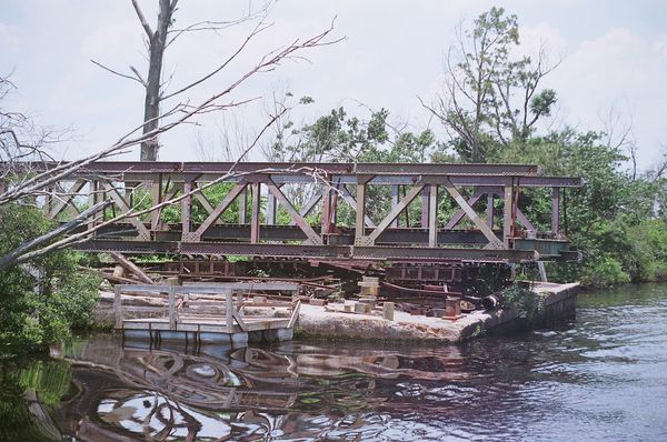
The railroad swing bridge which was built in 1899 serves as the oldest rail bridge crossing the St Marys River.
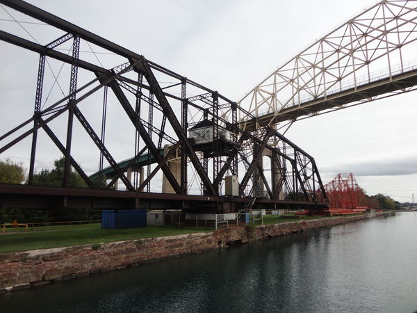
(Download)
Next to it is this emergency swing bridge dam which is used to stop the flow of water through the canal. Only 9 of these dams were constructed worldwide. This is the only one left & the only one ever used in an emergency. That accident occured on July 9th, 1909 when the lower gates broke away while the gates on the Lake Superior end, with the full pressure of the lake behind them were still open. The resulting torrent of water caused the ships involved to blast through the locks almost as if shot from a cannon.
(Download)
Oct 23, 2015 01:24:00 #
canarywood1 wrote:
Thanks for the very nice pic's, been through the Soo many times as a crew member on various ore carriers many years ago,brought back a lot of memories.
Thanks canarywood1......for finding the Soo pictures enjoyable. Happy to have brought back fond memories of some of your past life aboard some of those ore carriers. How interesting! Thanks for the wonderful comment! Bob :D :thumbup:
Oct 23, 2015 01:31:12 #
JCam wrote:
If you really want to get the feel of just how the... (show quote)
Thanks JCam for adding some additional information about life going thru some locks. The wilderness of what you have described sounds interesting. We were very satisfied with our experience at Sault Ste. Marie. What I'm really looking forward to someone of these days is the BIG ONE!. Would love to go thru The Panama Canal. That needs about 21 days aboard a cruise ship. Much appreciated, Bob
:)
Oct 23, 2015 09:27:22 #
Bob I 41 wrote:
Thanks JCam for adding some additional information about life going thru some locks. The wilderness of what you have described sounds interesting. We were very satisfied with our experience at Sault Ste. Marie. What I'm really looking forward to someone of these days is the BIG ONE!. Would love to go thru The Panama Canal. That needs about 21 days aboard a cruise ship. Much appreciated, Bob
:)
:)
Bob, We "did" the Panama Canal cruise a couple of years back, but the one we took only went through the lock on the Caribbean side, which surprisingly is further West than the Pacific lock. Hard to believe but true, look at a map. It was a gfreat cruise and we had perfect weather which, even for a sailor, helps!
We had a combined, 11 days I think, cruise on Holland America, and also hit some southern Carribbean ports, Aruba--so the ladies could refresh their jewelry boxes :-) , Bonaire & Curacao--then on to the Canal through the lock. The lock passage alone was worth the trip. We were on the Zuiderdam and she fit through the lock with less than a foot to spare on each side! We could also see the construction on the new canal; it's only about 1/4 mile south.
Jim
Oct 23, 2015 11:09:11 #
JCam wrote:
Bob, We "did" the Panama Canal cruise a... (show quote)
Thanks Jim for your information on the Panama Canal. If we do it we would like to do the Ft Lauderdale thru the canal to San Diego or San Francisco or reverse which explains the reason for 21 days. Guess we just want a longer cruise for a change rather than a 10 to 12 day one. Of course.....it makes it tougher to fit into our schedule since I have chosen to continue working! We have some very close friends who have done it a couple of times & on their last trip she accidently dropped her camera overboard! So several folks on board made sure they received copies from their collection of pictures. It does sound like an interesting adventure. Thanks for the input. Bob
:D
Oct 23, 2015 11:25:08 #

Very nice set! I've been in the viewing area a few times, but have never taken the actual boat tour of it. Hmmmm, might have to put that on my schedule for next summer. It IS quite interesting, there and the whole area.
Oct 23, 2015 11:26:28 #

Oct 23, 2015 23:02:36 #
wtompkins wrote:
Very nice set! I've been in the viewing area a few times, but have never taken the actual boat tour of it. Hmmmm, might have to put that on my schedule for next summer. It IS quite interesting, there and the whole area.
Judging by where you're located......I would highly recommend taking the boat tour. Next summer would be ideal......certainly not now! Thanks wtompkins for stopping by to check out the photos & your nice comment. Much appreciated.....Bob :)
If you want to reply, then register here. Registration is free and your account is created instantly, so you can post right away.