Abandoned railroad, ghost town and relics
Dec 2, 2021 16:29:07 #
In the 1870's a railroad was built over a high Continental Divide pass (11,990 feet elevation) in the Rockies to connect Denver with points west. In the 1920's a RR tunnel was completed through the mountains below the pass---making the RR above the pass obsolete.
The RR road bed then became a wagon and auto road over the pass until the 1980's when a RR tunnel on the east side collapsed, closing the route. The road up the west side of the pass is still somewhat open in the summer and early fall and leads to the remains of the RR facilities at the top of the pass.
There was a small outpost there, including a hotel, lunch room, restaurant, post office, store, bunk houses and quite a bit of RR equipment and repair facilities. Most of this stuff was under a series of snow sheds, as was much of the RR itself, due to the heavy snows and strong winds. Excursion trains ran up there for people to take mini-vacations as well as the through lines. I'll include a pic of a sign explaining the pass's history.
I was up there several weeks ago but the weather was pretty cloudy and snowy so the pics aren't nearly as colorful nor dramatic as they could be on a sunny day. We were looking for the debris of a train wreck that destroyed a locomotive and several cars and is down in a side canyon. Weather and darkness prevented us from going down to it (we think we know where it is) but after about 110 years it is questionable what wed find. We'll go back to find it next summer or fall.
There is a lot summit debris in the pix but you may have to download to see it.
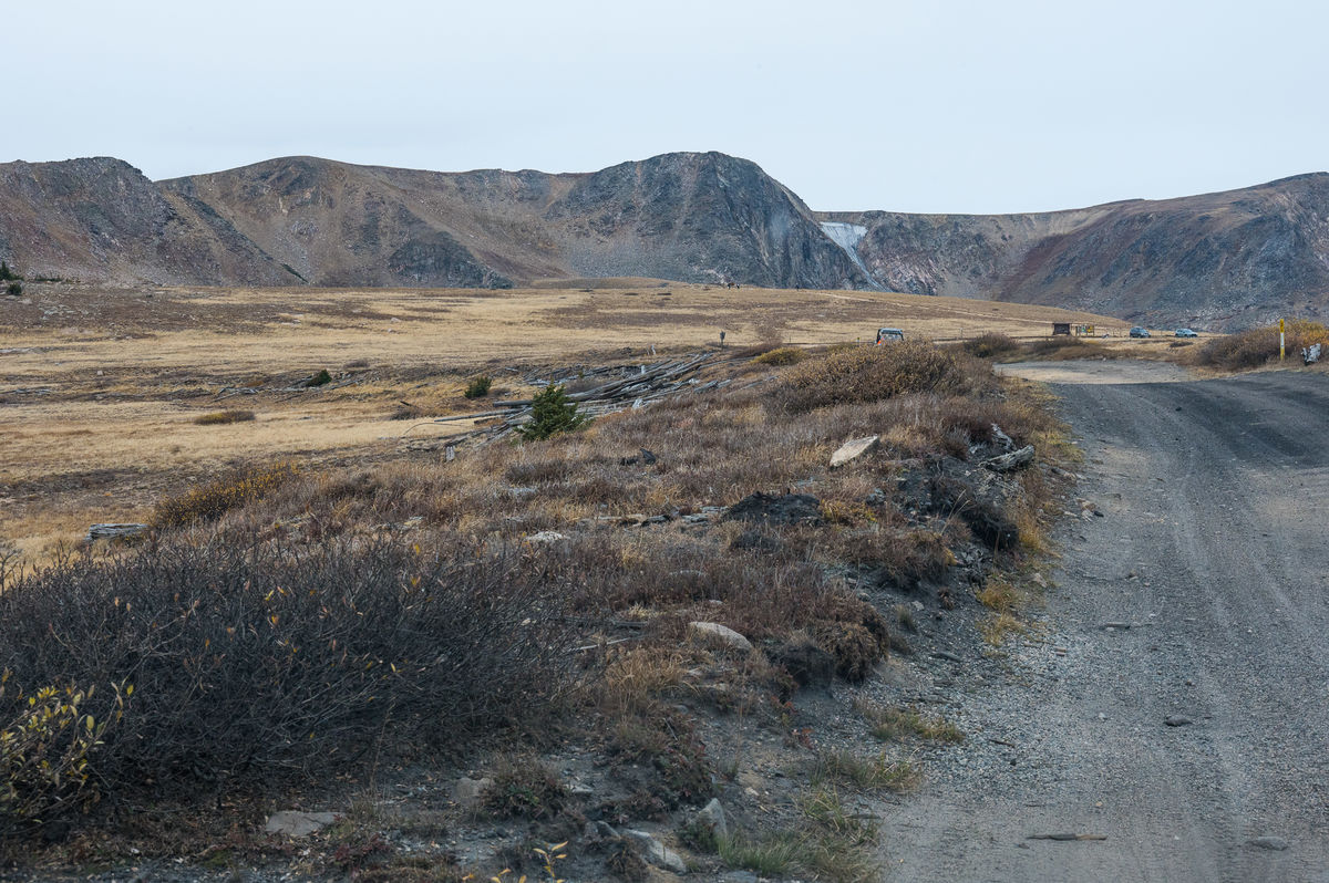
View to west from road
(Download)
Blown down trees from isolated microburst last winter
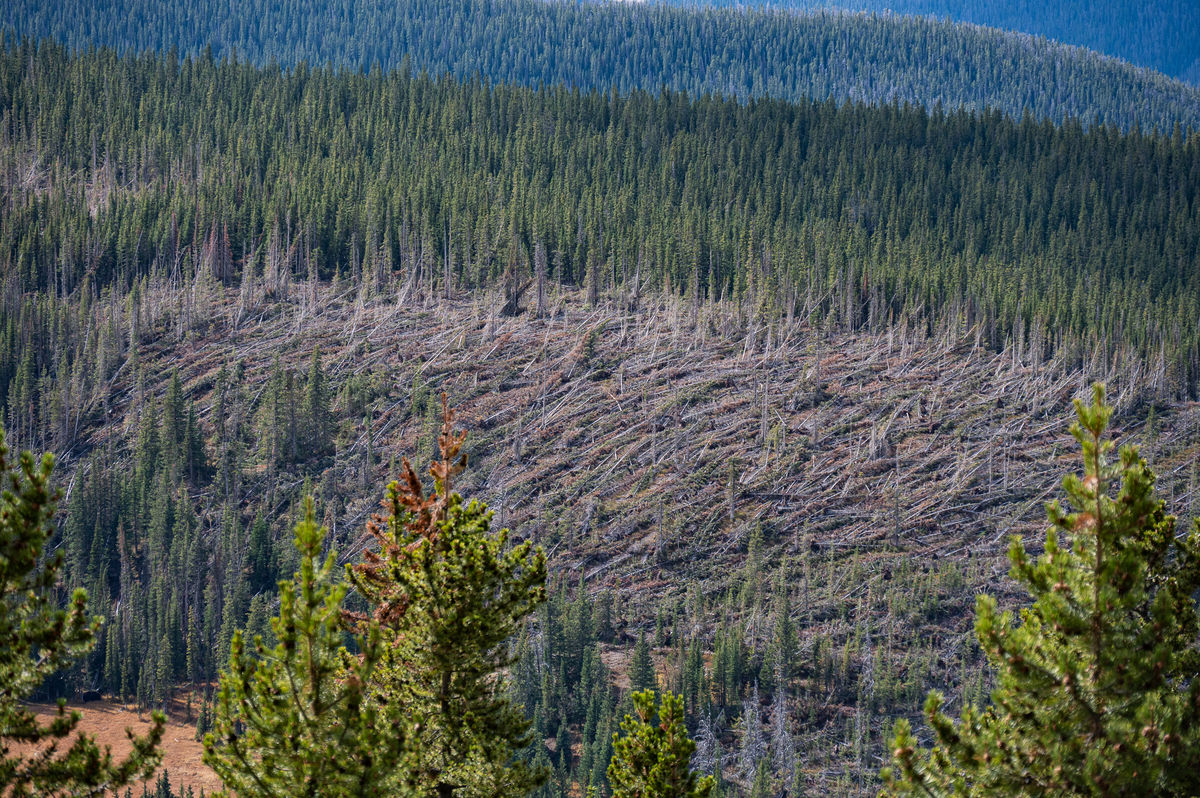
(Download)
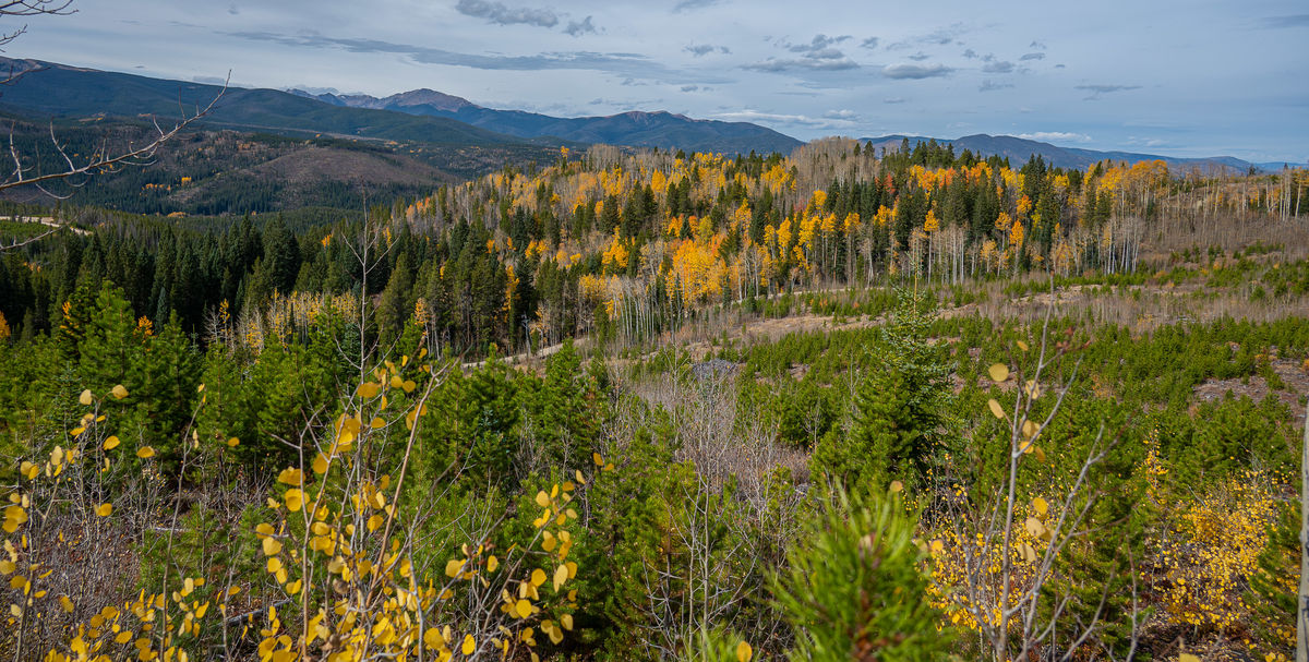
Looking west at Winter Park ski area
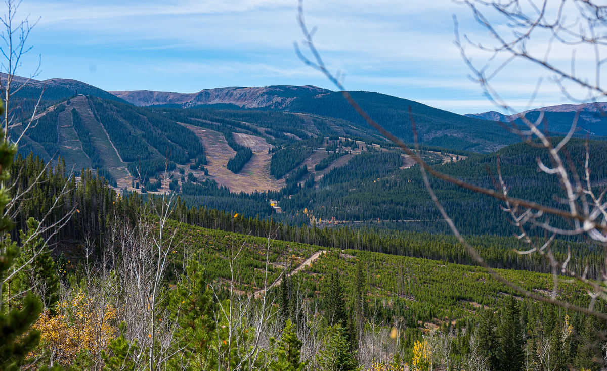
(Download)
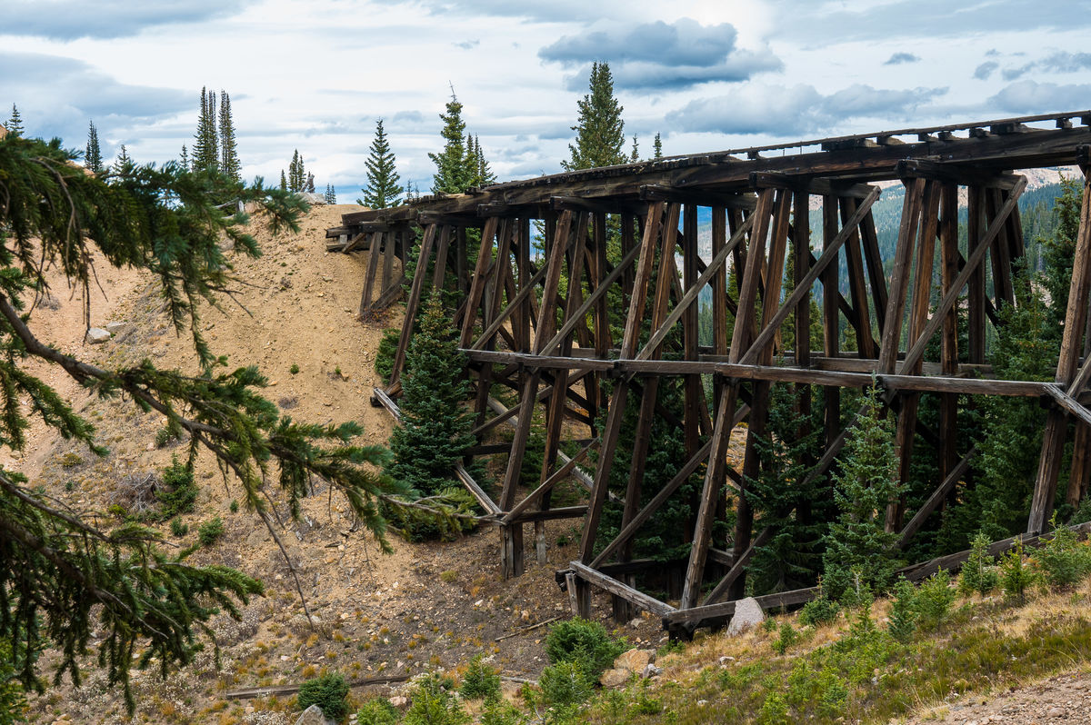
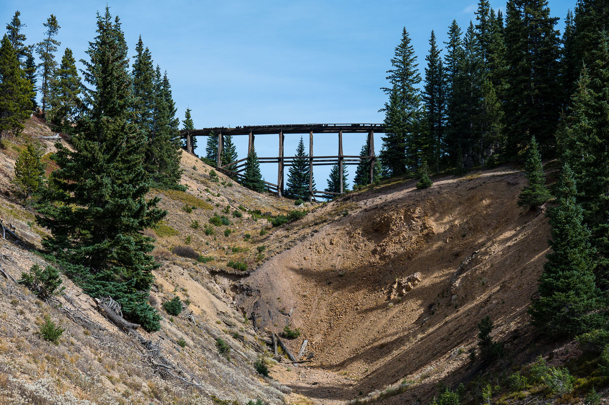
Railroad trestle above tunnel
(Download)
Filled in tunnel below trestle. Trains would cross trestle and make a long turn around ridge to lose elevation and pass thru tunnel to continue the descent
(Download)
debris and coal dust at top
(Download)
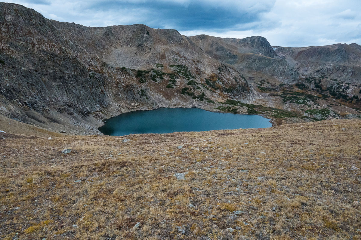
Lake below Continental Divide near top of pass
(Download)
Dec 2, 2021 16:34:37 #
Dec 2, 2021 17:16:30 #
mr spock wrote:
Nice set of images fantom.
Thanks for the historical perspective
Thanks for the historical perspective
Thanks for the comment. Based on your avatar picture you must like old things. You would love this area.
Check out Black and White Photography section of our forum.
Dec 2, 2021 17:33:29 #

Is that gold camp road? My brother used to talk about it but we didn’t make it up there.
Dec 2, 2021 20:04:17 #
Shellback wrote:
Is that gold camp road? My brother used to talk about it but we didn’t make it up there.
No, Gold Camp Road is southwest of Colorado Springs and this road is further north, about due west of Denver. I'm glad you mentioned Gold Camp though, I've been meaning to drive it for about the last 40 or 50 years and never got around to it. Thanks for reminding me. I might try it next week.
Dec 2, 2021 21:24:02 #
Hope the weather is good for you…
Bring back some good pictures 👍
Bring back some good pictures 👍
Dec 3, 2021 05:24:30 #
Check out Wedding Photography section of our forum.
Dec 3, 2021 06:31:55 #
Dec 3, 2021 07:03:39 #
fantom wrote:
In the 1870's a railroad was built over a high Con... (show quote)
Beautiful pictures of a beautiful area. We were up there several years ago and hiked to Devil's Thumb. The road was extremely rough, which I am sure it still is.
Thanks for the images and the history. We will have to go back next summer.
Dec 3, 2021 09:53:57 #
2buckskin
Loc: Wyoming
fantom wrote:
In the 1870's a railroad was built over a high Con... (show quote)
Really nice shots from the Winter Park side, thanks for posting. I have been up the east side before, up to the collapsed tunnel. I worked for the RR, and marveled at the engineering that went into constructing a RR in this mountain terrain. Coming back down the old grade, I wondered how many trainmen lost their lives in setting the brakes to slow the decent. Back then they had to walk the top of the cars and set those handbrakes, imagine doing that in the middle of the night!
Dec 3, 2021 12:45:22 #
Check out The Dynamics of Photographic Lighting section of our forum.
Dec 3, 2021 14:39:37 #

Dec 4, 2021 13:38:45 #

Dec 4, 2021 15:29:41 #
JayemCO wrote:
Beautiful pictures of a beautiful area. We were up there several years ago and hiked to Devil's Thumb. The road was extremely rough, which I am sure it still is.
Thanks for the images and the history. We will have to go back next summer.
Thanks for the images and the history. We will have to go back next summer.
Hiked to Devil's Thumb!!!, WOW, that's quite a hike, very long with a lot of elevation gain. I've never done that route, but decades ago we hiked to the top of the Continental Divide from the top of the pass and then hiked north along the Divide until we could drop down to Devil's Thumb Lake. We camped there and then hiked out to a trail head the next day. That was the only time I have ever had a touch of hypothermia. Got caught in a big, windy, storm on top of the Divide and were soaked badly by the time we go down to the lake. Storms above tree line are scary, cold and wet.
Coincidently, yesterday, I was going to hike to one of the closer lakes off the Devil's Thumb trail but the trip got interrupted at the last minute and couldn't make it. Some fabulously beautiful country up there.
The road is still very bad on the east side. A car can make it but it is very, very washboarded. It took me over an hour in my 4X4 to get to Yankee Doodle/Jenny Lake area earlier this year. Once a year is too much on that road.
Thanks for your comments and good luck on your next excursion.
Dec 4, 2021 15:40:16 #
2buckskin wrote:
Really nice shots from the Winter Park side, thanks for posting. I have been up the east side before, up to the collapsed tunnel. I worked for the RR, and marveled at the engineering that went into constructing a RR in this mountain terrain. Coming back down the old grade, I wondered how many trainmen lost their lives in setting the brakes to slow the decent. Back then they had to walk the top of the cars and set those handbrakes, imagine doing that in the middle of the night!
Setting the brakes in the middle of the night in a raging storm seems like a suicide waiting to happen. The snow sheds at the top were very dangerous also. They were very large and contained several sets of tracks and would fill with smoke and gasses and people couldn't see nor breathe.
There is a book called, I think, "Rails that Climb" by a guy named Bollinger. He describes that stretch of RR and the conditions very well. I saw it years ago. It might be out of print now, but might be on the internet. Its hard to imagine how dangerous it was. Every time we go up there someone comments on how tough the builders and operators had to be.
Glad you appreciated my pix and story.
If you want to reply, then register here. Registration is free and your account is created instantly, so you can post right away.
Check out Black and White Photography section of our forum.