Coronado Trail
Aug 18, 2020 10:54:22 #

Trying to find some information on this length of U.S. Route 191 in southeastern Arizona. I have found that it covers about 120 miles and consists of many switch-backs with lots of elevation changes. Was told to allow from 4 to 6 hours driving time. Sounds like an incredible photo-op if the topographical conditions will allow it. Do any Hoggers have any experience with this area? One critique by a motorcyclist indicates a rather wild ride. I find the lure of the drive intriguing but am wondering if I will be able to exit the roadway to set up and shoot. Anyone from the HOG ever been there? How wild is this drive?
Aug 18, 2020 11:03:35 #

I've driven it, but it was years ago. As I recall, there is little "road side" so pull-offs are not available. But there's little traffic. so stopping on the road (as long as you're visible and it's for a moment or two) shouldn't be a problem.
Aug 18, 2020 11:33:57 #

davidrb wrote:
Trying to find some information on this length of ... (show quote)
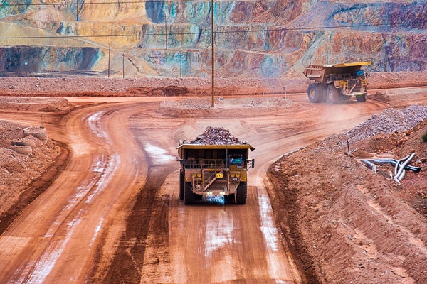
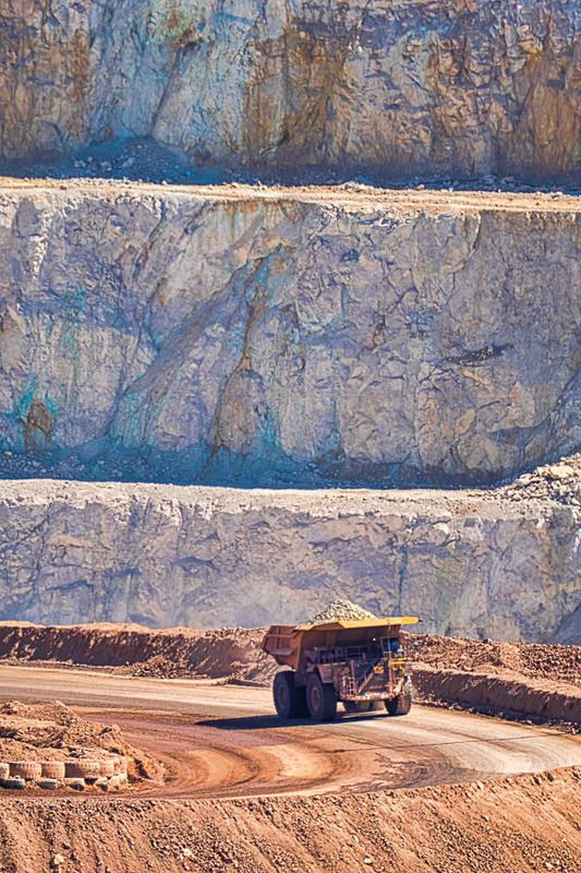
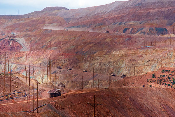
I looked it up on Google Earth and it appears to go from Alpine, AZ to Clifton, AZ. A few miles before Clifton is the town of Morenci where there is an open pit copper mine. The route does appear to include many turns, switchbacks and probably changes in elevation. It would be an interesting drive and even more interesting on a motorcycle. If you get the opportunity to travel it, I am sure you would obtain some very wonderful photos that many here would wish to see. Getting driving directions on Google Earth from Alpine to Clifton, the time to drive is shown as 2 hours, 32 minutes and distance of 93.5 miles.
Aug 18, 2020 11:53:21 #
Aug 18, 2020 14:29:42 #

To add to the Google search suggestions: after you've typed "Coronado Trail" and hit enter, change the tab from "all" to "IMAGES." Here is one result, not for the faint of heart!
https://www.americansouthwest.net/arizona/coronado_trail/coronadotrail_l.html
.
https://www.americansouthwest.net/arizona/coronado_trail/coronadotrail_l.html
.
Aug 18, 2020 15:53:12 #
Linda From Maine wrote:
To add to the Google search suggestions: after you've typed "Coronado Trail" and hit enter, change the tab from "all" to "IMAGES." Here is one result, not for the faint of heart!
https://www.americansouthwest.net/arizona/coronado_trail/coronadotrail_l.html
.
https://www.americansouthwest.net/arizona/coronado_trail/coronadotrail_l.html
.

Aug 18, 2020 17:31:22 #
Linda From Maine wrote:
To add to the Google search suggestions: after you've typed "Coronado Trail" and hit enter, change the tab from "all" to "IMAGES." Here is one result, not for the faint of heart!
https://www.americansouthwest.net/arizona/coronado_trail/coronadotrail_l.html
.
https://www.americansouthwest.net/arizona/coronado_trail/coronadotrail_l.html
.
I said it before, it would be an interesting drive. Even more interesting riding a motorcycle.
Aug 18, 2020 18:24:25 #

Aug 18, 2020 19:03:06 #
Mr Bill 2011
Loc: southern Indiana
looks like a really fun drive, unless you are in a hurry to get somewhere!
Aug 19, 2020 07:20:49 #

davidrb wrote:
Trying to find some information on this length of ... (show quote)
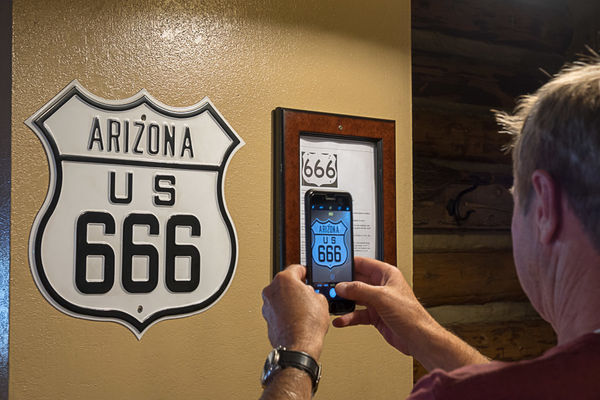
This used to be route 666 and is referred to by motorcyclists as "The Devil's Highway" - it is indeed a lovely run (I've done the bit from Springerville to Morenci numerous times over the years). About midway down is the Hannagan Lodge - a nice stopping point for lunch (well, if they're operating now).
There are some lovely views, though I haven't found much to be that photogenic per se, other than Morenci where (if you have a long lens) catching the huge loaders trundling around can make for some potentially interesting shots.
Aug 19, 2020 09:53:28 #

Looks interesting. Next fall when I head over to Bosque from Tucson I think I’ll give it a try. Thx
Aug 19, 2020 10:13:05 #
brucebc
Loc: Tooele, Utah
Go one state north and on 191 you will find Mexican Hat,Garden of the Gods, Arches Np, Canyonlands Np and Flaming Gorge NRA.
Aug 19, 2020 11:04:39 #
Wags
Loc: Mequon, WI
US Highway 191 runs from the Canadian border at Morgan, MT, to the Mexican border in AZ. I plan on driving/camping/hiking some of it in the next couple of weeks. Yellowstone, Grand Teton, Canyonlands, Arches, etc.
Aug 19, 2020 11:26:30 #
Wags wrote:
US Highway 191 runs from the Canadian border at Morgan, MT, to the Mexican border in AZ. I plan on driving/camping/hiking some of it in the next couple of weeks. Yellowstone, Grand Teton, Canyonlands, Arches, etc.
That will be a wonderful trip. Enjoy!
Aug 19, 2020 12:08:33 #
I drove 191 from Alpine to Guthrie (south of Morenci) last November in my Outback 3.6R and well worth the time in my opinion.
The blacktop was in reasonable condition but I suggest allowing at least three and preferably four hours because some sections are slow going and weather could be a factor in monsoon season. In addition there are long sections where passing a slower moving vehicle would be downright dangerous so coming up behind a large truck or ranchers moving horses or cattle could cause some unforeseen delays.
There are a couple of really excellent locations to pull off and enjoy the views and the scenery is certainly interesting but I would not classify it as breathtakingly beautiful. However, I enjoy driving challenging roads, took my time and really enjoyed the route.
If you want to reply, then register here. Registration is free and your account is created instantly, so you can post right away.