Texas and New Mexico trip - Petroglyphs and Lava
May 25, 2017 11:37:22 #
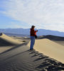
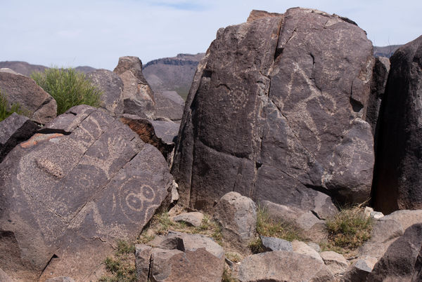
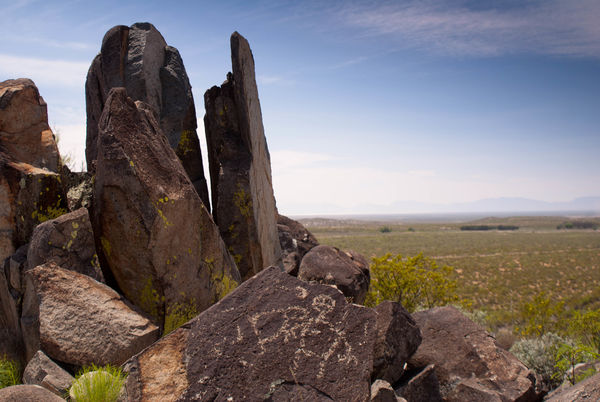
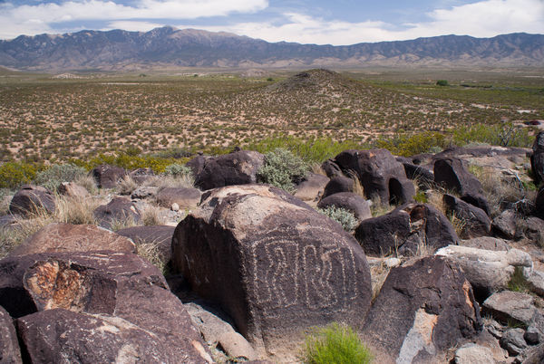
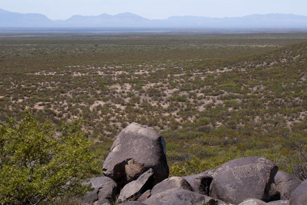
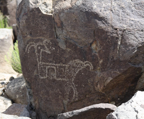
Just north of Alamagordo are Three Rivers Petroglyph Site (which is a National Recreation and BLM area) and Valley of Fires Recreation Area (another BLM area). I took a day and headed north through a stark landscape of dry grass, and creosote bushes. Paralleling my journey was the ever-present railroad system that is a real workhorse in the western US. I heard and saw lots and lots of trains......some trains nearly a mile long. The area of Three Rivers consisted of an old schoolhouse, ancient house, and souvenir stand. Turning onto a secondary road, past a ranch, and around several bends in the road was the petroglyph site Welcome Center. There is a one mile (round trip) trail from the Welcome Center to a hill piled high with lava boulders that have been used for centuries by the Mogollon and other Native American people in the area for creating petroglyphs. As I hiked around I noticed the rocks under my feet had a bit of sparkle to them, so I picked one up and found that they were made of lava, but also had pieces of volcanic glass (obsidian) in them that gave them their sparkle. A lot of the petroglyphs were right along the main trail and smaller side trails around outcrops, but some of the artwork were on rocks that were very hard to climb up to - so I didn't and used my longer lens. The Welcome Center gives you a printed handout that you can carry with you that points out particularly unique petroglyphs along the trail. There are 21,000 known petroglyphs in the area of the Sacramento Mountains and the Tularosa Basin, and students from the University of New Mexico are always on the hunt for more.
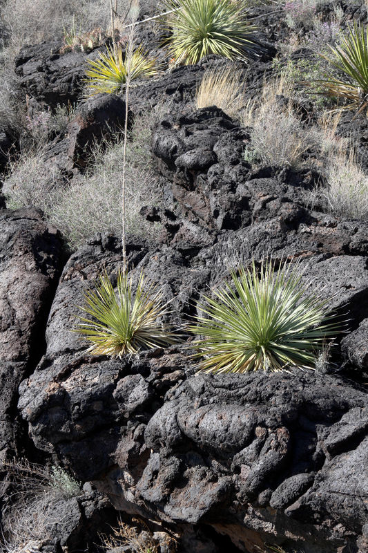
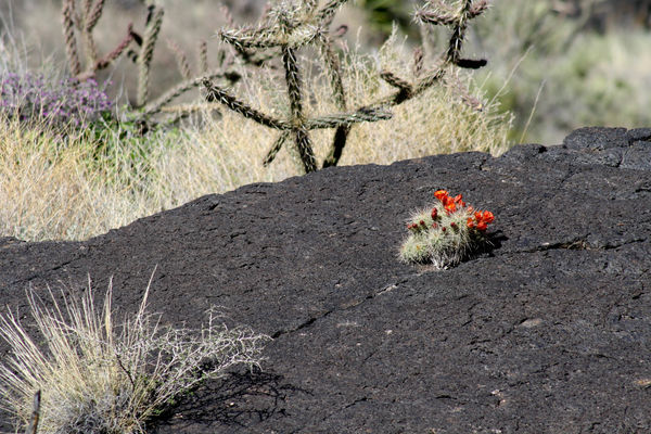
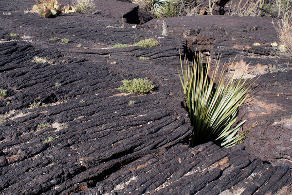
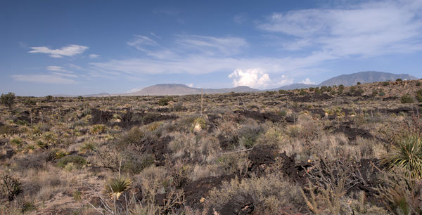
After finishing my hike at Three Rivers, I returned to the main road and headed north, seeing a very dark stain on the land to my left. I thought it looked like a lava flow, but I was quite a way away from Valley of Fires NM, so thought it might be something else. In Carrizozo I turned onto Rt. 380 towards Albuquerque, and within a few miles, the "dark stain" became known to me as a gigantic lava flow that Rt. 380 bisected, so I had been correct many miles before. The Visitor Center at Valley of Fires is a nice little place with a handout for the paved nature trail just down the hill. There are also campsites for RVs here that were being used by several families. The volcano that caused this gigantic lava flow is called Little Black Peak and is over a mile away, with the lava flow stretching 44 miles towards Alamagordo. This is a rather young flow, occurring between 1,500 and 2,000 years ago, and permits from the Visitor Center are available to hike over the lava flow (which is 160 feet deep in some places) to Little Black Peak, but there is no paved or guided trail, and you are totally on your own in finding your way through this broken and tortured landscape. I am always astounded at how much volcanic activity is, or has been, in the western US, and it is always a treat to visit an interesting volcanic site, and remind myself of just how tenacious life can be in these landscapes.
After finishing my hike at Three Rivers, I returned to the main road and headed north, seeing a very dark stain on the land to my left. I thought it looked like a lava flow, but I was quite a way away from Valley of Fires NM, so thought it might be something else. In Carrizozo I turned onto Rt. 380 towards Albuquerque, and within a few miles, the "dark stain" became known to me as a gigantic lava flow that Rt. 380 bisected, so I had been correct many miles before. The Visitor Center at Valley of Fires is a nice little place with a handout for the paved nature trail just down the hill. There are also campsites for RVs here that were being used by several families. The volcano that caused this gigantic lava flow is called Little Black Peak and is over a mile away, with the lava flow stretching 44 miles towards Alamagordo. This is a rather young flow, occurring between 1,500 and 2,000 years ago, and permits from the Visitor Center are available to hike over the lava flow (which is 160 feet deep in some places) to Little Black Peak, but there is no paved or guided trail, and you are totally on your own in finding your way through this broken and tortured landscape. I am always astounded at how much volcanic activity is, or has been, in the western US, and it is always a treat to visit an interesting volcanic site, and remind myself of just how tenacious life can be in these landscapes.
Three Rivers Site
(Download)
(Download)
The Sacramento Mountains
(Download)
Mountain Sheep petroglyph overlooking Tularosa Basin
(Download)
(Download)
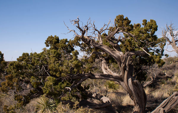
400 year old cedar tree at Valley of Fires
(Download)
(Download)
(Download)
(Download)
(Download)
May 25, 2017 19:14:59 #

Very interesting, thanks for details about your trip. I have a "Roadside Geology..." book that is fascinating, for locating interesting geology in my state. I enjoyed your pictures.
May 25, 2017 19:34:04 #

Another incredibly interesting group of photos. I enjoyed the download of each one, but my personal favorite was #2. I thoroughly enjoyed your detailed commentary and descriptions of these places and sites. 
May 25, 2017 20:29:17 #
JanIDAHO wrote:
Very interesting, thanks for details about your trip. I have a "Roadside Geology..." book that is fascinating, for locating interesting geology in my state. I enjoyed your pictures.
Thanks for looking. Glad you enjoyed the photos. I probably should see if there are "Roadside Geology" books for the western states where I travel. It sure would be helpful.
May 25, 2017 20:31:02 #
tbell7D wrote:
Another incredibly interesting group of photos. I enjoyed the download of each one, but my personal favorite was #2. I thoroughly enjoyed your detailed commentary and descriptions of these places and sites.
I am so glad you liked the series and downloads. I love the sciences and learning things about the natural world and ancient civilizations and creatures.
May 26, 2017 05:34:10 #


May 26, 2017 05:56:02 #

I love 3 rivers, it is a beautiful area, and never any crowd. A couple of years ago, I posted photos from there on this site and a person tried to argue with me that they weren't that old because he (or she ) thought they looked like graffiti or something. Funny, but I know what we learned the first time I went there years ago. I'm glad you took the time to go there. Your photos are very nice. Did you pass through the tiny town of Ore Grande? Practically a ghost town, has some abandoned tourist sites, such as an old mine shaft. I have taken photos there too. I get to go to some of those areas when we visit El Paso where my husband is from. Love the area, but don't want to live in the desert. I am enjoying your photos and trip commentary.
May 26, 2017 07:06:54 #

May 26, 2017 07:23:21 #
May 26, 2017 10:19:32 #
roxiemarty wrote:
I love 3 rivers, it is a beautiful area, and never... (show quote)
I did not go south from Alamgordo, and therefore did not go through Orogrande, but I found it on a map I have. The thing about Three Rivers that disturbed me was the damage done to some of the rocks by people coming in and hacking great chunks of the rock off to take the petroglyphs away. Thankfully, now that the site is better known, and there are people around all the time, that desecration has ceased. The other site I want to get to before it is gone is Nine Mile Canyon in Utah - but those are mostly pictographs. Thanks for looking and commenting.
May 26, 2017 10:19:58 #
Jay Pat wrote:
Very nice, AuntieM!!
Pat
Pat
Thanks Pat. Glad to see you are still hanging in with me.
May 26, 2017 10:21:20 #
jerryc41 wrote:
Petroglyphs are amazing, and they're all over the world.
Thanks Jerry - I am always amazed by petroglyphs and by the work it took for the ancients to make them. Thanks for looking and commenting.
May 27, 2017 07:30:18 #

AuntieM wrote:
Just north of Alamagordo are Three Rivers Petrogly... (show quote)
So far that sounds like the perfect road trip, and your pictures prove it!
May 27, 2017 13:11:41 #
Cykdelic wrote:
So far that sounds like the perfect road trip, and your pictures prove it!
Thank you. So glad you liked them.
If you want to reply, then register here. Registration is free and your account is created instantly, so you can post right away.