Texas and New Mexico trip - Carlsbad to Alamagordo
May 23, 2017 12:41:18 #
Again I had to make a decision as to which road to take to my next stop. I could drive back the way I had come and continue on to El Paso and then north to Alamagordo, or head north to Artesia and then west through the Lincoln National Forest and over the mountains to Alamagordo. The second route was less mileage and seemed to have several interesting places along the way to check out.
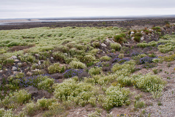
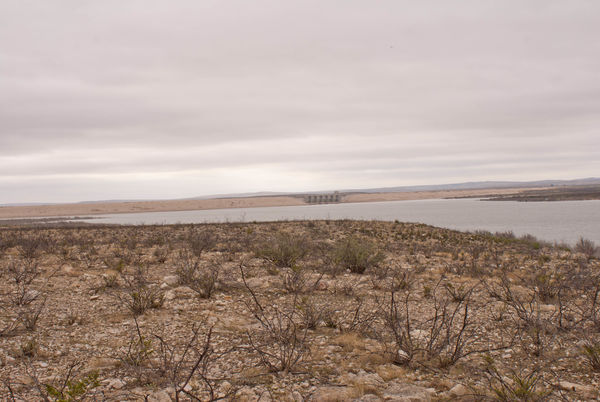
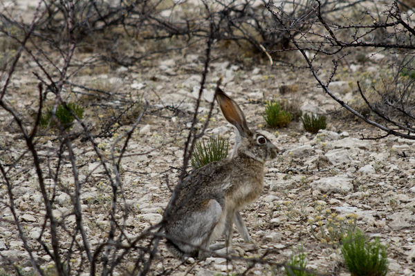
Just north of Carlsbad is Brantley Lake State Park which is a man-made lake behind a dam on the Pecos River. This was my second meet-up with the Pecos, and I would meet up with the Pecos one more time on my travels. Brantley Lake is a bit off the beaten path, but the day was young and overcast, and I was in no hurry. On the way to the Park, I spied something in the road and it turned out to be my first rattlesnake - dead and decapitated. Yep - I took a picture of it for information purposes. There was no one in the Park office/entrance building , so proceeded to take a short drive through. Purple, yellow, and white wildflowers were all along the sides of the road on my drive and I found there was a good sized lake with a rather steep boat launch area, picnic area, playground for kids, and a nice camping area with hookups for RV campers and areas for tent campers. There were also a bunch of Jackrabbits and Desert Cottontail rabbits around and I kept looking for Wylie Coyote - but never saw him.
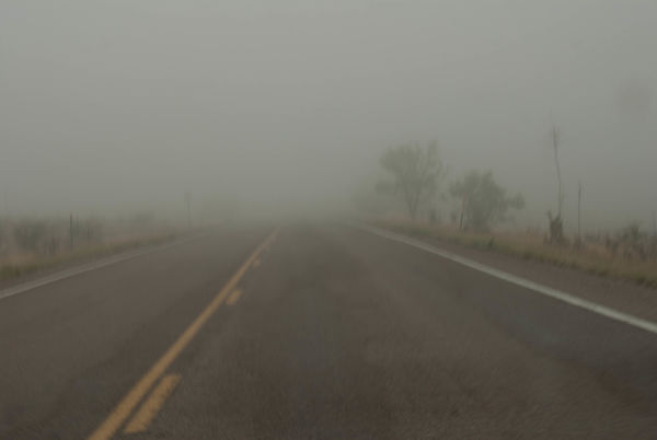
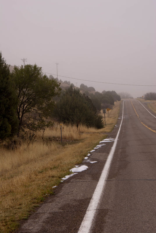
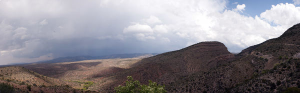
The land north of Carlsbad contained more and more gas and oil drilling rigs and storage tanks, and the smell in the town of Artesia reminded me of the smell of crude oil when I was a kid traveling with my parents through the Pennsylvania oil fields on our trips from New York to Ohio. I did, however, start to also see giant wind turbines which would get more numerous as I headed towards the Texas Panhandle later in my trip. The western side of Artesia started to look like high desert grasslands with golden grass and few mesquite or creosote bushes. Then the fog descended - light at first, and then very heavy. I stopped to see if there might be a way that cut from my route, over the mountains coming in south of Alamagordo, but the road I was on was it. There were a few other roads that went through the mountains, but they looped around and came back to the main road I was on. On a sunny day, those roads would have been great to drive for photographic opportunities, but not today. The fog got a bit better the further west I went - then I saw it. White on the road. Small piles of white on the side of the road. About the third time I saw this, I stopped to investigate and found that it was sleet. There was no sleet hitting the car, or on the main road, just on the side of the road. This cat and mouse game with the fog and piles of sleet continued all the way through the Lincoln National Forest - with the temperatures hovering in the 40s. Once I crested Cloudcroft at 8,600 in the Sacramento Mountains, it was literally all downhill from there and I was finally out of the fog.
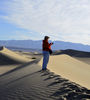
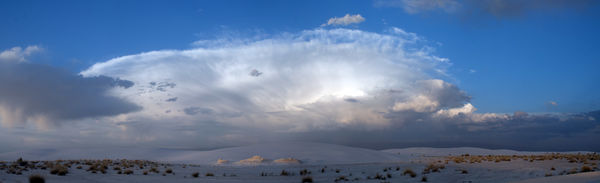
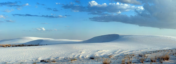
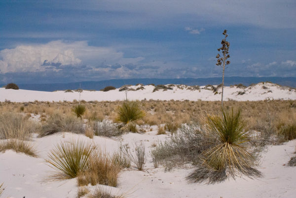
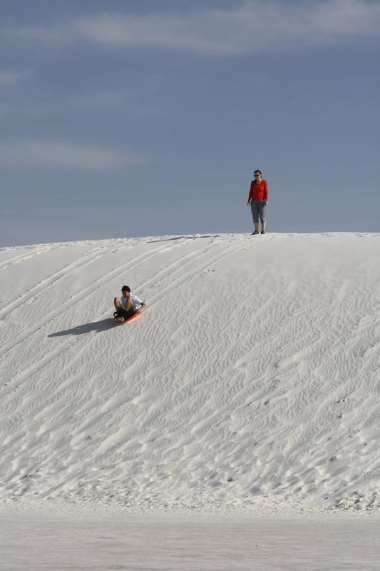
I entered Alamagordo in plenty of time to drive south to White Sands National Monument and get some late afternoon photos. There were storms and dark clouds over the Sacramento Mountains to the north of the Park and that made for a dramatic backdrop to the glaringly white "sands." Sand is usually made of quartz, but this "sand" is pulverized gypsum that has eroded out of the rocks of the San Andres Mountains to the west. Driving into the area, I noticed that the dunes are nearly covered with vegetation, and I wondered where the nice open dunes were that were featured in photographs. The drive is paved - to a point where the Park has erected a boardwalk a short way into the dunes. After that point, the road is unpaved, but is made of the natural base that the dunes sit on, which is like concrete. The loose dune material is periodically scraped off the road by graders, but the road has a pronounced washboard to it that is hard on shocks, and teeth. I found it laughable that the speed limit on the unpaved portion is 35 miles an hour when I could not go any faster than 5-10 mph without making the car act like it was going to fall apart on me. Driving to the end of the unpaved section brings you to a loop into the dunes that has picnic areas with sunscreens, and people were sledding down the dunes on coasters they brought with them or rented at the Visitor Center. There are also several hiking trails into the dunes or around an alkali flat. I noticed when I got out of the car that the road and parking lots were drawing a lot of moisture out of the air and the gypsum stuck fast to my shoes and made puddles of water in the parking lots. I waited for sunset to see if I could get a good photo, but it was not to happen on this day.
Just north of Carlsbad is Brantley Lake State Park which is a man-made lake behind a dam on the Pecos River. This was my second meet-up with the Pecos, and I would meet up with the Pecos one more time on my travels. Brantley Lake is a bit off the beaten path, but the day was young and overcast, and I was in no hurry. On the way to the Park, I spied something in the road and it turned out to be my first rattlesnake - dead and decapitated. Yep - I took a picture of it for information purposes. There was no one in the Park office/entrance building , so proceeded to take a short drive through. Purple, yellow, and white wildflowers were all along the sides of the road on my drive and I found there was a good sized lake with a rather steep boat launch area, picnic area, playground for kids, and a nice camping area with hookups for RV campers and areas for tent campers. There were also a bunch of Jackrabbits and Desert Cottontail rabbits around and I kept looking for Wylie Coyote - but never saw him.
The land north of Carlsbad contained more and more gas and oil drilling rigs and storage tanks, and the smell in the town of Artesia reminded me of the smell of crude oil when I was a kid traveling with my parents through the Pennsylvania oil fields on our trips from New York to Ohio. I did, however, start to also see giant wind turbines which would get more numerous as I headed towards the Texas Panhandle later in my trip. The western side of Artesia started to look like high desert grasslands with golden grass and few mesquite or creosote bushes. Then the fog descended - light at first, and then very heavy. I stopped to see if there might be a way that cut from my route, over the mountains coming in south of Alamagordo, but the road I was on was it. There were a few other roads that went through the mountains, but they looped around and came back to the main road I was on. On a sunny day, those roads would have been great to drive for photographic opportunities, but not today. The fog got a bit better the further west I went - then I saw it. White on the road. Small piles of white on the side of the road. About the third time I saw this, I stopped to investigate and found that it was sleet. There was no sleet hitting the car, or on the main road, just on the side of the road. This cat and mouse game with the fog and piles of sleet continued all the way through the Lincoln National Forest - with the temperatures hovering in the 40s. Once I crested Cloudcroft at 8,600 in the Sacramento Mountains, it was literally all downhill from there and I was finally out of the fog.
I entered Alamagordo in plenty of time to drive south to White Sands National Monument and get some late afternoon photos. There were storms and dark clouds over the Sacramento Mountains to the north of the Park and that made for a dramatic backdrop to the glaringly white "sands." Sand is usually made of quartz, but this "sand" is pulverized gypsum that has eroded out of the rocks of the San Andres Mountains to the west. Driving into the area, I noticed that the dunes are nearly covered with vegetation, and I wondered where the nice open dunes were that were featured in photographs. The drive is paved - to a point where the Park has erected a boardwalk a short way into the dunes. After that point, the road is unpaved, but is made of the natural base that the dunes sit on, which is like concrete. The loose dune material is periodically scraped off the road by graders, but the road has a pronounced washboard to it that is hard on shocks, and teeth. I found it laughable that the speed limit on the unpaved portion is 35 miles an hour when I could not go any faster than 5-10 mph without making the car act like it was going to fall apart on me. Driving to the end of the unpaved section brings you to a loop into the dunes that has picnic areas with sunscreens, and people were sledding down the dunes on coasters they brought with them or rented at the Visitor Center. There are also several hiking trails into the dunes or around an alkali flat. I noticed when I got out of the car that the road and parking lots were drawing a lot of moisture out of the air and the gypsum stuck fast to my shoes and made puddles of water in the parking lots. I waited for sunset to see if I could get a good photo, but it was not to happen on this day.
Brantley Lake in the distance
(Download)
Brantley Lake behind the Dam
(Download)
Jackrabbit
(Download)
My view of the Lincoln National Forest
(Download)
Piles of sleet from a storm the day prior
(Download)
Coming down the Sacramento Mountains into Alamagordo
(Download)
White Sands with storm clouds
(Download)
The dunes in the dying light
(Download)
(Download)
Dune sledding
(Download)
May 23, 2017 21:57:47 #
Looks like you made the right decision. Dune sledding looks like a blast. gary
May 23, 2017 22:11:57 #
gwr wrote:
Looks like you made the right decision. Dune sledding looks like a blast. gary
They were having a lot of fun. Thanks for looking.
May 23, 2017 23:19:03 #

May 24, 2017 08:20:58 #

May 24, 2017 11:25:46 #
Thanks for the memories. We drove the same route you took. Camped in Cloudscroft, back in '66. It was cold as I remember, the water in the dog's bowl froze during the night. Things still look the same, but I'm sure the towns have grown. Artesia was just a spot on the map back then. Great pictures.
May 24, 2017 11:27:19 #
Jay Pat wrote:
White Sands is very bright.
You captured it very well!!
Pat
You captured it very well!!
Pat
You are absolutely right. I knew it was white from photos, but wasn't prepared for the WHITE that I saw.........
May 24, 2017 11:27:59 #
rmm0605 wrote:
The dunesliding photo is perfect!
I almost got a sled from the Visitor Center to try it myself.............but common sense took over at the last minute.

May 24, 2017 11:30:26 #
Michael Boggia wrote:
Thanks for the memories. We drove the same route you took. Camped in Cloudscroft, back in '66. It was cold as I remember, the water in the dog's bowl froze during the night. Things still look the same, but I'm sure the towns have grown. Artesia was just a spot on the map back then. Great pictures.
Thanks for looking and I am glad that you liked the photos and that they brought back fond memories for you. With Cloudscroft being over 8,000 feet, it is no wonder that it is cool to cold most of the year, but I would like to go back some time when there is no fog and drive the roads that are in the mountains. I'll wager that there are some stunning photos to be had there.
May 24, 2017 16:43:23 #
Was to all those places in February!
We really enjoyed Carlsbad. It was the only developed cave we've found that let's you roam on your own. I took the natural entrance walk down.
Where are your images from Carlsbad?
We also were very pleasantly surprised by White Sands. Had no idea. Took the Ranger guided sunset walk, which is nice.
We camped for three nights at Brantley Lake. My dog enjoyed the trails.
Too bad if you missed the Desert Museum in Carlsbad. Even though some parts were under construction in February it was well worth doing. The wolves were our highlight but tough to photograph.
May 24, 2017 20:03:27 #
MtnMan wrote:
Was to all those places in February! br br We rea... (show quote)
I am happy that I brought back some memories for you. My Carlsbad photos were in a post prior to this one - there have been several other posts of my 3 week trip - starting in Ft. Worth making a giant circle and ending in Dallas. I drove past the Desert Museum, but I am not a big fan of looking at captured animals behind fencing - of course seeing the critters they have in the wild is iffy at best. Thanks for looking and commenting.
May 25, 2017 00:26:08 #

Quite a trip you're on, AuntieM! I'm enjoying each one of your posts so much! I'm so glad you could share them with us!
May 25, 2017 10:21:32 #
sailorsmom wrote:
Quite a trip you're on, AuntieM! I'm enjoying each one of your posts so much! I'm so glad you could share them with us!
I'm glad you are enjoying my trip. I love sharing my photos and am happy that people find them pleasing.
May 25, 2017 10:27:05 #

AuntieM wrote:
Again I had to make a decision as to which road to... (show quote)
Attractive series, good compositions.
May 25, 2017 11:48:20 #
photophile wrote:
Attractive series, good compositions.
Thank you so much. Glad you enjoyed them.
If you want to reply, then register here. Registration is free and your account is created instantly, so you can post right away.