Texas and New Mexico trip - Ft. Davis to Carlsbad, NM
May 21, 2017 12:56:09 #
There are two routes from Ft. Davis to Carlsbad, NM. One is to head directly north on Rt. 17 through the Davis Mountains to interstate 40 and then west 70 miles to Van Horn where I would turn north to Guadalupe National Park and then Carlsbad. The other route would take me through a different part of the Davis Mountains on Rt. 118 where I would be able to peek into Davis Mountains State Park and McDonald Observatory then on to I-40 at Kent and 37 miles to Van Horn. Well, THAT was a no-brainer!
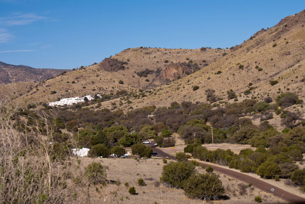
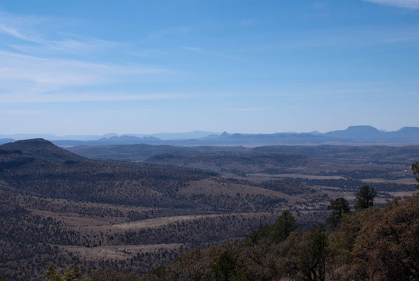
The road out of Ft. Davis was a twisted incline to Davis Mountains State Park, which is a small park having RV and primitive camping sites, wildlife viewing areas, lots of trails through the rugged terrain, and Indian Lodge which is a stark white adobe-style hotel partially built by the Civilian Conservation Corps in the 1930's. This hotel sits on the side of the one of the hills, as as seen from the scenic drive in the park, looks totally out of place, but has a restaurant and well-appointed rooms and a pool for the guests. I got a good view of the surrounding area from the scenic overlook at the top of Park Road looking over Ft. Davis and the high Texas Plains in one direction, and McDonald Observatory on a higher mountain to the north in the other direction, and my next destination.
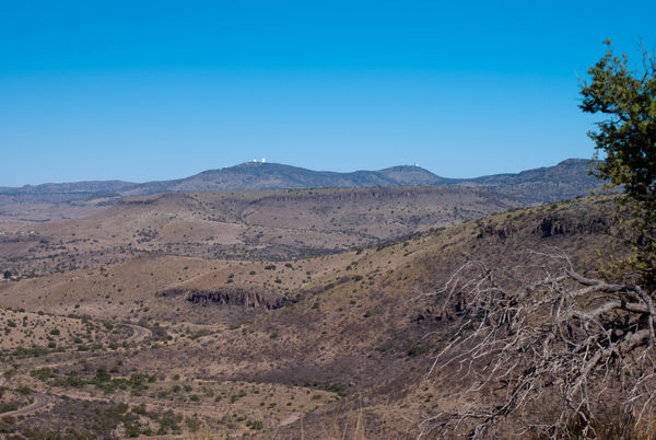
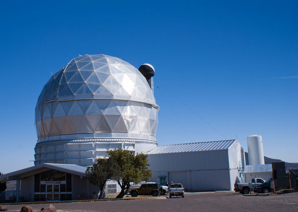
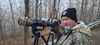
McDonald Observatory has a wonderful Visitor Center where you can purchase a ticket for a guided tour of the facility, or you can drive a self-guided tour using a handout they provide for you. Because of time constraints, I opted for the self-guided tour. The Observatory is the research facility for the University of Texas at Austin, and one of the top ranked ones in the world. There are three telescopes - 30", 48" and 82" with one of the telescopes having a viewing room with a glass partition so you can see the inner workings. There is also a radio telescope which looks like a satellite dish, on the floor of the valley below the mountains that is hooked in directly with a set of other radio telescopes in New Mexico (the huge array that was featured in the movie Contact). When someone presses the button in New Mexico to realign the array, this telescope also moves. Unfortunately, this telescope is in a no visitors allowed area.
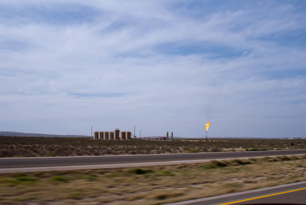
The drive from McDonald Observatory to Van Horn was quite uneventful, but I did notice a gigantic scar on the landscape that sometimes paralleled the road, and sometimes crossed the road. The scar was very wide and looked like a pipeline of some sort had been laid there, because there were white pipes sticking up out of the dirt every so often with orange labels on them - something I had seen with other pipelines. I also noticed the beginnings of oil pumps, and storage tanks along the way. These pumps and storage tanks would become more numerous the farther north I went.
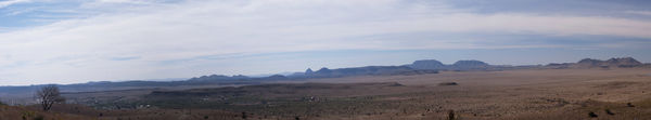
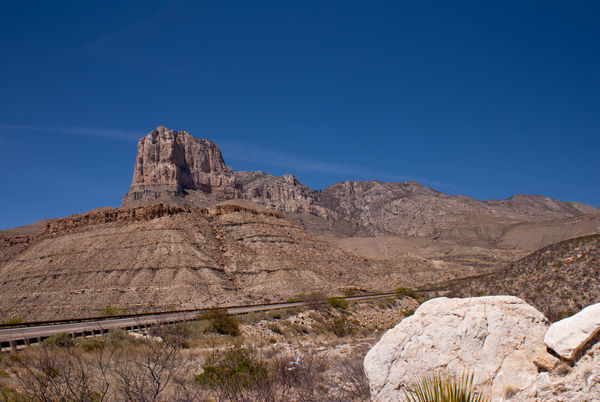
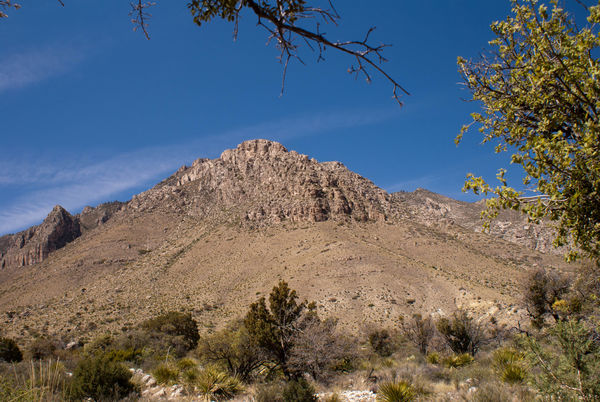
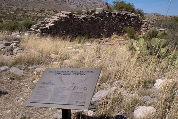
Soon I was approaching the Guadalupe National Park. I was a bit disappointed when I turned into the Visitor Center and found out that it was mostly a hiking park with some primitive camping areas approximately 30 miles off the main road. I did hike a small nature trail at the Center which was about a mile in length and found the remains of an old Butterfield Stage building, and wonderful views of the Guadalupe Mountains. These mountains are the beginning of a huge ancient limestone reef that stretches from northern Texas through the SE portion of New Mexico. As I drove to Carlsbad, NM, I could see the reef to my left the whole way, like a large levee that I was driving in the shadow of. As I came nearer and nearer Carlsbad the oil and gas production increased alongside the road, and Carlsbad was flush with oil workers and equipment.
The road out of Ft. Davis was a twisted incline to Davis Mountains State Park, which is a small park having RV and primitive camping sites, wildlife viewing areas, lots of trails through the rugged terrain, and Indian Lodge which is a stark white adobe-style hotel partially built by the Civilian Conservation Corps in the 1930's. This hotel sits on the side of the one of the hills, as as seen from the scenic drive in the park, looks totally out of place, but has a restaurant and well-appointed rooms and a pool for the guests. I got a good view of the surrounding area from the scenic overlook at the top of Park Road looking over Ft. Davis and the high Texas Plains in one direction, and McDonald Observatory on a higher mountain to the north in the other direction, and my next destination.
McDonald Observatory has a wonderful Visitor Center where you can purchase a ticket for a guided tour of the facility, or you can drive a self-guided tour using a handout they provide for you. Because of time constraints, I opted for the self-guided tour. The Observatory is the research facility for the University of Texas at Austin, and one of the top ranked ones in the world. There are three telescopes - 30", 48" and 82" with one of the telescopes having a viewing room with a glass partition so you can see the inner workings. There is also a radio telescope which looks like a satellite dish, on the floor of the valley below the mountains that is hooked in directly with a set of other radio telescopes in New Mexico (the huge array that was featured in the movie Contact). When someone presses the button in New Mexico to realign the array, this telescope also moves. Unfortunately, this telescope is in a no visitors allowed area.
The drive from McDonald Observatory to Van Horn was quite uneventful, but I did notice a gigantic scar on the landscape that sometimes paralleled the road, and sometimes crossed the road. The scar was very wide and looked like a pipeline of some sort had been laid there, because there were white pipes sticking up out of the dirt every so often with orange labels on them - something I had seen with other pipelines. I also noticed the beginnings of oil pumps, and storage tanks along the way. These pumps and storage tanks would become more numerous the farther north I went.
Soon I was approaching the Guadalupe National Park. I was a bit disappointed when I turned into the Visitor Center and found out that it was mostly a hiking park with some primitive camping areas approximately 30 miles off the main road. I did hike a small nature trail at the Center which was about a mile in length and found the remains of an old Butterfield Stage building, and wonderful views of the Guadalupe Mountains. These mountains are the beginning of a huge ancient limestone reef that stretches from northern Texas through the SE portion of New Mexico. As I drove to Carlsbad, NM, I could see the reef to my left the whole way, like a large levee that I was driving in the shadow of. As I came nearer and nearer Carlsbad the oil and gas production increased alongside the road, and Carlsbad was flush with oil workers and equipment.
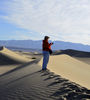
The high plains of Texas
(Download)
Davis Mountains State Park with Indian Lodge
(Download)
McDonald Observatory way in the distance
(Download)
One of the 3 observatories
(Download)
The view from the top of the mountain
(Download)
(Download)
The beginning of Guadalupe National Park and the ancient reef
(Download)
The mountains from the nature trail
(Download)
What's left of the Butterfield Station at Guadalupe NP
(Download)
What was becoming a common sight
(Download)
May 21, 2017 13:54:29 #

May 21, 2017 14:28:28 #

Very appealing and interesting set of photos. I enjoyed looking at each one in download.
May 21, 2017 14:32:39 #
May 21, 2017 14:38:42 #

May 21, 2017 15:50:40 #
Longshadow wrote:
Nice shots.
Thank you. Appreciate you looking and commenting.
May 21, 2017 15:50:59 #
tbell7D wrote:
Very appealing and interesting set of photos. I enjoyed looking at each one in download.
Thank you. Glad you enjoyed them.
May 21, 2017 15:52:03 #
Bill_de wrote:
Looks like you had a nice trip.--
Had a wonderful trip. About 1/2 way through at this point. Thanks for looking and commenting.
May 21, 2017 15:53:23 #
Jay Pat wrote:
Enjoying the ride!
Have not been to Guadalupe National Park.
Pat
Have not been to Guadalupe National Park.
Pat
There's not much at Guadalupe for people who are not into heavy hiking, but if you ever get to Carlsbad, it's not a far piece to go to just check it out. Glad you are still with me.
May 22, 2017 05:58:39 #
May 22, 2017 06:17:19 #
AuntieM wrote:
There are two routes from Ft. Davis to Carlsbad, N... (show quote)
Thanks for your interesting narrative and cool photos again. You've really done your homework on your trip. I was wondering if you connected with I-10 instead of I-40 when you left the observatory? I-40 runs east to west through Amarillo, Tx

May 22, 2017 08:12:31 #
May 22, 2017 08:14:12 #

Another great series. Up top the GNP offers some great hiking and camping for backpacking. It's a whole different ecosystem once you get to the higher elevation.
May 22, 2017 08:17:38 #
J-SPEIGHT wrote:
Nice set AuntieM.
Thank you for looking and commenting. Glad you liked the photos.
May 22, 2017 08:20:27 #
canondave1 wrote:
Thanks for your interesting narrative and cool photos again. You've really done your homework on your trip. I was wondering if you connected with I-10 instead of I-40 when you left the observatory? I-40 runs east to west through Amarillo, Tx
Well DUH - you are absolutely right - I connected with I-10. Thanks for keeping me honest. I did get on I-40 for a few miles later when I was in Amarillo. Thank you so much for viewing my post and your kind words.
If you want to reply, then register here. Registration is free and your account is created instantly, so you can post right away.