Texas and New Mexico trip- The Road to Ft. Davis
May 20, 2017 11:50:34 #
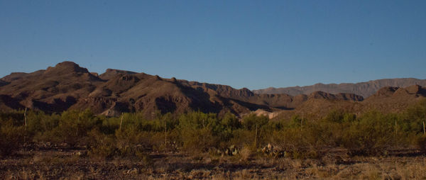
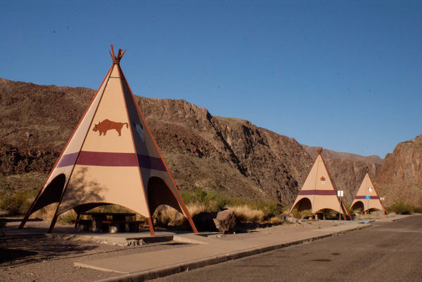
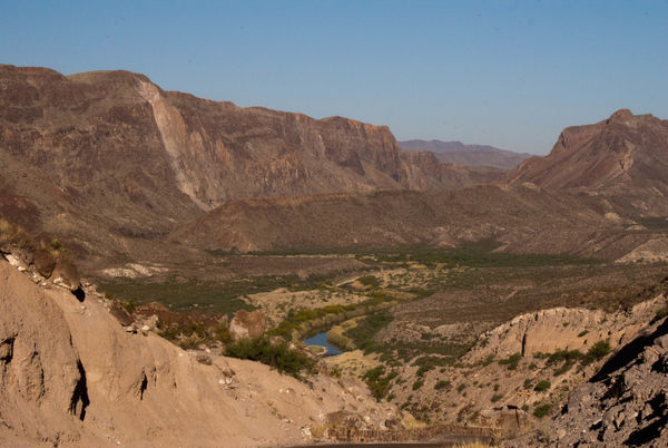
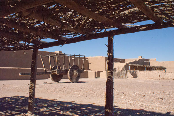
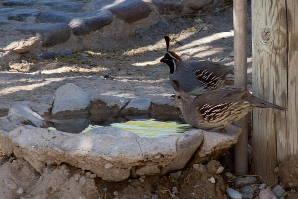
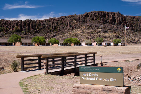
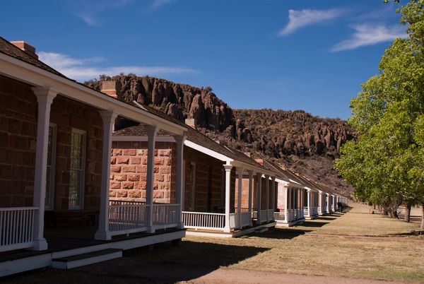
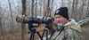
Leaving the Big Bend NP area, I decided to drive west along the Rio Grande River on Highway 170 to Presidio and then turn north to Marfa and Ft. Davis where I would stay overnight. I started out having no idea what, if anything I would encounter on the way that would be interesting. I passed the Lajitas International Airport sign with a Turkey Vulture sitting next to the closed gate. I guess he was the air traffic controller. Lajitas consists of a resort and golf course, and nothing more. Down the road were several primitive camping areas along the Rio Grande that had launch sites for kayaks and canoes. There was a rest stop that had tepee coverings for the tables. I thought that was really neat and have never seen a picnic area like this before. The road rose, fell, and was very scenic. I don't know what I was expecting with regard to the topography of the area, but I did not expect the terrain to be so rugged on either side of the Rio Grande. There were mountains on either side of the river, and in some places shear cliffs. I stumbled on a shelter with a viewing telescope when I pulled off to try and get some photos of quail that were constantly flying in front of my car and disappearing into the brush. The viewing scope was used to look at Desert Big Horn Sheep on the side of the hill across the road. Unfortunately, nothing was there to be seen. Coming into Presidio, the land got flatter and more agriculture appeared with large fields of alfalfa being grown. I stopped at Ft. Leaton, a Texas State Historic Site, and took a walk around this trading post that dates to the mid-1800s. It was a very interesting step back in time and well worth the stop. I also was able to get a shot of a pair of California Quail, the same species that had been playing hide and go seek with me all the way from Terlingua. Heading away from the border - up Rt. 67 the land changed to dry prairie grasses. There was also the small abandoned mining community of Shafter along the way. Eventually I arrived at Ft. Davis and decided to visit Ft. Davis National Historic Park which was an active calvary post from 1854 to 1891 to protect travelers on the San Antonio - El Paso road. The fort was abandoned by the Union army during the Civil War and taken over by the Confederacy, but retaken by the Union some time later. An experiment with using camels as pack animals was also based out of Ft. Davis. Unfortunately, the mules and camels did not work well together, and the rocky nature of the Chihuahuan desert and other parts of the west injured the feet of the camels - so that experiment was abandoned.
The rough terrain
(Download)
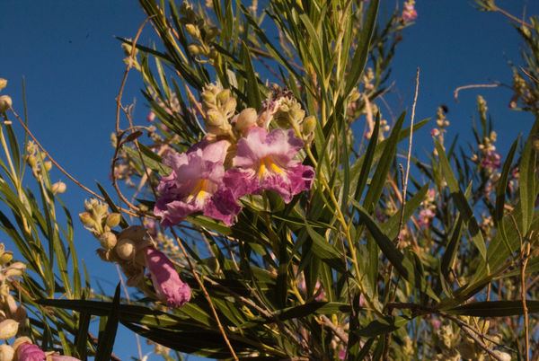
Desert Willow in bloom
(Download)
The picnic area along the river
(Download)
The Rio Grande and terrain
(Download)
Inside Ft. Leaton. I am 5'8" and the wheels on the cart are taller than I am
(Download)
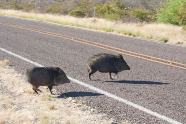
Javelinas along the road
(Download)
California Quail
(Download)
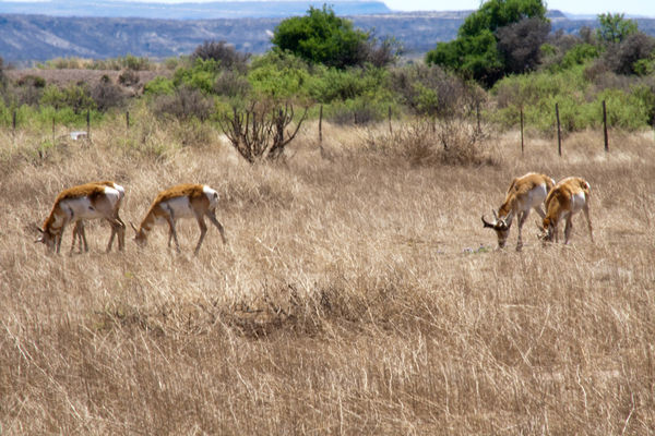
Pronghorn Antelope
(Download)
(Download)
(Download)
May 20, 2017 12:25:23 #
DougS
Loc: Central Arkansas
Your record of your trip is excellent! And the photos are quite enjoyable, as well as interesting. Looks like an excellent adventure, one I would like to duplicate!
May 20, 2017 12:28:38 #

I must say I was greatly appreciative of a well written short documentary of your travels of the region you went through and photos you posted thank you so much!
May 20, 2017 13:30:53 #
DougS wrote:
Your record of your trip is excellent! And the photos are quite enjoyable, as well as interesting. Looks like an excellent adventure, one I would like to duplicate!
I really have fun on my "walkabouts" and am glad that my narrative and photos please you.
May 20, 2017 13:31:37 #
RichardSM wrote:
I must say I was greatly appreciative of a well written short documentary of your travels of the region you went through and photos you posted thank you so much!
Thank YOU for viewing my post and your kind comments. They are much appreciated.
May 20, 2017 14:02:47 #
RichardSM wrote:
I must say I was greatly appreciative of a well written short documentary of your travels of the region you went through and photos you posted thank you so much!
I agree with RichardSM!!
Still, enjoying the tour!
Pat
May 20, 2017 14:08:46 #
Jay Pat wrote:
I agree with RichardSM!!
Still, enjoying the tour!
Pat
Still, enjoying the tour!
Pat
Glad you are still with me and enjoying my trip.

May 20, 2017 23:09:54 #

AuntieM wrote:
Leaving the Big Bend NP area, I decided to drive w... (show quote)
I agree with the others! Loved the tour guide, complete with photos!! (which are very well captured, BTW). I have wanted to take that trip for a while. Have not gotten around to it. It is about an 8 hr drive. I'd love to visit the planetarium there, and get some shots of the night sky. I hope I get to go to the next Photography workshop there. Thanks for the photos and narrative.
May 21, 2017 06:46:34 #
May 21, 2017 06:57:02 #
AuntieM wrote:
Leaving the Big Bend NP area, I decided to drive w... (show quote)
Nice trip and nice set AuntieM!

May 21, 2017 06:57:38 #
AuntieM wrote:
Leaving the Big Bend NP area, I decided to drive w... (show quote)
Your photos and narrative are spot-on, and I appreciate you sharing your trip.
May 21, 2017 08:07:39 #
Another great series. Have traveled the road many times. The Mexican city of Ojinaga across the river from Presidio is much nicer. The movie Giant, for those of us that are that old, was filmed around Marfa. Forgot to ask if there is still a beer guzzling goat at the hotel in Teralingua.
May 21, 2017 08:10:59 #
Tom G
Loc: Atlanta, GA
Very nice shots.
However, if you had used a few PARAGRAPHS it would have been more readable. Try 'em sometime; they work.
However, if you had used a few PARAGRAPHS it would have been more readable. Try 'em sometime; they work.
May 21, 2017 08:13:09 #
tresap23 wrote:
I agree with the others! Loved the tour guide, complete with photos!! (which are very well captured, BTW). I have wanted to take that trip for a while. Have not gotten around to it. It is about an 8 hr drive. I'd love to visit the planetarium there, and get some shots of the night sky. I hope I get to go to the next Photography workshop there. Thanks for the photos and narrative.
My next post will be from Ft. Davis to Carlsbad, NM, and I stopped at McDonald Observatory on the way. It is a fascinating place, and I can only imagine taking a photography workshop there on the night sky. Unfortunately on this trip the moon was not in a cooperative phase for night photographs - and after hiking all day, neither was I.
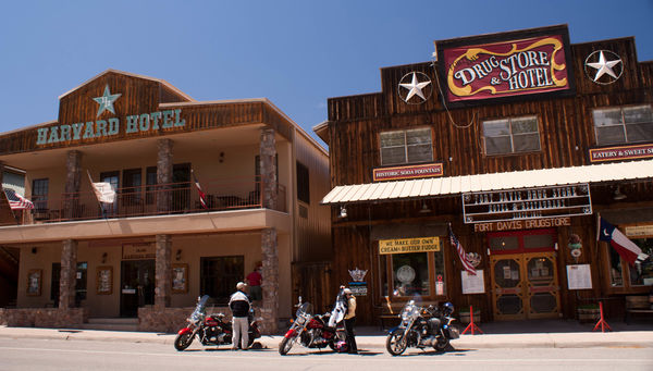
I hope you get there one day, because Ft. Davis is a wonderful little town with a few unique shops, including the Drugstore and Hotel where I had lunch.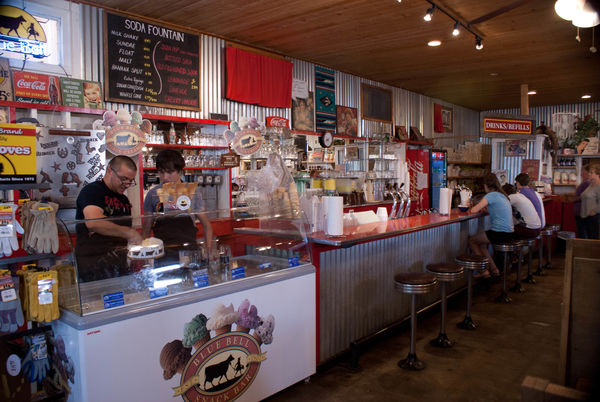
May 21, 2017 08:14:40 #
If you want to reply, then register here. Registration is free and your account is created instantly, so you can post right away.