How things change
Mar 12, 2013 00:33:51 #

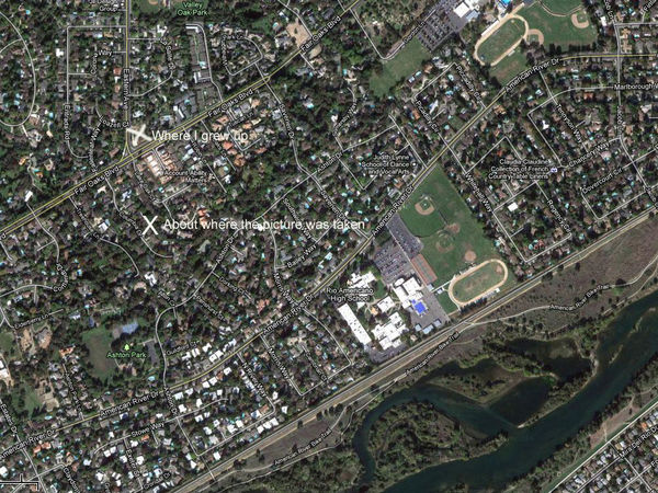
The first picture was taken about a half mile from where I grew up in Sacramento in about 1960 or 1961. The picture was taken looking towards the American River. The second is copied from Google maps of that same area today.
Hop fields now taken over by houses
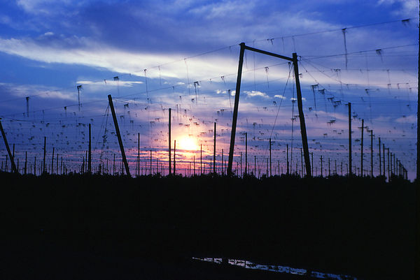
Rancho Cordova, California
Mar 12, 2013 06:34:50 #

Your photograph has weathered well - good take.
Nothing stays the same and change is not always for the best.
Nothing stays the same and change is not always for the best.
Mar 13, 2013 12:33:20 #

Mar 13, 2013 18:52:16 #
iDoc wrote:
I like the first but exactly what am I seeing?
Hops used in making beer are planted in the field. Lanyards are run from the horizontal lanyards down to the ground. The hop plants climb the vertical lanyards as they grow. The second picture is the Google maps image of that area as it appears today. Hop fields gone, replaced row after row of houses.
Mar 14, 2013 10:45:05 #
EdJ0307 wrote:
Hops used in making beer are planted in the field. Lanyards are run from the horizontal lanyards down to the ground. The hop plants climb the vertical lanyards as they grow. The second picture is the Google maps image of that area as it appears today. Hop fields gone, replaced row after row of houses.
iDoc wrote:
I like the first but exactly what am I seeing?
Hops used in making beer are planted in the field. Lanyards are run from the horizontal lanyards down to the ground. The hop plants climb the vertical lanyards as they grow. The second picture is the Google maps image of that area as it appears today. Hop fields gone, replaced row after row of houses.
Thanks for the explanation. I didn't know how hops were grown.(I like martinis).
Mar 14, 2013 19:38:19 #
iDoc wrote:
(I like martinis).
I'll pass on both, thank you very much.
If you want to reply, then register here. Registration is free and your account is created instantly, so you can post right away.