Posts for: Hsch39
Aug 16, 2022 09:39:06 #
Apr 26, 2022 09:50:36 #
If you like to see the GPS coordinates on the camera display for an image taken, just push the "info" button next to the menu button twice. If you like to see the location on a map, you would have to download the image to a photo app supporting a map. I'm using Affinity, but I also can use "Preview" on my Mac.
Mar 8, 2022 10:12:17 #
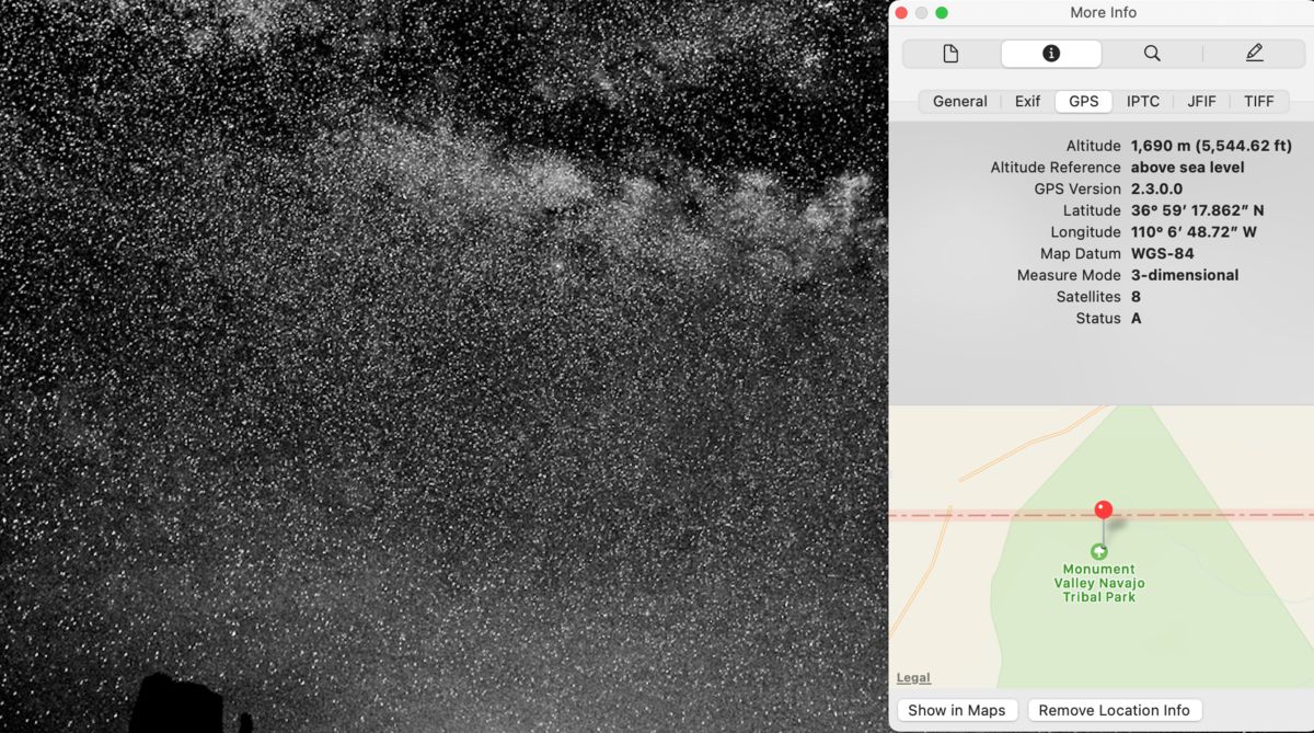
Great image. Thanks for the tip. I will be at Monument Valley for 3 days at the end of May. I will stop by on the way from Flagstaff.
Feb 22, 2022 16:10:53 #
sheldon minsky wrote:
It is a Leica 111f Circa 1952 Wish I had kept,it along with 6 lenses and a fitted leather case. Oh well.
You are correct. It's a Leica IIIF 1952 or slightly older. I own a IIIF 1953 model, which doesn't have the 2 little screws to hold the top plate.
Jan 22, 2022 10:33:01 #
I think you are asking about geotagging your photos with your Nikon App on your smartphone. I have a Panasonic camera, which probably works the same as a Nikon. Once your Nikon app on your phone established communication with your camera through Bluetooth or Wifi, you will use only the camera shutter release to take a photo. What I don't like about this function, is that you have to make sure that the camera and the phone are communicating. Another thing is that the batteries in both your camera and the phone will be used constantly.
I also have the "Geotag Photos Pro 2" app installed on my phone, which is much easier to use. You just have to make sure that your camera and phone have the same time and date. You also would need the "Geotag" application for your computer.
I also have the "Geotag Photos Pro 2" app installed on my phone, which is much easier to use. You just have to make sure that your camera and phone have the same time and date. You also would need the "Geotag" application for your computer.
Jan 14, 2022 12:19:13 #
DWU2 wrote:
How did you chance to see it?
We were on a smaller sightseeing boat out of Ushuaia.
Jan 13, 2022 19:43:36 #
"Les Eclaireurs" Beagle Channel, Ushuaia, Argentina.

Dec 15, 2021 11:23:21 #
SoHillGuy wrote:
You will need a pair of anaglyph glasses to view in 3D. (red & cyan lenses.)
2D converted to 3D.
Photo Credit: Batuhan Kocabas.
2D converted to 3D.
Photo Credit: Batuhan Kocabas.
Looks like Cappadocia, Turkey. We stayed in one of these in 2014.
Nov 18, 2021 14:56:13 #
ronWA wrote:
Regarding geotagged images, I am using a Mac but I... (show quote)
Take a look at the "Geotag Photos" app for your smartphone. You only have to make sure that the time on your camera is the same as on your smartphone, and you don't have to take photos with your phone. You also have to get the Geotag Photos App for your computer. Works great for me.
Nov 18, 2021 11:20:12 #
DirtFarmer wrote:
Your example appears to be on a Mac.
Windows also has a program called "Photos" but I don't see a way to use the GPS metadata within that program.
Windows File Explorer can show you properties of the image file and the details tab will show you the GPS data if it is there, but there is no link to automatically use those data.
(Using Win10)
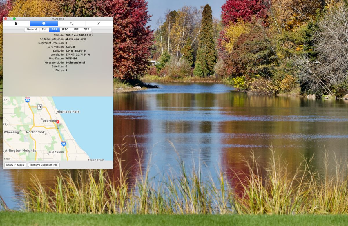
Yes, I'm using a Mac.
Nov 18, 2021 09:43:50 #
If your photo is in your "Photos" Library go to image>Edit with> Preview>Tools>show inspector>GPS
Nov 5, 2021 20:18:54 #
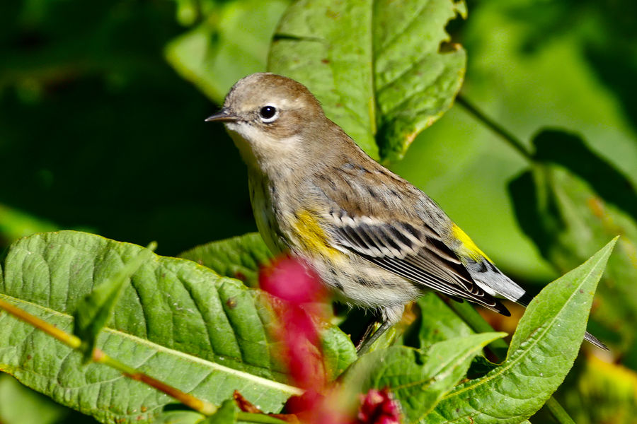
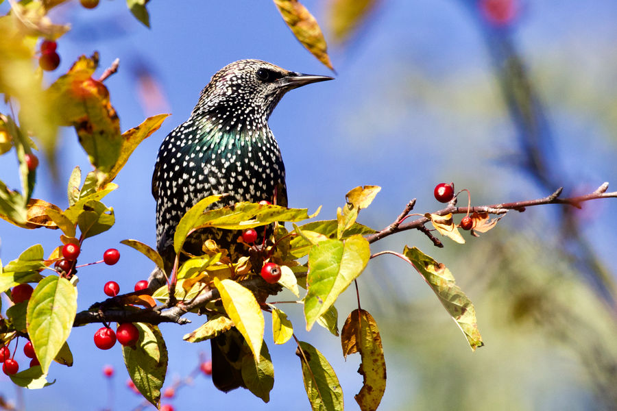
I was very surprised to see Warblers in November. I went back three days later, and they were gone, but I got a
Starling instead.
Starling instead.
Oct 15, 2021 11:33:37 #
Will you be staying at the Cleary Summit Lodge or the Cabins? We were there in March 2015 for four days. The temperature was about 10-15ºF, and I had no problems with the camera, (Canon 5D II). Since the Aurora disappears several times during the night, you will have time to change the battery and also warm up. Bringing your camera from the cold to a warm room temperature will produce condensation on the camera and lens, and it takes a long time to clear up. I just left the camera and tripod outside.
Oct 4, 2021 16:20:25 #
daledo wrote:
Had to downsize to load on Hedgehog which seems to have stripped EXIF data. D850, Irix 15mm firefly, f2.4, 25 sec., iso 100
Thank you for the reply.
Oct 4, 2021 12:46:49 #
I wanted to see the EXIF data, but the download did not show it. I like to see the camera settings, so I could learn from them.