Needles North
Sep 18, 2019 09:40:32 #
Cany143
Loc: SE Utah
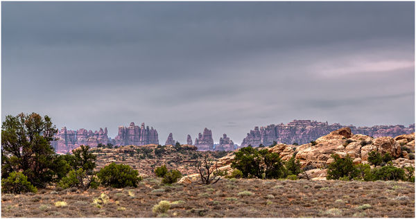
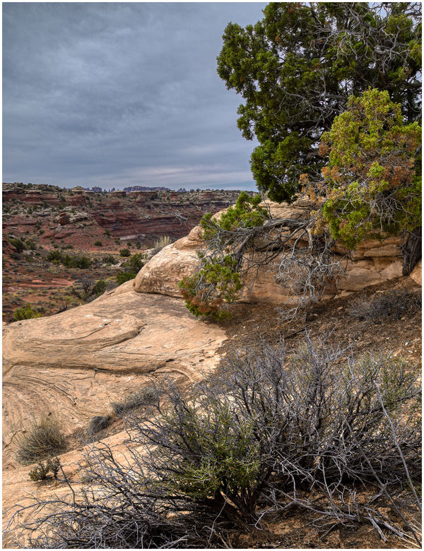
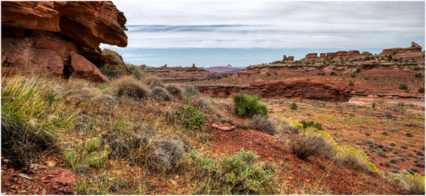
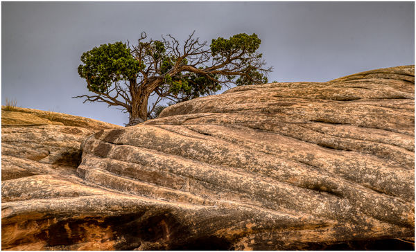
The least visited section of the Needles District of Canyonlands NP lies north and west of the Visitor Center. Designated the Needles North Backpacking Zone, it forms a sizable portion of the district, and is dominated by larger and lesser canyons that terminate at the Colorado River. Access is either by hiking or by way of a 4WD road that parallels the archaeologically rich Salt Creek Canyon drainage.
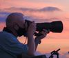
The day was overcast. Hints of brightness broke through from time to time, but never enough to cast a hard edged shadow. The accompanying images are less 'photographs' than they are the products of a person with a camera who was overjoyed with the possibility of finally being able to get out to hike somewhere in less than triple digit temperatures.
The day was overcast. Hints of brightness broke through from time to time, but never enough to cast a hard edged shadow. The accompanying images are less 'photographs' than they are the products of a person with a camera who was overjoyed with the possibility of finally being able to get out to hike somewhere in less than triple digit temperatures.
Sep 18, 2019 09:42:42 #

Such beautiful country. I envy you your time to explore and the ability to get off the beaten path!
Sep 18, 2019 09:49:11 #

Sep 18, 2019 09:55:37 #
PaulBrit
Loc: Merlin, Southern Oregon
Utah is an incredible State and the NP’s are to die for. Next week we travel to Capital Reef NP; I wonder if we will find our way to here as well. What about local motels?
Sep 18, 2019 10:01:08 #

Sep 18, 2019 10:03:21 #

You certainly do justice to the landscape in both knowledge and photography.
--Bob
--Bob
Cany143 wrote:
The least visited section of the Needles District ... (show quote)
Sep 18, 2019 10:15:16 #
Sep 18, 2019 10:17:39 #
Cany143
Loc: SE Utah
PaulBrit wrote:
Utah is an incredible State and the NP’s are to die for. Next week we travel to Capital Reef NP; I wonder if we will find our way to here as well. What about local motels?
Capital Reef is way under-rated. The (relatively) few who see it, however, barely see it since it stretches almost 80 miles north to south. Most see the thin strip formed by Hwy 24 and the Fremont River, fewer still access places like Capital Gorge or the Pleasant Valley areas, and less than a handful drive the Burr Trail/Notom Road that crosses a southerly portion of the park. I had the good fortune (some years ago) to be detailed (assigned) to CARE (the NPS acronym for the park) for a week to photograph in some of the least accessible regions. We packed in by horse.
Finding a room at a motel in Torrey shouldn't be difficult, but it is a 'busy' time of the year. If you get east to the Arches/Canyonlands areas, there are 11,597 motels in Moab, with six more under construction as we speak. Getting a room could be tricky.
Sep 18, 2019 10:18:03 #

Sep 18, 2019 10:32:29 #
Sep 18, 2019 10:38:03 #

Sep 18, 2019 10:43:22 #
Jim .. a continuous pleasure to be viewing ... it takes considerable effort to be consistent like you are ...
Sep 18, 2019 10:53:37 #
PaulBrit
Loc: Merlin, Southern Oregon
Cany143 wrote:
Capital Reef is way under-rated. The (relatively)... (show quote)
Thanks. We will be fairly restricted to hiking, Jeannie has Parkinson's, but we are in a 4WD truck and will have quite a few days in the area. We were initially attracted to CARE because of the stunning slot canyons that we really want to see, and take photographs.
Accommodation will have to come as it is presented; we also will have one of our dogs with us.
But, whatever, we are going to really enjoy the area.
Sep 18, 2019 10:57:05 #
Cany143
Loc: SE Utah
SpyderJan wrote:
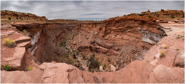
Beautiful set Jim. What caused that crater in #3. Is it a mine?
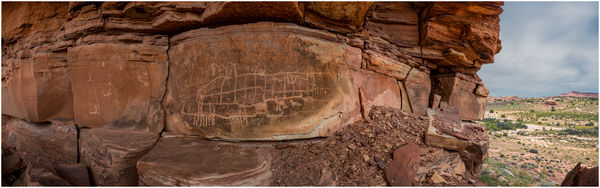
Its not a crater, Spidey. Its a canyon. Specifically, its a place along the roughly 40 mile stretch of the Salt Creek drainage where, after flowing through flatter, less 'canyon-y' land it suddenly drops. The dry fall there is called 'Lower Jump.' (Upper Jump, another --but slightly less dramatic-- dry fall drop is located many miles to the south, in a more often accessed (by foot) section of Salt Creek Canyon where there are numerous Ancestral Puebloan ruins, rock art sites, arches, bears, and beauty). Before Canyonlands was designated a National Park (in 1964), much of it was cattle country. There was plenty of mining exploration done in years past, but unlike so much of the region outside what today is the Needles, little mineral resources were ever found. As well, it seems that nobody needed any more red/orange rocks, either.
I've seen Salt Creek Canyon positively RAGE after a heavy rain. I'd like to see Lower Jump under such conditions, but getting there --and getting out again-- would be really, really tricky unless you waited a week (or a month) to let things dry out again.
Sep 18, 2019 11:12:32 #
Cany143
Loc: SE Utah
PaulBrit wrote:
Thanks. We will be fairly restricted to hiking, Jeannie has Parkinson's, but we are in a 4WD truck and will have quite a few days in the area. We were initially attracted to CARE because of the stunning slot canyons that we really want to see, and take photographs.
Accommodation will have to come as it is presented; we also will have one of our dogs with us.
But, whatever, we are going to really enjoy the area.
Accommodation will have to come as it is presented; we also will have one of our dogs with us.
But, whatever, we are going to really enjoy the area.
Paul-- Considering your info, by all means --and only if it hasn't/isn't about to rain--, drive the Burr Trail. Easy day trip from where ever you may be staying, and if you can stretch that out into an overnight, its even better. Whatever you end up doing, you're gonna love the place.
If you want to reply, then register here. Registration is free and your account is created instantly, so you can post right away.