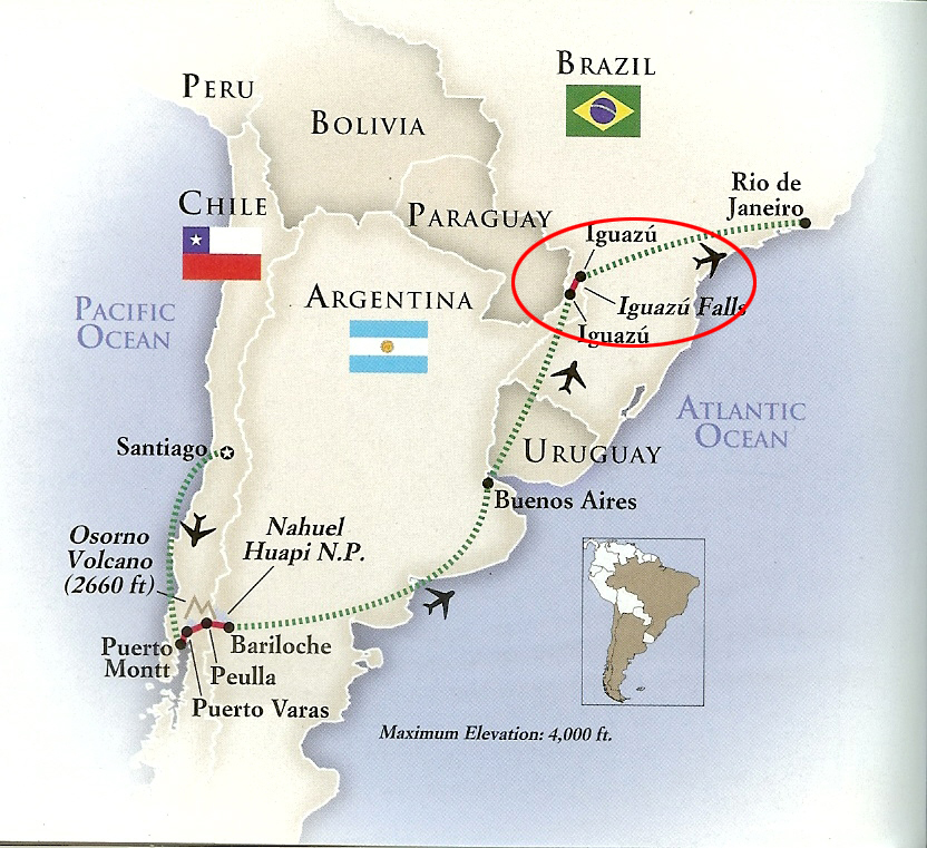
South America: Iguazu Falls, Argentina
May 6, 2022 14:25:48 #

We were sad to leave beautiful Buenos Aires but we weren't prepared for the absolute magnificence of Iguazu Falls which will be the subject of my next series of posts.
Iguazú Falls or Iguaçu Falls (Guarani: Chororõ Yguasu [ɕoɾo'ɾõ ɨɣʷa'su], Spanish: Cataratas del Iguazú [kataˈɾataz ðel iɣwaˈsu]; Portuguese: Cataratas do Iguaçu [kataˈɾatɐs du iɡwaˈsu]) are waterfalls of the Iguazu River on the border of the Argentine province of Misiones and the Brazilian state of Paraná. Together, they make up the largest waterfall system in the world. The falls divide the river into the upper and lower Iguazu. The Iguazu River rises near the heart of the city of Curitiba. For most of its course, the river flows through Brazil; however, most of the falls are on the Argentine side. Below its confluence with the San Antonio River, the Iguazu River forms the border between Argentina and Brazil.
The name Iguazú comes from the Guarani or Tupi words "y", meaning "water", and "ûasú "[waˈsu], meaning "big". Legend has it that a deity planned to marry a beautiful woman named Naipí, who fled with her mortal lover Tarobá in a canoe. In a rage, the deity sliced the river, creating the waterfalls and condemning the lovers to an eternal fall. The first European to record the existence of the falls was the Spanish Conquistador Álvar Núñez Cabeza de Vaca in 1541.
The staircase character of the falls consists of a two-step waterfall formed by three layers of basalt. The steps are 35 and 40 metres (115 and 131 ft) in height. The columnar basalt rock sequences are part of the 1,000-metre-thick (3,300 ft) Serra Geral Formation within the Paleozoic-Mesozoic Paraná Basin. The tops of these sequences are characterized by 8–10 m (26–33 ft) of highly resistant vesicular basalt and the contact between these layers controls the shape of the falls. Headwater erosion rates are estimated at 1.4–2.1 cm/year (0.55–0.83 in/year). Numerous islands along the 2.7-kilometre-long (1.7 mi) edge divide the falls into many separate waterfalls and cataracts, varying between 60 and 82 m (197 and 269 ft) high. The number of these smaller waterfalls fluctuates from 150 to 300, depending on the water level. About half of the river's flow falls into a long and narrow chasm called the Devil's Throat (Garganta del Diablo in Spanish or Garganta do Diabo in Portuguese).
The Devil's Throat canyon is 80–90 m (260–300 ft) wide and 70–80 m (230–260 ft) deep. Left of this canyon, another part of the river forms 160–200 individual falls, which merge into a single front during flood stage. The largest falls are named San Martín, Adam and Eva, Penoni, and Bergano.
About 900 m (2,950 ft) of the 2.7 km (1.7 mi) length does not have water flowing over it. The water of the lower Iguazu collects in a canyon that drains into the Paraná River, a short distance downstream from the Itaipu Dam. The junction of the water flows marks the border between Brazil, Argentina, and Paraguay. Some points in the cities of Foz do Iguaçu, Brazil, Puerto Iguazú, Argentina, and Ciudad del Este, Paraguay, have access to the Iguazu River, where the borders of all three nations may be seen, a popular tourist attraction for visitors to the three cities.
The Iguazu Falls are arranged in a way that resembles a reversed letter "J". The Argentina–Brazil border runs through the Devil's Throat. On the right bank is the Brazilian territory, which is home to more than 95% of the Iguazu River basin but has just over 20% of the jumps of these falls, and the left side jumps are Argentine, which makes up almost 80% of the falls.
The falls may be reached from two main towns, with one on either side of the falls: Foz do Iguaçu in Brazil and Puerto Iguazú in Argentina, as well as from Ciudad del Este, Paraguay, on the other side of the Paraná River from Foz do Iguaçu, each of those three cities having commercial airports. The falls are shared by the Iguazú National Park (Argentina) and Iguaçu National Park (Brazil). The two parks were designated UNESCO World Heritage Sites in 1984 and 1986, respectively.
Upon seeing Iguazu, the United States First Lady Eleanor Roosevelt reportedly exclaimed, "Poor Niagara!" (which, at 50 m or 165 feet, are a third shorter). Often, Iguazu also is compared with Victoria Falls in Southern Africa, which separates Zambia and Zimbabwe. Iguazu is wider but is split into roughly 275 distinct falls and large islands, whereas Victoria has the largest curtain of water in the world, at more than 1,600 m (5,249 ft) wide and over 100 m (328 ft) in height (in low flow, Victoria is split into five by islands but in high flow it may be uninterrupted). The only wider falls are extremely large rapid-like falls, such as the Boyoma Falls (Stanley Falls).
With the flooding of the Guaíra Falls in 1982, Iguazu currently has the sixth-greatest average annual flow of any waterfall in the world, following number five Niagara, with an average rate of 1,746 m3/s (61,660 cu ft/s). Its maximum recorded flow was 45,700 m3/s (1,614,000 cu ft/s) on 9 June 2014. By comparison, the average flow of Niagara Falls is 2,400 m3/s (85,000 cu ft/s), with a maximum recorded flow of 8,300 m3/s (293,000 cu ft/s). The average flow at Victoria Falls is 1,088 m3/s (38,420 cu ft/s), with a maximum recorded flow of 7,100 m3/s (250,000 cu ft/s).
https://en.wikipedia.org/wiki/Iguazu_Falls
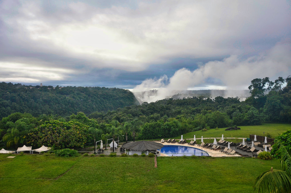
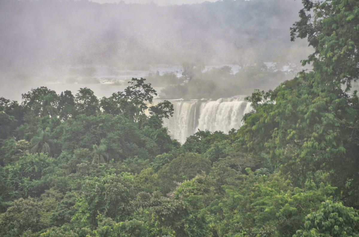
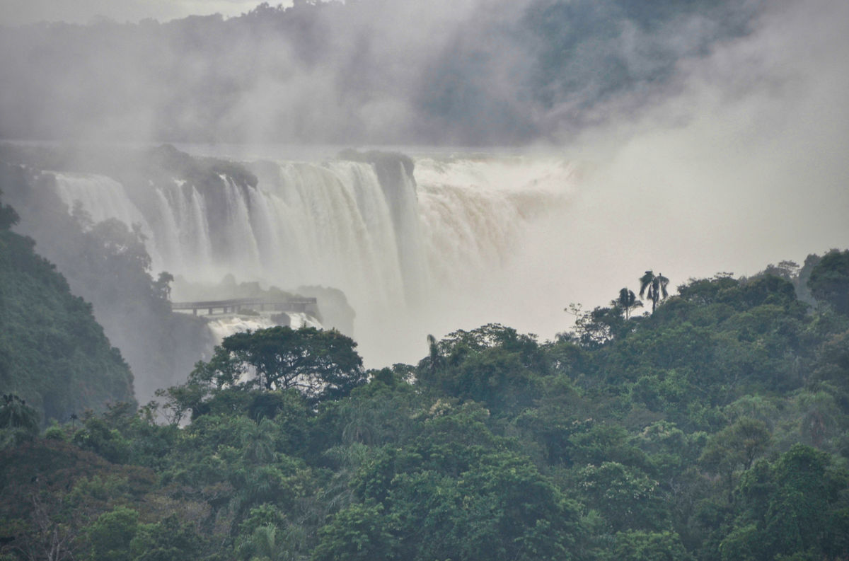
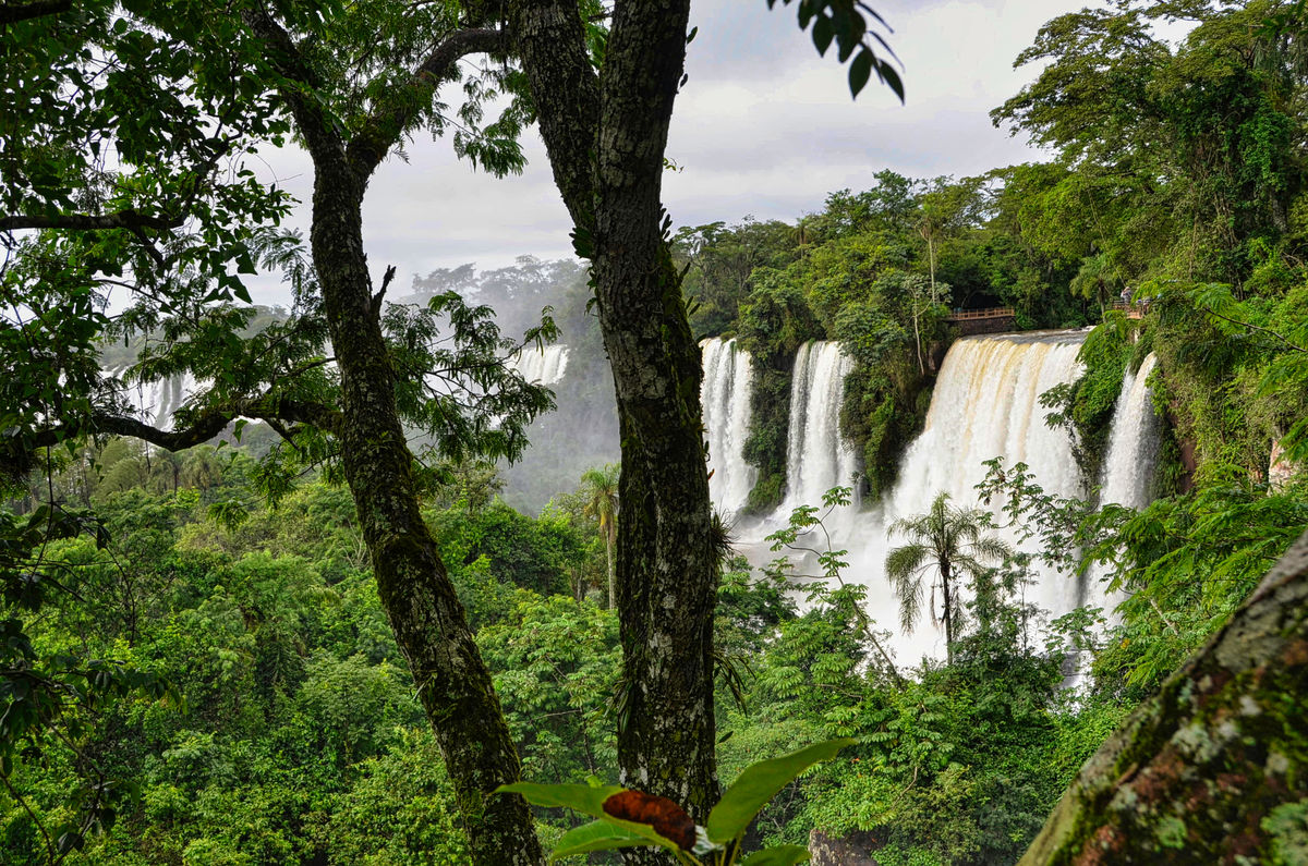
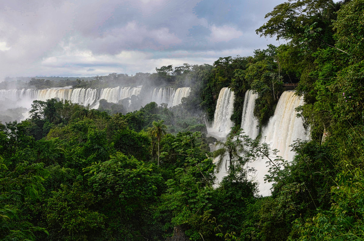
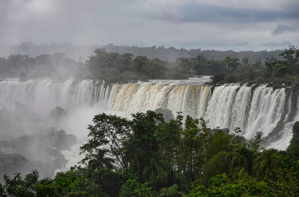
We were fortunate to arrive 2 days after torrential rains, so the falls were at their fullest. A plastic raincoat and camera protection is an absolute requirement since the spray is like rain coming upward! The roar was tremendous. I'm not a fan of silky waterfalls and Iguazu is certainly quite the opposite. The first three images were taken from the balcony of our hotel room shortly after we arrived. I hope you enjoy them.
Mark
Iguazú Falls or Iguaçu Falls (Guarani: Chororõ Yguasu [ɕoɾo'ɾõ ɨɣʷa'su], Spanish: Cataratas del Iguazú [kataˈɾataz ðel iɣwaˈsu]; Portuguese: Cataratas do Iguaçu [kataˈɾatɐs du iɡwaˈsu]) are waterfalls of the Iguazu River on the border of the Argentine province of Misiones and the Brazilian state of Paraná. Together, they make up the largest waterfall system in the world. The falls divide the river into the upper and lower Iguazu. The Iguazu River rises near the heart of the city of Curitiba. For most of its course, the river flows through Brazil; however, most of the falls are on the Argentine side. Below its confluence with the San Antonio River, the Iguazu River forms the border between Argentina and Brazil.
The name Iguazú comes from the Guarani or Tupi words "y", meaning "water", and "ûasú "[waˈsu], meaning "big". Legend has it that a deity planned to marry a beautiful woman named Naipí, who fled with her mortal lover Tarobá in a canoe. In a rage, the deity sliced the river, creating the waterfalls and condemning the lovers to an eternal fall. The first European to record the existence of the falls was the Spanish Conquistador Álvar Núñez Cabeza de Vaca in 1541.
The staircase character of the falls consists of a two-step waterfall formed by three layers of basalt. The steps are 35 and 40 metres (115 and 131 ft) in height. The columnar basalt rock sequences are part of the 1,000-metre-thick (3,300 ft) Serra Geral Formation within the Paleozoic-Mesozoic Paraná Basin. The tops of these sequences are characterized by 8–10 m (26–33 ft) of highly resistant vesicular basalt and the contact between these layers controls the shape of the falls. Headwater erosion rates are estimated at 1.4–2.1 cm/year (0.55–0.83 in/year). Numerous islands along the 2.7-kilometre-long (1.7 mi) edge divide the falls into many separate waterfalls and cataracts, varying between 60 and 82 m (197 and 269 ft) high. The number of these smaller waterfalls fluctuates from 150 to 300, depending on the water level. About half of the river's flow falls into a long and narrow chasm called the Devil's Throat (Garganta del Diablo in Spanish or Garganta do Diabo in Portuguese).
The Devil's Throat canyon is 80–90 m (260–300 ft) wide and 70–80 m (230–260 ft) deep. Left of this canyon, another part of the river forms 160–200 individual falls, which merge into a single front during flood stage. The largest falls are named San Martín, Adam and Eva, Penoni, and Bergano.
About 900 m (2,950 ft) of the 2.7 km (1.7 mi) length does not have water flowing over it. The water of the lower Iguazu collects in a canyon that drains into the Paraná River, a short distance downstream from the Itaipu Dam. The junction of the water flows marks the border between Brazil, Argentina, and Paraguay. Some points in the cities of Foz do Iguaçu, Brazil, Puerto Iguazú, Argentina, and Ciudad del Este, Paraguay, have access to the Iguazu River, where the borders of all three nations may be seen, a popular tourist attraction for visitors to the three cities.
The Iguazu Falls are arranged in a way that resembles a reversed letter "J". The Argentina–Brazil border runs through the Devil's Throat. On the right bank is the Brazilian territory, which is home to more than 95% of the Iguazu River basin but has just over 20% of the jumps of these falls, and the left side jumps are Argentine, which makes up almost 80% of the falls.
The falls may be reached from two main towns, with one on either side of the falls: Foz do Iguaçu in Brazil and Puerto Iguazú in Argentina, as well as from Ciudad del Este, Paraguay, on the other side of the Paraná River from Foz do Iguaçu, each of those three cities having commercial airports. The falls are shared by the Iguazú National Park (Argentina) and Iguaçu National Park (Brazil). The two parks were designated UNESCO World Heritage Sites in 1984 and 1986, respectively.
Upon seeing Iguazu, the United States First Lady Eleanor Roosevelt reportedly exclaimed, "Poor Niagara!" (which, at 50 m or 165 feet, are a third shorter). Often, Iguazu also is compared with Victoria Falls in Southern Africa, which separates Zambia and Zimbabwe. Iguazu is wider but is split into roughly 275 distinct falls and large islands, whereas Victoria has the largest curtain of water in the world, at more than 1,600 m (5,249 ft) wide and over 100 m (328 ft) in height (in low flow, Victoria is split into five by islands but in high flow it may be uninterrupted). The only wider falls are extremely large rapid-like falls, such as the Boyoma Falls (Stanley Falls).
With the flooding of the Guaíra Falls in 1982, Iguazu currently has the sixth-greatest average annual flow of any waterfall in the world, following number five Niagara, with an average rate of 1,746 m3/s (61,660 cu ft/s). Its maximum recorded flow was 45,700 m3/s (1,614,000 cu ft/s) on 9 June 2014. By comparison, the average flow of Niagara Falls is 2,400 m3/s (85,000 cu ft/s), with a maximum recorded flow of 8,300 m3/s (293,000 cu ft/s). The average flow at Victoria Falls is 1,088 m3/s (38,420 cu ft/s), with a maximum recorded flow of 7,100 m3/s (250,000 cu ft/s).
https://en.wikipedia.org/wiki/Iguazu_Falls
We were fortunate to arrive 2 days after torrential rains, so the falls were at their fullest. A plastic raincoat and camera protection is an absolute requirement since the spray is like rain coming upward! The roar was tremendous. I'm not a fan of silky waterfalls and Iguazu is certainly quite the opposite. The first three images were taken from the balcony of our hotel room shortly after we arrived. I hope you enjoy them.
Mark
(Download)
(Download)
(Download)
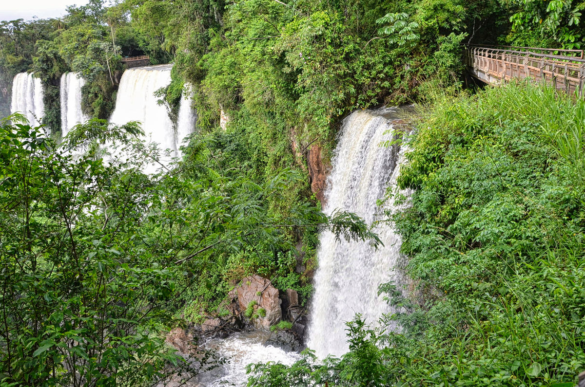
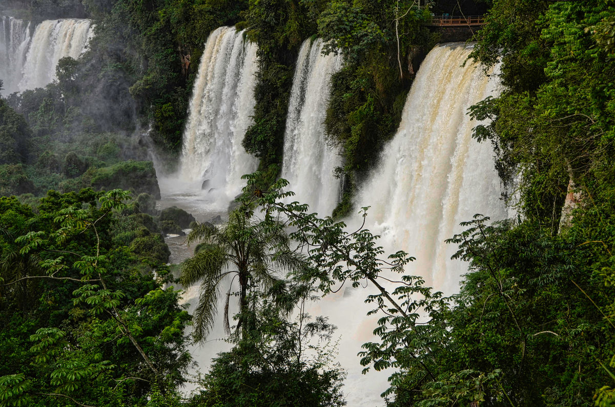
From our walk along the incredibly well maintaind walkways
(Download)
(Download)
(Download)
(Download)
(Download)
(Download)
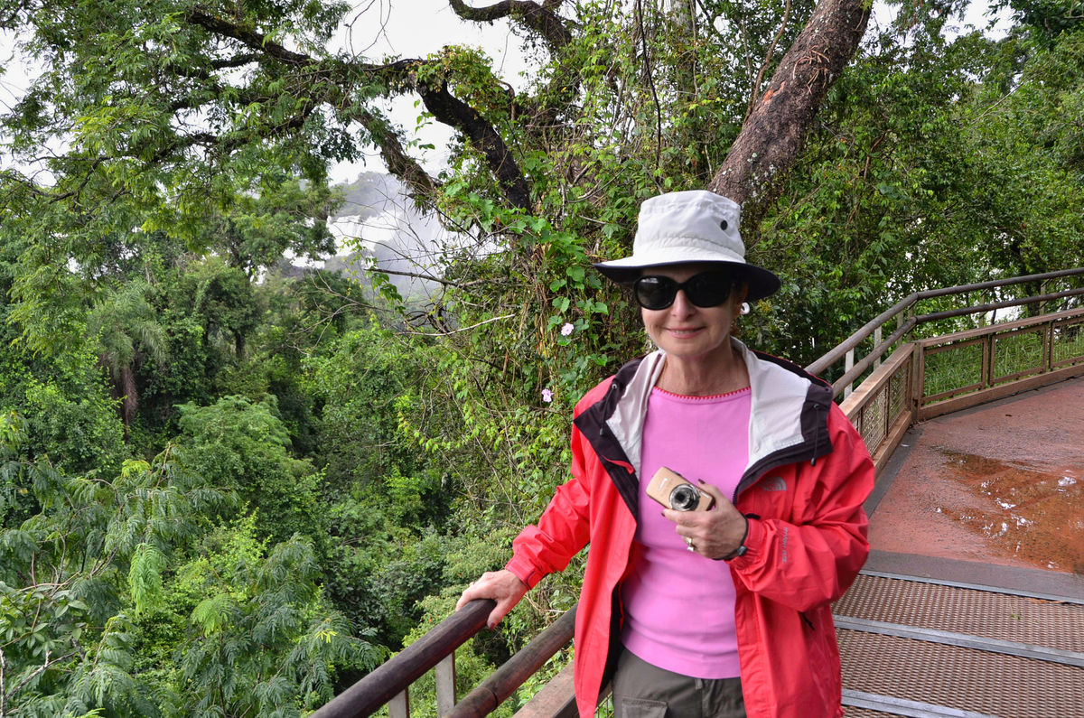
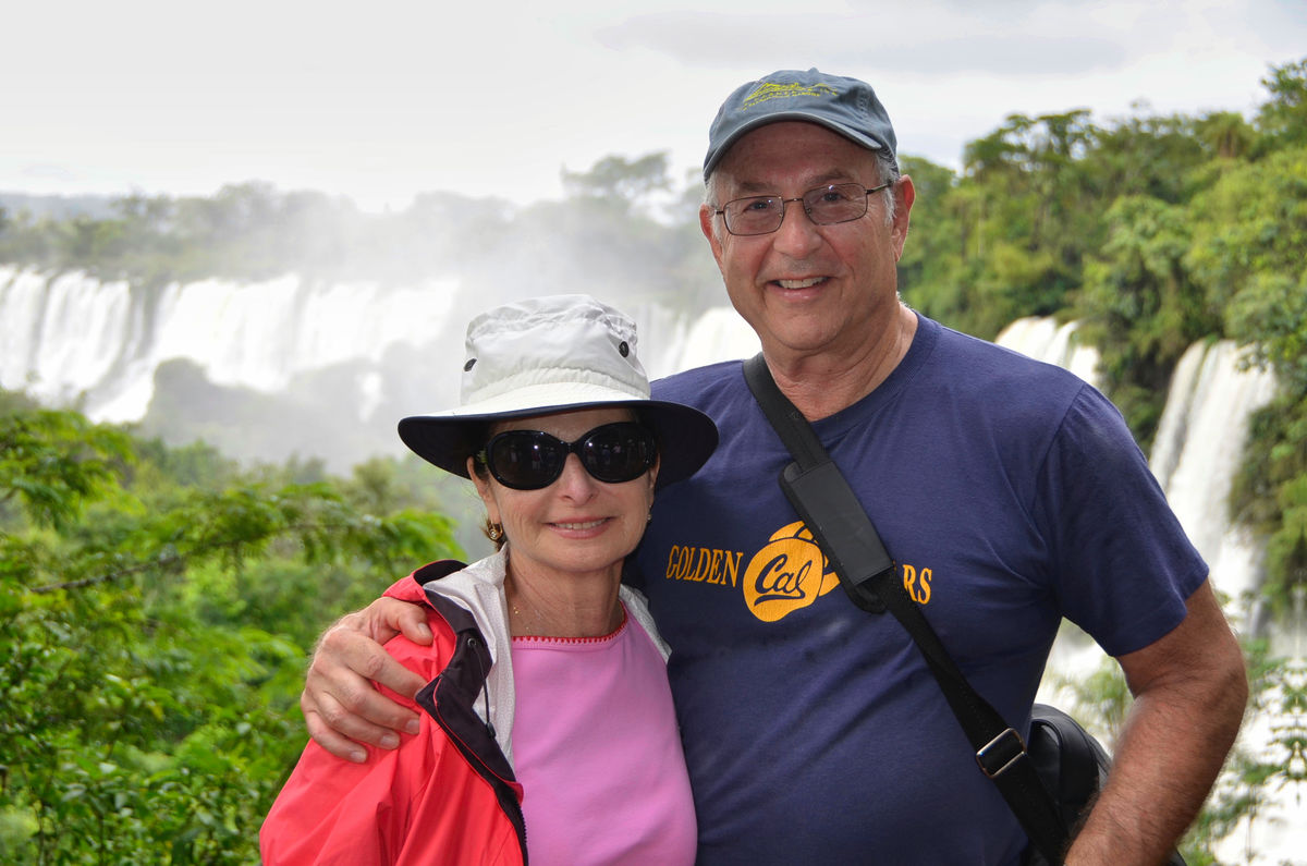
The obligatory tourist shot
(Download)
May 6, 2022 14:26:28 #
May 6, 2022 14:31:25 #


May 6, 2022 15:16:36 #

May 6, 2022 16:02:49 #

srfmhg wrote:
We were sad to leave beautiful Buenos Aires but we... (show quote)
Mindbogglingly spectacular location and shots 💦💦💦💦💦
May 6, 2022 17:34:17 #

May 6, 2022 17:44:56 #

May 6, 2022 18:20:03 #
May 6, 2022 18:20:37 #
May 6, 2022 18:21:02 #
joecichjr wrote:
Mindbogglingly spectacular location and shots 💦💦💦💦💦
Thanks very much Joe.
May 6, 2022 18:21:23 #
May 6, 2022 18:21:46 #
May 6, 2022 18:41:56 #

May 6, 2022 18:51:55 #

srfmhg wrote:
We were sad to leave beautiful Buenos Aires but we... (show quote)
Gorgeous place and I can see why you are both smiling.
May 6, 2022 20:47:07 #
If you want to reply, then register here. Registration is free and your account is created instantly, so you can post right away.