South America: Argentina - A cruise on Lago Frias
Jan 21, 2022 14:58:13 #

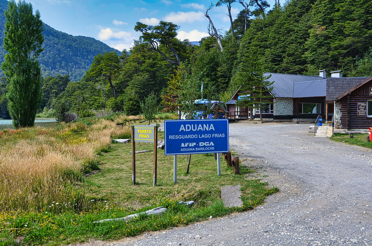
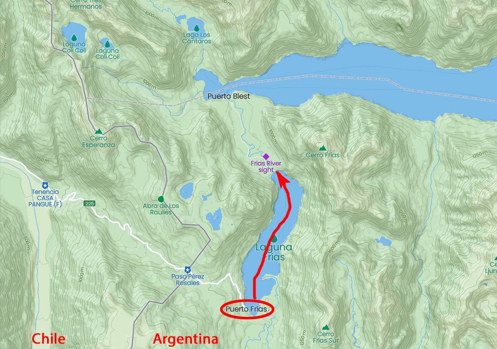
After crossing the border into Argentina, we drove to Puerto Frias where we stopped in the "Anduna" which is customs and immigration. We then boarded a boat for a trip north on Lago Frias to Puerto Alegre and a short road trip to Puerto Blest.
A translation from the Spanish Language Wikipedia:
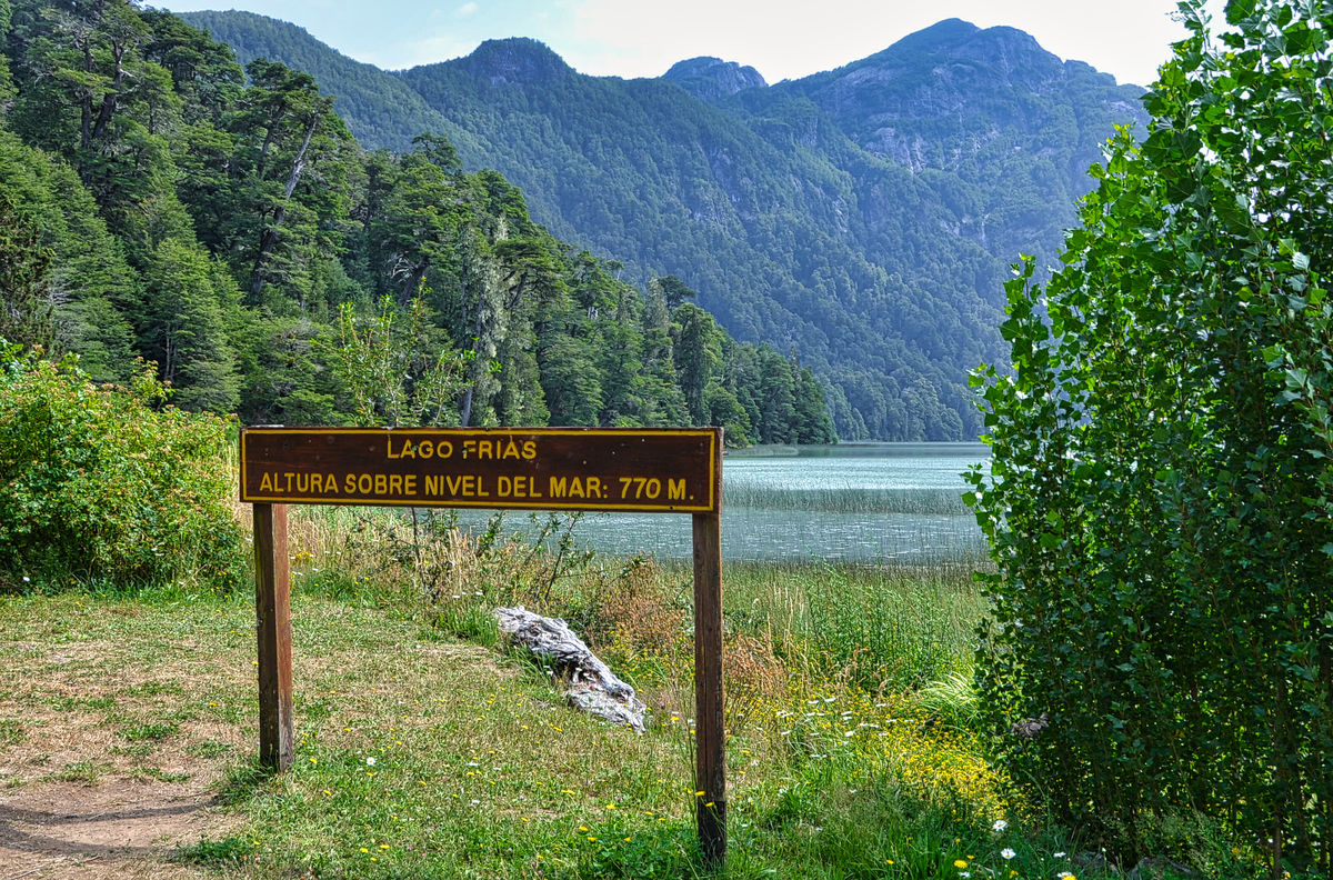
"The Lake Frías is a mirror of water of glacial origin located in the Nahuel Huapi National Park in the province of Rio Black , Argentina , in the department Bariloche .
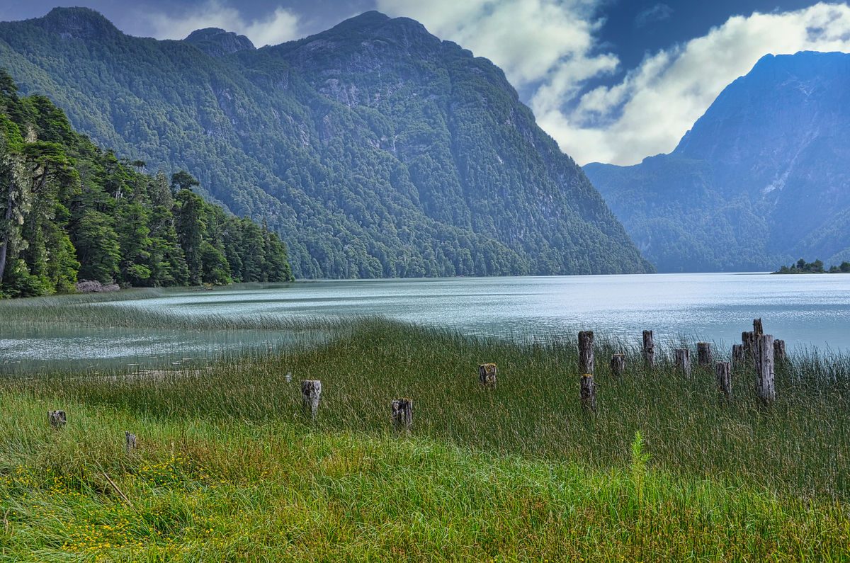
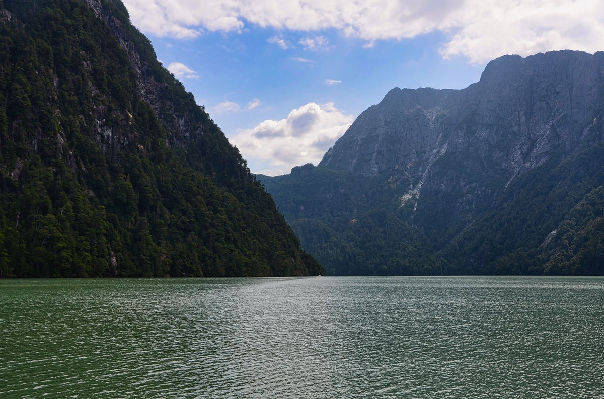
The lake has the shape of an elongated oval in a north-south direction, and is located at a latitude of about 41º South. Its eastern and western margins are formed by very steep rock walls partially covered by vegetation that submerge in the waters, giving Lake Frías the appearance of a fjord.
The area is located at the foot of the Andes mountain range , which is why copious rainfall is registered as a result of the humid winds that blow most of the year from the Pacific Ocean , with records of 3,500 mm of precipitation per year. Winter is the season with the highest rainfall record, and it is the place in the Argentine Republic with the highest annual rainfall records.
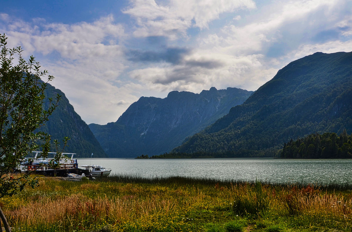
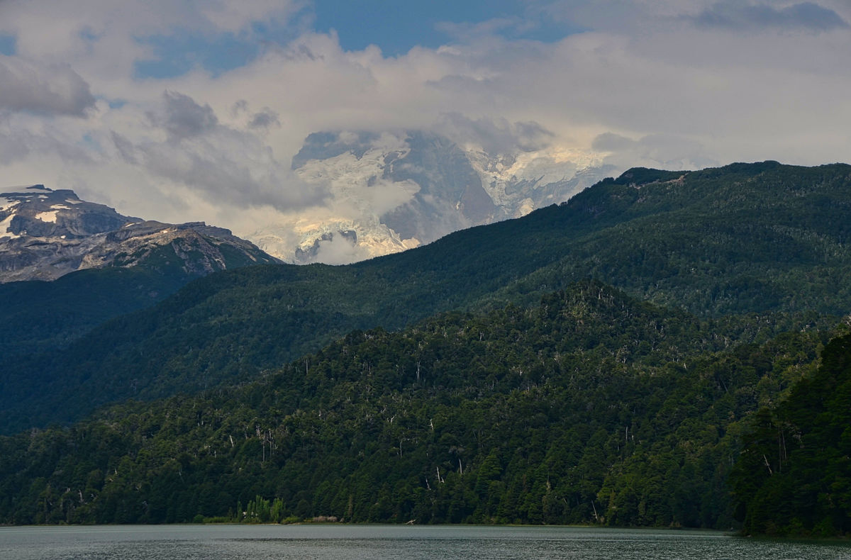
The lake is fed by several streams that provide meltwater and rainfall produced in the area; the main one is the Frías stream, which provides meltwater from the glaciers of Mount Tronador . On its northern margin, the lake discharges into the Frías River, which flows into Lake Nahuel Huapi in the vicinity of Puerto Blest .
The contribution of the sediments transported by the streams, in particular the channel of the upper Frías River that runs for about 10 km to the North from the foothills of the Frías Glacier on the Tronador hill , gives the lake its characteristic and beautiful turquoise tone, which makes it one of the most visited points of attraction in the Nahuel Huapí National Park.
On the southern shore of the lake is Puerto Frías, a place that has a small pier, a post of the Argentine Gendarmerie and a Migration Office. From Puerto Frías starts the road that crosses the border through the so-called Pérez Rosales pass , and that allows crossing the border between Argentina and Chile.
During the winters, some portions of the lake get to freeze, which gives the landscape an unparalleled beauty.
Originally, the lake was named Cold Lake by the explorer Francisco Fonck . Its name was later changed to the very similar Lago Frías , after Félix Frías , a late 19th-century Argentine politician and legislator . Frías was the Argentine representative in Chile during the government of Domingo Faustino Sarmiento (1869) and the staunchest defender in the matter of Argentine sovereignty in Patagonia .
There is a boat service that allows you to cross the lake. The service is the only connection route between Puerto Alegre and Puerto Frías. The Puerto Alegre pier on the north bank is linked by a vehicular road with Puerto Blest, which is about 3 km away.
Puerto Frías constitutes one of the ends of the "Pass of the Clouds" crossing, which allows you to travel along a path of great beauty a section of the Andes mountain range in the vicinity of the Tronador hill . The other end of the Paso de las Nubes traverse is in the area called Pampa Linda . The "Agostino Rocca" refuge of the Club Andino Bariloche is located in the area of El Paso .
From Puerto Frías it is possible to cross to Chile by means of a bus that circulates along a road for vehicles. The road extends for about 30 km and crosses into Chile through the Pérez Rosales pass , reaching the village of Peulla and Lake Todos Los Santos."
https://es.wikipedia.org/wiki/Lago_Fr%C3%ADas_%28R%C3%ADo_Negro%29
I hope you enjoy these images. As always, downloads are best.
Mark
A translation from the Spanish Language Wikipedia:
"The Lake Frías is a mirror of water of glacial origin located in the Nahuel Huapi National Park in the province of Rio Black , Argentina , in the department Bariloche .
The lake has the shape of an elongated oval in a north-south direction, and is located at a latitude of about 41º South. Its eastern and western margins are formed by very steep rock walls partially covered by vegetation that submerge in the waters, giving Lake Frías the appearance of a fjord.
The area is located at the foot of the Andes mountain range , which is why copious rainfall is registered as a result of the humid winds that blow most of the year from the Pacific Ocean , with records of 3,500 mm of precipitation per year. Winter is the season with the highest rainfall record, and it is the place in the Argentine Republic with the highest annual rainfall records.
The lake is fed by several streams that provide meltwater and rainfall produced in the area; the main one is the Frías stream, which provides meltwater from the glaciers of Mount Tronador . On its northern margin, the lake discharges into the Frías River, which flows into Lake Nahuel Huapi in the vicinity of Puerto Blest .
The contribution of the sediments transported by the streams, in particular the channel of the upper Frías River that runs for about 10 km to the North from the foothills of the Frías Glacier on the Tronador hill , gives the lake its characteristic and beautiful turquoise tone, which makes it one of the most visited points of attraction in the Nahuel Huapí National Park.
On the southern shore of the lake is Puerto Frías, a place that has a small pier, a post of the Argentine Gendarmerie and a Migration Office. From Puerto Frías starts the road that crosses the border through the so-called Pérez Rosales pass , and that allows crossing the border between Argentina and Chile.
During the winters, some portions of the lake get to freeze, which gives the landscape an unparalleled beauty.
Originally, the lake was named Cold Lake by the explorer Francisco Fonck . Its name was later changed to the very similar Lago Frías , after Félix Frías , a late 19th-century Argentine politician and legislator . Frías was the Argentine representative in Chile during the government of Domingo Faustino Sarmiento (1869) and the staunchest defender in the matter of Argentine sovereignty in Patagonia .
There is a boat service that allows you to cross the lake. The service is the only connection route between Puerto Alegre and Puerto Frías. The Puerto Alegre pier on the north bank is linked by a vehicular road with Puerto Blest, which is about 3 km away.
Puerto Frías constitutes one of the ends of the "Pass of the Clouds" crossing, which allows you to travel along a path of great beauty a section of the Andes mountain range in the vicinity of the Tronador hill . The other end of the Paso de las Nubes traverse is in the area called Pampa Linda . The "Agostino Rocca" refuge of the Club Andino Bariloche is located in the area of El Paso .
From Puerto Frías it is possible to cross to Chile by means of a bus that circulates along a road for vehicles. The road extends for about 30 km and crosses into Chile through the Pérez Rosales pass , reaching the village of Peulla and Lake Todos Los Santos."
https://es.wikipedia.org/wiki/Lago_Fr%C3%ADas_%28R%C3%ADo_Negro%29
I hope you enjoy these images. As always, downloads are best.
Mark
(Download)
(Download)
(Download)
(Download)
(Download)
(Download)
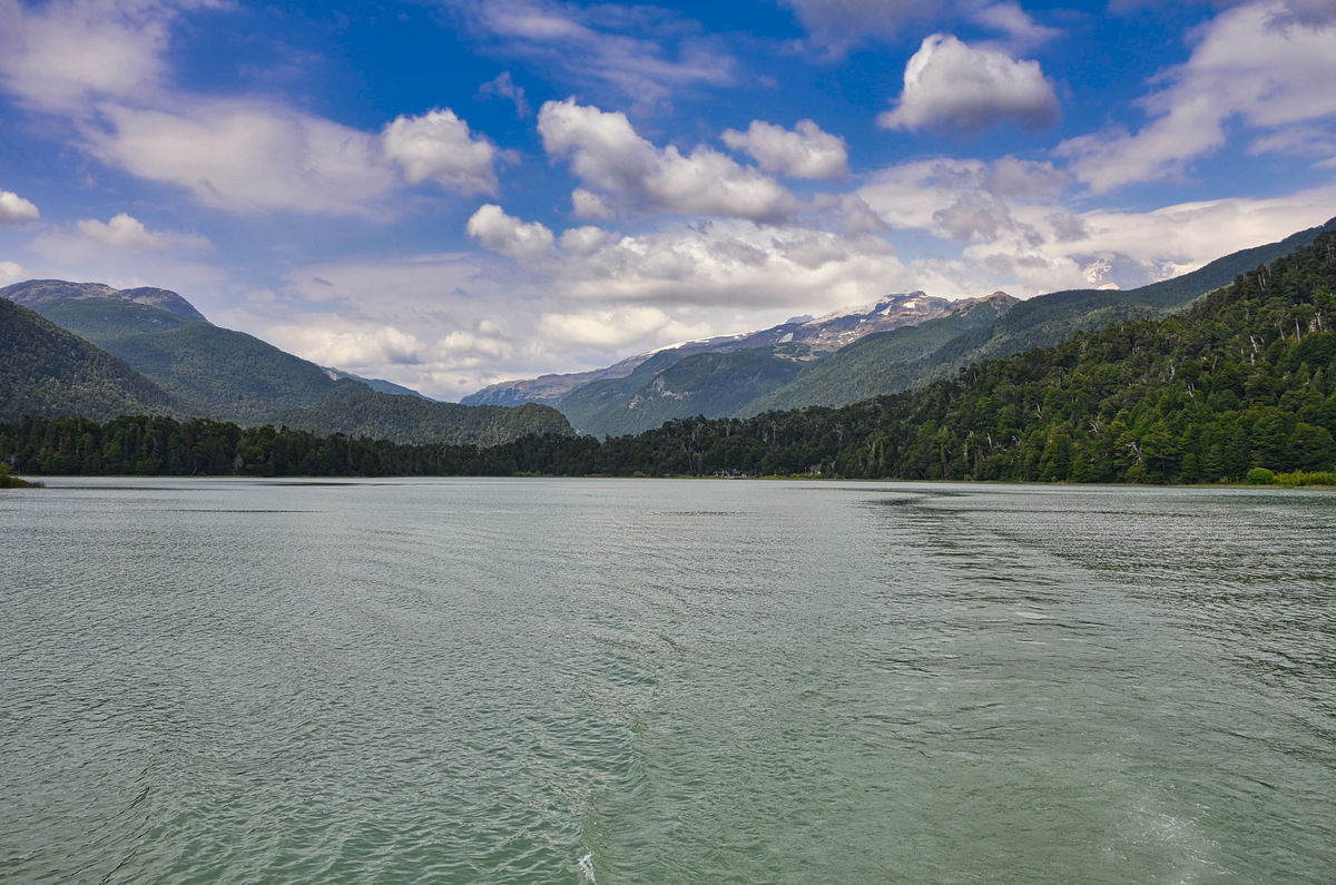
Looking back to Puerto Frias at the southern end of the lake from the boat
(Download)
(Download)
(Download)
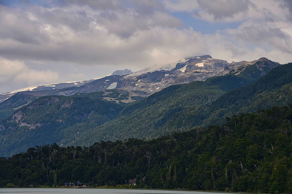
View of Mount Tronador from the lake.
(Download)
Jan 21, 2022 14:58:57 #
Jan 21, 2022 15:24:32 #
Jan 21, 2022 15:41:17 #

Jan 21, 2022 15:44:52 #


Jan 21, 2022 16:25:48 #
Jan 21, 2022 17:18:46 #
kpmac wrote:
Beautiful. Thanks for the narrative, too.
Thanks so much for looking and taking the time to read the narrative Ken.
Jan 21, 2022 17:19:13 #
NMGal wrote:
Gorgeous place. Beautiful photos.
Thanks so much Barbara. I appreciate!
Jan 21, 2022 17:19:38 #
Jan 21, 2022 17:19:57 #
Jan 21, 2022 20:00:42 #

Jan 21, 2022 20:14:33 #
UTMike wrote:
Water, mountains and a beauty - a winning combination, Mark!
Thanks so much Mike. She always appreciates your great compliments as do I!
Jan 21, 2022 20:46:33 #

srfmhg wrote:
After crossing the border into Argentina, we drove... (show quote)
Beautiful set Mark. It reminds me of a cross between the Canadian Rockies and the Norwegian fjords.
Jan 21, 2022 20:55:37 #
DJphoto wrote:
Beautiful set Mark. It reminds me of a cross between the Canadian Rockies and the Norwegian fjords.
Thanks very much Dennis. Also like the Westfjords in Iceland.
Jan 22, 2022 05:24:45 #

If you want to reply, then register here. Registration is free and your account is created instantly, so you can post right away.