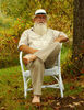
My last post of The Kapellbrücke (literally, Chapel Bridge) would not be complete if I didn't post images of some of the magnificent views of the Reuss Rivew taken from the bridge and along the banks.
The Reuss (Swiss German: Rüüss) is a river in Switzerland. With a length of 164 kilometres (102 mi) and a drainage basin of 3,426 square kilometres (1,323 sq mi), it is the fourth largest river in Switzerland (after the Rhine, Aare and Rhône). The upper Reuss forms the main valley of the canton of Uri. The course of the lower Reuss runs from Lake Lucerne to the confluence with the Aare at Brugg and Windisch.
The Reuss is one of the four major rivers taking their source in the Gotthard region, along with the Rhine, Ticino and Rhône.
The Gotthardreuss rises in the Gotthard massif, emerging from Lago di Lucendro (reservoir built in 1947; elevation 2,134 m) in the canton of Ticino and passing into the canton of Uri at Brüggboden (1,910 m).
The Furkareuss rises east of Furka Pass from Schwärziseeli and forms the valley called Urseren, passing Realp at 1,540 m. This source is only around 5km away from, and on the same mountain massif as the source of the Rhône, but will ultimately lead to the opposite side of the continent.
Gotthardreuss and Furkareuss join at Hospental (1,452 m). Downstream of Andermatt (1,432 m) the Reuss passes through Schöllenen Gorge and under the legendary Devil's Bridge. At Göschenen (1,102 m) it is joined by the Göschenerreuss. From here it forms the main valley of the canton of Uri, passing below Wassen (840 m), Gurtnellen (711 m), Silenen (500 m), and through Erstfeld (471 m), past Attinghausen and Altdorf (452 m), joining the southernmost part of Lake Lucerne (the Urnersee) between Flüelen and Seedorf (434 m).
The Reuss leaves Lake Lucerne some 20 km to the north-west, at the city of Lucerne. Notable bridges in Lucerne are the Kapellbrücke, first built 1333, rebuilt 1993 and Spreuerbrücke, built 1408. A needle dam just upstream from the Spreuerbrücke) maintains the water level. It receives the Kleine Emme from Entlebuch at Emmen (432 m). From here, it flows north-east through Buchrain, Root, Gisikon and Honau, and downstream of Honau (402 m) leaves the canton of Lucerne, now forming the border between Aargau and Zug, passing Dietwil (Aargau), Risch-Rotkreuz (Zug), Oberrüti (Aargau) and Sins (Aargau), Hünenberg (Zug) and Mühlau (Aargau). It receives the Lorze from Lake Zug downstream of Maschwanden.
Downstream of this confluence, the Reuss forms the border between Aargau and Zürich, passing Merenschwand (Aargau, 389 m) and Ottenbach (Zurich, 384 m), and enters Aargau downstream of Ottenbach.
The lower Reuss flows along a series of former glacial lakes. Settlements along the river were built on lateral moraines, while the river bed itself was marshy and subject to flooding, and thus unsuitable for settlement. The oldest river crossings are along terminal moraines between the former glacial lakes.
The Reuss valley was under Habsburg Austrian rule during the 14th century.
In the 15th century, the Reuss became the border between territories of the Swiss Confederacy, in 1429 between Lucerne and Zürich, and later between Zug, Zürich and the Freie Ämter condominium, between Freie Ämter and Baden, and between Baden and Berne. The Reuss downstream of Ottenbach came to lie within Aargau with the creation of this canton in 1803.
The Reuss had the status of "imperial road" (freie Reichsstrasse) in the late medieval period. Until 1798, it was the responsibility of cantonal authorities (the Reussherren of Lucerne and Zug) to keep the river navigable. The river was important as waterway for traffic between Lucerne and Zurzach, and via Aare and Rhine to Basel, until the construction of transit roads in the 18th century. River crossings by ferry in the medieval period were at Lunkhofen (mentioned 1160), Windisch, Sins, Mühlau, Oberrüti, and Dietwil. The crossing at Lunkhofen was on the main route from Zürich to Berne. Bridges across the Reuss were in Lucerne, Bremgarten (1230), Mellingen (mentioned 1253) and Gisikon (1432). In 1528, the Catholic cantons blocked the trade routes across the Reuss for Protestant cantons and trade between Zürich and Berne was re-routed through Windisch.
Because ferries and bridges were a source of income, the construction of new crossings was opposed during the early modern period, and only one new bridge was built, commissioned by Zug, at Sins (1640). New bridges were built only after the collapse of the Old Swiss Confederacy, e.g. at Windisch (1799), Ottenbach (1864) and Mühlau (1940).
By the end of the 20th century, there were more than a dozen crossings of the lower Reuss, including a number of railway and motorway bridges.
https://en.wikipedia.org/wiki/Reuss_%28river%29I hope you enjoy these images. For additional images of the Chapel Bridge, Lake Lucerne and Lucerne street scenes, please see my previous posts:
https://www.uglyhedgehog.com/t-712513-1.htmlhttps://www.uglyhedgehog.com/t-712232-1.htmlhttps://www.uglyhedgehog.com/t-711865-1.htmlMark
My last post of The Kapellbrücke (literally, Chape... (